Property Record
5160 N Northwest Hwy, Chicago, IL 60630


NEARBY LISTINGS FOR SALE OR LEASE
Property Detail
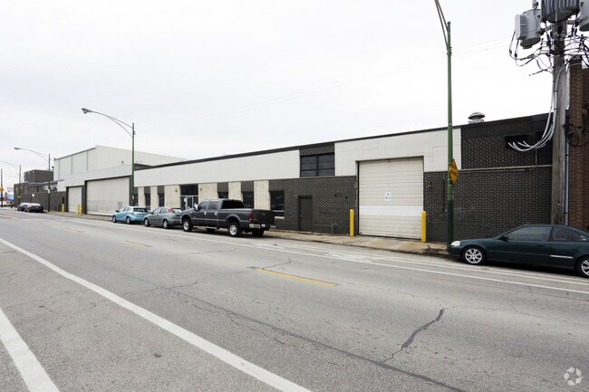
5160 N Northwest Hwy
13-09-310-047-0000
Jefferson Park Llc
Commercialnec
Cook
X
Illinois
17031C0382J
0.82 AC
2023
Northwest City
2025
Chicago
110400
Chicago-Naperville-Elgin, IL-IN-WI
130,310 SF
DEMOGRAPHICS near 5160 N Northwest Hwy
1 Mile
3 Mile
5 Mile
2024 Total Population
33,991
273,702
804,009
2029 Population
32,050
259,669
764,699
Pop Growth 2024-2029
(5.71%)
(5.13%)
(4.89%)
Average Age
42
41
40
2024 Total Households
13,474
101,292
299,307
HH Growth 2024-2029
(6.10%)
(5.46%)
(5.20%)
Median Household Inc
$82,067
$81,975
$77,942
Avg Household Size
2.40
2.60
2.60
2024 Avg HH Vehicles
2.00
2.00
2.00
Median Home Value
$342,164
$356,004
$353,864
Median Year Built
1949
1949
1949
Nearby Places
Map Layers
Map Styles
 Street
 Aerial
- Restaurants
- Banks
- Shops
- Fitness
- Groceries
PUBLIC TRANSPORTATION
COMMUTER RAIL
Jefferson Park Station (Union Pacific Northwest Line - Northeast Illinois Regional Commuter Railroad (Metra))
DRIVE
WALK
Distance
Jefferson Park Station (Union Pacific Northwest Line - Northeast Illinois Regional Commuter Railroad (Metra))
1 min
7 min
0.3 mi
Forest Glen Station (Milwaukee District North Line - Northeast Illinois Regional Commuter Railroad (Metra))
DRIVE
WALK
Distance
Forest Glen Station (Milwaukee District North Line - Northeast Illinois Regional Commuter Railroad (Metra))
3 min
15 min
0.8 mi
AIRPORT
Chicago O'Hare International
DRIVE
WALK
Distance
Chicago O'Hare International
13 min
7.7 mi
Chicago Midway International
DRIVE
WALK
Distance
Chicago Midway International
26 min
14.3 mi
Nearby Properties
Address
Land Use
TOTAL SIZE
Lot Size
Zoning
Address
Land Use
TOTAL SIZE
Lot Size
Zoning
240,942 SF
15.94 AC
PD 72
Address
Land Use
TOTAL SIZE
Lot Size
Zoning
Address
Land Use
TOTAL SIZE
Lot Size
Zoning
24.49 AC
Address
Land Use
TOTAL SIZE
Lot Size
Zoning
9.90 AC
Address
Land Use
TOTAL SIZE
Lot Size
Zoning
Address
Land Use
TOTAL SIZE
Lot Size
Zoning
16.27 AC
Address
Land Use
TOTAL SIZE
Lot Size
Zoning
21.56 AC
RS-2
Address
Land Use
TOTAL SIZE
Lot Size
Zoning
PD 184
Address
Land Use
TOTAL SIZE
Lot Size
Zoning
1.04 AC
PD 130
Address
Land Use
TOTAL SIZE
Lot Size
Zoning
9.38 AC
PD 1179,PO
Address
Land Use
TOTAL SIZE
Lot Size
Zoning
92,457 SF
4.09 AC
Address
Land Use
TOTAL SIZE
Lot Size
Zoning
139.71 AC
PD 184
Address
Land Use
TOTAL SIZE
Lot Size
Zoning
43,765 SF
2.79 AC
Address
Land Use
TOTAL SIZE
Lot Size
Zoning
486,884 SF
16.41 AC
Address
Land Use
TOTAL SIZE
Lot Size
Zoning
269,500 SF
11.03 AC
Address
Land Use
TOTAL SIZE
Lot Size
Zoning
100,900 SF
4.85 AC
PD 1415
Address
Land Use
TOTAL SIZE
Lot Size
Zoning
67,588 SF
2.50 AC
PD 415
Address
Land Use
TOTAL SIZE
Lot Size
Zoning
629,244 SF
11.07 AC
RS-2
Address
Land Use
TOTAL SIZE
Lot Size
Zoning
43,750 SF
1.19 AC
B1-1
Address
Land Use
TOTAL SIZE
Lot Size
Zoning
83,288 SF
13.43 AC
RT-4
Address
Land Use
TOTAL SIZE
Lot Size
Zoning
95,614 SF
4.20 AC
Address
Land Use
TOTAL SIZE
Lot Size
Zoning
302,379 SF
10.74 AC
Address
Land Use
TOTAL SIZE
Lot Size
Zoning
91,638 SF
6.64 AC
Address
Land Use
TOTAL SIZE
Lot Size
Zoning
0.43 AC
RS-2
Address
Land Use
TOTAL SIZE
Lot Size
Zoning
Address
Land Use
TOTAL SIZE
Lot Size
Zoning
122,489 SF
9.92 AC
Address
Land Use
TOTAL SIZE
Lot Size
Zoning
132,087 SF
9.82 AC
Address
Land Use
TOTAL SIZE
Lot Size
Zoning
65,243 SF
3.70 AC
Address
Land Use
TOTAL SIZE
Lot Size
Zoning
264,187 SF
9.04 AC
The World's #1 Commercial Real Estate Marketplace
Connect with us
© 2025 CoStar Group
The information above has been obtained from sources believed reliable. While we do not doubt its accuracy we have not verified it and make no guarantee, warranty or representation about it. It is your responsibility to independently confirm its accuracy and completeness. Any projections, opinions, assumptions, or estimates used are for example only and do not represent the current or future performance of the property. The value of this transaction to you depends on tax and other factors which should be evaluated by your tax, financial, and legal advisors. You and your advisors should conduct a careful, independent investigation of the property to determine to your satisfaction the suitability of the property for your needs.