Property Record
519 E 75Th St, Kansas City, MO 64131


NEARBY LISTINGS FOR SALE OR LEASE
Property Detail
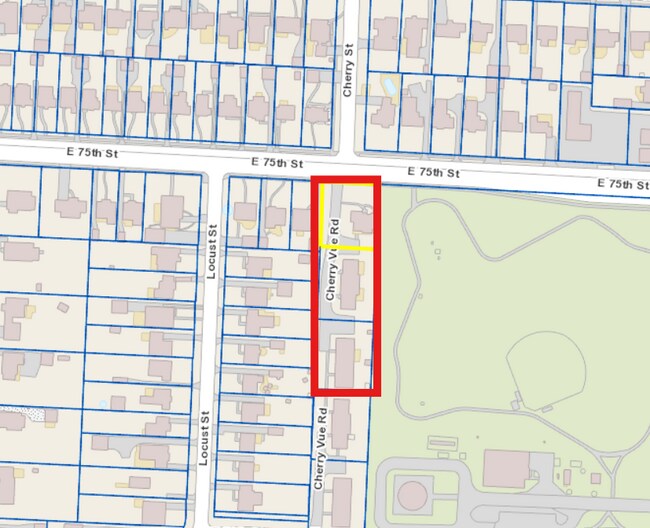
519 E 75Th St
Kansas City, MO-KS
Jackson
47-810-03-38-00-0-00-000
Missouri
Duplex
0.26 AC
X
South Kansas City MO
29095C0377G
Kansas City
2,159 SF
DEMOGRAPHICS near 519 E 75Th St
1 Mile
3 Mile
5 Mile
2024 Total Population
14,676
89,893
242,668
2029 Population
14,560
90,486
247,347
Pop Growth 2024-2029
(0.79%)
+ 0.66%
+ 1.93%
Average Age
40
40
40
2024 Total Households
6,865
38,267
111,551
HH Growth 2024-2029
(1.02%)
+ 0.44%
+ 1.87%
Median Household Inc
$80,453
$76,837
$69,735
Avg Household Size
2.10
2.20
2.10
2024 Avg HH Vehicles
2.00
2.00
2.00
Median Home Value
$228,139
$288,332
$283,184
Median Year Built
1948
1952
1957
Nearby Places
Map Layers
Map Styles
 Street
 Aerial
- Restaurants
- Banks
- Shops
- Fitness
- Groceries
PUBLIC TRANSPORTATION
COMMUTER RAIL
Kansas City (Lincoln Service Missouri River Runner - Amtrak, Missouri River Runner - Amtrak, Southwest Chief - Amtrak)
DRIVE
WALK
Distance
Kansas City (Lincoln Service Missouri River Runner - Amtrak, Missouri River Runner - Amtrak, Southwest Chief - Amtrak)
15 min
7.6 mi
AIRPORT
Kansas City International
DRIVE
WALK
Distance
Kansas City International
42 min
29.8 mi
Freight Ports
Tulsa Port Of Catoosa
DRIVE
WALK
Distance
Tulsa Port Of Catoosa
261 min
230.7 mi
SALE & LEASE HISTORY
LISTING DATE
SALE/LEASE

Aug 02, 2024
For Sale
Nearby Properties
Address
Land Use
TOTAL SIZE
Lot Size
Zoning
Address
Land Use
TOTAL SIZE
Lot Size
Zoning
183,684 SF
36.94 AC
R-1A
Address
Land Use
TOTAL SIZE
Lot Size
Zoning
616,742 SF
13.59 AC
Address
Land Use
TOTAL SIZE
Lot Size
Zoning
188,248 SF
4.78 AC
C-2
Address
Land Use
TOTAL SIZE
Lot Size
Zoning
552,475 SF
Address
Land Use
TOTAL SIZE
Lot Size
Zoning
465,394 SF
16.63 AC
Address
Land Use
TOTAL SIZE
Lot Size
Zoning
379,472 SF
Address
Land Use
TOTAL SIZE
Lot Size
Zoning
99,812 SF
3.85 AC
R-1A
Address
Land Use
TOTAL SIZE
Lot Size
Zoning
387,197 SF
Address
Land Use
TOTAL SIZE
Lot Size
Zoning
124,249 SF
6.13 AC
R-1B
Address
Land Use
TOTAL SIZE
Lot Size
Zoning
457,500 SF
Address
Land Use
TOTAL SIZE
Lot Size
Zoning
109,553 SF
3.08 AC
Address
Land Use
TOTAL SIZE
Lot Size
Zoning
67,981 SF
7.12 AC
R-1A
Address
Land Use
TOTAL SIZE
Lot Size
Zoning
785,016 SF
23.73 AC
Address
Land Use
TOTAL SIZE
Lot Size
Zoning
136,963 SF
2.05 AC
Address
Land Use
TOTAL SIZE
Lot Size
Zoning
151,831 SF
12.93 AC
Address
Land Use
TOTAL SIZE
Lot Size
Zoning
36,324 SF
16.55 AC
R-1A
Address
Land Use
TOTAL SIZE
Lot Size
Zoning
257,979 SF
14.35 AC
C-2
Address
Land Use
TOTAL SIZE
Lot Size
Zoning
68,004 SF
7.75 AC
R-1B
Address
Land Use
TOTAL SIZE
Lot Size
Zoning
352,344 SF
24.43 AC
Address
Land Use
TOTAL SIZE
Lot Size
Zoning
136,963 SF
0.66 AC
Address
Land Use
TOTAL SIZE
Lot Size
Zoning
262,727 SF
16.81 AC
C-2
Address
Land Use
TOTAL SIZE
Lot Size
Zoning
194,371 SF
12.94 AC
R2A
Address
Land Use
TOTAL SIZE
Lot Size
Zoning
244,478 SF
26.69 AC
Address
Land Use
TOTAL SIZE
Lot Size
Zoning
62,625 SF
10.23 AC
R-1A
Address
Land Use
TOTAL SIZE
Lot Size
Zoning
431,078 SF
Address
Land Use
TOTAL SIZE
Lot Size
Zoning
423,342 SF
13 AC
Address
Land Use
TOTAL SIZE
Lot Size
Zoning
65,128 SF
8.70 AC
Address
Land Use
TOTAL SIZE
Lot Size
Zoning
308,509 SF
16.45 AC
Address
Land Use
TOTAL SIZE
Lot Size
Zoning
260,629 SF
7.17 AC
Address
Land Use
TOTAL SIZE
Lot Size
Zoning
12,900 SF
1.05 AC
R-1A
The World's #1 Commercial Real Estate Marketplace
Connect with us
© 2026 CoStar Group
The information above has been obtained from sources believed reliable. While we do not doubt its accuracy we have not verified it and make no guarantee, warranty or representation about it. It is your responsibility to independently confirm its accuracy and completeness. Any projections, opinions, assumptions, or estimates used are for example only and do not represent the current or future performance of the property. The value of this transaction to you depends on tax and other factors which should be evaluated by your tax, financial, and legal advisors. You and your advisors should conduct a careful, independent investigation of the property to determine to your satisfaction the suitability of the property for your needs.