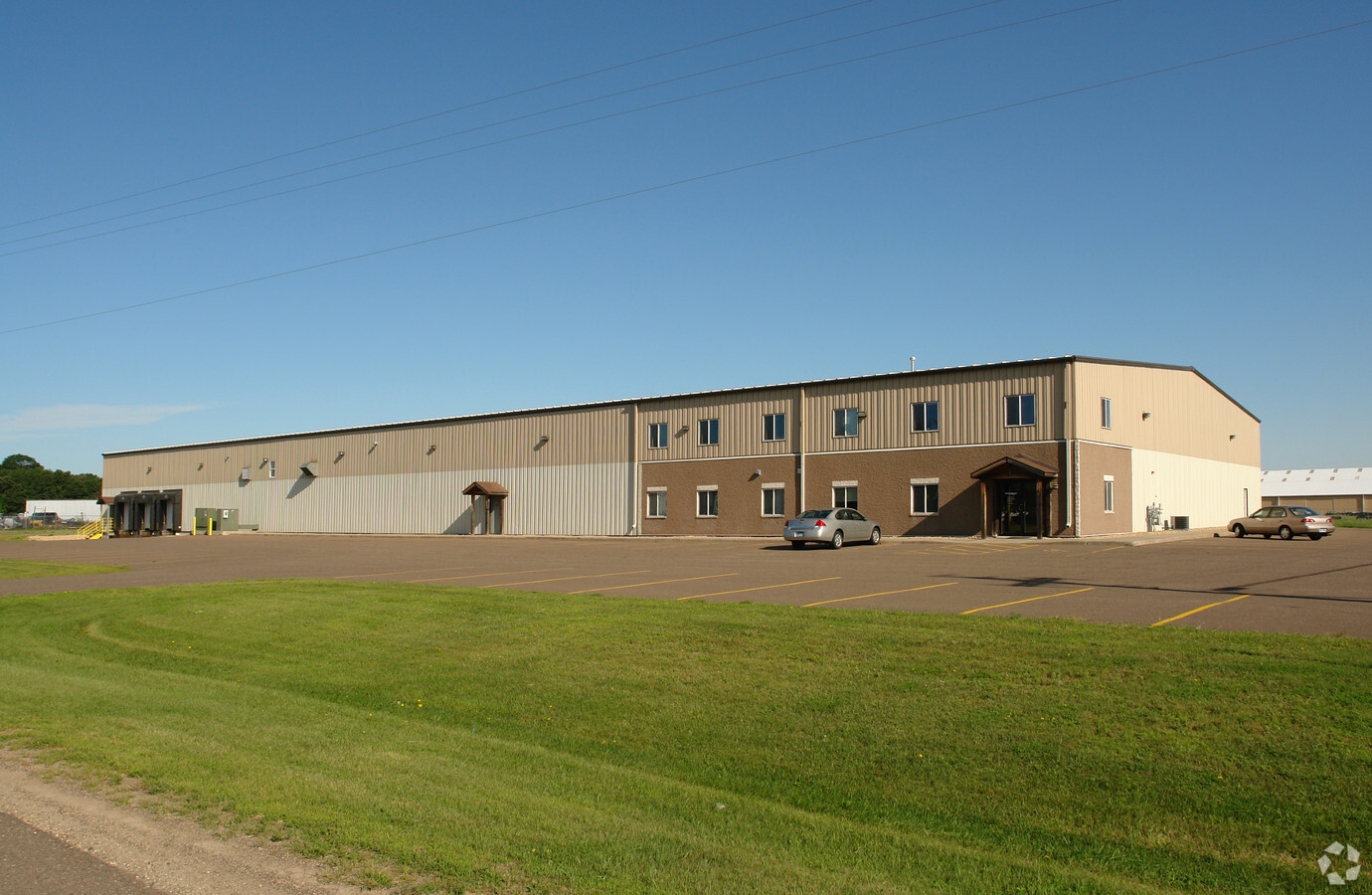
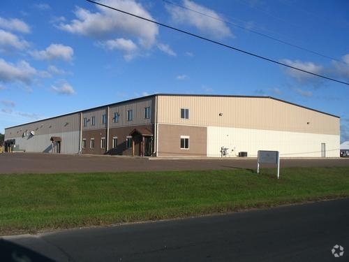
Property Record
5190 260Th St, Wyoming, MN 55092

NEARBY LISTINGS FOR SALE OR LEASE
-
-
View all Wyoming listings for sale on LoopNet.com
Property Detail
5190 260Th St
Minneapolis-St. Paul-Bloomington, MN-WI
Hallbergs Wyo Industrial Park
21-00468-30
TOGETHER WITH LOT 4 & 5 BLK 2. AND THAT VACATED PORTION OF FALCON AVE WHICH LIES N'LY OF A LINE DRAWN PARA WITH & DIST 10 FT
Multipleuses
Chisago
X
Minnesota
27003C0235E
4-5
2024
7.90 AC
2023
Chisago County
110404
Minneapolis/St Paul
66,000 SF
DEMOGRAPHICS near 5190 260Th St
1 Mile
3 Mile
5 Mile
2024 Total Population
2,959
9,402
26,490
2029 Population
3,108
9,897
28,213
Pop Growth 2024-2029
+ 5.04%
+ 5.26%
+ 6.50%
Average Age
40
41
40
2024 Total Households
1,101
3,534
10,277
HH Growth 2024-2029
+ 5.09%
+ 5.43%
+ 6.70%
Median Household Inc
$89,353
$90,023
$88,516
Avg Household Size
2.70
2.60
2.50
2024 Avg HH Vehicles
3.00
2.00
2.00
Median Home Value
$271,760
$294,032
$314,771
Median Year Built
1993
1991
1989
Nearby Places
- Restaurants
- Banks
- Shops
- Fitness
- Groceries
Nearby Properties
Address
Land Use
TOTAL SIZE
Lot Size
Zoning
Address
Land Use
TOTAL SIZE
Lot Size
Zoning
87,648 SF
10.70 AC
Address
Land Use
TOTAL SIZE
Lot Size
Zoning
69,020 SF
10.20 AC
Address
Land Use
TOTAL SIZE
Lot Size
Zoning
198,573 SF
25.60 AC
OHC
Address
Land Use
TOTAL SIZE
Lot Size
Zoning
38,656 SF
3.07 AC
Address
Land Use
TOTAL SIZE
Lot Size
Zoning
59,915 SF
4.20 AC
OHC
Address
Land Use
TOTAL SIZE
Lot Size
Zoning
99,282 SF
12.20 AC
I
Address
Land Use
TOTAL SIZE
Lot Size
Zoning
28,387 SF
0.82 AC
Address
Land Use
TOTAL SIZE
Lot Size
Zoning
68,648 SF
8.23 AC
I
Address
Land Use
TOTAL SIZE
Lot Size
Zoning
52,704 SF
7.80 AC
Address
Land Use
TOTAL SIZE
Lot Size
Zoning
35,076 SF
6.40 AC
I
Address
Land Use
TOTAL SIZE
Lot Size
Zoning
48,852 SF
1.89 AC
Address
Land Use
TOTAL SIZE
Lot Size
Zoning
59,381 SF
8.62 AC
I
Address
Land Use
TOTAL SIZE
Lot Size
Zoning
79,620 SF
2.41 AC
I
Address
Land Use
TOTAL SIZE
Lot Size
Zoning
73,208 SF
3.62 AC
Address
Land Use
TOTAL SIZE
Lot Size
Zoning
45,160 SF
5.90 AC
C
Address
Land Use
TOTAL SIZE
Lot Size
Zoning
26,942 SF
1.50 AC
OHC
Address
Land Use
TOTAL SIZE
Lot Size
Zoning
21,284 SF
1.40 AC
Address
Land Use
TOTAL SIZE
Lot Size
Zoning
32,708 SF
3.30 AC
R6
Address
Land Use
TOTAL SIZE
Lot Size
Zoning
54,000 SF
4.95 AC
I
Address
Land Use
TOTAL SIZE
Lot Size
Zoning
52,000 SF
8.33 AC
I
Address
Land Use
TOTAL SIZE
Lot Size
Zoning
37,355 SF
3.44 AC
Address
Land Use
TOTAL SIZE
Lot Size
Zoning
39,968 SF
7 AC
I
Address
Land Use
TOTAL SIZE
Lot Size
Zoning
269.50 AC
I
Address
Land Use
TOTAL SIZE
Lot Size
Zoning
320 SF
8 AC
R1
Address
Land Use
TOTAL SIZE
Lot Size
Zoning
29,076 SF
3.67 AC
R6
Address
Land Use
TOTAL SIZE
Lot Size
Zoning
44,850 SF
15.37 AC
C
Address
Land Use
TOTAL SIZE
Lot Size
Zoning
42,100 SF
15.50 AC
I
Address
Land Use
TOTAL SIZE
Lot Size
Zoning
20,000 SF
15.60 AC
I
Address
Land Use
TOTAL SIZE
Lot Size
Zoning
2,412 SF
30 AC
R5
The World's #1 Commercial Real Estate Marketplace
Connect with us
© 2025 CoStar Group
The information above has been obtained from sources believed reliable. While we do not doubt its accuracy we have not verified it and make no guarantee, warranty or representation about it. It is your responsibility to independently confirm its accuracy and completeness. Any projections, opinions, assumptions, or estimates used are for example only and do not represent the current or future performance of the property. The value of this transaction to you depends on tax and other factors which should be evaluated by your tax, financial, and legal advisors. You and your advisors should conduct a careful, independent investigation of the property to determine to your satisfaction the suitability of the property for your needs.