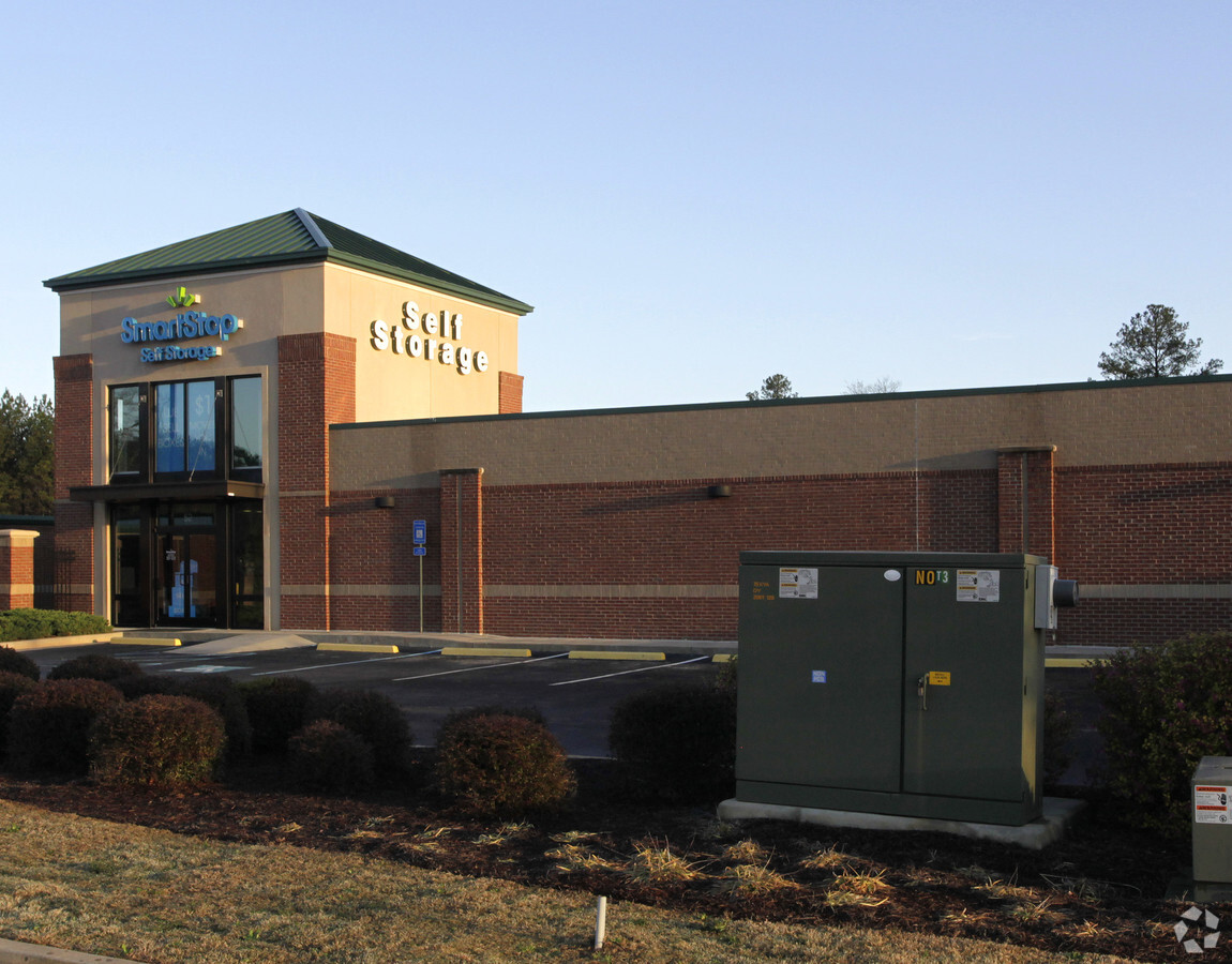
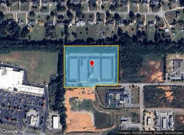
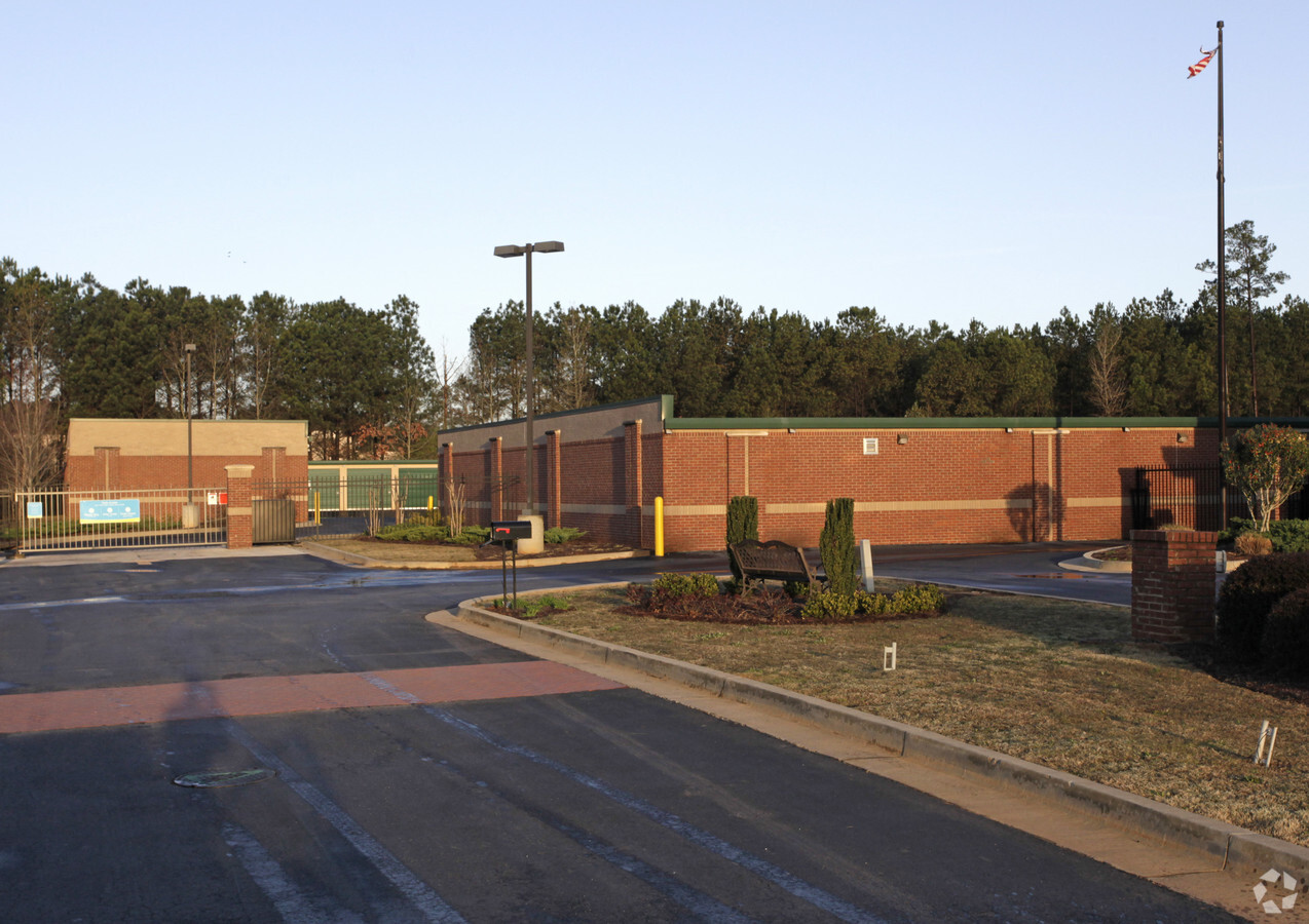
Property Record
52 Bailey Station Cir, Sharpsburg, GA 30277

NEARBY LISTINGS FOR SALE OR LEASE
Property Detail
52 Bailey Station Cir
Atlanta-Sandy Springs-Roswell, GA
Mount Paran
121-6059-084
MINI WHSE/LT 8&9 5.70 AC LL 59 LD 6 BAILEY ST
Publicstorage
Coweta
X
Georgia
13077C0170D
8,9
2024
5.70 AC
2023
Fayette/Coweta County
170404
Atlanta
112,650 SF
DEMOGRAPHICS near 52 Bailey Station Cir
1 Mile
3 Mile
5 Mile
2024 Total Population
2,706
22,161
66,003
2029 Population
3,013
24,570
72,568
Pop Growth 2024-2029
+ 11.35%
+ 10.87%
+ 9.95%
Average Age
43
42
41
2024 Total Households
984
7,919
24,284
HH Growth 2024-2029
+ 11.48%
+ 10.99%
+ 10.01%
Median Household Inc
$98,201
$108,551
$101,676
Avg Household Size
2.70
2.80
2.70
2024 Avg HH Vehicles
3.00
2.00
2.00
Median Home Value
$272,193
$280,732
$303,838
Median Year Built
1993
1995
1998
Nearby Places
- Restaurants
- Banks
- Shops
- Fitness
- Groceries
PUBLIC TRANSPORTATION
AIRPORT
Hartsfield - Jackson Atlanta International
DRIVE
WALK
Distance
Hartsfield - Jackson Atlanta International
36 min
27.4 mi
Freight Ports
Georgia Ports - Savannah
DRIVE
WALK
Distance
Georgia Ports - Savannah
291 min
248.9 mi
Nearby Properties
Address
Land Use
TOTAL SIZE
Lot Size
Zoning
Address
Land Use
TOTAL SIZE
Lot Size
Zoning
1,206,927 SF
109.06 AC
R1
Address
Land Use
TOTAL SIZE
Lot Size
Zoning
1,206,927 SF
109.06 AC
R1
Address
Land Use
TOTAL SIZE
Lot Size
Zoning
1,079,000 SF
73.44 AC
M
Address
Land Use
TOTAL SIZE
Lot Size
Zoning
457,922 SF
45.16 AC
R1
Address
Land Use
TOTAL SIZE
Lot Size
Zoning
215,344 SF
28.12 AC
R1
Address
Land Use
TOTAL SIZE
Lot Size
Zoning
108,138 SF
6.36 AC
002
Address
Land Use
TOTAL SIZE
Lot Size
Zoning
134,417 SF
13.01 AC
R1
Address
Land Use
TOTAL SIZE
Lot Size
Zoning
71,888 SF
23.48 AC
R1
Address
Land Use
TOTAL SIZE
Lot Size
Zoning
70,162 SF
12.32 AC
001
Address
Land Use
TOTAL SIZE
Lot Size
Zoning
121,290 SF
11.74 AC
R1
Address
Land Use
TOTAL SIZE
Lot Size
Zoning
186,249 SF
17.99 AC
R1
Address
Land Use
TOTAL SIZE
Lot Size
Zoning
117,354 SF
48.81 AC
ND
Address
Land Use
TOTAL SIZE
Lot Size
Zoning
48,000 SF
4.65 AC
M
Address
Land Use
TOTAL SIZE
Lot Size
Zoning
877,500 SF
73.44 AC
M
Address
Land Use
TOTAL SIZE
Lot Size
Zoning
63,876 SF
9.58 AC
ND
Address
Land Use
TOTAL SIZE
Lot Size
Zoning
53,968 SF
3.33 AC
M
Address
Land Use
TOTAL SIZE
Lot Size
Zoning
186,695 SF
29.47 AC
R1
Address
Land Use
TOTAL SIZE
Lot Size
Zoning
117,635 SF
20 AC
001
Address
Land Use
TOTAL SIZE
Lot Size
Zoning
152.89 AC
R1
Address
Land Use
TOTAL SIZE
Lot Size
Zoning
25,372 SF
2.27 AC
001
Address
Land Use
TOTAL SIZE
Lot Size
Zoning
90,474 SF
12.56 AC
C
Address
Land Use
TOTAL SIZE
Lot Size
Zoning
103,594 SF
18.83 AC
R1
Address
Land Use
TOTAL SIZE
Lot Size
Zoning
47,540 SF
6.33 AC
R1
Address
Land Use
TOTAL SIZE
Lot Size
Zoning
37.78 AC
002
Address
Land Use
TOTAL SIZE
Lot Size
Zoning
200,000 SF
13 AC
M
Address
Land Use
TOTAL SIZE
Lot Size
Zoning
16,187 SF
354.49 AC
ND
Address
Land Use
TOTAL SIZE
Lot Size
Zoning
67,604 SF
29.71 AC
R1
Address
Land Use
TOTAL SIZE
Lot Size
Zoning
150,000 SF
10.47 AC
002
Address
Land Use
TOTAL SIZE
Lot Size
Zoning
41,355 SF
25.21 AC
R1
The World's #1 Commercial Real Estate Marketplace
Connect with us
© 2025 CoStar Group
The information above has been obtained from sources believed reliable. While we do not doubt its accuracy we have not verified it and make no guarantee, warranty or representation about it. It is your responsibility to independently confirm its accuracy and completeness. Any projections, opinions, assumptions, or estimates used are for example only and do not represent the current or future performance of the property. The value of this transaction to you depends on tax and other factors which should be evaluated by your tax, financial, and legal advisors. You and your advisors should conduct a careful, independent investigation of the property to determine to your satisfaction the suitability of the property for your needs.