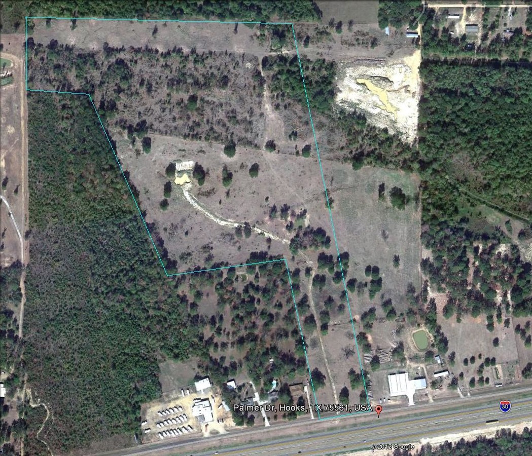
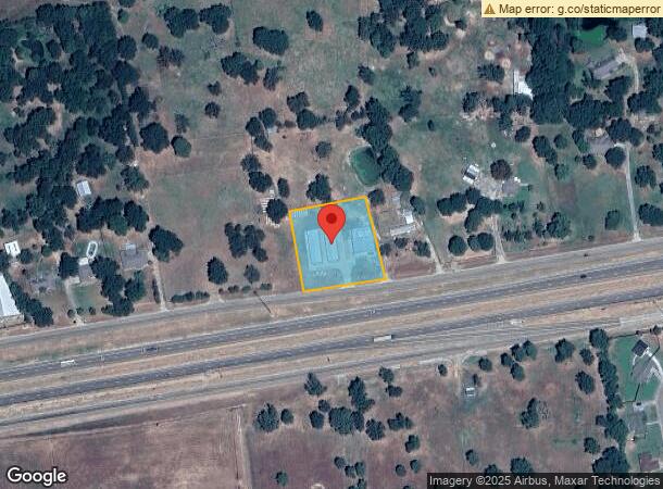
Property Record
520 Palmer Dr, Hooks, TX 75561
NEARBY LISTINGS FOR SALE OR LEASE
-
-
View all Hooks listings for sale on LoopNet.com
Property Detail
520 Palmer Dr
04280012704
George Collum A-119
Commercialnec
GEORGE COLLUM A-119 MINI WHSE BLDGS BLK/TRACT 92 1 ACRES
X
Bowie
48037C0310D
Texas
2023
1 AC
2023
Texas East Area
011302
Other Market Areas
8,400 SF
Texarkana, TX-AR
DEMOGRAPHICS near 520 Palmer Dr
1 Mile
3 Mile
5 Mile
2024 Total Population
1,285
3,405
4,494
2029 Population
1,245
3,319
4,390
Pop Growth 2024-2029
(3.11%)
(2.53%)
(2.31%)
Average Age
40
40
41
2024 Total Households
546
1,391
1,819
HH Growth 2024-2029
(3.11%)
(2.52%)
(2.36%)
Median Household Inc
$53,562
$51,302
$50,768
Avg Household Size
2.40
2.40
2.40
2024 Avg HH Vehicles
2.00
2.00
2.00
Median Home Value
$109,328
$97,015
$99,844
Median Year Built
1979
1975
1975
Nearby Places
- Restaurants
- Banks
- Shops
- Fitness
- Groceries
PUBLIC TRANSPORTATION
AIRPORT
Texarkana Regional-Webb Field
DRIVE
WALK
Distance
Texarkana Regional-Webb Field
32 min
23.4 mi
Freight Ports
Port of Shreveport
DRIVE
WALK
Distance
Port of Shreveport
127 min
111.4 mi
SALE & LEASE HISTORY
LISTING DATE
SALE/LEASE

Aug 23, 2017
For Sale
Nearby Properties
Address
Land Use
TOTAL SIZE
Lot Size
Zoning
Address
Land Use
TOTAL SIZE
Lot Size
Zoning
16.86 AC
Address
Land Use
TOTAL SIZE
Lot Size
Zoning
5.20 AC
Address
Land Use
TOTAL SIZE
Lot Size
Zoning
10 AC
Address
Land Use
TOTAL SIZE
Lot Size
Zoning
262,312 SF
279.97 AC
Address
Land Use
TOTAL SIZE
Lot Size
Zoning
8.96 AC
Address
Land Use
TOTAL SIZE
Lot Size
Zoning
6.60 AC
Address
Land Use
TOTAL SIZE
Lot Size
Zoning
27,000 SF
13.80 AC
Address
Land Use
TOTAL SIZE
Lot Size
Zoning
834.91 AC
Address
Land Use
TOTAL SIZE
Lot Size
Zoning
15,338 SF
2 AC
Address
Land Use
TOTAL SIZE
Lot Size
Zoning
79,784 SF
10 AC
Address
Land Use
TOTAL SIZE
Lot Size
Zoning
9,114 SF
6.76 AC
Address
Land Use
TOTAL SIZE
Lot Size
Zoning
26,684 SF
20 AC
Address
Land Use
TOTAL SIZE
Lot Size
Zoning
35.30 AC
Address
Land Use
TOTAL SIZE
Lot Size
Zoning
18,855 SF
10.25 AC
Address
Land Use
TOTAL SIZE
Lot Size
Zoning
38,048 SF
4.06 AC
Address
Land Use
TOTAL SIZE
Lot Size
Zoning
5,765 SF
2.28 AC
Address
Land Use
TOTAL SIZE
Lot Size
Zoning
444.87 AC
Address
Land Use
TOTAL SIZE
Lot Size
Zoning
37,920 SF
1.62 AC
Address
Land Use
TOTAL SIZE
Lot Size
Zoning
19,669 SF
18.20 AC
Address
Land Use
TOTAL SIZE
Lot Size
Zoning
10,810 SF
1.12 AC
Address
Land Use
TOTAL SIZE
Lot Size
Zoning
28,678 SF
9.81 AC
Address
Land Use
TOTAL SIZE
Lot Size
Zoning
408.68 AC
Address
Land Use
TOTAL SIZE
Lot Size
Zoning
415.46 AC
Address
Land Use
TOTAL SIZE
Lot Size
Zoning
7,892 SF
1.75 AC
Address
Land Use
TOTAL SIZE
Lot Size
Zoning
5,550 SF
210.88 AC
Address
Land Use
TOTAL SIZE
Lot Size
Zoning
9,012 SF
1.44 AC
Address
Land Use
TOTAL SIZE
Lot Size
Zoning
10,152 SF
1.27 AC
Address
Land Use
TOTAL SIZE
Lot Size
Zoning
10,028 SF
1 AC
Address
Land Use
TOTAL SIZE
Lot Size
Zoning
29,440 SF
1.72 AC
Address
Land Use
TOTAL SIZE
Lot Size
Zoning
The World's #1 Commercial Real Estate Marketplace
Connect with us
© 2025 CoStar Group
The information above has been obtained from sources believed reliable. While we do not doubt its accuracy we have not verified it and make no guarantee, warranty or representation about it. It is your responsibility to independently confirm its accuracy and completeness. Any projections, opinions, assumptions, or estimates used are for example only and do not represent the current or future performance of the property. The value of this transaction to you depends on tax and other factors which should be evaluated by your tax, financial, and legal advisors. You and your advisors should conduct a careful, independent investigation of the property to determine to your satisfaction the suitability of the property for your needs.