Property Record
5200 E State Highway 100 E, Palm Coast, FL 32164
NEARBY LISTINGS FOR SALE OR LEASE
Property Detail
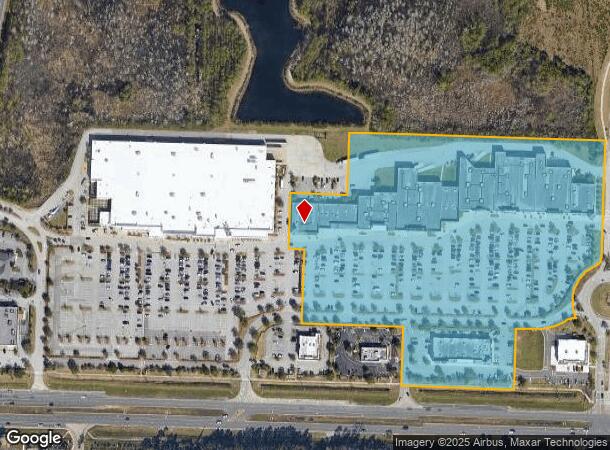
5200 E State Highway 100 E
Deltona-Daytona Beach-Ormond Beach, FL
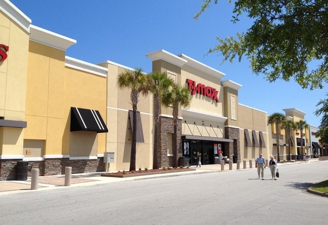
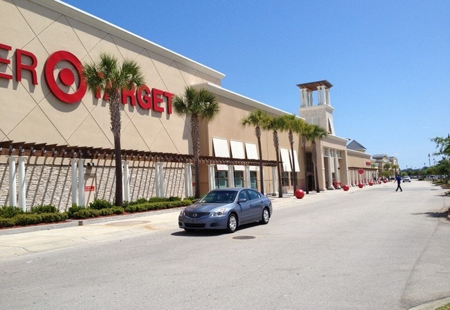
Palm Coast Landing At Town Center
07-12-31-4955-00000-0030
PALM COAST LANDING AT TOWN CENTER - A PARTIAL REPLAT MB36 PG34 PT LOT 3 (16.06 AC) OR 1562 PG 1310 (OUTPARCEL LYING IN THE SELY CRNR SAID CRNR BEING ALONG SR 100 AND LANDING BLVD ORIGINAL AC 17.46 OR 1686 PG 1050-DEV OD) OR 1828/7 OR 1841/635 OR 1848
Departmentstore
Flagler
X
Florida
12035C0230E
3
2024
16.06 AC
2025
Daytona Area
060213
Other Market Areas
280,742 SF
DEMOGRAPHICS near 5200 E State Highway 100 E
1 Mile
3 Mile
5 Mile
2024 Total Population
2,815
30,140
64,650
2029 Population
3,494
36,942
79,152
Pop Growth 2024-2029
+ 24.12%
+ 22.57%
+ 22.43%
Average Age
48
45
46
2024 Total Households
1,305
11,988
25,896
HH Growth 2024-2029
+ 23.52%
+ 21.91%
+ 21.68%
Median Household Inc
$41,155
$58,009
$63,270
Avg Household Size
2.20
2.50
2.40
2024 Avg HH Vehicles
1.00
2.00
2.00
Median Home Value
$307,824
$256,933
$262,208
Median Year Built
2008
2004
2002
Nearby Places
Map Layers
Map Styles
 Street
 Aerial
- Restaurants
- Banks
- Shops
- Fitness
- Groceries
PUBLIC TRANSPORTATION
AIRPORT
Daytona Beach International
DRIVE
WALK
Distance
Daytona Beach International
36 min
26.7 mi
Freight Ports
Jacksonville Port
DRIVE
WALK
Distance
Jacksonville Port
87 min
72.9 mi
SALE & LEASE HISTORY
LISTING DATE
SALE/LEASE

Sep 25, 2016
For Lease
Sep 25, 2016
For Lease
Mar 03, 2017
For Lease
Aug 14, 2019
For Lease
Nearby Properties
Address
Land Use
TOTAL SIZE
Lot Size
Zoning
Address
Land Use
TOTAL SIZE
Lot Size
Zoning
345,915 SF
94.85 AC
COM-2
Address
Land Use
TOTAL SIZE
Lot Size
Zoning
913,614 SF
85.53 AC
PSP
Address
Land Use
TOTAL SIZE
Lot Size
Zoning
320,259 SF
83.19 AC
P
Address
Land Use
TOTAL SIZE
Lot Size
Zoning
217,927 SF
1,165.37 AC
I-C
Address
Land Use
TOTAL SIZE
Lot Size
Zoning
225,108 SF
41.71 AC
MPD
Address
Land Use
TOTAL SIZE
Lot Size
Zoning
236,316 SF
61.38 AC
PSP
Address
Land Use
TOTAL SIZE
Lot Size
Zoning
138,991 SF
18.66 AC
P
Address
Land Use
TOTAL SIZE
Lot Size
Zoning
141,171 SF
8.18 AC
MPD
Address
Land Use
TOTAL SIZE
Lot Size
Zoning
121,173 SF
10 AC
AC
Address
Land Use
TOTAL SIZE
Lot Size
Zoning
64,208 SF
8.41 AC
PSP
Address
Land Use
TOTAL SIZE
Lot Size
Zoning
76,544 SF
48.85 AC
R/C
Address
Land Use
TOTAL SIZE
Lot Size
Zoning
124,911 SF
10.18 AC
PUD
Address
Land Use
TOTAL SIZE
Lot Size
Zoning
15.91 AC
PSP
Address
Land Use
TOTAL SIZE
Lot Size
Zoning
220,314 SF
17.41 AC
MPD
Address
Land Use
TOTAL SIZE
Lot Size
Zoning
82,459 SF
4.09 AC
MPD
Address
Land Use
TOTAL SIZE
Lot Size
Zoning
122,353 SF
17.97 AC
MPD
Address
Land Use
TOTAL SIZE
Lot Size
Zoning
208,450 SF
11.85 AC
MPD
Address
Land Use
TOTAL SIZE
Lot Size
Zoning
68,684 SF
9.68 AC
MPD
Address
Land Use
TOTAL SIZE
Lot Size
Zoning
89,590 SF
9.90 AC
B-1
Address
Land Use
TOTAL SIZE
Lot Size
Zoning
220.05 AC
MPD
Address
Land Use
TOTAL SIZE
Lot Size
Zoning
42,025 SF
15.64 AC
MPD
Address
Land Use
TOTAL SIZE
Lot Size
Zoning
84,899 SF
10.35 AC
COM-2
Address
Land Use
TOTAL SIZE
Lot Size
Zoning
35,243 SF
8.45 AC
COM-3
Address
Land Use
TOTAL SIZE
Lot Size
Zoning
28,591 SF
3.84 AC
PUD
Address
Land Use
TOTAL SIZE
Lot Size
Zoning
59,889 SF
0.75 AC
R-3A
Address
Land Use
TOTAL SIZE
Lot Size
Zoning
54,500 SF
4.95 AC
COM-2
Address
Land Use
TOTAL SIZE
Lot Size
Zoning
47,264 SF
10.20 AC
MPD
Address
Land Use
TOTAL SIZE
Lot Size
Zoning
50,497 SF
9.74 AC
MPD
The World's #1 Commercial Real Estate Marketplace
Connect with us
© 2026 CoStar Group
The information above has been obtained from sources believed reliable. While we do not doubt its accuracy we have not verified it and make no guarantee, warranty or representation about it. It is your responsibility to independently confirm its accuracy and completeness. Any projections, opinions, assumptions, or estimates used are for example only and do not represent the current or future performance of the property. The value of this transaction to you depends on tax and other factors which should be evaluated by your tax, financial, and legal advisors. You and your advisors should conduct a careful, independent investigation of the property to determine to your satisfaction the suitability of the property for your needs.