Property Record
5202 S Verrado Way, Buckeye, AZ 85326

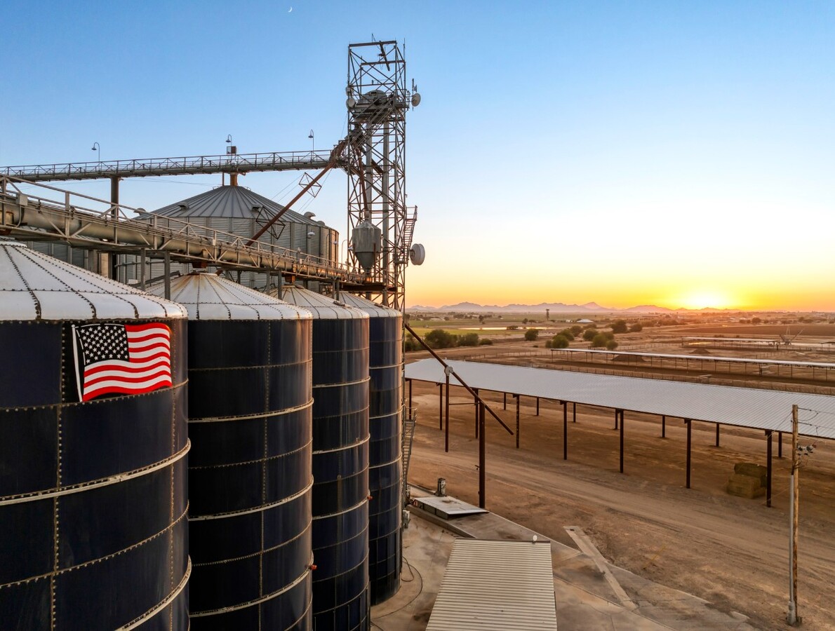
This Property Is For Sale
NEARBY LISTINGS FOR SALE OR LEASE
Property Detail
5202 S Verrado Way
504-44-002F
COM SW COR LOT 7 SEC 29 TH N 83F TPOB CONT N 60F TH E 177.15F TH S 60F TH W 177.04F TPOB
Farms
Maricopa
AH
Arizona
04013C2120M
7
2024
94.16 AC
2025
West I-10
050611
Phoenix
15,747 SF
Phoenix-Mesa-Scottsdale, AZ
DEMOGRAPHICS near 5202 S Verrado Way
1 Mile
3 Mile
5 Mile
2024 Total Population
247
4,943
60,629
2029 Population
251
5,348
66,366
Pop Growth 2024-2029
+ 1.62%
+ 8.19%
+ 9.46%
Average Age
36
36
36
2024 Total Households
62
1,391
18,328
HH Growth 2024-2029
+ 1.61%
+ 8.41%
+ 9.55%
Median Household Inc
$117,856
$97,684
$90,793
Avg Household Size
3.40
3.30
3.20
2024 Avg HH Vehicles
4.00
3.00
2.00
Median Home Value
$545,454
$469,892
$348,747
Median Year Built
2003
2008
2007
Nearby Places
- Restaurants
- Banks
- Shops
- Fitness
- Groceries
PUBLIC TRANSPORTATION
AIRPORT
Phoenix Sky Harbor International
DRIVE
WALK
Distance
Phoenix Sky Harbor International
49 min
35.6 mi
Freight Ports
Port of San Diego
DRIVE
WALK
Distance
Port of San Diego
368 min
327.3 mi
Nearby Properties
Address
Land Use
TOTAL SIZE
Lot Size
Zoning
Address
Land Use
TOTAL SIZE
Lot Size
Zoning
2,310,631 SF
215.58 AC
Address
Land Use
TOTAL SIZE
Lot Size
Zoning
1,834,456 SF
142.44 AC
C-G
Address
Land Use
TOTAL SIZE
Lot Size
Zoning
1.98 AC
PAD
Address
Land Use
TOTAL SIZE
Lot Size
Zoning
73,130 SF
3.68 AC
PAD
Address
Land Use
TOTAL SIZE
Lot Size
Zoning
5,597 SF
164.45 AC
PR
Address
Land Use
TOTAL SIZE
Lot Size
Zoning
99,117 SF
21.66 AC
SU
Address
Land Use
TOTAL SIZE
Lot Size
Zoning
65,023 SF
12.52 AC
C-C
Address
Land Use
TOTAL SIZE
Lot Size
Zoning
53.11 AC
C-G
Address
Land Use
TOTAL SIZE
Lot Size
Zoning
108,952 SF
32.46 AC
I-2
Address
Land Use
TOTAL SIZE
Lot Size
Zoning
14,968 SF
73.37 AC
R-43
Address
Land Use
TOTAL SIZE
Lot Size
Zoning
15,452 SF
6.50 AC
C-G
Address
Land Use
TOTAL SIZE
Lot Size
Zoning
11.41 AC
PAD
Address
Land Use
TOTAL SIZE
Lot Size
Zoning
17,298 SF
5.58 AC
CC
Address
Land Use
TOTAL SIZE
Lot Size
Zoning
2,528 SF
17 AC
R-43
Address
Land Use
TOTAL SIZE
Lot Size
Zoning
16,558 SF
4 AC
PUD
Address
Land Use
TOTAL SIZE
Lot Size
Zoning
2,448 SF
28.01 AC
PAD
Address
Land Use
TOTAL SIZE
Lot Size
Zoning
19,800 SF
14.73 AC
C-G
Address
Land Use
TOTAL SIZE
Lot Size
Zoning
351.02 AC
C-G
Address
Land Use
TOTAL SIZE
Lot Size
Zoning
7,567 SF
2.15 AC
PC
Address
Land Use
TOTAL SIZE
Lot Size
Zoning
30,980 SF
38.75 AC
R-43
Address
Land Use
TOTAL SIZE
Lot Size
Zoning
73.82 AC
R-43
Address
Land Use
TOTAL SIZE
Lot Size
Zoning
9,657 SF
4.79 AC
R-R
Address
Land Use
TOTAL SIZE
Lot Size
Zoning
Address
Land Use
TOTAL SIZE
Lot Size
Zoning
4.09 AC
C-C
Address
Land Use
TOTAL SIZE
Lot Size
Zoning
0.17 AC
PUD
Address
Land Use
TOTAL SIZE
Lot Size
Zoning
0.18 AC
PUD
Address
Land Use
TOTAL SIZE
Lot Size
Zoning
15,384 SF
4.81 AC
I-2
The World's #1 Commercial Real Estate Marketplace
Connect with us
© 2025 CoStar Group
The information above has been obtained from sources believed reliable. While we do not doubt its accuracy we have not verified it and make no guarantee, warranty or representation about it. It is your responsibility to independently confirm its accuracy and completeness. Any projections, opinions, assumptions, or estimates used are for example only and do not represent the current or future performance of the property. The value of this transaction to you depends on tax and other factors which should be evaluated by your tax, financial, and legal advisors. You and your advisors should conduct a careful, independent investigation of the property to determine to your satisfaction the suitability of the property for your needs.