Property Record
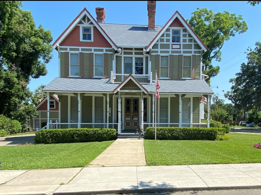
521 E Fort King St, Ocala, FL 34471

NEARBY LISTINGS FOR SALE OR LEASE
Property Detail
521 E Fort King St
Ocala, FL
Caldwells Add
2820-000-016
Marion
Sfr
Florida
X
Downtown Ocala
12083C0517E
Ocala
DEMOGRAPHICS near 521 E Fort King St
1 Mile
3 Mile
5 Mile
2024 Total Population
5,644
48,067
99,574
2029 Population
6,420
54,176
112,165
Pop Growth 2024-2029
+ 13.75%
+ 12.71%
+ 12.64%
Average Age
39
40
41
2024 Total Households
2,405
19,148
40,404
HH Growth 2024-2029
+ 13.80%
+ 12.79%
+ 12.67%
Median Household Inc
$49,141
$44,685
$53,933
Avg Household Size
2.30
2.30
2.30
2024 Avg HH Vehicles
2.00
2.00
2.00
Median Home Value
$210,862
$178,978
$199,612
Median Year Built
1958
1977
1983
Nearby Places
- Restaurants
- Banks
- Shops
- Fitness
- Groceries
SALE & LEASE HISTORY
LISTING DATE
SALE/LEASE

Jun 03, 2022
For Sale
Nearby Properties
Address
Land Use
TOTAL SIZE
Lot Size
Zoning
Address
Land Use
TOTAL SIZE
Lot Size
Zoning
207,950 SF
14.08 AC
INST
Address
Land Use
TOTAL SIZE
Lot Size
Zoning
326,425 SF
11.66 AC
INST
Address
Land Use
TOTAL SIZE
Lot Size
Zoning
704,765 SF
71.04 AC
GU
Address
Land Use
TOTAL SIZE
Lot Size
Zoning
446,764 SF
138.06 AC
GU
Address
Land Use
TOTAL SIZE
Lot Size
Zoning
189,286 SF
35.42 AC
PD08
Address
Land Use
TOTAL SIZE
Lot Size
Zoning
178,015 SF
18.28 AC
PD07
Address
Land Use
TOTAL SIZE
Lot Size
Zoning
222,210 SF
22.14 AC
SC
Address
Land Use
TOTAL SIZE
Lot Size
Zoning
92,049 SF
15.75 AC
R3
Address
Land Use
TOTAL SIZE
Lot Size
Zoning
266,503 SF
25.48 AC
SC
Address
Land Use
TOTAL SIZE
Lot Size
Zoning
88,462 SF
31.76 AC
INST
Address
Land Use
TOTAL SIZE
Lot Size
Zoning
604,920 SF
42.92 AC
M1
Address
Land Use
TOTAL SIZE
Lot Size
Zoning
89,426 SF
15.16 AC
PD12
Address
Land Use
TOTAL SIZE
Lot Size
Zoning
228,997 SF
22.89 AC
SC
Address
Land Use
TOTAL SIZE
Lot Size
Zoning
180,334 SF
24.29 AC
INST
Address
Land Use
TOTAL SIZE
Lot Size
Zoning
101,892 SF
16.81 AC
INST
Address
Land Use
TOTAL SIZE
Lot Size
Zoning
482,618 SF
34.54 AC
M2
Address
Land Use
TOTAL SIZE
Lot Size
Zoning
111,395 SF
13 AC
B2
Address
Land Use
TOTAL SIZE
Lot Size
Zoning
66,600 SF
21.50 AC
B4
Address
Land Use
TOTAL SIZE
Lot Size
Zoning
56,484 SF
12.50 AC
PD14
Address
Land Use
TOTAL SIZE
Lot Size
Zoning
116,035 SF
38.20 AC
GU
Address
Land Use
TOTAL SIZE
Lot Size
Zoning
69,607 SF
6.74 AC
INST
Address
Land Use
TOTAL SIZE
Lot Size
Zoning
30,334 SF
29.72 AC
GU
Address
Land Use
TOTAL SIZE
Lot Size
Zoning
78,280 SF
12.54 AC
R3
Address
Land Use
TOTAL SIZE
Lot Size
Zoning
19,117 SF
0.98 AC
FBC
Address
Land Use
TOTAL SIZE
Lot Size
Zoning
95,964 SF
15.51 AC
M1
Address
Land Use
TOTAL SIZE
Lot Size
Zoning
112,663 SF
32.72 AC
INST
Address
Land Use
TOTAL SIZE
Lot Size
Zoning
71,065 SF
12.01 AC
B2
Address
Land Use
TOTAL SIZE
Lot Size
Zoning
134,827 SF
14.83 AC
SC
Address
Land Use
TOTAL SIZE
Lot Size
Zoning
132,244 SF
11.60 AC
SC
Address
Land Use
TOTAL SIZE
Lot Size
Zoning
49,963 SF
9.84 AC
PD14
The World's #1 Commercial Real Estate Marketplace
Connect with us
© 2025 CoStar Group
The information above has been obtained from sources believed reliable. While we do not doubt its accuracy we have not verified it and make no guarantee, warranty or representation about it. It is your responsibility to independently confirm its accuracy and completeness. Any projections, opinions, assumptions, or estimates used are for example only and do not represent the current or future performance of the property. The value of this transaction to you depends on tax and other factors which should be evaluated by your tax, financial, and legal advisors. You and your advisors should conduct a careful, independent investigation of the property to determine to your satisfaction the suitability of the property for your needs.