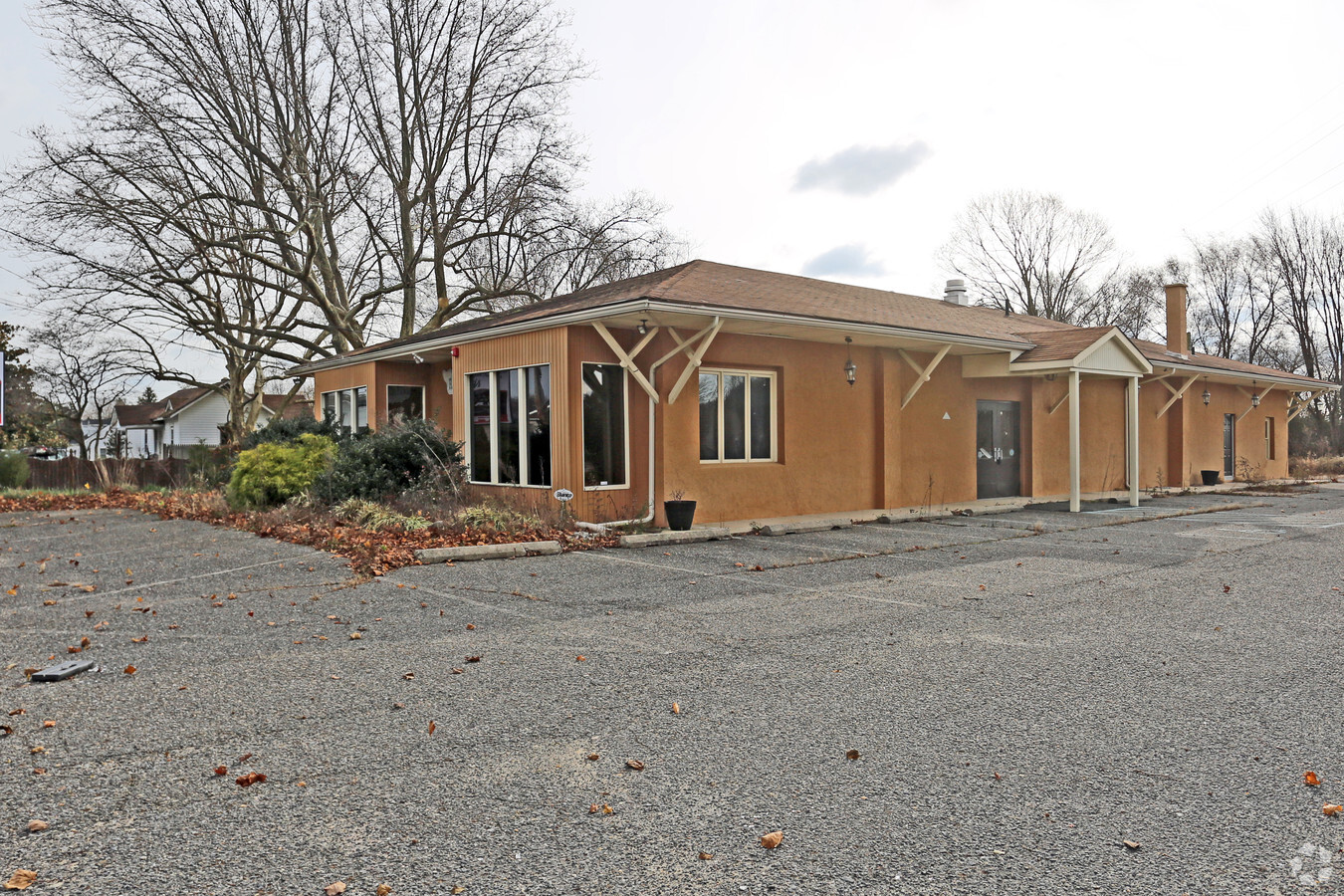
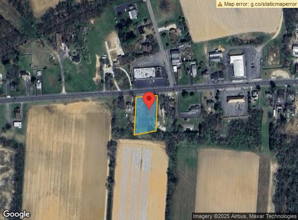
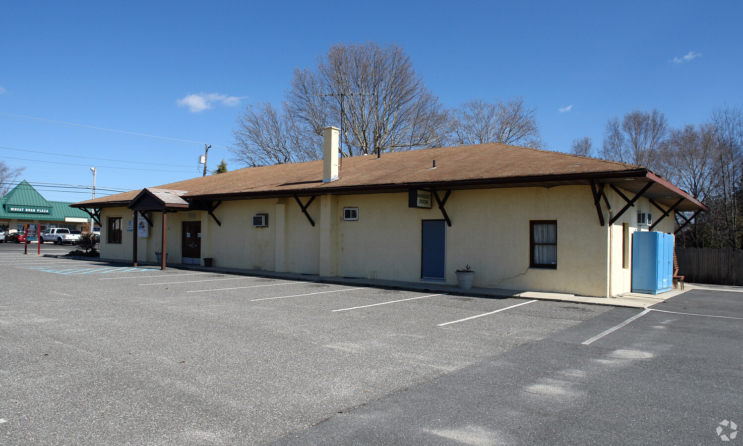
Property Record
363 Wheat Rd, Vineland, NJ 08360

NEARBY LISTINGS FOR SALE OR LEASE
-
-
-
No Photo
-
-
-
-
View all Vineland listings for sale on LoopNet.com
Property Detail
363 Wheat Rd
04-00207-0000-00020
Atlantic
Restaurantbuilding
New Jersey
X
20
34001C0090F
0.73 AC
2024
Atlantic City/Hammonton
2024
Philadelphia
011300
Atlantic City-Hammonton, NJ
DEMOGRAPHICS near 363 Wheat Rd
1 Mile
3 Mile
5 Mile
2024 Total Population
1,386
21,538
59,598
2029 Population
1,377
21,252
58,736
Pop Growth 2024-2029
(0.65%)
(1.33%)
(1.45%)
Average Age
42
41
40
2024 Total Households
574
8,246
21,921
HH Growth 2024-2029
(1.22%)
(1.55%)
(1.59%)
Median Household Inc
$82,160
$70,338
$61,871
Avg Household Size
2.30
2.50
2.60
2024 Avg HH Vehicles
2.00
2.00
2.00
Median Home Value
$249,367
$212,367
$203,596
Median Year Built
1976
1971
1969
Nearby Places
- Restaurants
- Banks
- Shops
- Fitness
- Groceries
PUBLIC TRANSPORTATION
AIRPORT
Atlantic City International
DRIVE
WALK
Distance
Atlantic City International
59 min
26.1 mi
Philadelphia International
DRIVE
WALK
Distance
Philadelphia International
63 min
39.8 mi
Freight Ports
Broadway Terminal - Pier 5
DRIVE
WALK
Distance
Broadway Terminal - Pier 5
48 min
31.2 mi
SALE & LEASE HISTORY
LISTING DATE
SALE/LEASE

Nov 16, 2018
For Sale
Nearby Properties
Address
Land Use
TOTAL SIZE
Lot Size
Zoning
Address
Land Use
TOTAL SIZE
Lot Size
Zoning
156.67 AC
R4
Address
Land Use
TOTAL SIZE
Lot Size
Zoning
69.16 AC
R5
Address
Land Use
TOTAL SIZE
Lot Size
Zoning
25.52 AC
R5
Address
Land Use
TOTAL SIZE
Lot Size
Zoning
8.53 AC
R-3
Address
Land Use
TOTAL SIZE
Lot Size
Zoning
17.01 AC
R3
Address
Land Use
TOTAL SIZE
Lot Size
Zoning
32.41 AC
A
Address
Land Use
TOTAL SIZE
Lot Size
Zoning
11.44 AC
RA/B
Address
Land Use
TOTAL SIZE
Lot Size
Zoning
18.45 AC
R4
Address
Land Use
TOTAL SIZE
Lot Size
Zoning
18.25 AC
R3
Address
Land Use
TOTAL SIZE
Lot Size
Zoning
4,936 SF
35.45 AC
RA
Address
Land Use
TOTAL SIZE
Lot Size
Zoning
87 SF
R2
Address
Land Use
TOTAL SIZE
Lot Size
Zoning
69.47 AC
A
Address
Land Use
TOTAL SIZE
Lot Size
Zoning
2.51 AC
R2
Address
Land Use
TOTAL SIZE
Lot Size
Zoning
11.67 AC
Address
Land Use
TOTAL SIZE
Lot Size
Zoning
8.87 AC
B3
Address
Land Use
TOTAL SIZE
Lot Size
Zoning
4.96 AC
R5
Address
Land Use
TOTAL SIZE
Lot Size
Zoning
22.81 AC
R-4
Address
Land Use
TOTAL SIZE
Lot Size
Zoning
8.77 AC
R4
Address
Land Use
TOTAL SIZE
Lot Size
Zoning
10 AC
R4
Address
Land Use
TOTAL SIZE
Lot Size
Zoning
Address
Land Use
TOTAL SIZE
Lot Size
Zoning
6.52 AC
R5
Address
Land Use
TOTAL SIZE
Lot Size
Zoning
2,384 SF
49.67 AC
01
Address
Land Use
TOTAL SIZE
Lot Size
Zoning
2.68 AC
B3
Address
Land Use
TOTAL SIZE
Lot Size
Zoning
1.02 AC
RP
Address
Land Use
TOTAL SIZE
Lot Size
Zoning
20.38 AC
I2
Address
Land Use
TOTAL SIZE
Lot Size
Zoning
2.17 AC
R3
Address
Land Use
TOTAL SIZE
Lot Size
Zoning
Address
Land Use
TOTAL SIZE
Lot Size
Zoning
1.79 AC
B3
Address
Land Use
TOTAL SIZE
Lot Size
Zoning
3.48 AC
B3
Address
Land Use
TOTAL SIZE
Lot Size
Zoning
1.50 AC
R5
The World's #1 Commercial Real Estate Marketplace
Connect with us
© 2025 CoStar Group
The information above has been obtained from sources believed reliable. While we do not doubt its accuracy we have not verified it and make no guarantee, warranty or representation about it. It is your responsibility to independently confirm its accuracy and completeness. Any projections, opinions, assumptions, or estimates used are for example only and do not represent the current or future performance of the property. The value of this transaction to you depends on tax and other factors which should be evaluated by your tax, financial, and legal advisors. You and your advisors should conduct a careful, independent investigation of the property to determine to your satisfaction the suitability of the property for your needs.