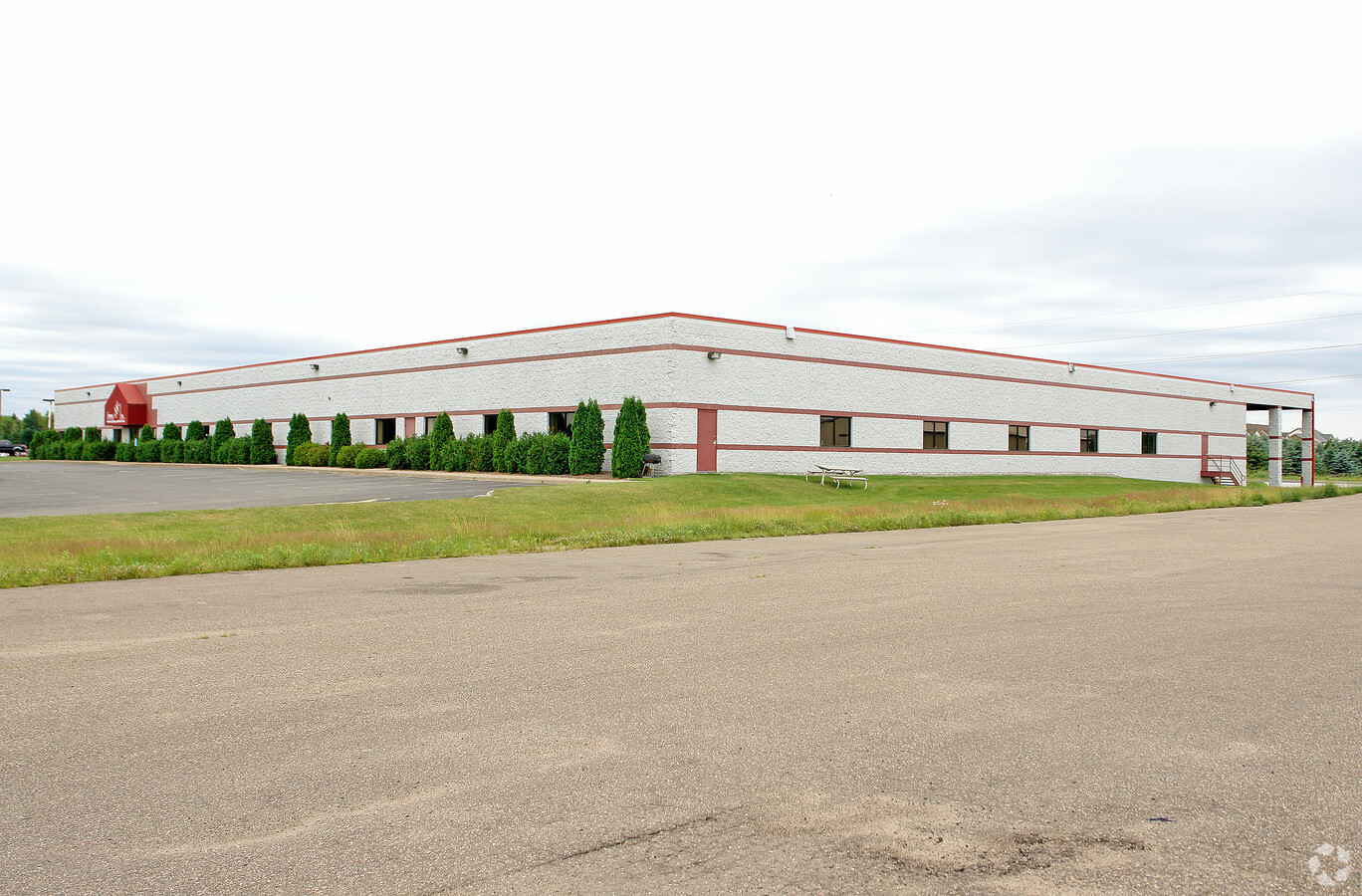
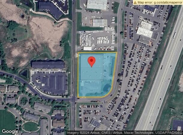
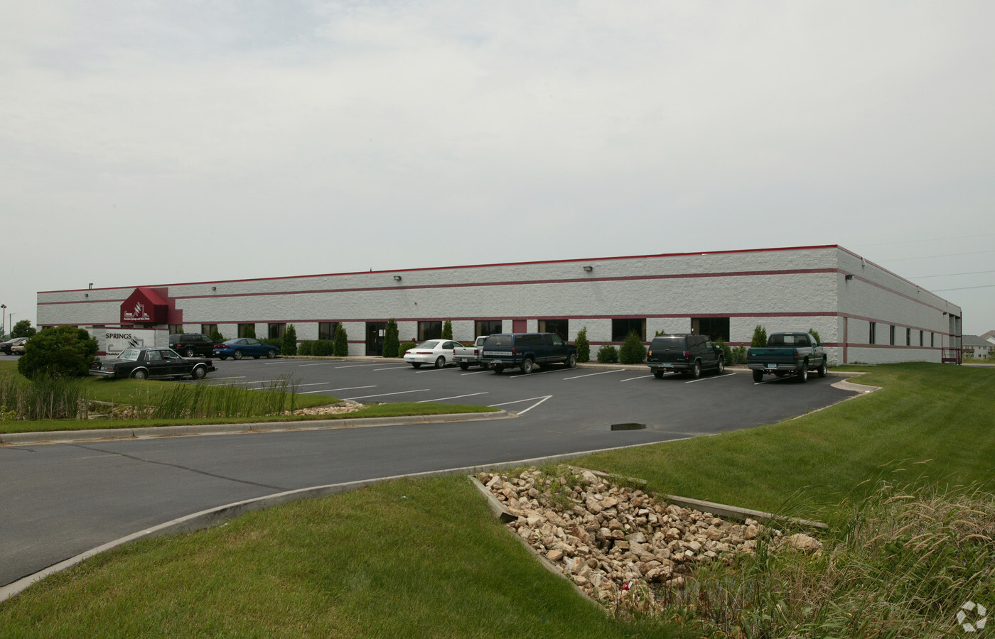
Property Record
522 19Th St Sw, Forest Lake, MN 55025

NEARBY LISTINGS FOR SALE OR LEASE
Property Detail
522 19Th St Sw
Minneapolis-St. Paul-Bloomington, MN-WI
Everton Park
07-032-21-42-0008
SUBDIVISIONNAME EVERTON PARK PLAT 2 LOT 3 BLOCK 2 SUBDIVISIONCD 32411
Apartment
Washington
X
Minnesota
27003C0245E
3
2024
3.03 AC
2023
East
070103
Minneapolis/St Paul
47,638 SF
DEMOGRAPHICS near 522 19Th St Sw
1 Mile
3 Mile
5 Mile
2024 Total Population
4,347
19,862
31,418
2029 Population
4,720
21,396
33,590
Pop Growth 2024-2029
+ 8.58%
+ 7.72%
+ 6.91%
Average Age
35
40
40
2024 Total Households
1,781
7,872
12,135
HH Growth 2024-2029
+ 8.65%
+ 7.88%
+ 7.09%
Median Household Inc
$78,385
$85,784
$92,824
Avg Household Size
2.30
2.50
2.50
2024 Avg HH Vehicles
2.00
2.00
2.00
Median Home Value
$295,832
$355,487
$352,496
Median Year Built
1995
1992
1990
Nearby Places
- Restaurants
- Banks
- Shops
- Fitness
- Groceries
PUBLIC TRANSPORTATION
AIRPORT
Minneapolis-St Paul International/Wold-Chamberlain
Drive
Walk
Distance
Minneapolis-St Paul International/Wold-Chamberlain
45 min
33.8 mi
Freight Ports
Port Milwaukee
Drive
Walk
Distance
Port Milwaukee
387 min
350.2 mi
Nearby Properties
Address
Land Use
TOTAL SIZE
Lot Size
Zoning
Address
Land Use
TOTAL SIZE
Lot Size
Zoning
317520
22.87 AC
Address
Land Use
TOTAL SIZE
Lot Size
Zoning
159240
2.40 AC
Address
Land Use
TOTAL SIZE
Lot Size
Zoning
76748
2.75 AC
Address
Land Use
TOTAL SIZE
Lot Size
Zoning
39032
12.34 AC
Address
Land Use
TOTAL SIZE
Lot Size
Zoning
Address
Land Use
TOTAL SIZE
Lot Size
Zoning
89703
3.28 AC
Address
Land Use
TOTAL SIZE
Lot Size
Zoning
136162
17.60 AC
Address
Land Use
TOTAL SIZE
Lot Size
Zoning
183622
20.24 AC
Address
Land Use
TOTAL SIZE
Lot Size
Zoning
109048
44.70 AC
Address
Land Use
TOTAL SIZE
Lot Size
Zoning
54507
8.63 AC
Address
Land Use
TOTAL SIZE
Lot Size
Zoning
64903
7.83 AC
Address
Land Use
TOTAL SIZE
Lot Size
Zoning
125884
10.22 AC
Address
Land Use
TOTAL SIZE
Lot Size
Zoning
Address
Land Use
TOTAL SIZE
Lot Size
Zoning
77637
5.43 AC
Address
Land Use
TOTAL SIZE
Lot Size
Zoning
113024
18.60 AC
Address
Land Use
TOTAL SIZE
Lot Size
Zoning
211944
29.31 AC
Address
Land Use
TOTAL SIZE
Lot Size
Zoning
103200
13.20 AC
Address
Land Use
TOTAL SIZE
Lot Size
Zoning
69691
6.51 AC
Address
Land Use
TOTAL SIZE
Lot Size
Zoning
66084
7.30 AC
Address
Land Use
TOTAL SIZE
Lot Size
Zoning
Address
Land Use
TOTAL SIZE
Lot Size
Zoning
74178
5.02 AC
Address
Land Use
TOTAL SIZE
Lot Size
Zoning
75099
3.44 AC
Address
Land Use
TOTAL SIZE
Lot Size
Zoning
75099
3.82 AC
Address
Land Use
TOTAL SIZE
Lot Size
Zoning
114251
7.58 AC
Address
Land Use
TOTAL SIZE
Lot Size
Zoning
1052
140.60 AC
Address
Land Use
TOTAL SIZE
Lot Size
Zoning
3598
23.11 AC
Address
Land Use
TOTAL SIZE
Lot Size
Zoning
81248
1.07 AC
Address
Land Use
TOTAL SIZE
Lot Size
Zoning
57672
3.15 AC
Address
Land Use
TOTAL SIZE
Lot Size
Zoning
69020
10.20 AC
Address
Land Use
TOTAL SIZE
Lot Size
Zoning
Start a new search to find other properties for sale or lease
Connect with us
© 2024 CoStar Group
The information above has been obtained from sources believed reliable. While we do not doubt its accuracy we have not verified it and make no guarantee, warranty or representation about it. It is your responsibility to independently confirm its accuracy and completeness. Any projections, opinions, assumptions, or estimates used are for example only and do not represent the current or future performance of the property. The value of this transaction to you depends on tax and other factors which should be evaluated by your tax, financial, and legal advisors. You and your advisors should conduct a careful, independent investigation of the property to determine to your satisfaction the suitability of the property for your needs.