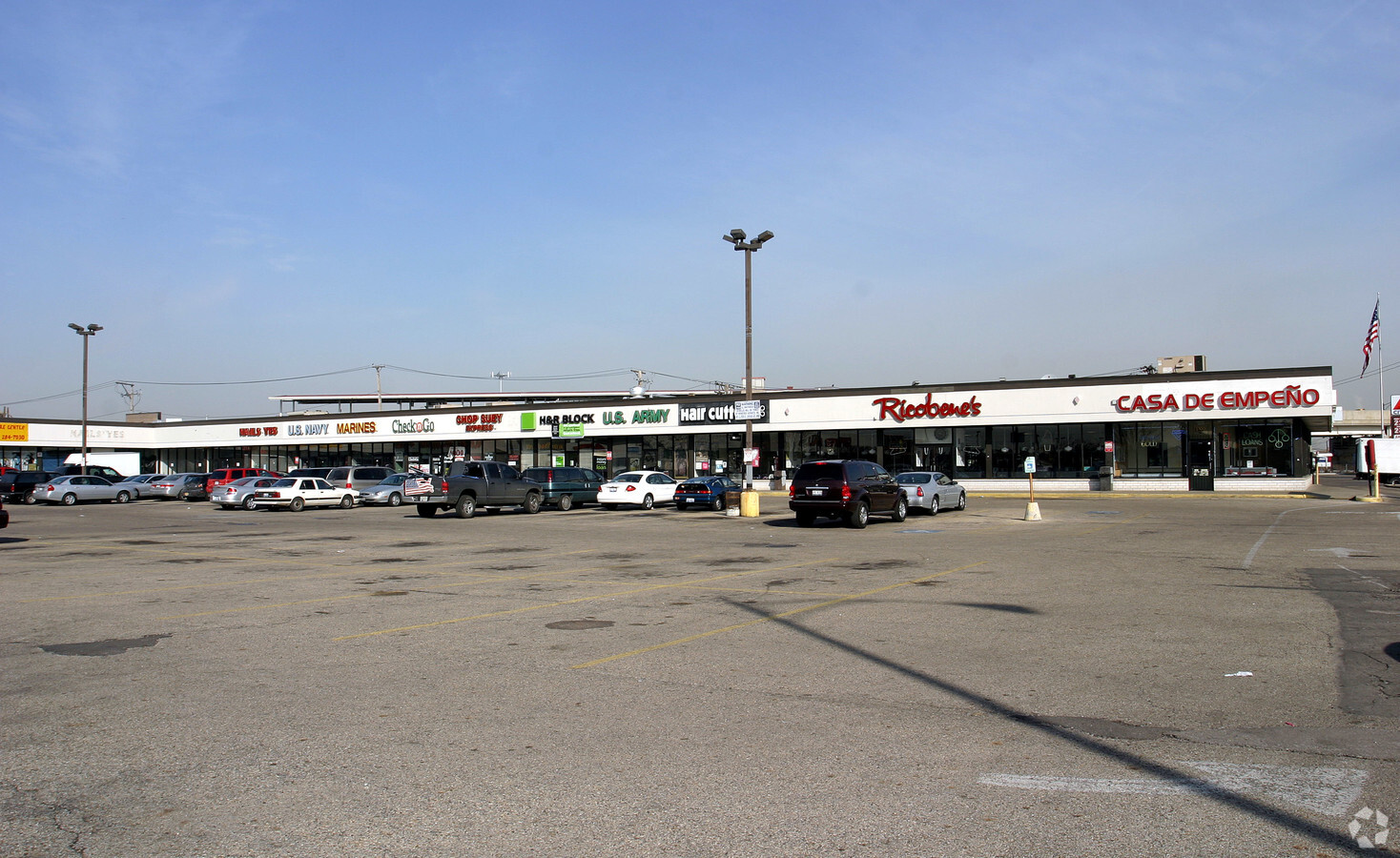
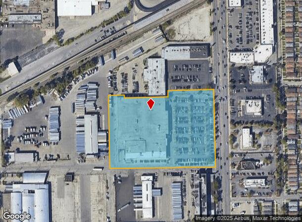
Property Record
5220 S Pulaski Rd, Chicago, IL 60632

NEARBY LISTINGS FOR SALE OR LEASE
Property Detail
5220 S Pulaski Rd
Chicago-Naperville-Elgin, IL-IN-WI
Plaza Sub
19-10-408-043-0000
(COURTESY) PLAZA SUBDIVISION IN THE SE SEC 10-38-13
Regionalshoppingcenterormallwithanchorstore
Cook
X
Illinois
17031C0515J
1
2022
6.22 AC
2024
South Chicago
620200
Chicago
100,027 SF
DEMOGRAPHICS near 5220 S Pulaski Rd
1 Mile
3 Mile
5 Mile
2024 Total Population
34,304
241,258
655,735
2029 Population
31,930
223,887
614,574
Pop Growth 2024-2029
(6.92%)
(7.20%)
(6.28%)
Average Age
36
36
37
2024 Total Households
9,610
69,989
208,673
HH Growth 2024-2029
(7.37%)
(7.60%)
(6.58%)
Median Household Inc
$57,642
$49,288
$51,305
Avg Household Size
3.40
3.30
3.00
2024 Avg HH Vehicles
2.00
2.00
1.00
Median Home Value
$222,929
$216,259
$222,271
Median Year Built
1953
1950
1949
Nearby Places
- Restaurants
- Banks
- Shops
- Fitness
- Groceries
PUBLIC TRANSPORTATION
TRANSIT/SUBWAY
Pulaski Station (Orange Line) (Orange Line - Chicago Transit Authority "L" Trains (The "L"))
DRIVE
WALK
Distance
Pulaski Station (Orange Line) (Orange Line - Chicago Transit Authority "L" Trains (The "L"))
1 min
5 min
0.3 mi
COMMUTER RAIL
Cicero Station (Burlington Northern-Santa Fe Railway Line - Northeast Illinois Regional Commuter Railroad (Metra))
DRIVE
WALK
Distance
Cicero Station (Burlington Northern-Santa Fe Railway Line - Northeast Illinois Regional Commuter Railroad (Metra))
9 min
4.5 mi
Wrightwood Station (SouthWest Service - Northeast Illinois Regional Commuter Railroad (Metra))
DRIVE
WALK
Distance
Wrightwood Station (SouthWest Service - Northeast Illinois Regional Commuter Railroad (Metra))
9 min
4.5 mi
AIRPORT
Chicago Midway International
DRIVE
WALK
Distance
Chicago Midway International
4 min
2.0 mi
Chicago O'Hare International
DRIVE
WALK
Distance
Chicago O'Hare International
38 min
21.0 mi
Freight Ports
Port Milwaukee
DRIVE
WALK
Distance
Port Milwaukee
116 min
89.3 mi
Nearby Properties
Address
Land Use
TOTAL SIZE
Lot Size
Zoning
Address
Land Use
TOTAL SIZE
Lot Size
Zoning
798,998 SF
B3-2
Address
Land Use
TOTAL SIZE
Lot Size
Zoning
4.71 AC
PD 1196
Address
Land Use
TOTAL SIZE
Lot Size
Zoning
1,615,006 SF
41.91 AC
PMD13
Address
Land Use
TOTAL SIZE
Lot Size
Zoning
1,269,112 SF
39.99 AC
M2-1
Address
Land Use
TOTAL SIZE
Lot Size
Zoning
2,155,128 SF
63.23 AC
PMD13
Address
Land Use
TOTAL SIZE
Lot Size
Zoning
2.98 AC
PD 1196
Address
Land Use
TOTAL SIZE
Lot Size
Zoning
134,800 SF
2.53 AC
PD 1273
Address
Land Use
TOTAL SIZE
Lot Size
Zoning
604,145 SF
28.21 AC
Address
Land Use
TOTAL SIZE
Lot Size
Zoning
124,324 SF
11.26 AC
Address
Land Use
TOTAL SIZE
Lot Size
Zoning
57,366 SF
10 AC
Address
Land Use
TOTAL SIZE
Lot Size
Zoning
27.31 AC
PD 1424
Address
Land Use
TOTAL SIZE
Lot Size
Zoning
101,034 SF
1.92 AC
Address
Land Use
TOTAL SIZE
Lot Size
Zoning
497,207 SF
3.53 AC
C1-3
Address
Land Use
TOTAL SIZE
Lot Size
Zoning
133,354 SF
PD 1198
Address
Land Use
TOTAL SIZE
Lot Size
Zoning
290,798 SF
23.70 AC
Address
Land Use
TOTAL SIZE
Lot Size
Zoning
633,057 SF
34.96 AC
PMD 8
Address
Land Use
TOTAL SIZE
Lot Size
Zoning
4.83 AC
Address
Land Use
TOTAL SIZE
Lot Size
Zoning
3.66 AC
M2-3
Address
Land Use
TOTAL SIZE
Lot Size
Zoning
435,677 SF
12.37 AC
M1-2
Address
Land Use
TOTAL SIZE
Lot Size
Zoning
0.84 AC
B1-3
Address
Land Use
TOTAL SIZE
Lot Size
Zoning
260,481 SF
12.93 AC
PD 463
Address
Land Use
TOTAL SIZE
Lot Size
Zoning
796,454 SF
25.68 AC
PMD13
Address
Land Use
TOTAL SIZE
Lot Size
Zoning
352,529 SF
12.77 AC
PMD 8
Address
Land Use
TOTAL SIZE
Lot Size
Zoning
151,303 SF
0.88 AC
PD 568
Address
Land Use
TOTAL SIZE
Lot Size
Zoning
189,197 SF
23.08 AC
Address
Land Use
TOTAL SIZE
Lot Size
Zoning
26,530 SF
26.74 AC
M3-3
Address
Land Use
TOTAL SIZE
Lot Size
Zoning
1,023,467 SF
21.45 AC
PD 1424
Address
Land Use
TOTAL SIZE
Lot Size
Zoning
134,078 SF
17.31 AC
Address
Land Use
TOTAL SIZE
Lot Size
Zoning
190,125 SF
3.72 AC
M1-2
Address
Land Use
TOTAL SIZE
Lot Size
Zoning
102,534 SF
3.87 AC
The World's #1 Commercial Real Estate Marketplace
Connect with us
© 2025 CoStar Group
The information above has been obtained from sources believed reliable. While we do not doubt its accuracy we have not verified it and make no guarantee, warranty or representation about it. It is your responsibility to independently confirm its accuracy and completeness. Any projections, opinions, assumptions, or estimates used are for example only and do not represent the current or future performance of the property. The value of this transaction to you depends on tax and other factors which should be evaluated by your tax, financial, and legal advisors. You and your advisors should conduct a careful, independent investigation of the property to determine to your satisfaction the suitability of the property for your needs.