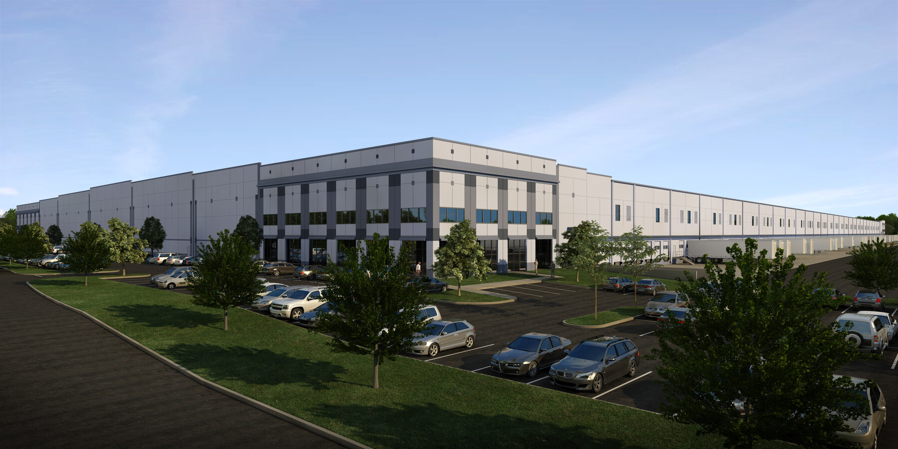
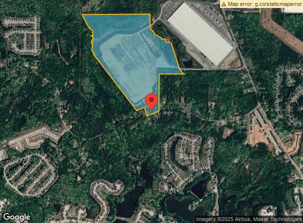
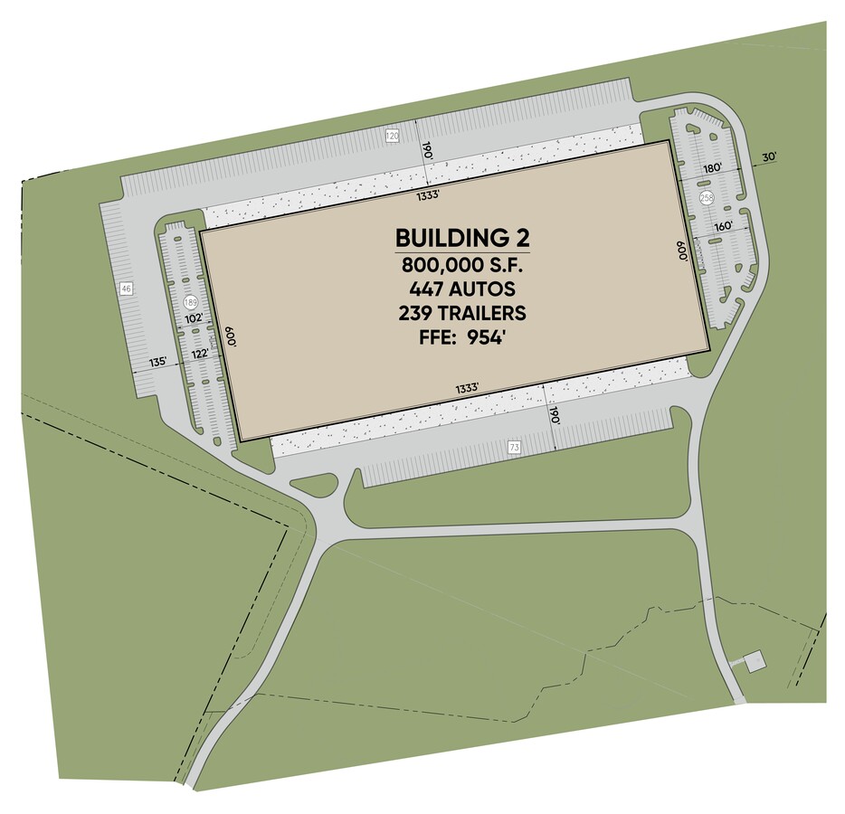
Property Record
5235 Stonewall Tell Rd, Atlanta, GA 30349
NEARBY LISTINGS FOR SALE OR LEASE
Property Detail
5235 Stonewall Tell Rd
Atlanta-Sandy Springs-Roswell, GA
Fulton
09F-2801-0122-059-1
Georgia
Commercialacreage
80.01 AC
2023
Airport/North Clayton
2023
Atlanta
010526
DEMOGRAPHICS near 5235 Stonewall Tell Rd
1 Mile
3 Mile
5 Mile
2024 Total Population
3,226
38,131
108,715
2029 Population
3,346
39,547
112,320
Pop Growth 2024-2029
+ 3.72%
+ 3.71%
+ 3.32%
Average Age
35
37
37
2024 Total Households
1,119
13,508
40,155
HH Growth 2024-2029
+ 3.75%
+ 3.80%
+ 3.36%
Median Household Inc
$65,913
$73,690
$71,571
Avg Household Size
2.80
2.70
2.60
2024 Avg HH Vehicles
2.00
2.00
2.00
Median Home Value
$249,401
$240,101
$231,598
Median Year Built
2002
2002
2002
Nearby Places
- Restaurants
- Banks
- Shops
- Fitness
- Groceries
PUBLIC TRANSPORTATION
AIRPORT
Hartsfield - Jackson Atlanta International
DRIVE
WALK
Distance
Hartsfield - Jackson Atlanta International
20 min
12.3 mi
Freight Ports
Georgia Ports - Savannah
DRIVE
WALK
Distance
Georgia Ports - Savannah
282 min
249.5 mi
SALE & LEASE HISTORY
LISTING DATE
SALE/LEASE

Jan 14, 2020
For Lease
Nearby Properties
Address
Land Use
TOTAL SIZE
Lot Size
Zoning
Address
Land Use
TOTAL SIZE
Lot Size
Zoning
324,371 SF
2.55 AC
I2
Address
Land Use
TOTAL SIZE
Lot Size
Zoning
1,325,500 SF
101.81 AC
AG1
Address
Land Use
TOTAL SIZE
Lot Size
Zoning
1,052,500 SF
127.39 AC
AG1
Address
Land Use
TOTAL SIZE
Lot Size
Zoning
595,060 SF
62.70 AC
Address
Land Use
TOTAL SIZE
Lot Size
Zoning
929,571 SF
65.66 AC
M1
Address
Land Use
TOTAL SIZE
Lot Size
Zoning
130,516 SF
6.50 AC
C1
Address
Land Use
TOTAL SIZE
Lot Size
Zoning
997,011 SF
68.07 AC
M1
Address
Land Use
TOTAL SIZE
Lot Size
Zoning
628,193 SF
56.10 AC
M1
Address
Land Use
TOTAL SIZE
Lot Size
Zoning
669,152 SF
39.13 AC
M1C
Address
Land Use
TOTAL SIZE
Lot Size
Zoning
572,000 SF
46.35 AC
AG1
Address
Land Use
TOTAL SIZE
Lot Size
Zoning
773,776 SF
61.42 AC
M1
Address
Land Use
TOTAL SIZE
Lot Size
Zoning
768,288 SF
40.65 AC
M1
Address
Land Use
TOTAL SIZE
Lot Size
Zoning
499,950 SF
63.40 AC
AG1
Address
Land Use
TOTAL SIZE
Lot Size
Zoning
244,487 SF
21.58 AC
C1
Address
Land Use
TOTAL SIZE
Lot Size
Zoning
32.52 AC
C2
Address
Land Use
TOTAL SIZE
Lot Size
Zoning
546,520 SF
31.54 AC
M1C
Address
Land Use
TOTAL SIZE
Lot Size
Zoning
24.53 AC
Address
Land Use
TOTAL SIZE
Lot Size
Zoning
211,514 SF
22.90 AC
GC
Address
Land Use
TOTAL SIZE
Lot Size
Zoning
426,244 SF
46.62 AC
AG1
Address
Land Use
TOTAL SIZE
Lot Size
Zoning
508,696 SF
94.30 AC
M1C
Address
Land Use
TOTAL SIZE
Lot Size
Zoning
31.58 AC
Address
Land Use
TOTAL SIZE
Lot Size
Zoning
392,685 SF
45.45 AC
AG1
Address
Land Use
TOTAL SIZE
Lot Size
Zoning
370,000 SF
35.50 AC
Address
Land Use
TOTAL SIZE
Lot Size
Zoning
330,086 SF
0.35 AC
MIX
Address
Land Use
TOTAL SIZE
Lot Size
Zoning
163,911 SF
0.16 AC
MIX
Address
Land Use
TOTAL SIZE
Lot Size
Zoning
294,500 SF
37.91 AC
M1A
Address
Land Use
TOTAL SIZE
Lot Size
Zoning
163,811 SF
16.65 AC
RM
Address
Land Use
TOTAL SIZE
Lot Size
Zoning
169,212 SF
0.20 AC
MIX
Address
Land Use
TOTAL SIZE
Lot Size
Zoning
283,060 SF
12.90 AC
M2
Address
Land Use
TOTAL SIZE
Lot Size
Zoning
165,328 SF
11.40 AC
RM
The World's #1 Commercial Real Estate Marketplace
Connect with us
© 2025 CoStar Group
The information above has been obtained from sources believed reliable. While we do not doubt its accuracy we have not verified it and make no guarantee, warranty or representation about it. It is your responsibility to independently confirm its accuracy and completeness. Any projections, opinions, assumptions, or estimates used are for example only and do not represent the current or future performance of the property. The value of this transaction to you depends on tax and other factors which should be evaluated by your tax, financial, and legal advisors. You and your advisors should conduct a careful, independent investigation of the property to determine to your satisfaction the suitability of the property for your needs.