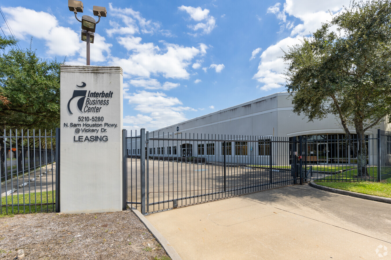
Property Record
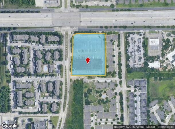
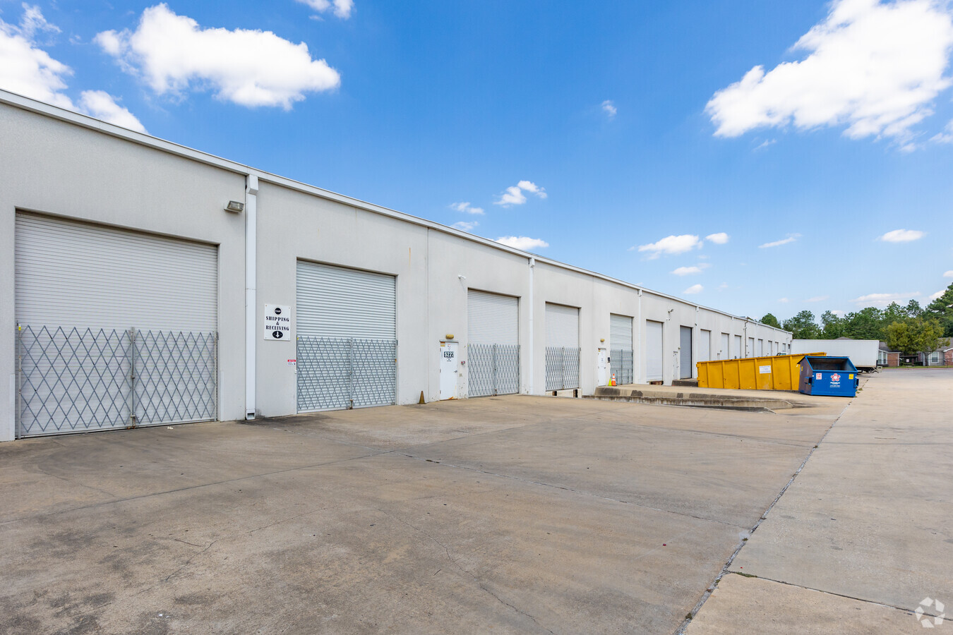
5210 N Sam Houston Pkwy E, Houston, TX 77032
NEARBY LISTINGS FOR SALE OR LEASE
Property Detail
5210 N Sam Houston Pkwy E
1209610010001
Interbeltbusiness Center R/P
Warehouse
RES A BLK 1 INTERBELT BUSINESS CENTER R/P
X
Harris
48201C0480M
Texas
2023
4.42 AC
2023
North Outer Loop
222702
Houston
87,106 SF
Houston-The Woodlands-Sugar Land, TX
DEMOGRAPHICS near 5210 N Sam Houston Pkwy E
1 Mile
3 Mile
5 Mile
2024 Total Population
8,052
53,416
150,224
2029 Population
8,251
54,249
152,928
Pop Growth 2024-2029
+ 2.47%
+ 1.56%
+ 1.80%
Average Age
32
34
34
2024 Total Households
2,678
16,281
47,001
HH Growth 2024-2029
+ 2.32%
+ 1.44%
+ 1.83%
Median Household Inc
$25,976
$47,666
$45,541
Avg Household Size
2.70
3.20
3.10
2024 Avg HH Vehicles
1.00
2.00
2.00
Median Home Value
$118,577
$161,816
$152,288
Median Year Built
1986
1983
1983
Nearby Places
- Restaurants
- Banks
- Shops
- Fitness
- Groceries
PUBLIC TRANSPORTATION
AIRPORT
George Bush Intcntl/Houston
DRIVE
WALK
Distance
George Bush Intcntl/Houston
8 min
4.7 mi
William P Hobby
DRIVE
WALK
Distance
William P Hobby
42 min
26.2 mi
Freight Ports
Port of Houston
DRIVE
WALK
Distance
Port of Houston
31 min
19.9 mi
SALE & LEASE HISTORY
LISTING DATE
SALE/LEASE

Jan 24, 2020
For Lease
Nearby Properties
Address
Land Use
TOTAL SIZE
Lot Size
Zoning
Address
Land Use
TOTAL SIZE
Lot Size
Zoning
1,845,724 SF
69.99 AC
Address
Land Use
TOTAL SIZE
Lot Size
Zoning
1,767,053 SF
88.85 AC
Address
Land Use
TOTAL SIZE
Lot Size
Zoning
621,700 SF
67.56 AC
Address
Land Use
TOTAL SIZE
Lot Size
Zoning
785,390 SF
66.02 AC
Address
Land Use
TOTAL SIZE
Lot Size
Zoning
Address
Land Use
TOTAL SIZE
Lot Size
Zoning
541,440 SF
76.97 AC
Address
Land Use
TOTAL SIZE
Lot Size
Zoning
514,500 SF
40.84 AC
Address
Land Use
TOTAL SIZE
Lot Size
Zoning
523,480 SF
29.22 AC
Address
Land Use
TOTAL SIZE
Lot Size
Zoning
241,625 SF
11.10 AC
Address
Land Use
TOTAL SIZE
Lot Size
Zoning
321,604 SF
16.68 AC
Address
Land Use
TOTAL SIZE
Lot Size
Zoning
431,400 SF
30.88 AC
Address
Land Use
TOTAL SIZE
Lot Size
Zoning
379,570 SF
30.12 AC
Address
Land Use
TOTAL SIZE
Lot Size
Zoning
448,760 SF
8.46 AC
Address
Land Use
TOTAL SIZE
Lot Size
Zoning
338,700 SF
22.99 AC
Address
Land Use
TOTAL SIZE
Lot Size
Zoning
368,632 SF
20.06 AC
Address
Land Use
TOTAL SIZE
Lot Size
Zoning
361,919 SF
23.59 AC
Address
Land Use
TOTAL SIZE
Lot Size
Zoning
259,500 SF
12.28 AC
Address
Land Use
TOTAL SIZE
Lot Size
Zoning
207,720 SF
12.33 AC
Address
Land Use
TOTAL SIZE
Lot Size
Zoning
276,464 SF
18.79 AC
Address
Land Use
TOTAL SIZE
Lot Size
Zoning
90,033 SF
46.96 AC
Address
Land Use
TOTAL SIZE
Lot Size
Zoning
227,400 SF
19.37 AC
Address
Land Use
TOTAL SIZE
Lot Size
Zoning
264,300 SF
15.89 AC
Address
Land Use
TOTAL SIZE
Lot Size
Zoning
113,604 SF
10.70 AC
Address
Land Use
TOTAL SIZE
Lot Size
Zoning
109,025 SF
6 AC
Address
Land Use
TOTAL SIZE
Lot Size
Zoning
170,407 SF
26.31 AC
Address
Land Use
TOTAL SIZE
Lot Size
Zoning
281,252 SF
8 AC
Address
Land Use
TOTAL SIZE
Lot Size
Zoning
738,939 SF
88.85 AC
Address
Land Use
TOTAL SIZE
Lot Size
Zoning
215,879 SF
7.30 AC
Address
Land Use
TOTAL SIZE
Lot Size
Zoning
181,720 SF
15.28 AC
Address
Land Use
TOTAL SIZE
Lot Size
Zoning
182,030 SF
15.12 AC
The World's #1 Commercial Real Estate Marketplace
Connect with us
© 2025 CoStar Group
The information above has been obtained from sources believed reliable. While we do not doubt its accuracy we have not verified it and make no guarantee, warranty or representation about it. It is your responsibility to independently confirm its accuracy and completeness. Any projections, opinions, assumptions, or estimates used are for example only and do not represent the current or future performance of the property. The value of this transaction to you depends on tax and other factors which should be evaluated by your tax, financial, and legal advisors. You and your advisors should conduct a careful, independent investigation of the property to determine to your satisfaction the suitability of the property for your needs.