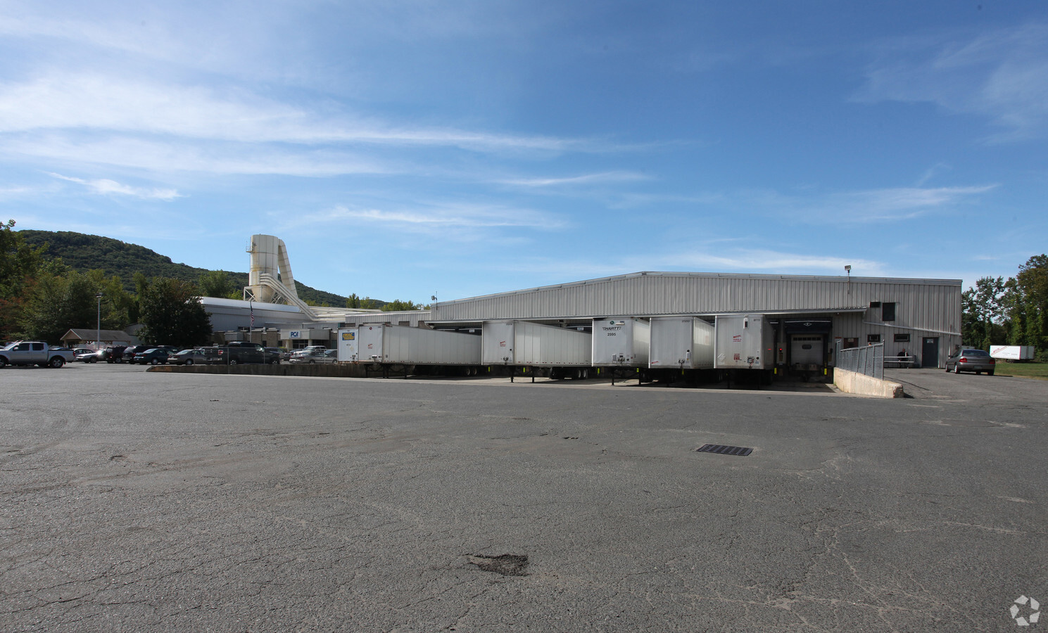
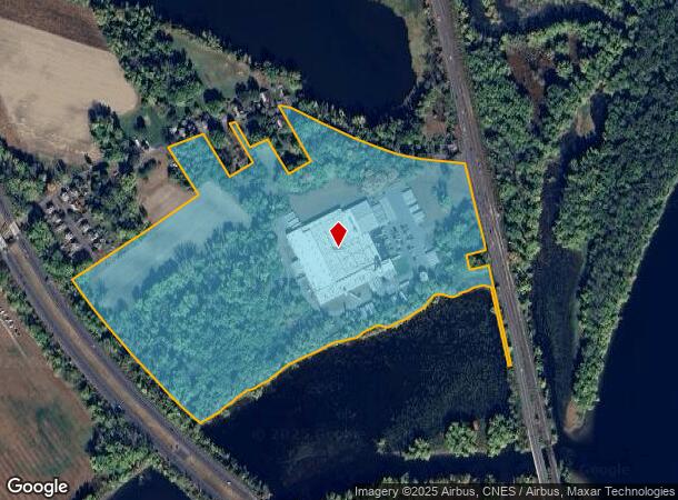
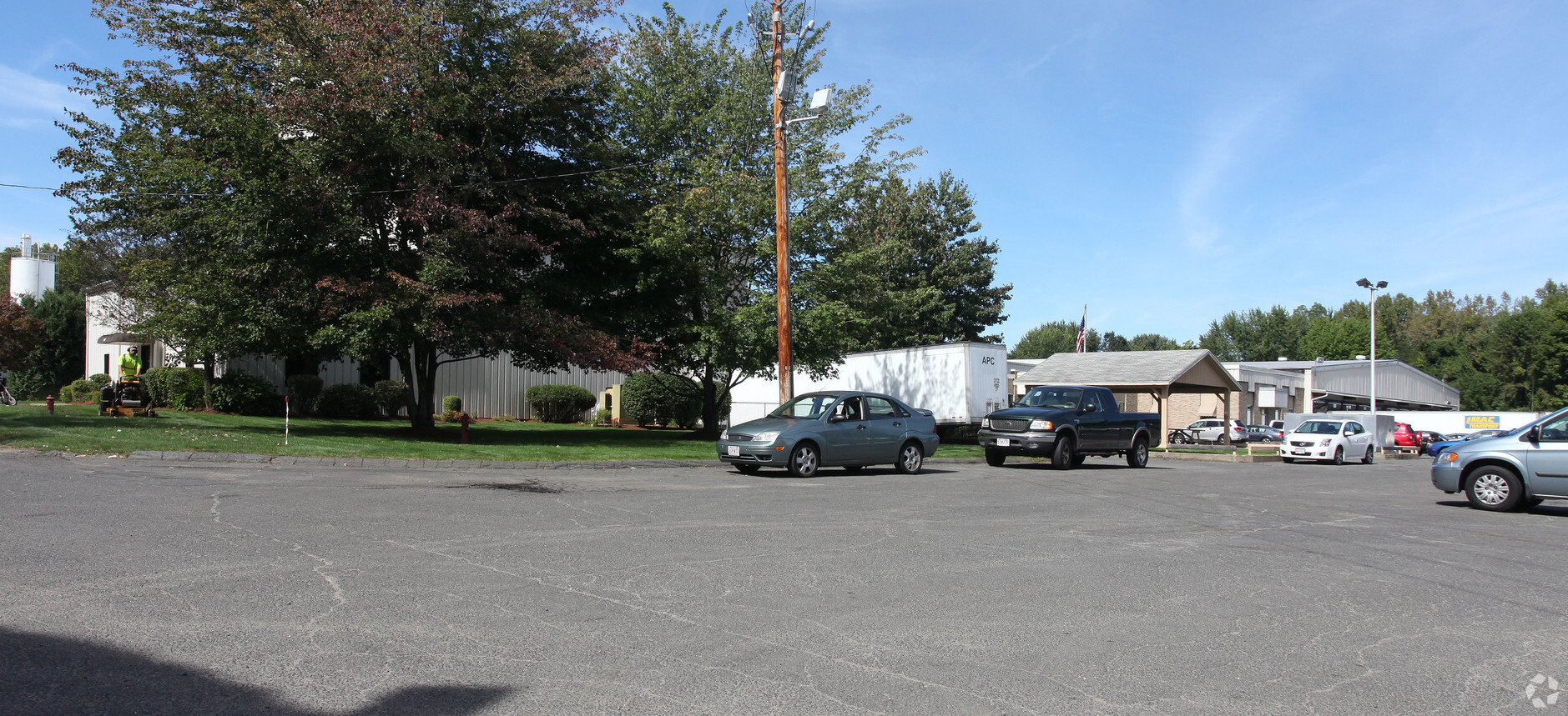
Property Record
525 Mount Tom Rd, Northampton, MA 01060
NEARBY LISTINGS FOR SALE OR LEASE
Property Detail
525 Mount Tom Rd
Springfield, MA
Hampshire
NHAM-000053-000005-000001
Massachusetts
Manufacturinglight
1
2024
44.36 AC
2024
Hampshire County
822200
Hartford
177,512 SF
DEMOGRAPHICS near 525 Mount Tom Rd
1 Mile
3 Mile
5 Mile
2024 Total Population
261
21,952
57,585
2029 Population
206
17,676
46,599
Pop Growth 2024-2029
(21.07%)
(19.48%)
(19.08%)
Average Age
43
41
43
2024 Total Households
119
9,768
24,412
HH Growth 2024-2029
(22.69%)
(21.59%)
(21.05%)
Median Household Inc
$68,823
$67,141
$74,656
Avg Household Size
2.20
2.00
2.10
2024 Avg HH Vehicles
2.00
2.00
2.00
Median Home Value
$337,037
$369,023
$353,253
Median Year Built
1948
1948
1957
Nearby Places
- Restaurants
- Banks
- Shops
- Fitness
- Groceries
PUBLIC TRANSPORTATION
AIRPORT
Bradley International
DRIVE
WALK
Distance
Bradley International
43 min
37.9 mi
Nearby Properties
Address
Land Use
TOTAL SIZE
Lot Size
Zoning
Address
Land Use
TOTAL SIZE
Lot Size
Zoning
29.13 AC
RR
Address
Land Use
TOTAL SIZE
Lot Size
Zoning
5.65 AC
URC
Address
Land Use
TOTAL SIZE
Lot Size
Zoning
17.40 AC
SC
Address
Land Use
TOTAL SIZE
Lot Size
Zoning
150,256 SF
13.58 AC
Address
Land Use
TOTAL SIZE
Lot Size
Zoning
243,012 SF
24.96 AC
URB
Address
Land Use
TOTAL SIZE
Lot Size
Zoning
4,114 SF
125.44 AC
R35
Address
Land Use
TOTAL SIZE
Lot Size
Zoning
0.12 AC
URC
Address
Land Use
TOTAL SIZE
Lot Size
Zoning
55,964 SF
0.36 AC
URC
Address
Land Use
TOTAL SIZE
Lot Size
Zoning
7.58 AC
HB
Address
Land Use
TOTAL SIZE
Lot Size
Zoning
66,138 SF
5 AC
GB
Address
Land Use
TOTAL SIZE
Lot Size
Zoning
21.77 AC
GI
Address
Land Use
TOTAL SIZE
Lot Size
Zoning
85,816 SF
6.80 AC
URB
Address
Land Use
TOTAL SIZE
Lot Size
Zoning
2.69 AC
URC
Address
Land Use
TOTAL SIZE
Lot Size
Zoning
88,144 SF
0.35 AC
CB
Address
Land Use
TOTAL SIZE
Lot Size
Zoning
1.77 AC
URC
Address
Land Use
TOTAL SIZE
Lot Size
Zoning
98,482 SF
1.03 AC
CB
Address
Land Use
TOTAL SIZE
Lot Size
Zoning
42,070 SF
4.38 AC
URA
Address
Land Use
TOTAL SIZE
Lot Size
Zoning
0.32 AC
URC
Address
Land Use
TOTAL SIZE
Lot Size
Zoning
5.84 AC
URC
Address
Land Use
TOTAL SIZE
Lot Size
Zoning
4.19 AC
HB
Address
Land Use
TOTAL SIZE
Lot Size
Zoning
0.14 AC
URC
Address
Land Use
TOTAL SIZE
Lot Size
Zoning
80,161 SF
2.08 AC
URC
Address
Land Use
TOTAL SIZE
Lot Size
Zoning
162,055 SF
2.92 AC
CB
Address
Land Use
TOTAL SIZE
Lot Size
Zoning
1.47 AC
URC
Address
Land Use
TOTAL SIZE
Lot Size
Zoning
45,480 SF
3.48 AC
GB
Address
Land Use
TOTAL SIZE
Lot Size
Zoning
32,187 SF
3.16 AC
HB
Address
Land Use
TOTAL SIZE
Lot Size
Zoning
2.51 AC
URC
Address
Land Use
TOTAL SIZE
Lot Size
Zoning
8.13 AC
BP
Address
Land Use
TOTAL SIZE
Lot Size
Zoning
8.29 AC
URC
Address
Land Use
TOTAL SIZE
Lot Size
Zoning
2.51 AC
URC
The World's #1 Commercial Real Estate Marketplace
Connect with us
© 2025 CoStar Group
The information above has been obtained from sources believed reliable. While we do not doubt its accuracy we have not verified it and make no guarantee, warranty or representation about it. It is your responsibility to independently confirm its accuracy and completeness. Any projections, opinions, assumptions, or estimates used are for example only and do not represent the current or future performance of the property. The value of this transaction to you depends on tax and other factors which should be evaluated by your tax, financial, and legal advisors. You and your advisors should conduct a careful, independent investigation of the property to determine to your satisfaction the suitability of the property for your needs.