Property Record
525 West Ave, Rochester, NY 14611


NEARBY LISTINGS FOR SALE OR LEASE
Property Detail
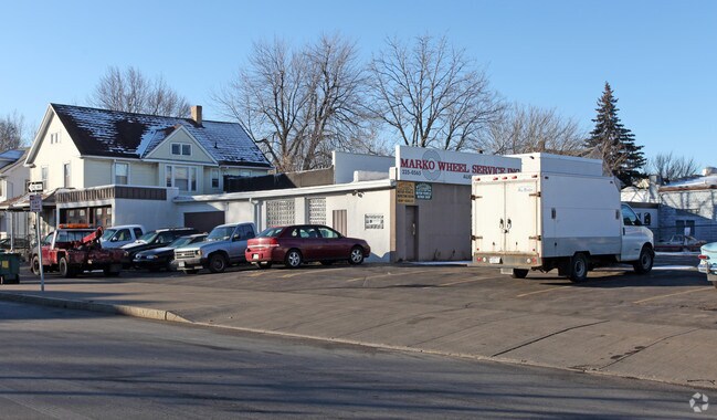
525 West Ave
Rochester, NY
Gardiner Homestead Tract
261400-120-470-0002-006-000-0000
0075.00 403 20 00000 178 179 GARDINER HOMED ASSN SUB
Autorepair
Monroe
X
New York
36055C0194G
6.000
2025
0.36 AC
2024
Greater Rochester
007500
Rochester
4,111 SF
DEMOGRAPHICS near 525 West Ave
1 Mile
3 Mile
5 Mile
2024 Total Population
18,874
118,314
283,693
2029 Population
18,518
116,520
279,076
Pop Growth 2024-2029
(1.89%)
(1.52%)
(1.63%)
Average Age
37
37
38
2024 Total Households
7,436
50,540
121,605
HH Growth 2024-2029
(1.98%)
(1.44%)
(1.67%)
Median Household Inc
$41,327
$42,063
$50,038
Avg Household Size
2.40
2.20
2.20
2024 Avg HH Vehicles
1.00
1.00
1.00
Median Home Value
$69,535
$99,775
$134,137
Median Year Built
1946
1948
1951
Nearby Places
Map Layers
Map Styles
 Street
 Aerial
- Restaurants
- Banks
- Shops
- Fitness
- Groceries
PUBLIC TRANSPORTATION
COMMUTER RAIL
DRIVE
WALK
Distance
7 min
3.0 mi
AIRPORT
Frederick Douglass/Greater Rochester International
DRIVE
WALK
Distance
Frederick Douglass/Greater Rochester International
8 min
3.8 mi
SALE & LEASE HISTORY
LISTING DATE
SALE/LEASE

Mar 06, 2018
For Lease
Mar 06, 2018
For Sale
Jan 04, 2018
For Sale
Dec 07, 2021
For Lease
Apr 03, 2019
For Sale
Nearby Properties
Address
Land Use
TOTAL SIZE
Lot Size
Zoning
Address
Land Use
TOTAL SIZE
Lot Size
Zoning
0.47 AC
Address
Land Use
TOTAL SIZE
Lot Size
Zoning
173,649 SF
85.98 AC
Address
Land Use
TOTAL SIZE
Lot Size
Zoning
1,216,095 SF
22.89 AC
Address
Land Use
TOTAL SIZE
Lot Size
Zoning
Address
Land Use
TOTAL SIZE
Lot Size
Zoning
60,120 SF
12.90 AC
Address
Land Use
TOTAL SIZE
Lot Size
Zoning
200,000 SF
764.91 AC
Address
Land Use
TOTAL SIZE
Lot Size
Zoning
7,800 SF
166.42 AC
02 - SINGL
Address
Land Use
TOTAL SIZE
Lot Size
Zoning
1,878,160 SF
4.05 AC
Address
Land Use
TOTAL SIZE
Lot Size
Zoning
0.13 AC
Address
Land Use
TOTAL SIZE
Lot Size
Zoning
181,500 SF
57.85 AC
Address
Land Use
TOTAL SIZE
Lot Size
Zoning
01 - NOT Z
Address
Land Use
TOTAL SIZE
Lot Size
Zoning
Address
Land Use
TOTAL SIZE
Lot Size
Zoning
614,053 SF
9.30 AC
Address
Land Use
TOTAL SIZE
Lot Size
Zoning
64,041 SF
42.66 AC
Address
Land Use
TOTAL SIZE
Lot Size
Zoning
41,376 SF
59.90 AC
06 - INDUS
Address
Land Use
TOTAL SIZE
Lot Size
Zoning
01 - NOT Z
Address
Land Use
TOTAL SIZE
Lot Size
Zoning
01 - NOT Z
Address
Land Use
TOTAL SIZE
Lot Size
Zoning
0.01 AC
Address
Land Use
TOTAL SIZE
Lot Size
Zoning
11,408 SF
98.28 AC
02 - SINGL
Address
Land Use
TOTAL SIZE
Lot Size
Zoning
6,056 SF
37.65 AC
Address
Land Use
TOTAL SIZE
Lot Size
Zoning
01 - NOT Z
Address
Land Use
TOTAL SIZE
Lot Size
Zoning
128,539 SF
15.01 AC
Address
Land Use
TOTAL SIZE
Lot Size
Zoning
Address
Land Use
TOTAL SIZE
Lot Size
Zoning
3.09 AC
02 - SINGL
Address
Land Use
TOTAL SIZE
Lot Size
Zoning
13.10 AC
Address
Land Use
TOTAL SIZE
Lot Size
Zoning
373,200 SF
5.42 AC
Address
Land Use
TOTAL SIZE
Lot Size
Zoning
178,321 SF
3.10 AC
Address
Land Use
TOTAL SIZE
Lot Size
Zoning
01 - NOT Z
Address
Land Use
TOTAL SIZE
Lot Size
Zoning
0.01 AC
Address
Land Use
TOTAL SIZE
Lot Size
Zoning
302,484 SF
2.53 AC
The World's #1 Commercial Real Estate Marketplace
Connect with us
© 2026 CoStar Group
The information above has been obtained from sources believed reliable. While we do not doubt its accuracy we have not verified it and make no guarantee, warranty or representation about it. It is your responsibility to independently confirm its accuracy and completeness. Any projections, opinions, assumptions, or estimates used are for example only and do not represent the current or future performance of the property. The value of this transaction to you depends on tax and other factors which should be evaluated by your tax, financial, and legal advisors. You and your advisors should conduct a careful, independent investigation of the property to determine to your satisfaction the suitability of the property for your needs.