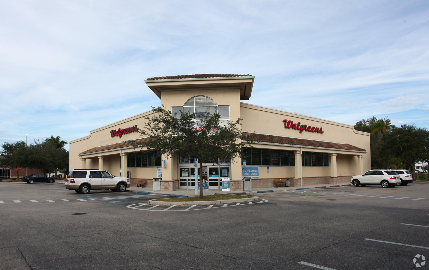
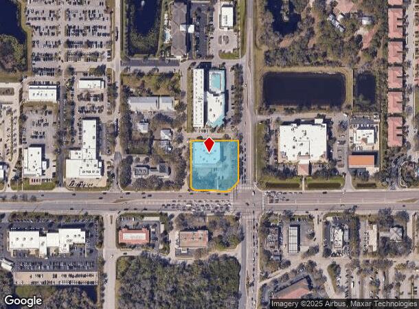
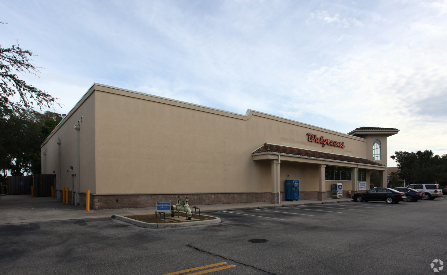
Property Record
5281 Clark Rd, Sarasota, FL 34233

NEARBY LISTINGS FOR SALE OR LEASE
Property Detail
5281 Clark Rd
North Port-Sarasota-Bradenton, FL
Ridgecrest
0092-16-0040
PART OF LOTS 15 THRU 26, BLK B, DESC AS COM AT SE COR OF SEC 11-37-18, TH N 53.87 FT TH S-89-44-46-W 98.81 FT FOR POB TH S-89-44-46-W 210.32 FT TH N 262 FT TH N-89-44-46-E 254.13 FT TH S 218.2 FT TH
Storemultistory
Sarasota
AE
Florida
12115C0164G
15-26
2023
1.39 AC
2024
Sarasota
001509
Tampa/St Petersburg
15,048 SF
DEMOGRAPHICS near 5281 Clark Rd
1 Mile
3 Mile
5 Mile
2024 Total Population
7,652
64,149
149,526
2029 Population
8,782
73,150
171,962
Pop Growth 2024-2029
+ 14.77%
+ 14.03%
+ 15.00%
Average Age
47
48
49
2024 Total Households
3,370
28,451
68,111
HH Growth 2024-2029
+ 14.87%
+ 14.06%
+ 15.19%
Median Household Inc
$75,846
$74,979
$76,869
Avg Household Size
2.20
2.20
2.10
2024 Avg HH Vehicles
2.00
2.00
2.00
Median Home Value
$361,960
$342,931
$368,074
Median Year Built
2001
1986
1983
Nearby Places
- Restaurants
- Banks
- Shops
- Fitness
- Groceries
PUBLIC TRANSPORTATION
AIRPORT
Sarasota/Bradenton International
DRIVE
WALK
Distance
Sarasota/Bradenton International
27 min
14.1 mi
Freight Ports
Port Manatee
DRIVE
WALK
Distance
Port Manatee
40 min
30.0 mi
Nearby Properties
Address
Land Use
TOTAL SIZE
Lot Size
Zoning
Address
Land Use
TOTAL SIZE
Lot Size
Zoning
912,672 SF
88.39 AC
RMF1
Address
Land Use
TOTAL SIZE
Lot Size
Zoning
409,467 SF
36.72 AC
RMF2
Address
Land Use
TOTAL SIZE
Lot Size
Zoning
19,761 SF
119.20 AC
RMH
Address
Land Use
TOTAL SIZE
Lot Size
Zoning
366,256 SF
32.53 AC
RMF3
Address
Land Use
TOTAL SIZE
Lot Size
Zoning
370,367 SF
27.32 AC
OPI
Address
Land Use
TOTAL SIZE
Lot Size
Zoning
15,614 SF
104.95 AC
RMH
Address
Land Use
TOTAL SIZE
Lot Size
Zoning
437,836 SF
72.05 AC
GU
Address
Land Use
TOTAL SIZE
Lot Size
Zoning
912,253 SF
43.46 AC
PID
Address
Land Use
TOTAL SIZE
Lot Size
Zoning
318,414 SF
22.35 AC
RMF1
Address
Land Use
TOTAL SIZE
Lot Size
Zoning
258,994 SF
20.03 AC
PCD
Address
Land Use
TOTAL SIZE
Lot Size
Zoning
263,961 SF
18.88 AC
RMF3
Address
Land Use
TOTAL SIZE
Lot Size
Zoning
94,981 SF
6 AC
PCD
Address
Land Use
TOTAL SIZE
Lot Size
Zoning
157,854 SF
8.32 AC
OPI
Address
Land Use
TOTAL SIZE
Lot Size
Zoning
151,510 SF
59.39 AC
RMF1
Address
Land Use
TOTAL SIZE
Lot Size
Zoning
150,433 SF
10.55 AC
RMF4
Address
Land Use
TOTAL SIZE
Lot Size
Zoning
87,816 SF
24.83 AC
ILW
Address
Land Use
TOTAL SIZE
Lot Size
Zoning
223,929 SF
28.24 AC
RMF1
Address
Land Use
TOTAL SIZE
Lot Size
Zoning
205,136 SF
17.32 AC
RMF2
Address
Land Use
TOTAL SIZE
Lot Size
Zoning
192,934 SF
55.82 AC
GU
Address
Land Use
TOTAL SIZE
Lot Size
Zoning
233,075 SF
19.49 AC
RMF2
Address
Land Use
TOTAL SIZE
Lot Size
Zoning
133,430 SF
19.60 AC
GU
Address
Land Use
TOTAL SIZE
Lot Size
Zoning
138,823 SF
14.31 AC
CG
Address
Land Use
TOTAL SIZE
Lot Size
Zoning
373,288 SF
53.07 AC
PID
Address
Land Use
TOTAL SIZE
Lot Size
Zoning
89,418 SF
7.86 AC
GU
Address
Land Use
TOTAL SIZE
Lot Size
Zoning
123,338 SF
8.52 AC
OPI
Address
Land Use
TOTAL SIZE
Lot Size
Zoning
166,310 SF
40.38 AC
GU
Address
Land Use
TOTAL SIZE
Lot Size
Zoning
80,038 SF
28.10 AC
ILW
Address
Land Use
TOTAL SIZE
Lot Size
Zoning
56,885 SF
10.14 AC
ILW
Address
Land Use
TOTAL SIZE
Lot Size
Zoning
43,181 SF
6.42 AC
PCD
Address
Land Use
TOTAL SIZE
Lot Size
Zoning
106,669 SF
5.02 AC
RMF1
The World's #1 Commercial Real Estate Marketplace
Connect with us
© 2025 CoStar Group
The information above has been obtained from sources believed reliable. While we do not doubt its accuracy we have not verified it and make no guarantee, warranty or representation about it. It is your responsibility to independently confirm its accuracy and completeness. Any projections, opinions, assumptions, or estimates used are for example only and do not represent the current or future performance of the property. The value of this transaction to you depends on tax and other factors which should be evaluated by your tax, financial, and legal advisors. You and your advisors should conduct a careful, independent investigation of the property to determine to your satisfaction the suitability of the property for your needs.