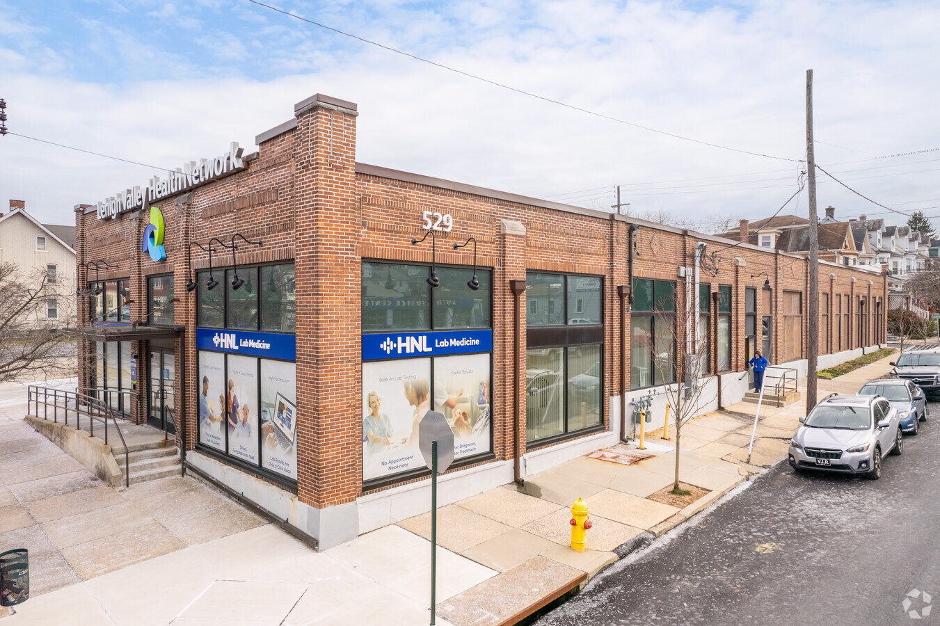
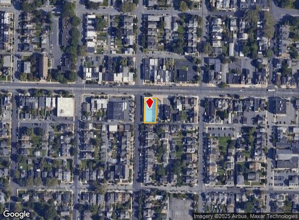
Property Record
529 W Broad St, Bethlehem, PA 18018

NEARBY LISTINGS FOR SALE OR LEASE
Property Detail
529 W Broad St
642738322572-1
LOTS: 001
Medicalbuilding
Lehigh
X
Pennsylvania
42095C0307E
1
2024
0.24 AC
2024
Lehigh Valley
009500
Philadelphia
7,800 SF
Allentown-Bethlehem-Easton, PA-NJ
DEMOGRAPHICS near 529 W Broad St
1 Mile
3 Mile
5 Mile
2024 Total Population
20,049
101,666
227,795
2029 Population
20,213
102,058
229,147
Pop Growth 2024-2029
+ 0.82%
+ 0.39%
+ 0.59%
Average Age
39
40
39
2024 Total Households
8,460
39,797
86,915
HH Growth 2024-2029
+ 0.58%
+ 0.50%
+ 0.70%
Median Household Inc
$58,061
$60,061
$60,205
Avg Household Size
2.10
2.30
2.50
2024 Avg HH Vehicles
1.00
2.00
2.00
Median Home Value
$188,614
$203,468
$216,921
Median Year Built
1948
1956
1958
Nearby Places
- Restaurants
- Banks
- Shops
- Fitness
- Groceries
PUBLIC TRANSPORTATION
AIRPORT
Lehigh Valley International
DRIVE
WALK
Distance
Lehigh Valley International
11 min
5.0 mi
Freight Ports
Port of Philadelphia
DRIVE
WALK
Distance
Port of Philadelphia
85 min
52.1 mi
SALE & LEASE HISTORY
LISTING DATE
SALE/LEASE

Oct 24, 2024
For Sale
May 11, 2022
For Sale
Jun 05, 2019
For Sale
Nearby Properties
Address
Land Use
TOTAL SIZE
Lot Size
Zoning
Address
Land Use
TOTAL SIZE
Lot Size
Zoning
541,843 SF
35.82 AC
INST
Address
Land Use
TOTAL SIZE
Lot Size
Zoning
425,507 SF
52.58 AC
HI
Address
Land Use
TOTAL SIZE
Lot Size
Zoning
649,498 SF
22.51 AC
I
Address
Land Use
TOTAL SIZE
Lot Size
Zoning
13,164 SF
27.89 AC
RT
Address
Land Use
TOTAL SIZE
Lot Size
Zoning
184,739 SF
6.75 AC
I
Address
Land Use
TOTAL SIZE
Lot Size
Zoning
29,982 SF
14.39 AC
RT
Address
Land Use
TOTAL SIZE
Lot Size
Zoning
252,920 SF
12.88 AC
I-G
Address
Land Use
TOTAL SIZE
Lot Size
Zoning
72,678 SF
17.21 AC
PC
Address
Land Use
TOTAL SIZE
Lot Size
Zoning
12,838 SF
36.50 AC
IP
Address
Land Use
TOTAL SIZE
Lot Size
Zoning
326,320 SF
11.73 AC
PC
Address
Land Use
TOTAL SIZE
Lot Size
Zoning
144,692 SF
3.51 AC
I
Address
Land Use
TOTAL SIZE
Lot Size
Zoning
104,379 SF
22.66 AC
CS
Address
Land Use
TOTAL SIZE
Lot Size
Zoning
19,581 SF
15.99 AC
R-MP
Address
Land Use
TOTAL SIZE
Lot Size
Zoning
26,653 SF
13.51 AC
HI
Address
Land Use
TOTAL SIZE
Lot Size
Zoning
57,441 SF
19.85 AC
CS
Address
Land Use
TOTAL SIZE
Lot Size
Zoning
164,451 SF
15.06 AC
PI
Address
Land Use
TOTAL SIZE
Lot Size
Zoning
11,856 SF
454.48 AC
CM
Address
Land Use
TOTAL SIZE
Lot Size
Zoning
134,774 SF
11.74 AC
PC
Address
Land Use
TOTAL SIZE
Lot Size
Zoning
80,277 SF
3.23 AC
MHDR
Address
Land Use
TOTAL SIZE
Lot Size
Zoning
189,805 SF
11.43 AC
I-3
Address
Land Use
TOTAL SIZE
Lot Size
Zoning
119,618 SF
19.84 AC
RR
Address
Land Use
TOTAL SIZE
Lot Size
Zoning
800,250 SF
40.07 AC
HI
Address
Land Use
TOTAL SIZE
Lot Size
Zoning
35,877 SF
9 AC
R-MH
Address
Land Use
TOTAL SIZE
Lot Size
Zoning
75,091 SF
5.23 AC
PUD
Address
Land Use
TOTAL SIZE
Lot Size
Zoning
11,356 SF
RG
Address
Land Use
TOTAL SIZE
Lot Size
Zoning
3,400 SF
65.07 AC
RM
Address
Land Use
TOTAL SIZE
Lot Size
Zoning
10,572 SF
54.17 AC
IP
Address
Land Use
TOTAL SIZE
Lot Size
Zoning
57,635 SF
2.69 AC
I
Address
Land Use
TOTAL SIZE
Lot Size
Zoning
62,433 SF
4.21 AC
I
Address
Land Use
TOTAL SIZE
Lot Size
Zoning
92,428 SF
3.88 AC
CS
The World's #1 Commercial Real Estate Marketplace
Connect with us
© 2025 CoStar Group
The information above has been obtained from sources believed reliable. While we do not doubt its accuracy we have not verified it and make no guarantee, warranty or representation about it. It is your responsibility to independently confirm its accuracy and completeness. Any projections, opinions, assumptions, or estimates used are for example only and do not represent the current or future performance of the property. The value of this transaction to you depends on tax and other factors which should be evaluated by your tax, financial, and legal advisors. You and your advisors should conduct a careful, independent investigation of the property to determine to your satisfaction the suitability of the property for your needs.