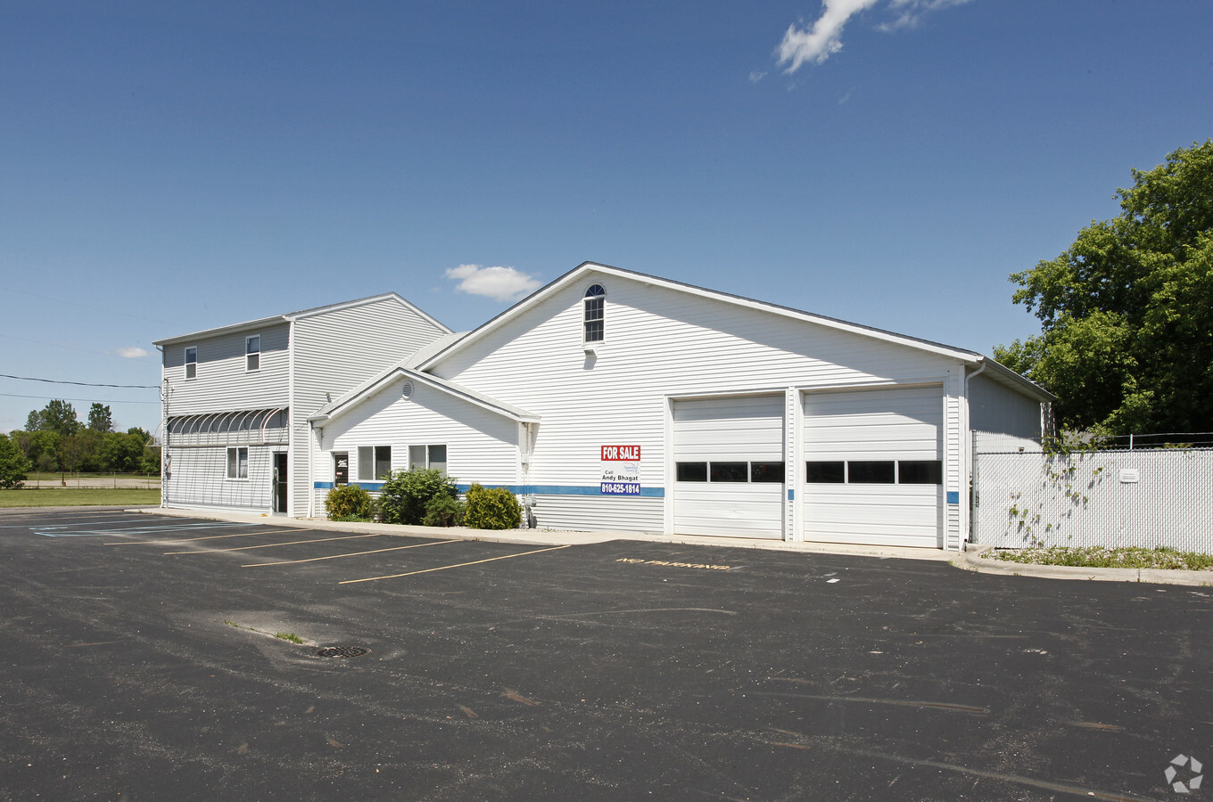
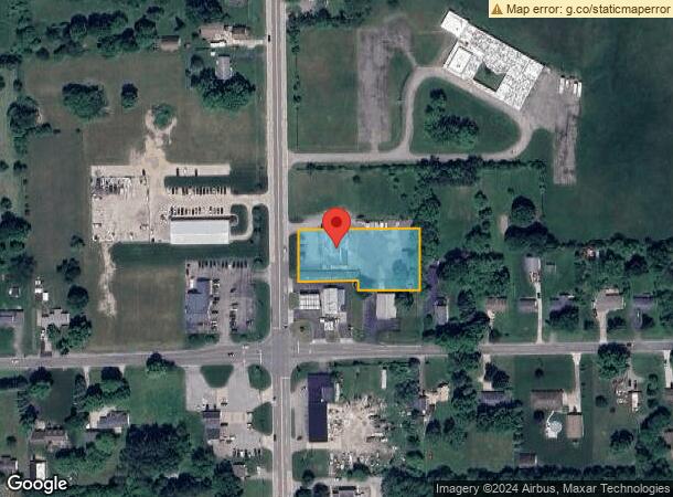
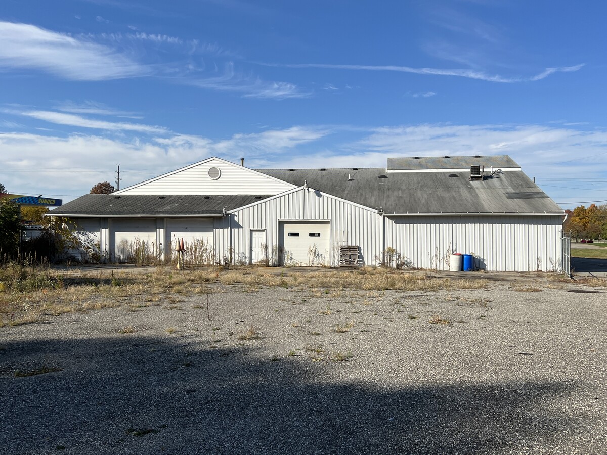
Property Record
5290 N Genesee Rd, Flint, MI 48506
NEARBY LISTINGS FOR SALE OR LEASE
Property Detail
5290 N Genesee Rd
Flint, MI
Mcneils Acres
11-23-501-017
LOT 1 AND LOT 7 EXCEPT S 131 FT ALSO EXCEPT N 131.95 FT MC NEILS ACRES (02) FR 11-23-501-016
Commercialnec
Genesee
X
Michigan
26049C0203D
1,7
2023
1.05 AC
2024
Flint
012008
Detroit
7,314 SF
DEMOGRAPHICS near 5290 N Genesee Rd
1 Mile
3 Mile
5 Mile
2024 Total Population
3,461
19,843
71,037
2029 Population
3,424
19,486
71,471
Pop Growth 2024-2029
(1.07%)
(1.80%)
+ 0.61%
Average Age
39
40
40
2024 Total Households
1,269
7,796
28,967
HH Growth 2024-2029
(1.34%)
(2.04%)
+ 0.58%
Median Household Inc
$55,654
$49,971
$41,627
Avg Household Size
2.60
2.50
2.40
2024 Avg HH Vehicles
2.00
2.00
2.00
Median Home Value
$128,037
$127,970
$95,057
Median Year Built
1979
1966
1962
Nearby Places
- Restaurants
- Banks
- Shops
- Fitness
- Groceries
PUBLIC TRANSPORTATION
COMMUTER RAIL
Flint Amtrak Station (Blue Water - Amtrak)
Drive
Walk
Distance
Flint Amtrak Station (Blue Water - Amtrak)
13 min
7.2 mi
AIRPORT
Bishop International
Drive
Walk
Distance
Bishop International
32 min
16.8 mi
Freight Ports
Port of Toledo
Drive
Walk
Distance
Port of Toledo
148 min
122.6 mi
SALE & LEASE HISTORY
LISTING DATE
SALE/LEASE

Sep 16, 2020
For Sale
Oct 20, 2022
For Sale
Nearby Properties
Address
Land Use
TOTAL SIZE
Lot Size
Zoning
Address
Land Use
TOTAL SIZE
Lot Size
Zoning
46808
32.06 AC
I-2 HVY IN
Address
Land Use
TOTAL SIZE
Lot Size
Zoning
2400
81 AC
R-4 MANUF
Address
Land Use
TOTAL SIZE
Lot Size
Zoning
633
69.20 AC
R-4 MANUF
Address
Land Use
TOTAL SIZE
Lot Size
Zoning
114888
11.86 AC
I-2 HVY IN
Address
Land Use
TOTAL SIZE
Lot Size
Zoning
Address
Land Use
TOTAL SIZE
Lot Size
Zoning
Address
Land Use
TOTAL SIZE
Lot Size
Zoning
2874
71.02 AC
R-4 MANUF
Address
Land Use
TOTAL SIZE
Lot Size
Zoning
70789
7.82 AC
C-2 HWY CO
Address
Land Use
TOTAL SIZE
Lot Size
Zoning
4260
301 AC
Address
Land Use
TOTAL SIZE
Lot Size
Zoning
726
10.40 AC
R-4 MANUF
Address
Land Use
TOTAL SIZE
Lot Size
Zoning
57.47 AC
R-4 MANUF
Address
Land Use
TOTAL SIZE
Lot Size
Zoning
2560
42 AC
R-4 MANUF
Address
Land Use
TOTAL SIZE
Lot Size
Zoning
9934
9.70 AC
I-2 HVY IN
Address
Land Use
TOTAL SIZE
Lot Size
Zoning
1538
17.74 AC
C-2 HWY CO
Address
Land Use
TOTAL SIZE
Lot Size
Zoning
163940
14.53 AC
Address
Land Use
TOTAL SIZE
Lot Size
Zoning
25800
4.94 AC
I-2 HVY IN
Address
Land Use
TOTAL SIZE
Lot Size
Zoning
29632
4.32 AC
R-3 MULTI
Address
Land Use
TOTAL SIZE
Lot Size
Zoning
44160
4.47 AC
C-2 HWY CO
Address
Land Use
TOTAL SIZE
Lot Size
Zoning
115712
141.66 AC
Address
Land Use
TOTAL SIZE
Lot Size
Zoning
55040
6.04 AC
C-2 HWY CO
Address
Land Use
TOTAL SIZE
Lot Size
Zoning
339
26.24 AC
R-4 MANUF
Address
Land Use
TOTAL SIZE
Lot Size
Zoning
43024
3.70 AC
Address
Land Use
TOTAL SIZE
Lot Size
Zoning
11515
11.20 AC
I-2 HVY IN
Address
Land Use
TOTAL SIZE
Lot Size
Zoning
10875
1.51 AC
C-2 HWY CO
Address
Land Use
TOTAL SIZE
Lot Size
Zoning
10950
2.39 AC
C-2 HWY CO
Address
Land Use
TOTAL SIZE
Lot Size
Zoning
3567
20.67 AC
I-2 HVY IN
Address
Land Use
TOTAL SIZE
Lot Size
Zoning
52322
6.24 AC
I-1 LHGT I
Address
Land Use
TOTAL SIZE
Lot Size
Zoning
5588
23.12 AC
Address
Land Use
TOTAL SIZE
Lot Size
Zoning
3183
2.41 AC
C-2 HWY CO
Address
Land Use
TOTAL SIZE
Lot Size
Zoning
16653
8.25 AC
D6
Start a new search to find other properties for sale or lease
Connect with us
© 2024 CoStar Group
The information above has been obtained from sources believed reliable. While we do not doubt its accuracy we have not verified it and make no guarantee, warranty or representation about it. It is your responsibility to independently confirm its accuracy and completeness. Any projections, opinions, assumptions, or estimates used are for example only and do not represent the current or future performance of the property. The value of this transaction to you depends on tax and other factors which should be evaluated by your tax, financial, and legal advisors. You and your advisors should conduct a careful, independent investigation of the property to determine to your satisfaction the suitability of the property for your needs.