Property Record
530 Ronlee Ln Nw, Olympia, WA 98502
NEARBY LISTINGS FOR SALE OR LEASE
-
-
View all Olympia listings for sale on LoopNet.com
Property Detail
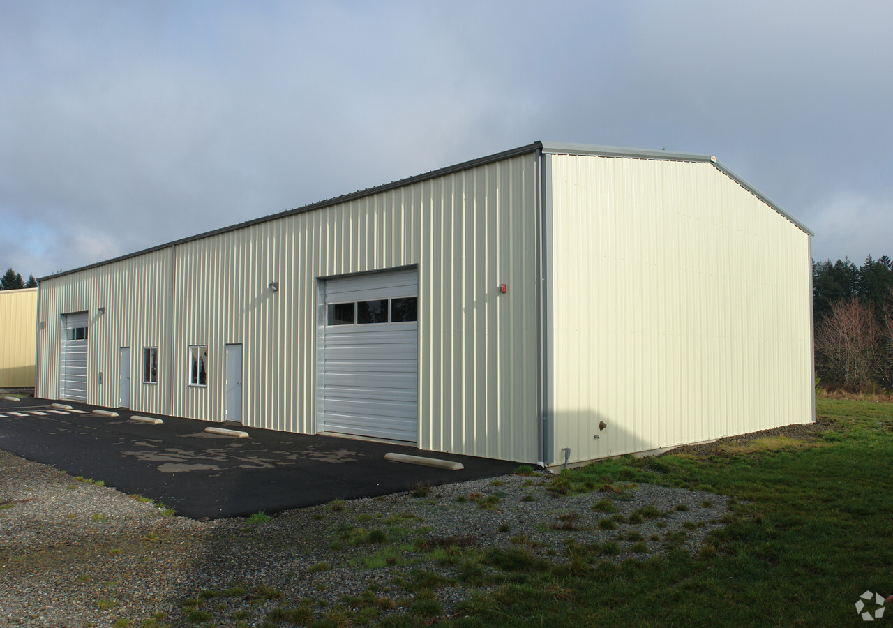
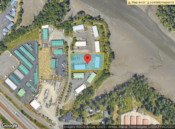
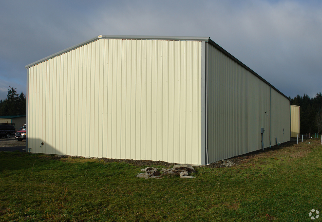
530 Ronlee Ln Nw
Olympia-Tumwater, WA
Bayside Business Park
33570000700
SECTION 13 TOWNSHIP 18 RANGE 3W QUARTER SE NE PLAT BAYSIDE BUSINESS PARK LT 7 DOCUMENT 3177064
Timberlandforesttreesagricultural
Thurston
X
Washington
53067C0161F
7
2024
1.06 AC
2024
Outlying Thurston County
011901
Olympia
8,000 SF
DEMOGRAPHICS near 530 Ronlee Ln Nw
1 Mile
3 Mile
5 Mile
2024 Total Population
1,161
18,542
57,857
2029 Population
1,215
19,485
61,144
Pop Growth 2024-2029
+ 4.65%
+ 5.09%
+ 5.68%
Average Age
41
41
42
2024 Total Households
345
7,335
25,184
HH Growth 2024-2029
+ 5.22%
+ 5.14%
+ 5.89%
Median Household Inc
$96,590
$78,002
$73,704
Avg Household Size
2.60
2.40
2.20
2024 Avg HH Vehicles
3.00
2.00
2.00
Median Home Value
$620,588
$443,122
$438,269
Median Year Built
1990
1994
1988
Nearby Places
- Restaurants
- Banks
- Shops
- Fitness
- Groceries
Nearby Properties
Address
Land Use
TOTAL SIZE
Lot Size
Zoning
Address
Land Use
TOTAL SIZE
Lot Size
Zoning
1,544,001 SF
929 AC
MEI
Address
Land Use
TOTAL SIZE
Lot Size
Zoning
602,509 SF
49.48 AC
HDC-4
Address
Land Use
TOTAL SIZE
Lot Size
Zoning
151,657 SF
2.62 AC
MS
Address
Land Use
TOTAL SIZE
Lot Size
Zoning
175,178 SF
36.69 AC
R-4-8
Address
Land Use
TOTAL SIZE
Lot Size
Zoning
243,845 SF
12.58 AC
RM-24
Address
Land Use
TOTAL SIZE
Lot Size
Zoning
273,091 SF
17.87 AC
PO/RM
Address
Land Use
TOTAL SIZE
Lot Size
Zoning
217,366 SF
10.88 AC
RM-24
Address
Land Use
TOTAL SIZE
Lot Size
Zoning
241,689 SF
10.75 AC
RM-24
Address
Land Use
TOTAL SIZE
Lot Size
Zoning
161,002 SF
8.66 AC
PO/RM
Address
Land Use
TOTAL SIZE
Lot Size
Zoning
178,997 SF
21.67 AC
HDC-4
Address
Land Use
TOTAL SIZE
Lot Size
Zoning
176,932 SF
9.39 AC
RM-18
Address
Land Use
TOTAL SIZE
Lot Size
Zoning
143,378 SF
15.95 AC
HDC-4
Address
Land Use
TOTAL SIZE
Lot Size
Zoning
72,443 SF
19.30 AC
RLI
Address
Land Use
TOTAL SIZE
Lot Size
Zoning
97,714 SF
5.18 AC
RM-24
Address
Land Use
TOTAL SIZE
Lot Size
Zoning
90,101 SF
3.05 AC
PO/RM
Address
Land Use
TOTAL SIZE
Lot Size
Zoning
64,927 SF
5.72 AC
MS
Address
Land Use
TOTAL SIZE
Lot Size
Zoning
94,413 SF
7.47 AC
HDC-4
Address
Land Use
TOTAL SIZE
Lot Size
Zoning
108,940 SF
9.26 AC
RLI 2-4
Address
Land Use
TOTAL SIZE
Lot Size
Zoning
122,626 SF
9.27 AC
RLI 2-4
Address
Land Use
TOTAL SIZE
Lot Size
Zoning
100,472 SF
6.56 AC
MS
Address
Land Use
TOTAL SIZE
Lot Size
Zoning
95,847 SF
4.10 AC
RM-24
Address
Land Use
TOTAL SIZE
Lot Size
Zoning
137,775 SF
8.09 AC
PO/RM
Address
Land Use
TOTAL SIZE
Lot Size
Zoning
48,027 SF
15.28 AC
R 1/10
Address
Land Use
TOTAL SIZE
Lot Size
Zoning
45,605 SF
17.01 AC
RLI
Address
Land Use
TOTAL SIZE
Lot Size
Zoning
57,179 SF
12.05 AC
RRR1/5
Address
Land Use
TOTAL SIZE
Lot Size
Zoning
45,139 SF
17.79 AC
MS
Address
Land Use
TOTAL SIZE
Lot Size
Zoning
77,428 SF
4.94 AC
R-4-8
Address
Land Use
TOTAL SIZE
Lot Size
Zoning
59,373 SF
0.56 AC
MS
Address
Land Use
TOTAL SIZE
Lot Size
Zoning
131,760 SF
16.13 AC
HDC-4
Address
Land Use
TOTAL SIZE
Lot Size
Zoning
87,601 SF
8.20 AC
RM-18
The World's #1 Commercial Real Estate Marketplace
Connect with us
© 2025 CoStar Group
The information above has been obtained from sources believed reliable. While we do not doubt its accuracy we have not verified it and make no guarantee, warranty or representation about it. It is your responsibility to independently confirm its accuracy and completeness. Any projections, opinions, assumptions, or estimates used are for example only and do not represent the current or future performance of the property. The value of this transaction to you depends on tax and other factors which should be evaluated by your tax, financial, and legal advisors. You and your advisors should conduct a careful, independent investigation of the property to determine to your satisfaction the suitability of the property for your needs.