Property Record
530 Round House Rd, Stoneville, NC 27048

NEARBY LISTINGS FOR SALE OR LEASE
-
-
View all Stoneville listings for sale on LoopNet.com
Property Detail
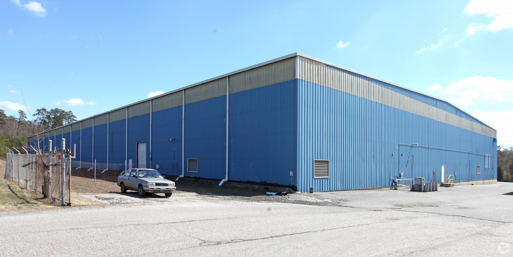
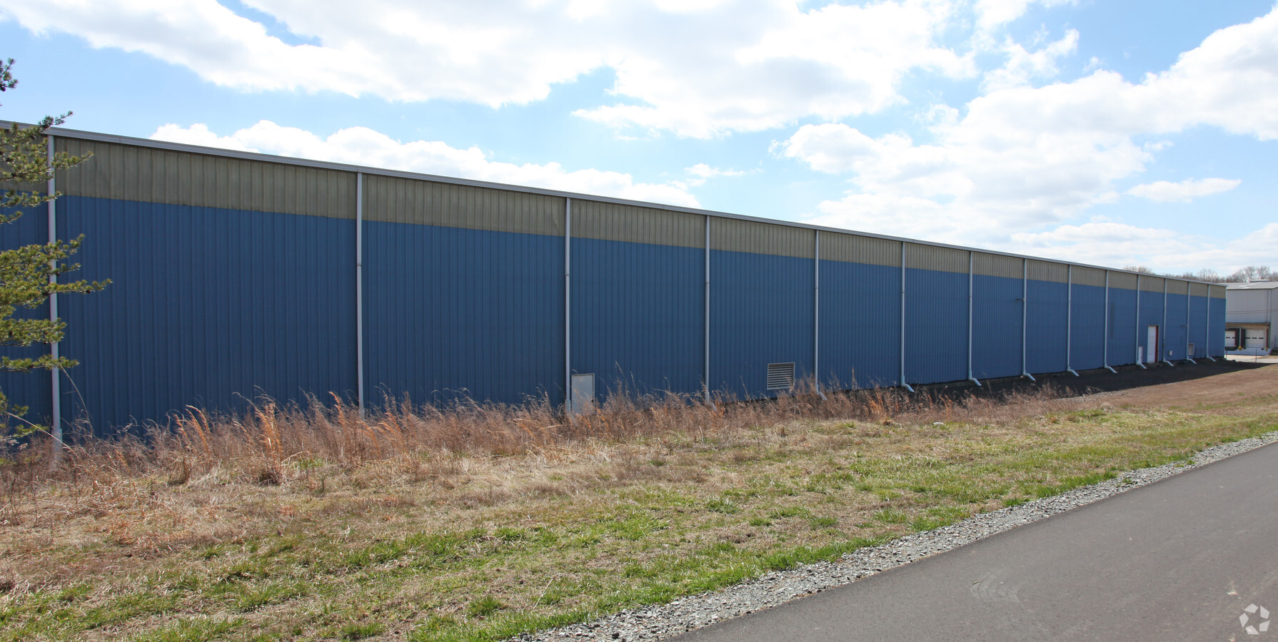
530 Round House Rd
109818
5 AC EVANS WAREHOUSE INC EVANS WAREHOUSE INC
Warehouse
Rockingham
X
North Carolina
51143C0590E
5 AC
2024
Rockingham County
2024
Greensboro/Winston-Salem
040601
Greensboro-High Point, NC
100,000 SF
DEMOGRAPHICS near 530 Round House Rd
1 Mile
3 Mile
5 Mile
2024 Total Population
1,201
10,782
22,033
2029 Population
1,248
11,137
22,700
Pop Growth 2024-2029
+ 3.91%
+ 3.29%
+ 3.03%
Average Age
41
42
43
2024 Total Households
503
4,595
9,608
HH Growth 2024-2029
+ 3.98%
+ 3.26%
+ 2.95%
Median Household Inc
$68,281
$39,494
$37,778
Avg Household Size
2.30
2.30
2.20
2024 Avg HH Vehicles
3.00
2.00
2.00
Median Home Value
$106,906
$97,213
$109,011
Median Year Built
1977
1966
1968
Nearby Places
- Restaurants
- Banks
- Shops
- Fitness
- Groceries
Nearby Properties
Address
Land Use
TOTAL SIZE
Lot Size
Zoning
Address
Land Use
TOTAL SIZE
Lot Size
Zoning
1,094,878 SF
61.89 AC
LIGHT INDU
Address
Land Use
TOTAL SIZE
Lot Size
Zoning
51,491 SF
22.80 AC
NEIGHBORHO
Address
Land Use
TOTAL SIZE
Lot Size
Zoning
73,711 SF
42.90 AC
RES 20 EDE
Address
Land Use
TOTAL SIZE
Lot Size
Zoning
161,928 SF
22.72 AC
LIGHT INDU
Address
Land Use
TOTAL SIZE
Lot Size
Zoning
27,040 SF
605.77 AC
HEAVY INDU
Address
Land Use
TOTAL SIZE
Lot Size
Zoning
348,265 SF
35.79 AC
HEAVY INDU
Address
Land Use
TOTAL SIZE
Lot Size
Zoning
478,724 SF
142.07 AC
LIGHT INDU
Address
Land Use
TOTAL SIZE
Lot Size
Zoning
77,910 SF
23.77 AC
NEIGHBORHO
Address
Land Use
TOTAL SIZE
Lot Size
Zoning
25,844 SF
11.81 AC
NEIGHBORHO
Address
Land Use
TOTAL SIZE
Lot Size
Zoning
143,646 SF
12.47 AC
HWY BUS ED
Address
Land Use
TOTAL SIZE
Lot Size
Zoning
10,100 SF
10.19 AC
RES 12 EDE
Address
Land Use
TOTAL SIZE
Lot Size
Zoning
52,332 SF
14.20 AC
RES 20 EDE
Address
Land Use
TOTAL SIZE
Lot Size
Zoning
88,170 SF
15.39 AC
RES 12 EDE
Address
Land Use
TOTAL SIZE
Lot Size
Zoning
46,226 SF
44.93 AC
RES 20 EDE
Address
Land Use
TOTAL SIZE
Lot Size
Zoning
172,252 SF
17 AC
LIGHT INDU
Address
Land Use
TOTAL SIZE
Lot Size
Zoning
85,306 SF
14.78 AC
LIGHT INDU
Address
Land Use
TOTAL SIZE
Lot Size
Zoning
19,966 SF
2 AC
NEIGHBORHO
Address
Land Use
TOTAL SIZE
Lot Size
Zoning
1,009.82 AC
RES AG/RES
Address
Land Use
TOTAL SIZE
Lot Size
Zoning
530,639 SF
50.52 AC
HEAVY INDU
Address
Land Use
TOTAL SIZE
Lot Size
Zoning
18,124 SF
5.20 AC
RES 12 EDE
Address
Land Use
TOTAL SIZE
Lot Size
Zoning
14,732 SF
1.63 AC
HWY BUS ED
Address
Land Use
TOTAL SIZE
Lot Size
Zoning
104,602 SF
35.73 AC
LIGHT INDU
Address
Land Use
TOTAL SIZE
Lot Size
Zoning
140,503 SF
15.65 AC
LIGHT INDU
Address
Land Use
TOTAL SIZE
Lot Size
Zoning
20,983 SF
4.52 AC
GEN BUS ED
Address
Land Use
TOTAL SIZE
Lot Size
Zoning
4,926 SF
3.85 AC
GEN BUS ED
Address
Land Use
TOTAL SIZE
Lot Size
Zoning
7,040 SF
3.61 AC
HWY BUS ED
Address
Land Use
TOTAL SIZE
Lot Size
Zoning
912 SF
60.93 AC
OPEN SPACE
Address
Land Use
TOTAL SIZE
Lot Size
Zoning
185,512 SF
21.60 AC
LIGHT INDU
Address
Land Use
TOTAL SIZE
Lot Size
Zoning
25.31 AC
I1
Address
Land Use
TOTAL SIZE
Lot Size
Zoning
23,710 SF
3.21 AC
HWY BUS ED
The World's #1 Commercial Real Estate Marketplace
Connect with us
© 2025 CoStar Group
The information above has been obtained from sources believed reliable. While we do not doubt its accuracy we have not verified it and make no guarantee, warranty or representation about it. It is your responsibility to independently confirm its accuracy and completeness. Any projections, opinions, assumptions, or estimates used are for example only and do not represent the current or future performance of the property. The value of this transaction to you depends on tax and other factors which should be evaluated by your tax, financial, and legal advisors. You and your advisors should conduct a careful, independent investigation of the property to determine to your satisfaction the suitability of the property for your needs.