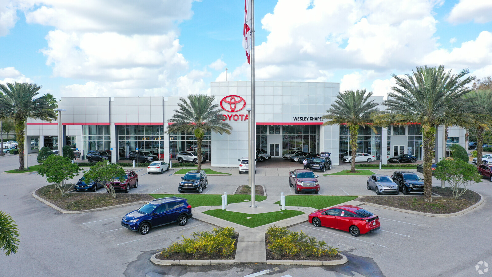
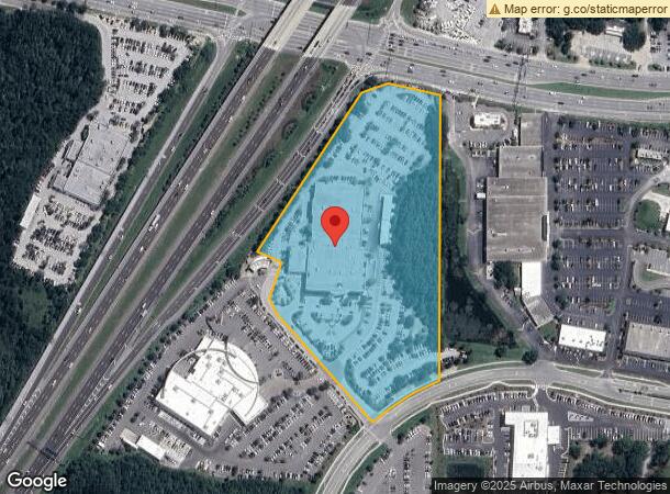
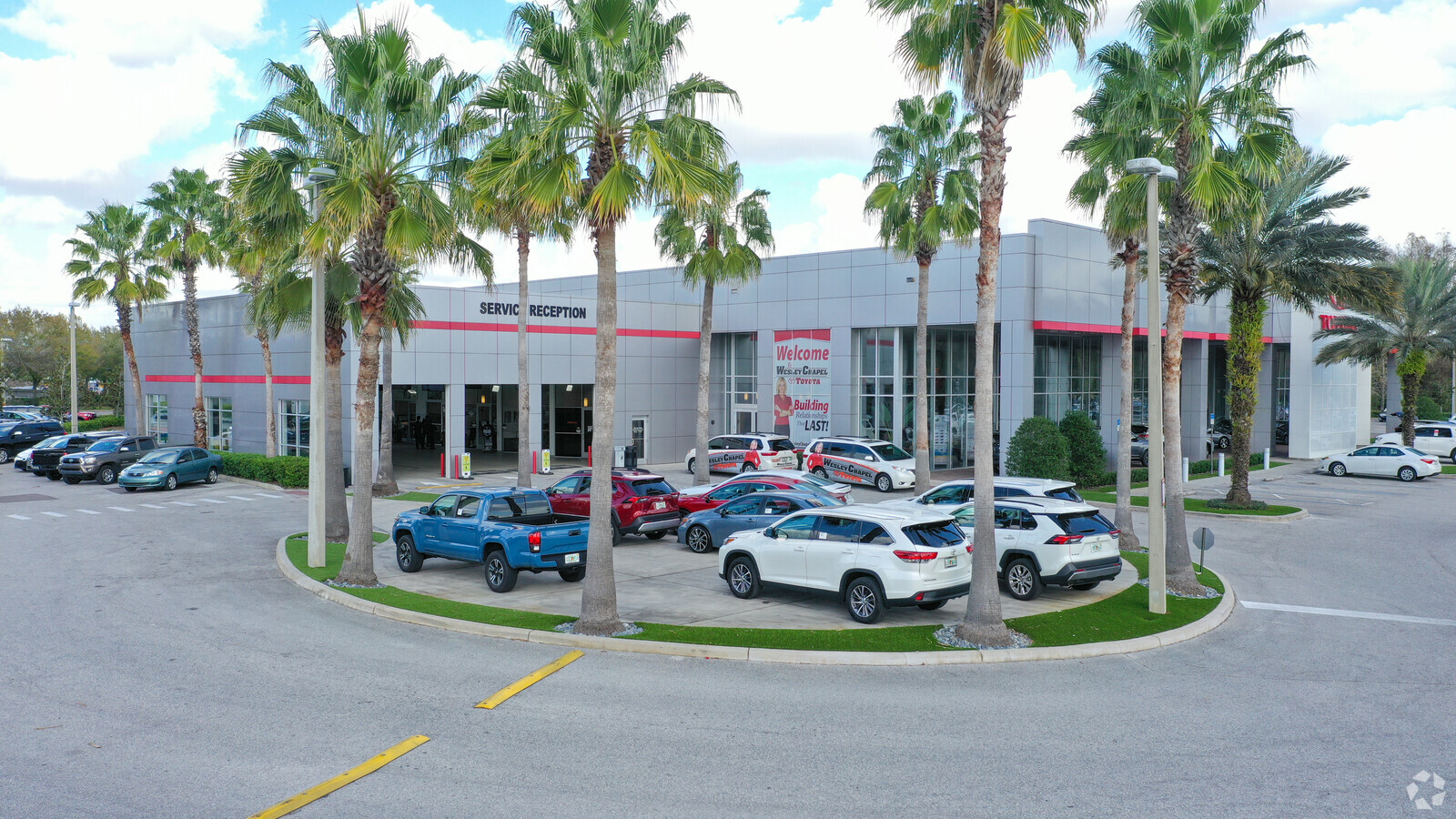
Property Record
5300 Eagleston Blvd, Wesley Chapel, FL 33544

NEARBY LISTINGS FOR SALE OR LEASE
Property Detail
5300 Eagleston Blvd
Tampa-St. Petersburg-Clearwater, FL
Shopping Center Or Other Site
12-26-19-0000-00500-0070
COM AT SE COR OF SEC 12 TH N00 DEG2108E 1588.55 FT TO POB TH ALG ARC CV L RAD 725 FT CHG BRG & DIST S47DEG2418W 511.5 FT TH W 102.78 FT TH S61DEG04 49W 64.81 FT TH S63DEG4656W 54.04 FT TH S75DEG2338W 52.48 FT TH N59DEG3306W 32.53 FT TH N50DEG3103W 9.
Vehiclerentalsvehiclesales
Pasco
AE
Florida
12101C0426F
7
2024
9.54 AC
2024
Pasco County
032106
Tampa/St Petersburg
38,392 SF
DEMOGRAPHICS near 5300 Eagleston Blvd
1 Mile
3 Mile
5 Mile
2024 Total Population
4,897
40,065
102,907
2029 Population
5,935
48,431
123,887
Pop Growth 2024-2029
+ 21.20%
+ 20.88%
+ 20.39%
Average Age
38
38
38
2024 Total Households
1,701
13,822
36,114
HH Growth 2024-2029
+ 21.16%
+ 20.83%
+ 20.30%
Median Household Inc
$101,104
$103,962
$100,010
Avg Household Size
2.90
2.90
2.80
2024 Avg HH Vehicles
2.00
2.00
2.00
Median Home Value
$312,410
$328,659
$311,060
Median Year Built
2005
2004
2005
Nearby Places
- Restaurants
- Banks
- Shops
- Fitness
- Groceries
PUBLIC TRANSPORTATION
AIRPORT
Tampa International
DRIVE
WALK
Distance
Tampa International
41 min
30.2 mi
Freight Ports
Port of Tampa Bay
DRIVE
WALK
Distance
Port of Tampa Bay
37 min
25.9 mi
Nearby Properties
Address
Land Use
TOTAL SIZE
Lot Size
Zoning
Address
Land Use
TOTAL SIZE
Lot Size
Zoning
425,346 SF
19.60 AC
MPUD
Address
Land Use
TOTAL SIZE
Lot Size
Zoning
306,559 SF
34.59 AC
MPUD
Address
Land Use
TOTAL SIZE
Lot Size
Zoning
343,155 SF
23.92 AC
MPUD
Address
Land Use
TOTAL SIZE
Lot Size
Zoning
293,253 SF
51.11 AC
MPUD
Address
Land Use
TOTAL SIZE
Lot Size
Zoning
315,343 SF
20.80 AC
MPUD
Address
Land Use
TOTAL SIZE
Lot Size
Zoning
418,644 SF
105.51 AC
AR
Address
Land Use
TOTAL SIZE
Lot Size
Zoning
319,575 SF
19.80 AC
MPUD
Address
Land Use
TOTAL SIZE
Lot Size
Zoning
244,355 SF
70.12 AC
MPUD
Address
Land Use
TOTAL SIZE
Lot Size
Zoning
267,326 SF
22.50 AC
MPUD
Address
Land Use
TOTAL SIZE
Lot Size
Zoning
153,412 SF
9.77 AC
MPUD
Address
Land Use
TOTAL SIZE
Lot Size
Zoning
146,401 SF
17.78 AC
MPUD
Address
Land Use
TOTAL SIZE
Lot Size
Zoning
59,481 SF
43.31 AC
PD
Address
Land Use
TOTAL SIZE
Lot Size
Zoning
115,596 SF
3.83 AC
C2
Address
Land Use
TOTAL SIZE
Lot Size
Zoning
104,418 SF
89.04 AC
MPUD
Address
Land Use
TOTAL SIZE
Lot Size
Zoning
97,416 SF
0.94 AC
MPUD
Address
Land Use
TOTAL SIZE
Lot Size
Zoning
91,866 SF
2.70 AC
MPUD
Address
Land Use
TOTAL SIZE
Lot Size
Zoning
96,210 SF
0.85 AC
MPUD
Address
Land Use
TOTAL SIZE
Lot Size
Zoning
189,610 SF
13.68 AC
MPUD
Address
Land Use
TOTAL SIZE
Lot Size
Zoning
86,782 SF
12.21 AC
C2
Address
Land Use
TOTAL SIZE
Lot Size
Zoning
28,631 SF
8.84 AC
MPUD
Address
Land Use
TOTAL SIZE
Lot Size
Zoning
106,061 SF
14.01 AC
MPUD
Address
Land Use
TOTAL SIZE
Lot Size
Zoning
118,112 SF
10.41 AC
MF1
Address
Land Use
TOTAL SIZE
Lot Size
Zoning
93,933 SF
3.63 AC
C2
Address
Land Use
TOTAL SIZE
Lot Size
Zoning
235,286 SF
15.11 AC
MF2
Address
Land Use
TOTAL SIZE
Lot Size
Zoning
210,354 SF
29.03 AC
C2
Address
Land Use
TOTAL SIZE
Lot Size
Zoning
118,441 SF
14.20 AC
C2
Address
Land Use
TOTAL SIZE
Lot Size
Zoning
99,666 SF
8.68 AC
MPUD
Address
Land Use
TOTAL SIZE
Lot Size
Zoning
91,050 SF
4.18 AC
C2
Address
Land Use
TOTAL SIZE
Lot Size
Zoning
153,903 SF
12.91 AC
I1
The World's #1 Commercial Real Estate Marketplace
Connect with us
© 2025 CoStar Group
The information above has been obtained from sources believed reliable. While we do not doubt its accuracy we have not verified it and make no guarantee, warranty or representation about it. It is your responsibility to independently confirm its accuracy and completeness. Any projections, opinions, assumptions, or estimates used are for example only and do not represent the current or future performance of the property. The value of this transaction to you depends on tax and other factors which should be evaluated by your tax, financial, and legal advisors. You and your advisors should conduct a careful, independent investigation of the property to determine to your satisfaction the suitability of the property for your needs.