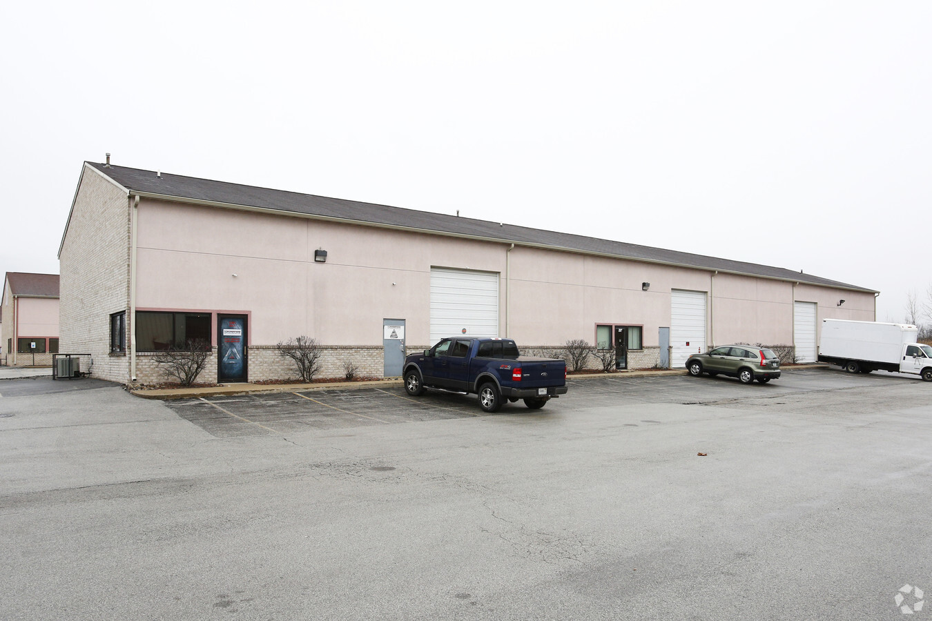
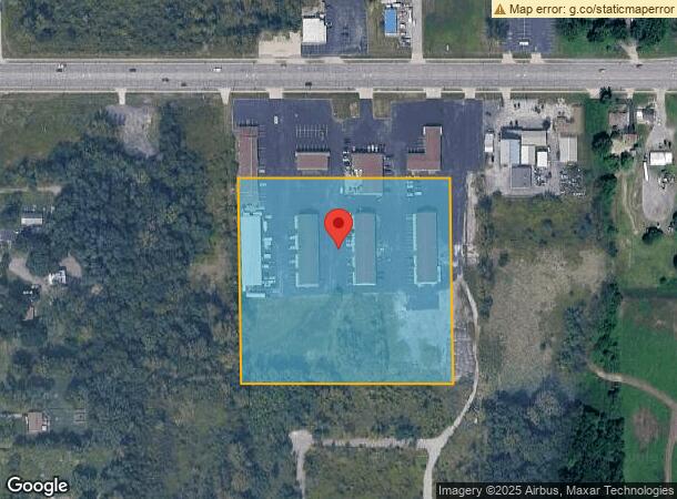
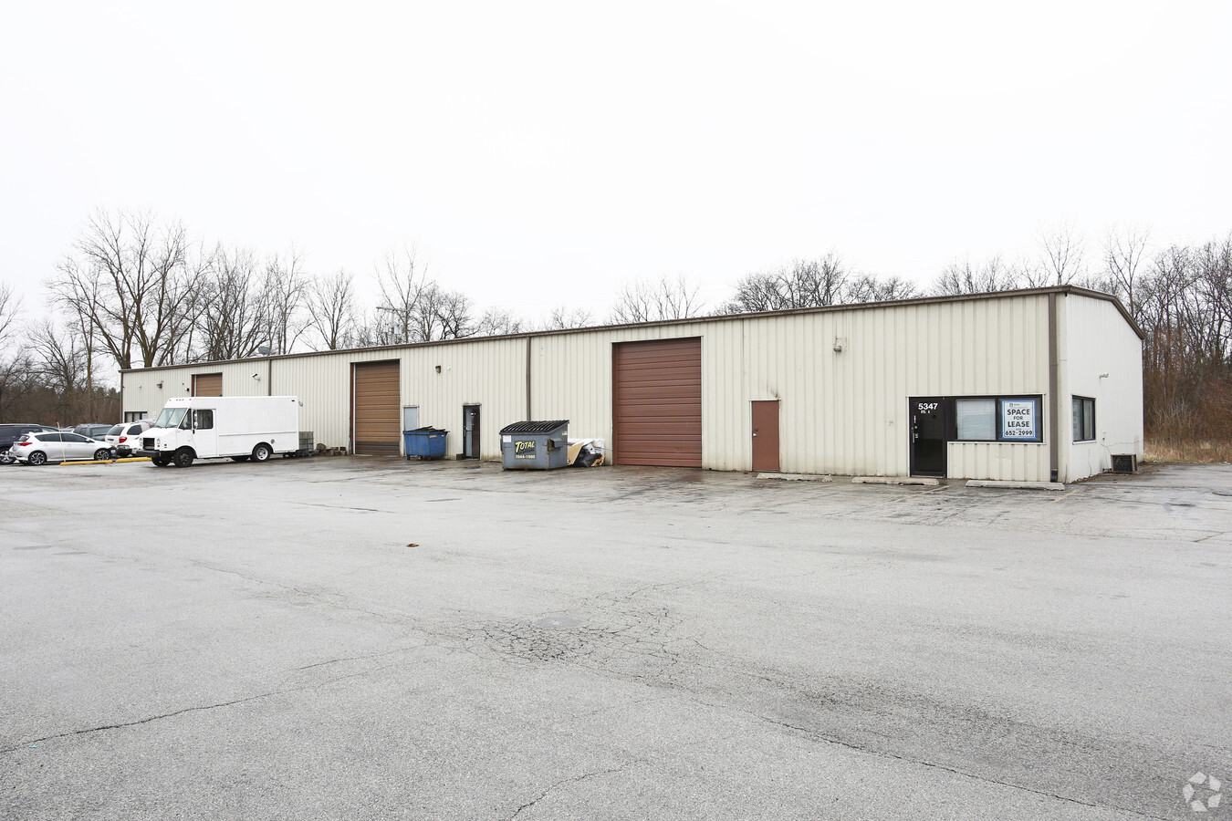
Property Record
5347 Us 6 Hwy, Portage, IN 46368
NEARBY LISTINGS FOR SALE OR LEASE
Property Detail
5347 Us 6 Hwy
64-05-27-201-018.000-016
S544 N807 W561 E1/2 W1/2 NE 27-36-7 7A ANXD
Warehouse
Porter
X
Indiana
18127C0112D
7 AC
2022
Porter County
2023
Chicago
050506
Chicago-Naperville-Elgin, IL-IN-WI
37,152 SF
DEMOGRAPHICS near 5347 Us 6 Hwy
1 Mile
3 Mile
5 Mile
2024 Total Population
7,893
45,245
96,993
2029 Population
8,062
45,893
98,075
Pop Growth 2024-2029
+ 2.14%
+ 1.43%
+ 1.12%
Average Age
40
40
40
2024 Total Households
3,225
17,764
37,947
HH Growth 2024-2029
+ 2.14%
+ 1.45%
+ 1.15%
Median Household Inc
$47,692
$61,731
$60,533
Avg Household Size
2.40
2.50
2.50
2024 Avg HH Vehicles
2.00
2.00
2.00
Median Home Value
$126,376
$168,823
$168,606
Median Year Built
1983
1974
1972
Nearby Places
- Restaurants
- Banks
- Shops
- Fitness
- Groceries
PUBLIC TRANSPORTATION
COMMUTER RAIL
Miller (Gary) Station (South Shore Line - Northern Indiana Commuter Transportation District (South Shore Line))
DRIVE
WALK
Distance
Miller (Gary) Station (South Shore Line - Northern Indiana Commuter Transportation District (South Shore Line))
13 min
6.4 mi
Ogden Dunes (Portage) Station (South Shore Line - Northern Indiana Commuter Transportation District (South Shore Line))
DRIVE
WALK
Distance
Ogden Dunes (Portage) Station (South Shore Line - Northern Indiana Commuter Transportation District (South Shore Line))
14 min
7.2 mi
Freight Ports
Port Milwaukee
DRIVE
WALK
Distance
Port Milwaukee
162 min
126.5 mi
Nearby Properties
Address
Land Use
TOTAL SIZE
Lot Size
Zoning
Address
Land Use
TOTAL SIZE
Lot Size
Zoning
83,904 SF
15.47 AC
Address
Land Use
TOTAL SIZE
Lot Size
Zoning
218,452 SF
18.01 AC
Address
Land Use
TOTAL SIZE
Lot Size
Zoning
161,118 SF
22.13 AC
R33
Address
Land Use
TOTAL SIZE
Lot Size
Zoning
215,770 SF
16.52 AC
Address
Land Use
TOTAL SIZE
Lot Size
Zoning
112,216 SF
9.98 AC
Address
Land Use
TOTAL SIZE
Lot Size
Zoning
169,427 SF
8.70 AC
Address
Land Use
TOTAL SIZE
Lot Size
Zoning
212,330 SF
10.70 AC
Address
Land Use
TOTAL SIZE
Lot Size
Zoning
69,459 SF
13.97 AC
Address
Land Use
TOTAL SIZE
Lot Size
Zoning
223,221 SF
16.69 AC
Address
Land Use
TOTAL SIZE
Lot Size
Zoning
95,281 SF
6.74 AC
Address
Land Use
TOTAL SIZE
Lot Size
Zoning
168,126 SF
13.79 AC
Address
Land Use
TOTAL SIZE
Lot Size
Zoning
50,382 SF
9.83 AC
Address
Land Use
TOTAL SIZE
Lot Size
Zoning
191,547 SF
18.29 AC
Address
Land Use
TOTAL SIZE
Lot Size
Zoning
64,619 SF
4.21 AC
Address
Land Use
TOTAL SIZE
Lot Size
Zoning
48,955 SF
14.50 AC
Address
Land Use
TOTAL SIZE
Lot Size
Zoning
70,762 SF
3.04 AC
Address
Land Use
TOTAL SIZE
Lot Size
Zoning
37,351 SF
13.74 AC
Address
Land Use
TOTAL SIZE
Lot Size
Zoning
100,690 SF
15.44 AC
Address
Land Use
TOTAL SIZE
Lot Size
Zoning
159,933 SF
142.83 AC
Address
Land Use
TOTAL SIZE
Lot Size
Zoning
133,249 SF
11.80 AC
Address
Land Use
TOTAL SIZE
Lot Size
Zoning
39,644 SF
2.84 AC
Address
Land Use
TOTAL SIZE
Lot Size
Zoning
70,454 SF
1.14 AC
Address
Land Use
TOTAL SIZE
Lot Size
Zoning
70,454 SF
1.20 AC
Address
Land Use
TOTAL SIZE
Lot Size
Zoning
89,232 SF
7.70 AC
Address
Land Use
TOTAL SIZE
Lot Size
Zoning
108,527 SF
10.52 AC
Address
Land Use
TOTAL SIZE
Lot Size
Zoning
124,160 SF
20.84 AC
Address
Land Use
TOTAL SIZE
Lot Size
Zoning
65,216 SF
7.61 AC
R33
Address
Land Use
TOTAL SIZE
Lot Size
Zoning
134,075 SF
12.39 AC
Address
Land Use
TOTAL SIZE
Lot Size
Zoning
140,434 SF
15.26 AC
Address
Land Use
TOTAL SIZE
Lot Size
Zoning
29,251 SF
25.96 AC
The World's #1 Commercial Real Estate Marketplace
Connect with us
© 2025 CoStar Group
The information above has been obtained from sources believed reliable. While we do not doubt its accuracy we have not verified it and make no guarantee, warranty or representation about it. It is your responsibility to independently confirm its accuracy and completeness. Any projections, opinions, assumptions, or estimates used are for example only and do not represent the current or future performance of the property. The value of this transaction to you depends on tax and other factors which should be evaluated by your tax, financial, and legal advisors. You and your advisors should conduct a careful, independent investigation of the property to determine to your satisfaction the suitability of the property for your needs.