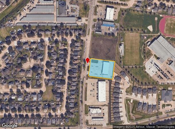
Property Record
5350 Fry Rd, Katy, TX 77449

NEARBY LISTINGS FOR SALE OR LEASE
Property Detail
5350 Fry Rd
1167100000001
Villages Of Bear Creek Plaza
Commercialnec
RES A VILLAGES OF BEAR CREEK PLAZA
X
Harris
48201C0605M
Texas
2023
1.38 AC
2024
Katy/Grand Parkway West
542105
Houston
10,800 SF
Houston-The Woodlands-Sugar Land, TX
DEMOGRAPHICS near 5350 Fry Rd
1 Mile
3 Mile
5 Mile
2024 Total Population
24,472
145,954
316,694
2029 Population
25,298
148,933
324,766
Pop Growth 2024-2029
+ 3.38%
+ 2.04%
+ 2.55%
Average Age
33
34
35
2024 Total Households
6,853
42,467
98,617
HH Growth 2024-2029
+ 3.34%
+ 1.97%
+ 2.48%
Median Household Inc
$80,002
$83,753
$81,462
Avg Household Size
3.40
3.40
3.10
2024 Avg HH Vehicles
2.00
2.00
2.00
Median Home Value
$217,200
$200,212
$223,682
Median Year Built
2008
2003
2003
Nearby Places
- Restaurants
- Banks
- Shops
- Fitness
- Groceries
PUBLIC TRANSPORTATION
AIRPORT
George Bush Intcntl/Houston
DRIVE
WALK
Distance
George Bush Intcntl/Houston
45 min
30.4 mi
William P Hobby
DRIVE
WALK
Distance
William P Hobby
59 min
39.5 mi
Freight Ports
Port of Houston
DRIVE
WALK
Distance
Port of Houston
52 min
36.3 mi
SALE & LEASE HISTORY
LISTING DATE
SALE/LEASE

Sep 24, 2016
For Sale
Nearby Properties
Address
Land Use
TOTAL SIZE
Lot Size
Zoning
Address
Land Use
TOTAL SIZE
Lot Size
Zoning
826,250 SF
54.15 AC
Address
Land Use
TOTAL SIZE
Lot Size
Zoning
347,834 SF
15.25 AC
Address
Land Use
TOTAL SIZE
Lot Size
Zoning
335,899 SF
12.62 AC
Address
Land Use
TOTAL SIZE
Lot Size
Zoning
331,263 SF
11.36 AC
Address
Land Use
TOTAL SIZE
Lot Size
Zoning
266,532 SF
6.45 AC
Address
Land Use
TOTAL SIZE
Lot Size
Zoning
262,174 SF
11.64 AC
Address
Land Use
TOTAL SIZE
Lot Size
Zoning
87.76 AC
Address
Land Use
TOTAL SIZE
Lot Size
Zoning
266,532 SF
21.76 AC
Address
Land Use
TOTAL SIZE
Lot Size
Zoning
838,700 SF
36.68 AC
Address
Land Use
TOTAL SIZE
Lot Size
Zoning
147,923 SF
11.60 AC
Address
Land Use
TOTAL SIZE
Lot Size
Zoning
117,860 SF
12.44 AC
Address
Land Use
TOTAL SIZE
Lot Size
Zoning
236,406 SF
11.40 AC
Address
Land Use
TOTAL SIZE
Lot Size
Zoning
171,000 SF
7.08 AC
Address
Land Use
TOTAL SIZE
Lot Size
Zoning
119,086 SF
18.61 AC
Address
Land Use
TOTAL SIZE
Lot Size
Zoning
223,832 SF
22.61 AC
Address
Land Use
TOTAL SIZE
Lot Size
Zoning
303,556 SF
8.01 AC
Address
Land Use
TOTAL SIZE
Lot Size
Zoning
267,766 SF
12.95 AC
Address
Land Use
TOTAL SIZE
Lot Size
Zoning
143,950 SF
10.30 AC
Address
Land Use
TOTAL SIZE
Lot Size
Zoning
122,880 SF
15 AC
Address
Land Use
TOTAL SIZE
Lot Size
Zoning
144,736 SF
2.55 AC
Address
Land Use
TOTAL SIZE
Lot Size
Zoning
52,035 SF
9.23 AC
Address
Land Use
TOTAL SIZE
Lot Size
Zoning
83,750 SF
4.88 AC
Address
Land Use
TOTAL SIZE
Lot Size
Zoning
143,560 SF
12.52 AC
Address
Land Use
TOTAL SIZE
Lot Size
Zoning
57,012 SF
7.10 AC
Address
Land Use
TOTAL SIZE
Lot Size
Zoning
105,500 SF
5.49 AC
Address
Land Use
TOTAL SIZE
Lot Size
Zoning
150,734 SF
29.67 AC
Address
Land Use
TOTAL SIZE
Lot Size
Zoning
121,560 SF
12.22 AC
Address
Land Use
TOTAL SIZE
Lot Size
Zoning
108,920 SF
8.56 AC
Address
Land Use
TOTAL SIZE
Lot Size
Zoning
87,900 SF
5.55 AC
Address
Land Use
TOTAL SIZE
Lot Size
Zoning
67,312 SF
6.94 AC
The World's #1 Commercial Real Estate Marketplace
Connect with us
© 2025 CoStar Group
The information above has been obtained from sources believed reliable. While we do not doubt its accuracy we have not verified it and make no guarantee, warranty or representation about it. It is your responsibility to independently confirm its accuracy and completeness. Any projections, opinions, assumptions, or estimates used are for example only and do not represent the current or future performance of the property. The value of this transaction to you depends on tax and other factors which should be evaluated by your tax, financial, and legal advisors. You and your advisors should conduct a careful, independent investigation of the property to determine to your satisfaction the suitability of the property for your needs.