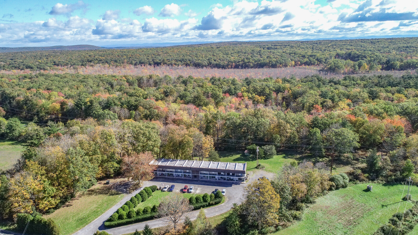
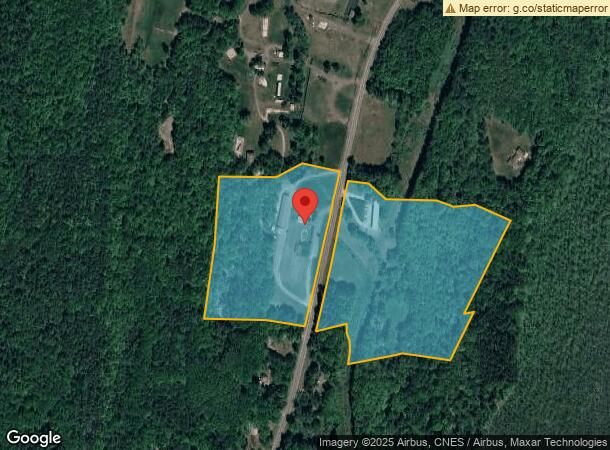
Property Record
5371 Route 32, Catskill, NY 12414
NEARBY LISTINGS FOR SALE OR LEASE
-
-
View all Catskill listings for sale on LoopNet.com
Property Detail
5371 Route 32
Motel
Greene
X
New York
36039C0426F
35.000
2024
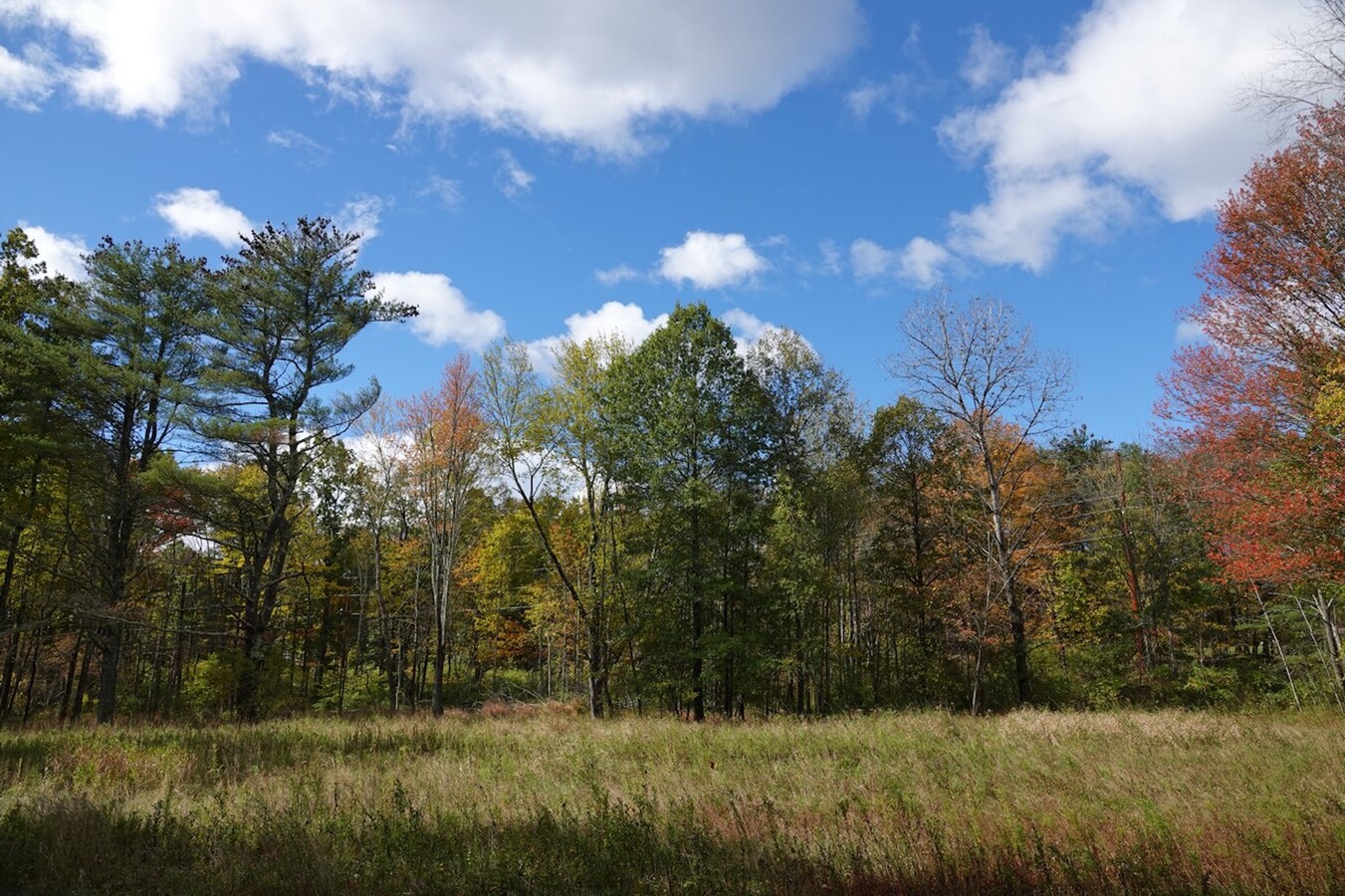
31.50 AC
2023
Greene County
081101
Albany/Schenectady/Troy
10,264 SF
192689-153-000-0003-035-000-0000
DEMOGRAPHICS near 5371 Route 32
1 Mile
3 Mile
5 Mile
2024 Total Population
285
2,959
9,026
2029 Population
287
2,990
9,127
Pop Growth 2024-2029
+ 0.70%
+ 1.05%
+ 1.12%
Average Age
43
44
45
2024 Total Households
118
1,275
3,922
HH Growth 2024-2029
+ 0.85%
+ 0.94%
+ 0.94%
Median Household Inc
$41,785
$59,204
$64,029
Avg Household Size
2.30
2.20
2.20
2024 Avg HH Vehicles
1.00
2.00
2.00
Median Home Value
$184,523
$212,365
$206,671
Median Year Built
1963
1971
1971
Nearby Places
- Restaurants
- Banks
- Shops
- Fitness
- Groceries
SALE & LEASE HISTORY
LISTING DATE
SALE/LEASE

Oct 20, 2023
For Sale
Jul 07, 2017
For Sale
Nearby Properties
Address
Land Use
TOTAL SIZE
Lot Size
Zoning
Address
Land Use
TOTAL SIZE
Lot Size
Zoning
342,894 SF
29.60 AC
02 - SINGL
Address
Land Use
TOTAL SIZE
Lot Size
Zoning
4,163 SF
14.10 AC
01 - NOT Z
Address
Land Use
TOTAL SIZE
Lot Size
Zoning
21,921 SF
95.10 AC
08 - GOVER
Address
Land Use
TOTAL SIZE
Lot Size
Zoning
12,592 SF
209.10 AC
01 - NOT Z
Address
Land Use
TOTAL SIZE
Lot Size
Zoning
56,758 SF
27.20 AC
02 - SINGL
Address
Land Use
TOTAL SIZE
Lot Size
Zoning
7,640 SF
63.80 AC
01 - NOT Z
Address
Land Use
TOTAL SIZE
Lot Size
Zoning
23,444 SF
110.50 AC
01 - NOT Z
Address
Land Use
TOTAL SIZE
Lot Size
Zoning
3,452 SF
193 AC
08 - GOVER
Address
Land Use
TOTAL SIZE
Lot Size
Zoning
3,446 SF
119.60 AC
08 - GOVER
Address
Land Use
TOTAL SIZE
Lot Size
Zoning
6,534 SF
11.60 AC
02 - SINGL
Address
Land Use
TOTAL SIZE
Lot Size
Zoning
4,500 SF
8.10 AC
01 - NOT Z
Address
Land Use
TOTAL SIZE
Lot Size
Zoning
1,344 SF
104.81 AC
08 - GOVER
Address
Land Use
TOTAL SIZE
Lot Size
Zoning
1,292 SF
46.20 AC
01 - NOT Z
Address
Land Use
TOTAL SIZE
Lot Size
Zoning
1,904 SF
6.60 AC
01 - NOT Z
Address
Land Use
TOTAL SIZE
Lot Size
Zoning
16,629 SF
4.54 AC
01 - NOT Z
Address
Land Use
TOTAL SIZE
Lot Size
Zoning
1,496 SF
98.50 AC
08 - GOVER
Address
Land Use
TOTAL SIZE
Lot Size
Zoning
5,884 SF
6.30 AC
01 - NOT Z
Address
Land Use
TOTAL SIZE
Lot Size
Zoning
2,128 SF
84.80 AC
04 - FARM
Address
Land Use
TOTAL SIZE
Lot Size
Zoning
4,225 SF
3.20 AC
01 - NOT Z
Address
Land Use
TOTAL SIZE
Lot Size
Zoning
3,664 SF
1.60 AC
02 - SINGL
Address
Land Use
TOTAL SIZE
Lot Size
Zoning
4,446 SF
4.50 AC
06 - INDUS
Address
Land Use
TOTAL SIZE
Lot Size
Zoning
9,450 SF
4.65 AC
01 - NOT Z
Address
Land Use
TOTAL SIZE
Lot Size
Zoning
3,948 SF
12 AC
02 - SINGL
Address
Land Use
TOTAL SIZE
Lot Size
Zoning
9,700 SF
4.30 AC
01 - NOT Z
Address
Land Use
TOTAL SIZE
Lot Size
Zoning
2,914 SF
3.50 AC
01 - NOT Z
Address
Land Use
TOTAL SIZE
Lot Size
Zoning
5,222 SF
4.35 AC
01 - NOT Z
Address
Land Use
TOTAL SIZE
Lot Size
Zoning
4,408 SF
3.86 AC
02 - SINGL
Address
Land Use
TOTAL SIZE
Lot Size
Zoning
3,368 SF
102.01 AC
02 - SINGL
Address
Land Use
TOTAL SIZE
Lot Size
Zoning
12,224 SF
12 AC
01 - NOT Z
The World's #1 Commercial Real Estate Marketplace
Connect with us
© 2025 CoStar Group
The information above has been obtained from sources believed reliable. While we do not doubt its accuracy we have not verified it and make no guarantee, warranty or representation about it. It is your responsibility to independently confirm its accuracy and completeness. Any projections, opinions, assumptions, or estimates used are for example only and do not represent the current or future performance of the property. The value of this transaction to you depends on tax and other factors which should be evaluated by your tax, financial, and legal advisors. You and your advisors should conduct a careful, independent investigation of the property to determine to your satisfaction the suitability of the property for your needs.