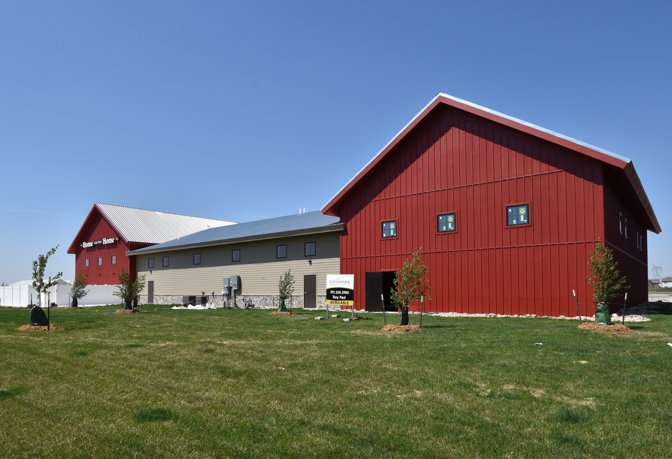
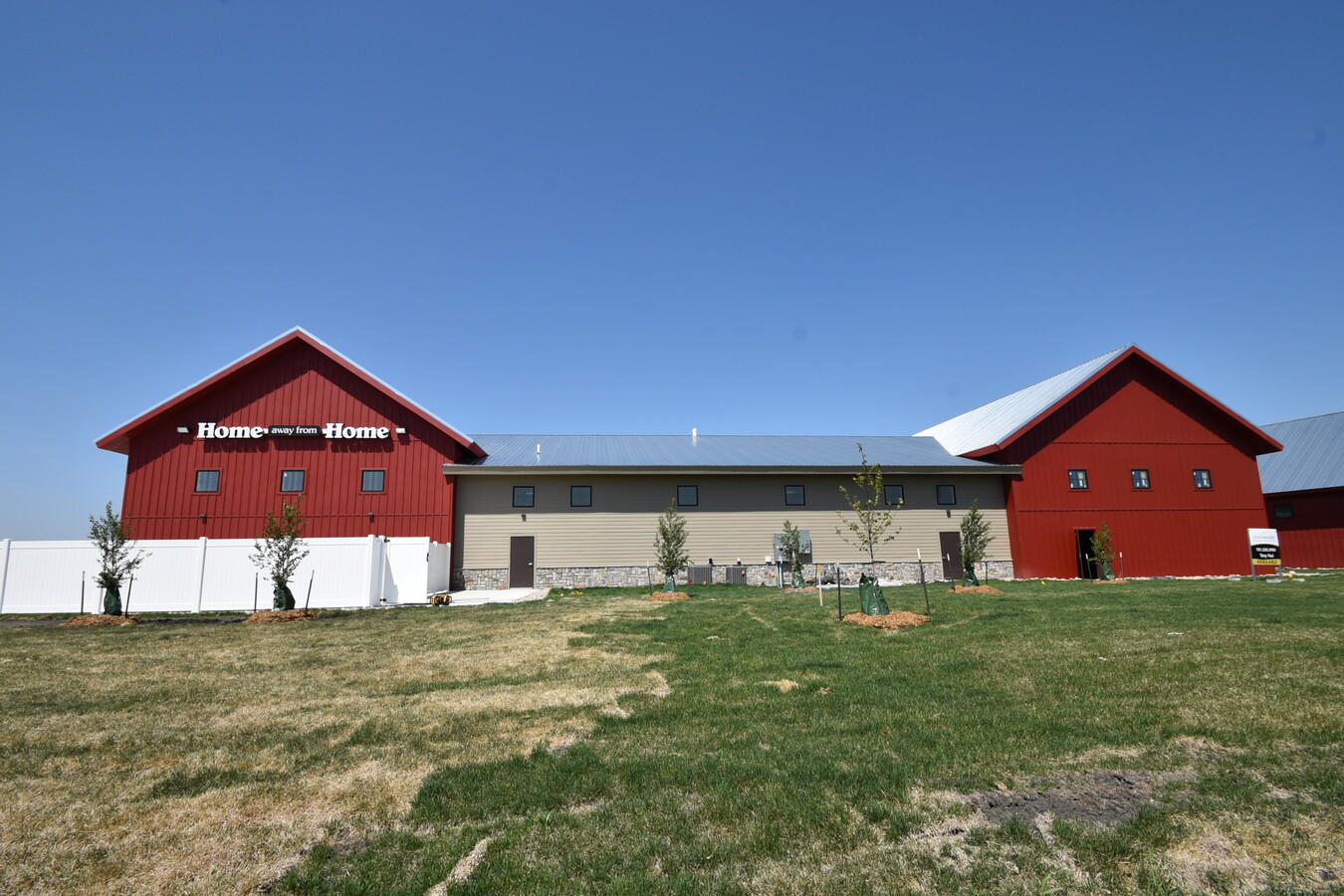
Property Record
5390 51St Ave S, Fargo, ND 58104
NEARBY LISTINGS FOR SALE OR LEASE
Property Detail
5390 51St Ave S
Fargo, ND-MN
Stone
01-8515-00200-014
LOT: 2 BLOCK: 1 ADDITION: ROCKING HORSE EAST 3RD ADDITIONAL: UNIT #5390 BROOKSTONE OFFICE PARK ERECTED UPON: ROCKING HORSE
Realpropertynec
Cass
AE
North Dakota
38017C0767G
1-2
2024
1.08 AC
2024
Fargo
040506
Other Market Areas
DEMOGRAPHICS near 5390 51St Ave S
1 Mile
3 Mile
5 Mile
2024 Total Population
9,354
60,067
130,375
2029 Population
9,945
64,861
140,188
Pop Growth 2024-2029
+ 6.32%
+ 7.98%
+ 7.53%
Average Age
31
33
36
2024 Total Households
3,655
24,669
55,611
HH Growth 2024-2029
+ 7.03%
+ 8.53%
+ 7.91%
Median Household Inc
$100,464
$82,367
$72,032
Avg Household Size
2.50
2.40
2.30
2024 Avg HH Vehicles
2.00
2.00
2.00
Median Home Value
$299,057
$324,213
$279,051
Median Year Built
2010
2010
2001
Nearby Places
- Restaurants
- Banks
- Shops
- Fitness
- Groceries
PUBLIC TRANSPORTATION
AIRPORT
Hector International
DRIVE
WALK
Distance
Hector International
22 min
13.0 mi
Freight Ports
Port Milwaukee
DRIVE
WALK
Distance
Port Milwaukee
636 min
578.4 mi
SALE & LEASE HISTORY
LISTING DATE
SALE/LEASE

Nov 01, 2019
For Lease
Jun 13, 2017
For Lease
Nearby Properties
Address
Land Use
TOTAL SIZE
Lot Size
Zoning
Address
Land Use
TOTAL SIZE
Lot Size
Zoning
55.68 AC
Address
Land Use
TOTAL SIZE
Lot Size
Zoning
Address
Land Use
TOTAL SIZE
Lot Size
Zoning
418,024 SF
10.88 AC
Address
Land Use
TOTAL SIZE
Lot Size
Zoning
Address
Land Use
TOTAL SIZE
Lot Size
Zoning
Address
Land Use
TOTAL SIZE
Lot Size
Zoning
7.66 AC
Address
Land Use
TOTAL SIZE
Lot Size
Zoning
Address
Land Use
TOTAL SIZE
Lot Size
Zoning
Address
Land Use
TOTAL SIZE
Lot Size
Zoning
Address
Land Use
TOTAL SIZE
Lot Size
Zoning
34,100 SF
1.46 AC
MR3
Address
Land Use
TOTAL SIZE
Lot Size
Zoning
Address
Land Use
TOTAL SIZE
Lot Size
Zoning
9,279 SF
8.33 AC
MR1
Address
Land Use
TOTAL SIZE
Lot Size
Zoning
48,300 SF
2.33 AC
MR3
Address
Land Use
TOTAL SIZE
Lot Size
Zoning
30,240 SF
1.54 AC
MR2
Address
Land Use
TOTAL SIZE
Lot Size
Zoning
217,776 SF
31.82 AC
GC
Address
Land Use
TOTAL SIZE
Lot Size
Zoning
Address
Land Use
TOTAL SIZE
Lot Size
Zoning
73,907 SF
3.41 AC
MR3
Address
Land Use
TOTAL SIZE
Lot Size
Zoning
152,509 SF
18.14 AC
Address
Land Use
TOTAL SIZE
Lot Size
Zoning
46,271 SF
2.06 AC
MR3
Address
Land Use
TOTAL SIZE
Lot Size
Zoning
122,201 SF
8.92 AC
GO
Address
Land Use
TOTAL SIZE
Lot Size
Zoning
191,151 SF
22.98 AC
LC
Address
Land Use
TOTAL SIZE
Lot Size
Zoning
54,927 SF
8.45 AC
Address
Land Use
TOTAL SIZE
Lot Size
Zoning
123,777 SF
1.90 AC
Address
Land Use
TOTAL SIZE
Lot Size
Zoning
41,046 SF
11.78 AC
Address
Land Use
TOTAL SIZE
Lot Size
Zoning
41,046 SF
11.90 AC
Address
Land Use
TOTAL SIZE
Lot Size
Zoning
794,266 SF
36.84 AC
GC
Address
Land Use
TOTAL SIZE
Lot Size
Zoning
Address
Land Use
TOTAL SIZE
Lot Size
Zoning
113,388 SF
3.41 AC
MR3
Address
Land Use
TOTAL SIZE
Lot Size
Zoning
88,956 SF
10.56 AC
GO
Address
Land Use
TOTAL SIZE
Lot Size
Zoning
160,913 SF
11.46 AC
GC
The World's #1 Commercial Real Estate Marketplace
Connect with us
© 2025 CoStar Group
The information above has been obtained from sources believed reliable. While we do not doubt its accuracy we have not verified it and make no guarantee, warranty or representation about it. It is your responsibility to independently confirm its accuracy and completeness. Any projections, opinions, assumptions, or estimates used are for example only and do not represent the current or future performance of the property. The value of this transaction to you depends on tax and other factors which should be evaluated by your tax, financial, and legal advisors. You and your advisors should conduct a careful, independent investigation of the property to determine to your satisfaction the suitability of the property for your needs.