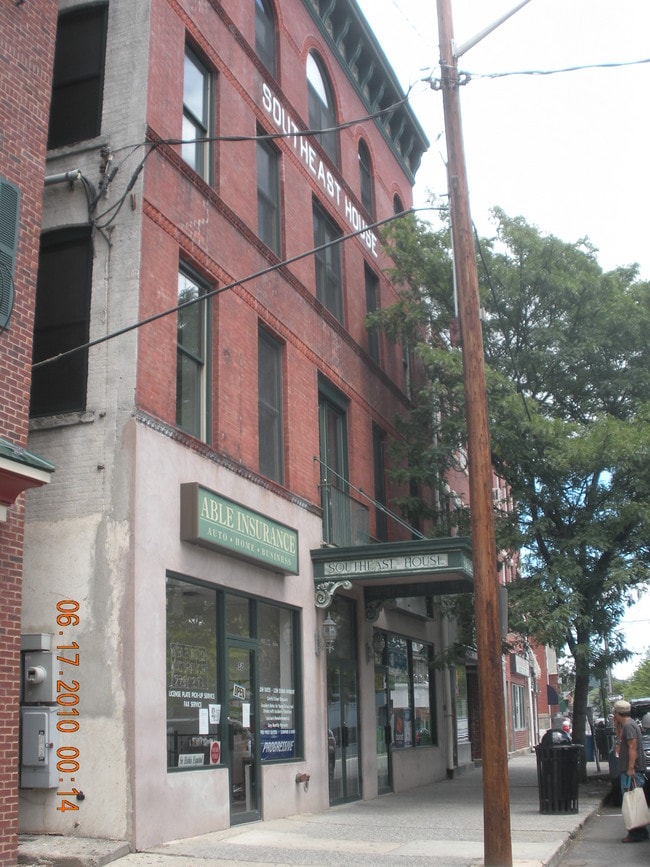
Property Record
52 Main St, Brewster, NY 10509


NEARBY LISTINGS FOR SALE OR LEASE
Property Detail
52 Main St
Dutchess County-Putnam County, NY
Putnam
373001-067-034-0002-006-000-0000
New York
Townhouserowhouse
0.07 AC
X
Brewster
36079C0163E
Westchester/So Connecticut
12,072 SF
DEMOGRAPHICS near 52 Main St
1 Mile
3 Mile
5 Mile
2024 Total Population
4,529
15,377
42,714
2029 Population
4,494
15,382
42,753
Pop Growth 2024-2029
(0.77%)
+ 0.03%
+ 0.09%
Average Age
40
43
44
2024 Total Households
1,607
5,737
16,140
HH Growth 2024-2029
(0.87%)
+ 0.05%
+ 0.10%
Median Household Inc
$86,076
$99,710
$109,717
Avg Household Size
2.70
2.60
2.60
2024 Avg HH Vehicles
2.00
2.00
2.00
Median Home Value
$354,340
$396,385
$421,062
Median Year Built
1955
1972
1976
Nearby Places
Map Layers
Map Styles
 Street
 Aerial
- Restaurants
- Banks
- Shops
- Fitness
- Groceries
PUBLIC TRANSPORTATION
COMMUTER RAIL
Brewster Station (Harlem Line - Metro-North Commuter Railroad Company (Metro-North))
DRIVE
WALK
Distance
Brewster Station (Harlem Line - Metro-North Commuter Railroad Company (Metro-North))
0 min
1 min
0.1 mi
Southeast Station (Harlem Line - Metro-North Commuter Railroad Company (Metro-North))
DRIVE
WALK
Distance
Southeast Station (Harlem Line - Metro-North Commuter Railroad Company (Metro-North))
12 min
4.6 mi
AIRPORT
Westchester County
DRIVE
WALK
Distance
Westchester County
35 min
26.0 mi
New York Stewart International
DRIVE
WALK
Distance
New York Stewart International
51 min
37.3 mi
Freight Ports
Port of New Haven
DRIVE
WALK
Distance
Port of New Haven
68 min
46.6 mi
SALE & LEASE HISTORY
LISTING DATE
SALE/LEASE

Nov 09, 2022
For Lease
Nearby Properties
Address
Land Use
TOTAL SIZE
Lot Size
Zoning
Address
Land Use
TOTAL SIZE
Lot Size
Zoning
1,078.50 AC
SR 6
Address
Land Use
TOTAL SIZE
Lot Size
Zoning
670.72 AC
SP Z
Address
Land Use
TOTAL SIZE
Lot Size
Zoning
5,328 SF
808.45 AC
R60
Address
Land Use
TOTAL SIZE
Lot Size
Zoning
282,770 SF
50.83 AC
R160
Address
Land Use
TOTAL SIZE
Lot Size
Zoning
306.87 AC
SP Z
Address
Land Use
TOTAL SIZE
Lot Size
Zoning
172,197 SF
43.18 AC
R
Address
Land Use
TOTAL SIZE
Lot Size
Zoning
110,970 SF
0.01 AC
R
Address
Land Use
TOTAL SIZE
Lot Size
Zoning
94,431 SF
0.01 AC
R
Address
Land Use
TOTAL SIZE
Lot Size
Zoning
146,484 SF
23.06 AC
SR 22
Address
Land Use
TOTAL SIZE
Lot Size
Zoning
223,335 SF
27.56 AC
OP2
Address
Land Use
TOTAL SIZE
Lot Size
Zoning
194,344 SF
17.77 AC
CBP
Address
Land Use
TOTAL SIZE
Lot Size
Zoning
67.30 AC
Address
Land Use
TOTAL SIZE
Lot Size
Zoning
Address
Land Use
TOTAL SIZE
Lot Size
Zoning
164.46 AC
OP3
Address
Land Use
TOTAL SIZE
Lot Size
Zoning
0.01 AC
OP3
Address
Land Use
TOTAL SIZE
Lot Size
Zoning
22,338 SF
2.37 AC
C
Address
Land Use
TOTAL SIZE
Lot Size
Zoning
69,500 SF
12 AC
CBP
Address
Land Use
TOTAL SIZE
Lot Size
Zoning
59,257 SF
21 AC
SR 6
Address
Land Use
TOTAL SIZE
Lot Size
Zoning
3,060 SF
2.47 AC
R40
Address
Land Use
TOTAL SIZE
Lot Size
Zoning
1.16 AC
SR 6
Address
Land Use
TOTAL SIZE
Lot Size
Zoning
116,593 SF
11.23 AC
HC
Address
Land Use
TOTAL SIZE
Lot Size
Zoning
66,037 SF
1.61 AC
R
Address
Land Use
TOTAL SIZE
Lot Size
Zoning
57,505 SF
11.75 AC
SR 6
Address
Land Use
TOTAL SIZE
Lot Size
Zoning
6,003 SF
35.29 AC
HC
Address
Land Use
TOTAL SIZE
Lot Size
Zoning
64.48 AC
OP3
Address
Land Use
TOTAL SIZE
Lot Size
Zoning
3,077 SF
10.66 AC
RMF
Address
Land Use
TOTAL SIZE
Lot Size
Zoning
111,450 SF
25.75 AC
CBP
Address
Land Use
TOTAL SIZE
Lot Size
Zoning
173,168 SF
7.94 AC
HC
Address
Land Use
TOTAL SIZE
Lot Size
Zoning
49,578 SF
7 AC
SP Z
Address
Land Use
TOTAL SIZE
Lot Size
Zoning
48,443 SF
6.46 AC
SR 6
The World's #1 Commercial Real Estate Marketplace
Connect with us
© 2025 CoStar Group
The information above has been obtained from sources believed reliable. While we do not doubt its accuracy we have not verified it and make no guarantee, warranty or representation about it. It is your responsibility to independently confirm its accuracy and completeness. Any projections, opinions, assumptions, or estimates used are for example only and do not represent the current or future performance of the property. The value of this transaction to you depends on tax and other factors which should be evaluated by your tax, financial, and legal advisors. You and your advisors should conduct a careful, independent investigation of the property to determine to your satisfaction the suitability of the property for your needs.