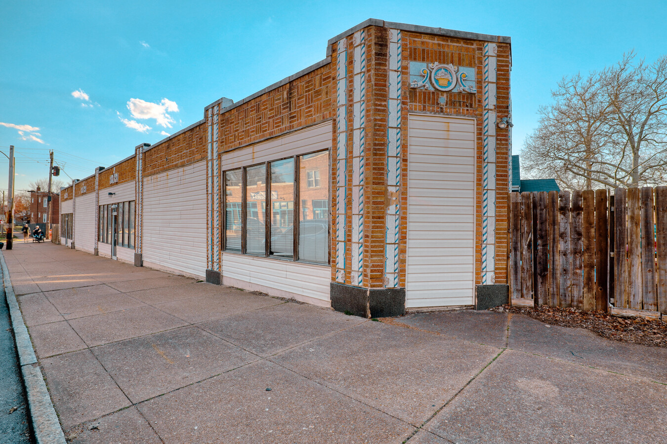
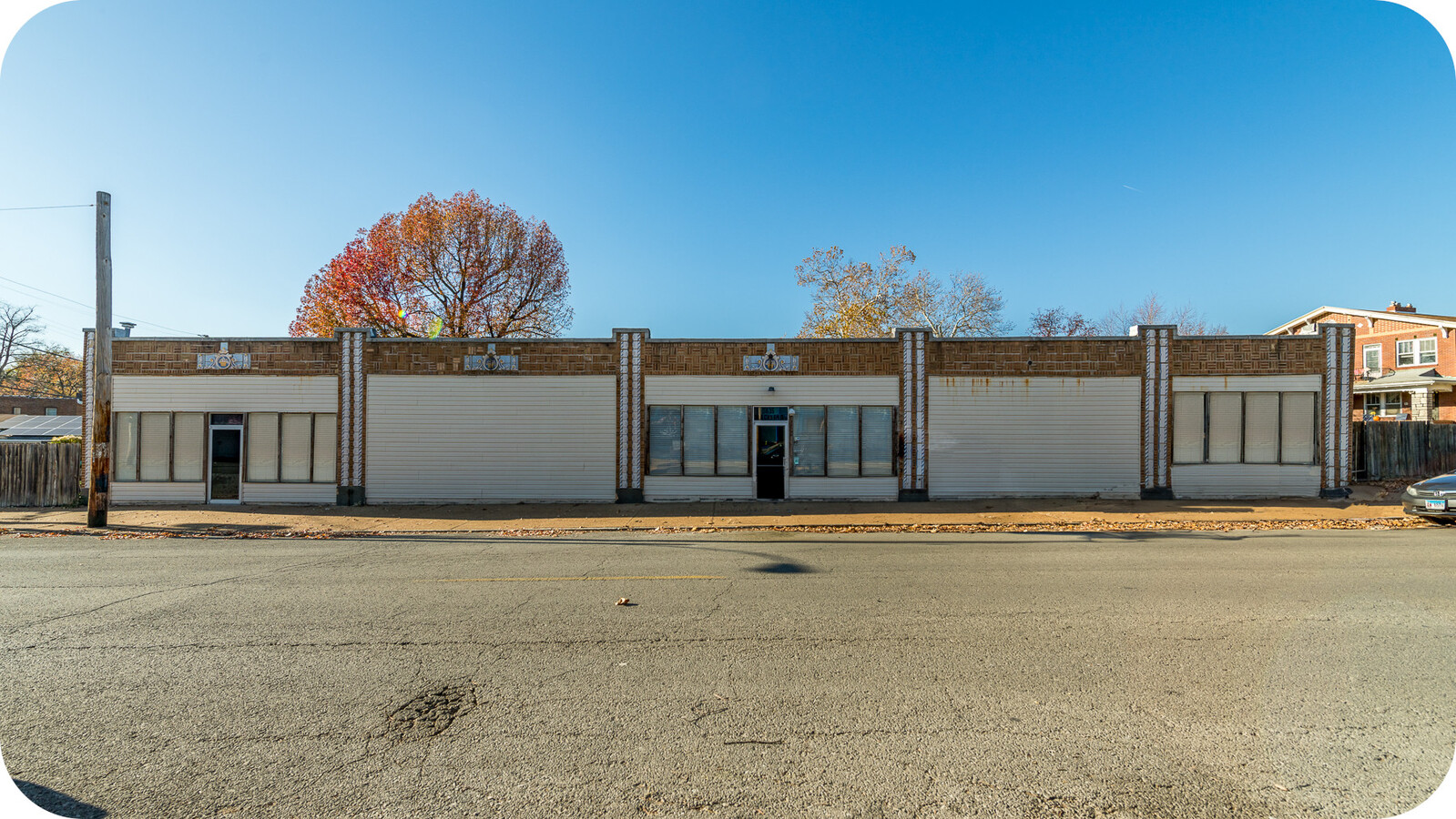
Property Record
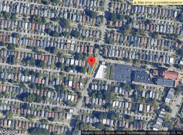
5835 Macklind Ave, Saint Louis, MO 63109
NEARBY LISTINGS FOR SALE OR LEASE
Property Detail
5835 Macklind Ave
St. Louis, MO-IL
Gardenville Terr Addn
5840-00-0290-0
C B 5840 RHODES 62.97 FT / 19.61 FT X 155 FT 7 IN / 149 FT 6 IN GARDENVILLE TERR ADDN BLOCK 2 LOT 1
Commercialnec
St. Louis City
X
Missouri
29189C0333K
1
2023
0.14 AC
2024
St Louis City South
114102
St. Louis
4,256 SF
DEMOGRAPHICS near 5835 Macklind Ave
1 Mile
3 Mile
5 Mile
2024 Total Population
18,899
145,199
311,515
2029 Population
17,212
136,127
296,188
Pop Growth 2024-2029
(8.93%)
(6.25%)
(4.92%)
Average Age
42
40
40
2024 Total Households
9,688
68,634
144,831
HH Growth 2024-2029
(8.73%)
(6.31%)
(5.11%)
Median Household Inc
$65,270
$58,604
$63,012
Avg Household Size
1.90
2.10
2.00
2024 Avg HH Vehicles
2.00
2.00
2.00
Median Home Value
$186,377
$176,906
$205,358
Median Year Built
1946
1948
1948
Nearby Places
- Restaurants
- Banks
- Shops
- Fitness
- Groceries
PUBLIC TRANSPORTATION
COMMUTER RAIL
Shrewsbury-Lansdowne (Shrewsbury-Lansdowne I-44 Emerson Park - St. Louis MetroLink (MetroLink))
DRIVE
WALK
Distance
Shrewsbury-Lansdowne (Shrewsbury-Lansdowne I-44 Emerson Park - St. Louis MetroLink (MetroLink))
6 min
2.7 mi
Sunnen (Shrewsbury-Lansdowne I-44 Emerson Park - St. Louis MetroLink (MetroLink))
DRIVE
WALK
Distance
Sunnen (Shrewsbury-Lansdowne I-44 Emerson Park - St. Louis MetroLink (MetroLink))
10 min
4.4 mi
AIRPORT
St Louis Lambert International
DRIVE
WALK
Distance
St Louis Lambert International
27 min
17.6 mi
Scott AFB/Midamerica St Louis
DRIVE
WALK
Distance
Scott AFB/Midamerica St Louis
51 min
33.7 mi
Freight Ports
Port Milwaukee
DRIVE
WALK
Distance
Port Milwaukee
430 min
378.0 mi
SALE & LEASE HISTORY
LISTING DATE
SALE/LEASE

Sep 19, 2022
For Sale
Mar 28, 2022
For Sale
Feb 27, 2023
For Lease
Dec 18, 2023
For Sale
Nearby Properties
Address
Land Use
TOTAL SIZE
Lot Size
Zoning
Address
Land Use
TOTAL SIZE
Lot Size
Zoning
0.92 AC
A
Address
Land Use
TOTAL SIZE
Lot Size
Zoning
5.61 AC
A
Address
Land Use
TOTAL SIZE
Lot Size
Zoning
229.57 AC
B
Address
Land Use
TOTAL SIZE
Lot Size
Zoning
177.77 AC
A
Address
Land Use
TOTAL SIZE
Lot Size
Zoning
57.77 AC
A
Address
Land Use
TOTAL SIZE
Lot Size
Zoning
212,406 SF
21.42 AC
AB
Address
Land Use
TOTAL SIZE
Lot Size
Zoning
22.44 AC
A
Address
Land Use
TOTAL SIZE
Lot Size
Zoning
559,752 SF
24.37 AC
53R-3
Address
Land Use
TOTAL SIZE
Lot Size
Zoning
23.21 AC
A
Address
Land Use
TOTAL SIZE
Lot Size
Zoning
44.38 AC
R1
Address
Land Use
TOTAL SIZE
Lot Size
Zoning
106,148 SF
13.01 AC
53C-2
Address
Land Use
TOTAL SIZE
Lot Size
Zoning
39,712 SF
30.49 AC
R1
Address
Land Use
TOTAL SIZE
Lot Size
Zoning
394,790 SF
19.32 AC
K
Address
Land Use
TOTAL SIZE
Lot Size
Zoning
375,783 SF
15.42 AC
37MULTI
Address
Land Use
TOTAL SIZE
Lot Size
Zoning
50.67 AC
A
Address
Land Use
TOTAL SIZE
Lot Size
Zoning
217,910 SF
12.41 AC
53C-2
Address
Land Use
TOTAL SIZE
Lot Size
Zoning
20.27 AC
R5
Address
Land Use
TOTAL SIZE
Lot Size
Zoning
17.93 AC
R5
Address
Land Use
TOTAL SIZE
Lot Size
Zoning
137,147 SF
12.11 AC
35PUD
Address
Land Use
TOTAL SIZE
Lot Size
Zoning
261,362 SF
17.19 AC
R6
Address
Land Use
TOTAL SIZE
Lot Size
Zoning
220,632 SF
15.60 AC
M1
Address
Land Use
TOTAL SIZE
Lot Size
Zoning
133,832 SF
12.18 AC
53C-2
Address
Land Use
TOTAL SIZE
Lot Size
Zoning
124,541 SF
13.07 AC
G
Address
Land Use
TOTAL SIZE
Lot Size
Zoning
122,278 SF
10.83 AC
F
Address
Land Use
TOTAL SIZE
Lot Size
Zoning
89,094 SF
9.91 AC
G
Address
Land Use
TOTAL SIZE
Lot Size
Zoning
Address
Land Use
TOTAL SIZE
Lot Size
Zoning
80,604 SF
7.93 AC
53C-2
Address
Land Use
TOTAL SIZE
Lot Size
Zoning
219,361 SF
9.36 AC
M1
Address
Land Use
TOTAL SIZE
Lot Size
Zoning
489,909 SF
20.11 AC
R4
Address
Land Use
TOTAL SIZE
Lot Size
Zoning
183,368 SF
9.79 AC
M1
The World's #1 Commercial Real Estate Marketplace
Connect with us
© 2025 CoStar Group
The information above has been obtained from sources believed reliable. While we do not doubt its accuracy we have not verified it and make no guarantee, warranty or representation about it. It is your responsibility to independently confirm its accuracy and completeness. Any projections, opinions, assumptions, or estimates used are for example only and do not represent the current or future performance of the property. The value of this transaction to you depends on tax and other factors which should be evaluated by your tax, financial, and legal advisors. You and your advisors should conduct a careful, independent investigation of the property to determine to your satisfaction the suitability of the property for your needs.