Property Record
5407 Gratiot Ave, Saint Clair, MI 48079
NEARBY LISTINGS FOR SALE OR LEASE
Property Detail
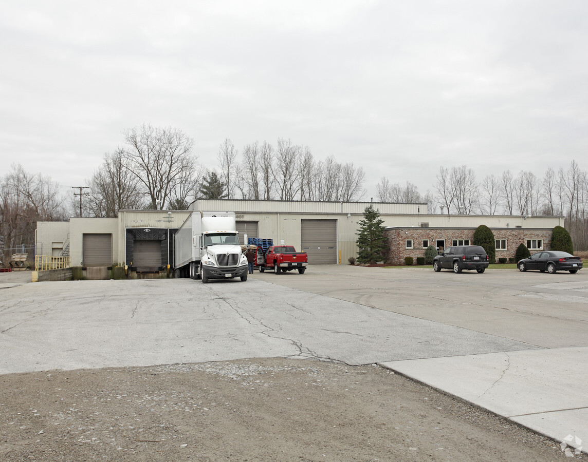
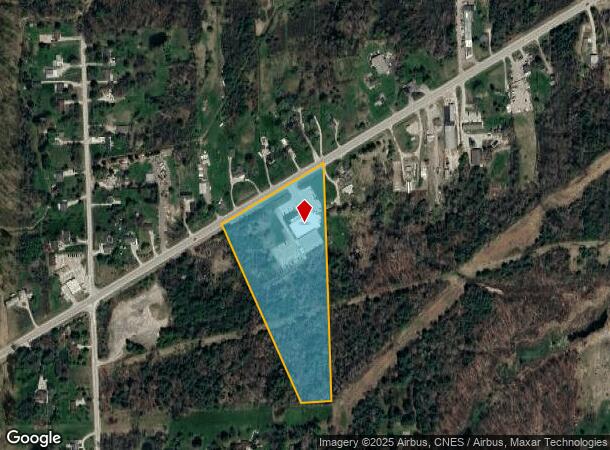
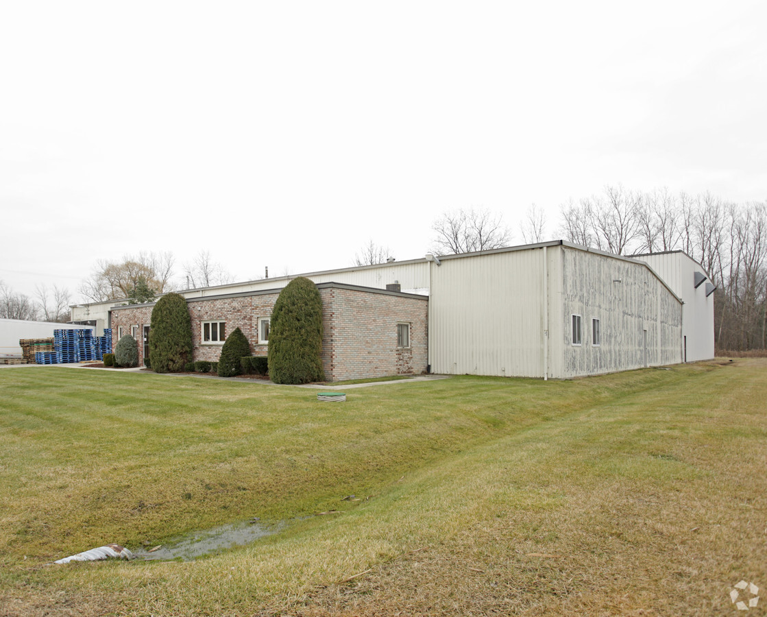
5407 Gratiot Ave
30-002-4009-600
BEG N 1103.33', TH N 61D 21M 42S E 865.73' & S 21D 59M 21S E 60.41' FROM SW SEC COR, TH N 61D 21M 42S E 650', TH S 0D 3M 12S
Commercialnec
St. Clair
X
Michigan
26147C0345D
10.50 AC
2024
St Clair & Lapeer Counties
2024
Detroit
640600
Detroit-Warren-Dearborn, MI
27,189 SF
DEMOGRAPHICS near 5407 Gratiot Ave
1 Mile
3 Mile
5 Mile
2024 Total Population
515
8,163
27,176
2029 Population
511
8,134
27,096
Pop Growth 2024-2029
(0.78%)
(0.36%)
(0.29%)
Average Age
44
42
42
2024 Total Households
218
3,380
10,890
HH Growth 2024-2029
(0.92%)
(0.36%)
(0.36%)
Median Household Inc
$82,552
$71,109
$62,071
Avg Household Size
2.30
2.40
2.40
2024 Avg HH Vehicles
2.00
2.00
2.00
Median Home Value
$225,308
$183,115
$183,527
Median Year Built
1975
1977
1980
Nearby Places
- Restaurants
- Banks
- Shops
- Fitness
- Groceries
PUBLIC TRANSPORTATION
COMMUTER RAIL
Port Huron Amtrak Station (Blue Water - Amtrak)
DRIVE
WALK
Distance
Port Huron Amtrak Station (Blue Water - Amtrak)
13 min
7.1 mi
Freight Ports
Port of Toledo
DRIVE
WALK
Distance
Port of Toledo
137 min
112.1 mi
Nearby Properties
Address
Land Use
TOTAL SIZE
Lot Size
Zoning
Address
Land Use
TOTAL SIZE
Lot Size
Zoning
682,515 SF
211.45 AC
M-2
Address
Land Use
TOTAL SIZE
Lot Size
Zoning
98,904 SF
29.48 AC
R1-A
Address
Land Use
TOTAL SIZE
Lot Size
Zoning
79,276 SF
311.74 AC
M-1
Address
Land Use
TOTAL SIZE
Lot Size
Zoning
204,347 SF
35.13 AC
C-2
Address
Land Use
TOTAL SIZE
Lot Size
Zoning
80,662 SF
R1-A
Address
Land Use
TOTAL SIZE
Lot Size
Zoning
138,360 SF
6.01 AC
M-1
Address
Land Use
TOTAL SIZE
Lot Size
Zoning
Address
Land Use
TOTAL SIZE
Lot Size
Zoning
108,767 SF
7.28 AC
R1-A
Address
Land Use
TOTAL SIZE
Lot Size
Zoning
83,623 SF
5.49 AC
M-1
Address
Land Use
TOTAL SIZE
Lot Size
Zoning
250,775 SF
11.29 AC
M-1
Address
Land Use
TOTAL SIZE
Lot Size
Zoning
100,096 SF
13.85 AC
M-2
Address
Land Use
TOTAL SIZE
Lot Size
Zoning
69,440 SF
12.30 AC
C-2
Address
Land Use
TOTAL SIZE
Lot Size
Zoning
50,314 SF
58.60 AC
M-2
Address
Land Use
TOTAL SIZE
Lot Size
Zoning
28,565 SF
R1-A
Address
Land Use
TOTAL SIZE
Lot Size
Zoning
55,760 SF
7.86 AC
M-1
Address
Land Use
TOTAL SIZE
Lot Size
Zoning
18,000 SF
9.62 AC
M-1
Address
Land Use
TOTAL SIZE
Lot Size
Zoning
5,213 SF
45 AC
I-2
Address
Land Use
TOTAL SIZE
Lot Size
Zoning
129,642 SF
10.49 AC
M-1
Address
Land Use
TOTAL SIZE
Lot Size
Zoning
13,532 SF
98.56 AC
CR
Address
Land Use
TOTAL SIZE
Lot Size
Zoning
29,312 SF
2 AC
R1-A
Address
Land Use
TOTAL SIZE
Lot Size
Zoning
72,284 SF
8.07 AC
C-2
Address
Land Use
TOTAL SIZE
Lot Size
Zoning
24,000 SF
R1-A
Address
Land Use
TOTAL SIZE
Lot Size
Zoning
10,366 SF
2.39 AC
C-3
Address
Land Use
TOTAL SIZE
Lot Size
Zoning
71,108 SF
5.02 AC
M-2
Address
Land Use
TOTAL SIZE
Lot Size
Zoning
1,028 SF
10.12 AC
I-1
Address
Land Use
TOTAL SIZE
Lot Size
Zoning
28,440 SF
R1-A
Address
Land Use
TOTAL SIZE
Lot Size
Zoning
42,222 SF
1.68 AC
M-1
Address
Land Use
TOTAL SIZE
Lot Size
Zoning
2,386 SF
16.50 AC
MH
Address
Land Use
TOTAL SIZE
Lot Size
Zoning
42,048 SF
5.68 AC
RMA
Address
Land Use
TOTAL SIZE
Lot Size
Zoning
3,933 SF
4.78 AC
C-2
The World's #1 Commercial Real Estate Marketplace
Connect with us
© 2025 CoStar Group
The information above has been obtained from sources believed reliable. While we do not doubt its accuracy we have not verified it and make no guarantee, warranty or representation about it. It is your responsibility to independently confirm its accuracy and completeness. Any projections, opinions, assumptions, or estimates used are for example only and do not represent the current or future performance of the property. The value of this transaction to you depends on tax and other factors which should be evaluated by your tax, financial, and legal advisors. You and your advisors should conduct a careful, independent investigation of the property to determine to your satisfaction the suitability of the property for your needs.