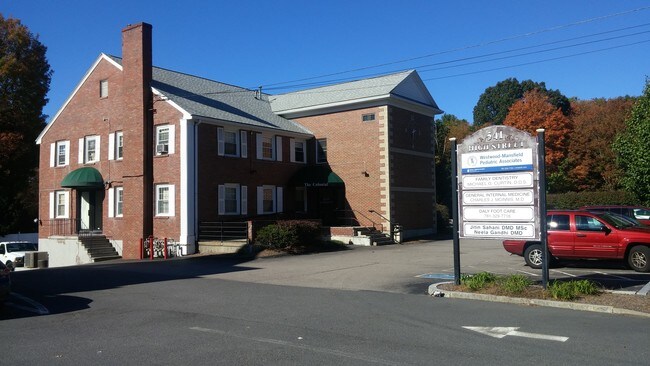
Property Record
541 High St, Westwood, MA 02090


NEARBY LISTINGS FOR SALE OR LEASE
Property Detail
541 High St
WWOO-000009-000000-000116
Norfolk
Officebuilding
Massachusetts
X
116
25021C0176F
0.43 AC
2025
Route 1 South
2025
Boston
412200
Boston-Cambridge-Newton, MA-NH
6,726 SF
DEMOGRAPHICS near 541 High St
1 Mile
3 Mile
5 Mile
2024 Total Population
4,377
41,160
148,113
2029 Population
4,466
41,052
146,046
Pop Growth 2024-2029
+ 2.03%
(0.26%)
(1.40%)
Average Age
45
43
42
2024 Total Households
1,457
15,438
55,496
HH Growth 2024-2029
+ 2.20%
(0.34%)
(1.60%)
Median Household Inc
$162,989
$140,518
$130,604
Avg Household Size
2.80
2.60
2.60
2024 Avg HH Vehicles
2.00
2.00
2.00
Median Home Value
$913,831
$808,330
$760,772
Median Year Built
1972
1963
1960
Nearby Places
Map Layers
Map Styles
 Street
 Aerial
- Restaurants
- Banks
- Shops
- Fitness
- Groceries
PUBLIC TRANSPORTATION
COMMUTER RAIL
Islington (Franklin Line - Massachusetts Bay Transportation Authority Commuter Rail (Purple Line))
DRIVE
WALK
Distance
Islington (Franklin Line - Massachusetts Bay Transportation Authority Commuter Rail (Purple Line))
7 min
3.4 mi
Dedham Corporate Center (Franklin Line - Massachusetts Bay Transportation Authority Commuter Rail (Purple Line))
DRIVE
WALK
Distance
Dedham Corporate Center (Franklin Line - Massachusetts Bay Transportation Authority Commuter Rail (Purple Line))
7 min
4.0 mi
AIRPORT
General Edward Lawrence Logan International
DRIVE
WALK
Distance
General Edward Lawrence Logan International
34 min
17.8 mi
Freight Ports
Port of Boston
DRIVE
WALK
Distance
Port of Boston
32 min
16.2 mi
SALE & LEASE HISTORY
LISTING DATE
SALE/LEASE

Oct 10, 2016
For Sale
Nov 17, 2016
For Sale
Nearby Properties
Address
Land Use
TOTAL SIZE
Lot Size
Zoning
Address
Land Use
TOTAL SIZE
Lot Size
Zoning
380,030 SF
24.87 AC
Address
Land Use
TOTAL SIZE
Lot Size
Zoning
413,827 SF
9.49 AC
RDO
Address
Land Use
TOTAL SIZE
Lot Size
Zoning
11.66 AC
LM
Address
Land Use
TOTAL SIZE
Lot Size
Zoning
45,836 SF
23.25 AC
Address
Land Use
TOTAL SIZE
Lot Size
Zoning
221,803 SF
36.46 AC
Address
Land Use
TOTAL SIZE
Lot Size
Zoning
8.18 AC
B
Address
Land Use
TOTAL SIZE
Lot Size
Zoning
5,349 SF
8.74 AC
Address
Land Use
TOTAL SIZE
Lot Size
Zoning
132,917 SF
24 AC
RE
Address
Land Use
TOTAL SIZE
Lot Size
Zoning
45.72 AC
LM
Address
Land Use
TOTAL SIZE
Lot Size
Zoning
15 AC
Address
Land Use
TOTAL SIZE
Lot Size
Zoning
141,322 SF
36.84 AC
Address
Land Use
TOTAL SIZE
Lot Size
Zoning
242,198 SF
53.28 AC
Address
Land Use
TOTAL SIZE
Lot Size
Zoning
100,963 SF
17.69 AC
A
Address
Land Use
TOTAL SIZE
Lot Size
Zoning
294,771 SF
17.85 AC
Address
Land Use
TOTAL SIZE
Lot Size
Zoning
130,344 SF
8.18 AC
Address
Land Use
TOTAL SIZE
Lot Size
Zoning
18.01 AC
GB
Address
Land Use
TOTAL SIZE
Lot Size
Zoning
150,802 SF
3.09 AC
LM
Address
Land Use
TOTAL SIZE
Lot Size
Zoning
205.75 AC
Address
Land Use
TOTAL SIZE
Lot Size
Zoning
15.40 AC
LM
Address
Land Use
TOTAL SIZE
Lot Size
Zoning
218,676 SF
22.54 AC
Address
Land Use
TOTAL SIZE
Lot Size
Zoning
11.70 AC
Address
Land Use
TOTAL SIZE
Lot Size
Zoning
92,278 SF
10.58 AC
Address
Land Use
TOTAL SIZE
Lot Size
Zoning
361,239 SF
37.28 AC
Address
Land Use
TOTAL SIZE
Lot Size
Zoning
529.60 AC
R2
Address
Land Use
TOTAL SIZE
Lot Size
Zoning
33,778 SF
18.86 AC
Address
Land Use
TOTAL SIZE
Lot Size
Zoning
108,601 SF
17.85 AC
A
Address
Land Use
TOTAL SIZE
Lot Size
Zoning
314.70 AC
R2
Address
Land Use
TOTAL SIZE
Lot Size
Zoning
105.77 AC
B
Address
Land Use
TOTAL SIZE
Lot Size
Zoning
27.61 AC
Address
Land Use
TOTAL SIZE
Lot Size
Zoning
138,380 SF
17.26 AC
The World's #1 Commercial Real Estate Marketplace
Connect with us
© 2025 CoStar Group
The information above has been obtained from sources believed reliable. While we do not doubt its accuracy we have not verified it and make no guarantee, warranty or representation about it. It is your responsibility to independently confirm its accuracy and completeness. Any projections, opinions, assumptions, or estimates used are for example only and do not represent the current or future performance of the property. The value of this transaction to you depends on tax and other factors which should be evaluated by your tax, financial, and legal advisors. You and your advisors should conduct a careful, independent investigation of the property to determine to your satisfaction the suitability of the property for your needs.