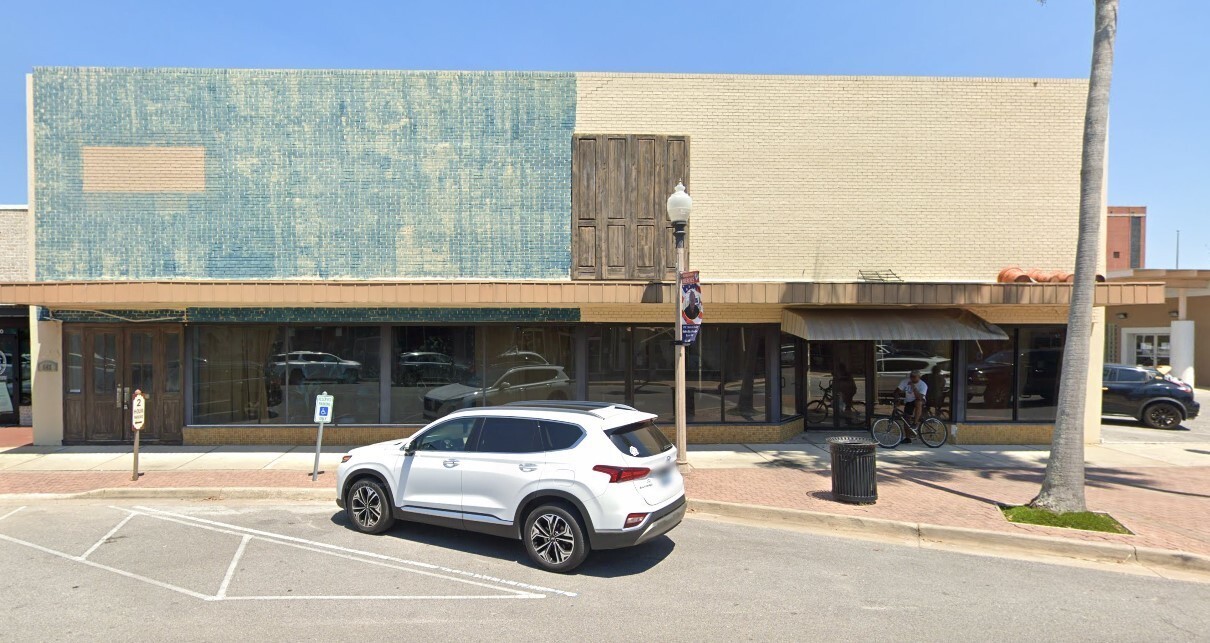
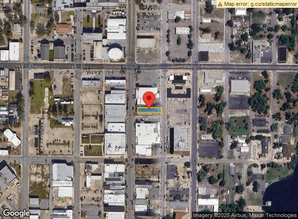
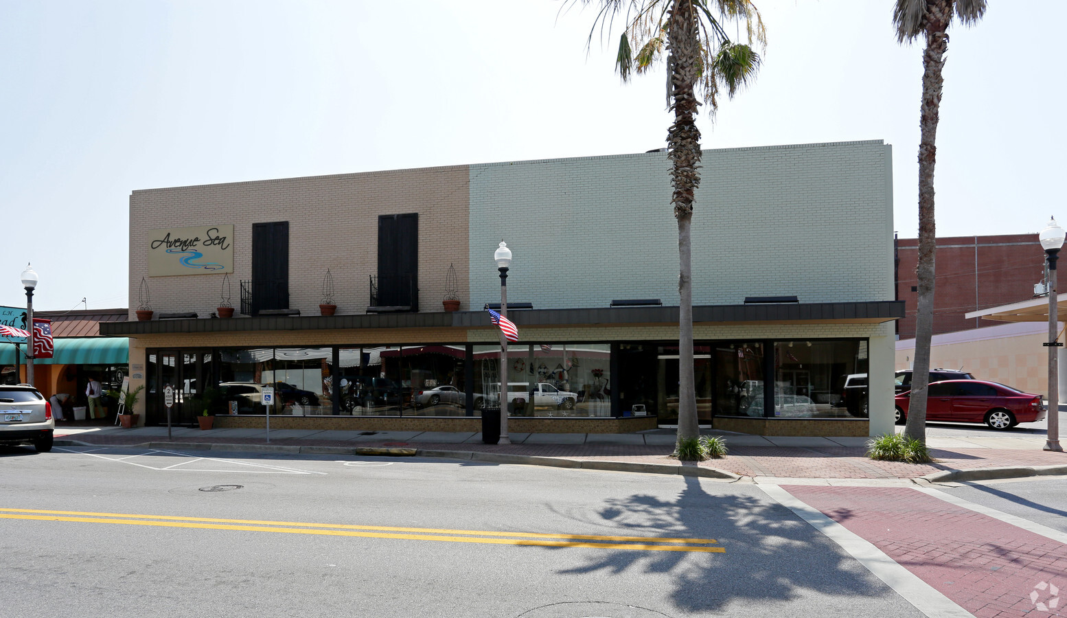
Property Record
542 Harrison Ave, Panama City, FL 32401
NEARBY LISTINGS FOR SALE OR LEASE
Property Detail
542 Harrison Ave
Panama City, FL
G C D Plat
19742-000-000
G C D PLAT LOT 14 & N1/2 OF LOT 13 BLK 19 ORB 4676 P 2236 MAP 92D1
Storemultistory
Bay
X
Florida
12005C0341J
14,13
2023
0.14 AC
2024
Downtown Panama City
002000
Other Market Areas
6,270 SF
DEMOGRAPHICS near 542 Harrison Ave
1 Mile
3 Mile
5 Mile
2024 Total Population
4,835
28,180
69,205
2029 Population
5,265
30,004
73,750
Pop Growth 2024-2029
+ 8.89%
+ 6.47%
+ 6.57%
Average Age
42
40
40
2024 Total Households
2,085
11,330
27,121
HH Growth 2024-2029
+ 9.45%
+ 6.97%
+ 6.93%
Median Household Inc
$45,319
$46,666
$54,373
Avg Household Size
2.20
2.40
2.40
2024 Avg HH Vehicles
1.00
1.00
2.00
Median Home Value
$184,277
$165,404
$188,772
Median Year Built
1976
1975
1984
Nearby Places
- Restaurants
- Banks
- Shops
- Fitness
- Groceries
PUBLIC TRANSPORTATION
AIRPORT
Northwest Florida Beaches International
DRIVE
WALK
Distance
Northwest Florida Beaches International
38 min
22.9 mi
Freight Ports
Port of Panama City
DRIVE
WALK
Distance
Port of Panama City
12 min
5.5 mi
SALE & LEASE HISTORY
LISTING DATE
SALE/LEASE

Nov 22, 2022
For Sale
May 16, 2017
For Sale
Feb 04, 2021
For Sale
Nearby Properties
Address
Land Use
TOTAL SIZE
Lot Size
Zoning
Address
Land Use
TOTAL SIZE
Lot Size
Zoning
764,032 SF
12.80 AC
PC14
Address
Land Use
TOTAL SIZE
Lot Size
Zoning
477,423 SF
21.91 AC
PC09
Address
Land Use
TOTAL SIZE
Lot Size
Zoning
455,239 SF
11.87 AC
PC11
Address
Land Use
TOTAL SIZE
Lot Size
Zoning
263,872 SF
41.43 AC
PC12
Address
Land Use
TOTAL SIZE
Lot Size
Zoning
214,953 SF
14.58 AC
PC09
Address
Land Use
TOTAL SIZE
Lot Size
Zoning
354,592 SF
24 AC
UND
Address
Land Use
TOTAL SIZE
Lot Size
Zoning
140,899 SF
15.48 AC
PC09
Address
Land Use
TOTAL SIZE
Lot Size
Zoning
86,629 SF
4.70 AC
Address
Land Use
TOTAL SIZE
Lot Size
Zoning
142,051 SF
13.43 AC
PC09
Address
Land Use
TOTAL SIZE
Lot Size
Zoning
415,651 SF
266 AC
BC13
Address
Land Use
TOTAL SIZE
Lot Size
Zoning
194,474 SF
16.03 AC
PC09
Address
Land Use
TOTAL SIZE
Lot Size
Zoning
Address
Land Use
TOTAL SIZE
Lot Size
Zoning
68,418 SF
443.50 AC
PC11
Address
Land Use
TOTAL SIZE
Lot Size
Zoning
115,056 SF
21 AC
PC09
Address
Land Use
TOTAL SIZE
Lot Size
Zoning
122,813 SF
9.58 AC
PC09
Address
Land Use
TOTAL SIZE
Lot Size
Zoning
424,813 SF
30 AC
Address
Land Use
TOTAL SIZE
Lot Size
Zoning
Address
Land Use
TOTAL SIZE
Lot Size
Zoning
207,286 SF
3.48 AC
PC10
Address
Land Use
TOTAL SIZE
Lot Size
Zoning
165,098 SF
9.67 AC
PC04
Address
Land Use
TOTAL SIZE
Lot Size
Zoning
164,923 SF
23.60 AC
PC09
Address
Land Use
TOTAL SIZE
Lot Size
Zoning
118,302 SF
8 AC
PC05
Address
Land Use
TOTAL SIZE
Lot Size
Zoning
41,300 SF
17.87 AC
PC14
Address
Land Use
TOTAL SIZE
Lot Size
Zoning
256,570 SF
7 AC
PC14
Address
Land Use
TOTAL SIZE
Lot Size
Zoning
126,234 SF
20.02 AC
PI
Address
Land Use
TOTAL SIZE
Lot Size
Zoning
62,640 SF
0.48 AC
PC10
Address
Land Use
TOTAL SIZE
Lot Size
Zoning
154,028 SF
2.01 AC
PC10
Address
Land Use
TOTAL SIZE
Lot Size
Zoning
98,827 SF
11.95 AC
PC09
Address
Land Use
TOTAL SIZE
Lot Size
Zoning
102,730 SF
11.12 AC
PC09
Address
Land Use
TOTAL SIZE
Lot Size
Zoning
36,866 SF
12 AC
PC14
Address
Land Use
TOTAL SIZE
Lot Size
Zoning
101,092 SF
10.27 AC
PC09
The World's #1 Commercial Real Estate Marketplace
Connect with us
© 2025 CoStar Group
The information above has been obtained from sources believed reliable. While we do not doubt its accuracy we have not verified it and make no guarantee, warranty or representation about it. It is your responsibility to independently confirm its accuracy and completeness. Any projections, opinions, assumptions, or estimates used are for example only and do not represent the current or future performance of the property. The value of this transaction to you depends on tax and other factors which should be evaluated by your tax, financial, and legal advisors. You and your advisors should conduct a careful, independent investigation of the property to determine to your satisfaction the suitability of the property for your needs.