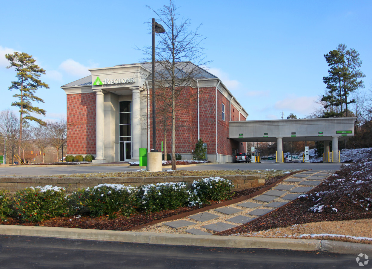
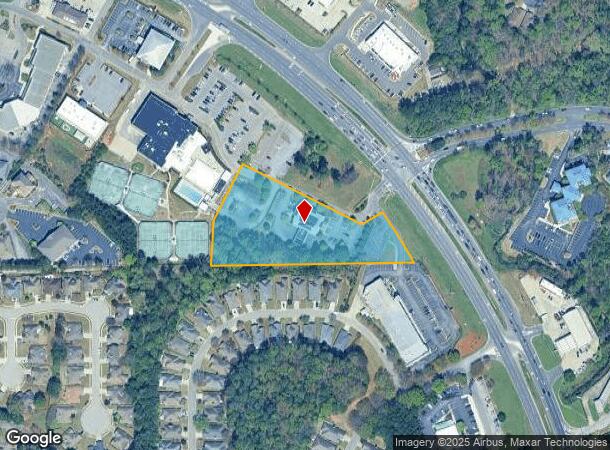
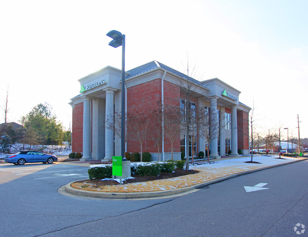
Property Record
5420 Highway 280, Hoover, AL 35242
NEARBY LISTINGS FOR SALE OR LEASE
Property Detail
5420 Highway 280
03-9-32-0-001-008-001
COM SW COR SE1/4 SW1/4 E258.72 TO POB; CONT E TO W ROW HWY #280 NW185(S) SW104.5 NW378.71 SW208.95 S144.62 TO POB.
Financialbuilding
Shelby
X
Alabama
01117C0091E
3.27 AC
2023
Hwy 280/Shelby County
2023
Birmingham
030348
Birmingham-Hoover, AL
10,012 SF
DEMOGRAPHICS near 5420 Highway 280
1 Mile
3 Mile
5 Mile
2024 Total Population
5,237
38,914
71,458
2029 Population
5,682
42,022
75,405
Pop Growth 2024-2029
+ 8.50%
+ 7.99%
+ 5.52%
Average Age
42
42
41
2024 Total Households
2,178
16,434
30,053
HH Growth 2024-2029
+ 8.63%
+ 8.04%
+ 5.36%
Median Household Inc
$86,739
$103,170
$102,762
Avg Household Size
2.40
2.30
2.30
2024 Avg HH Vehicles
2.00
2.00
2.00
Median Home Value
$402,511
$417,724
$393,561
Median Year Built
1994
1995
1996
Nearby Places
- Restaurants
- Banks
- Shops
- Fitness
- Groceries
PUBLIC TRANSPORTATION
AIRPORT
Birmingham-Shuttlesworth International
DRIVE
WALK
Distance
Birmingham-Shuttlesworth International
24 min
15.9 mi
Freight Ports
Port of Mobile
DRIVE
WALK
Distance
Port of Mobile
276 min
250.9 mi
Nearby Properties
Address
Land Use
TOTAL SIZE
Lot Size
Zoning
Address
Land Use
TOTAL SIZE
Lot Size
Zoning
15,013 SF
79.12 AC
Address
Land Use
TOTAL SIZE
Lot Size
Zoning
4,674 SF
28.10 AC
Address
Land Use
TOTAL SIZE
Lot Size
Zoning
132,501 SF
50.39 AC
Address
Land Use
TOTAL SIZE
Lot Size
Zoning
30,967 SF
17.39 AC
Address
Land Use
TOTAL SIZE
Lot Size
Zoning
64,375 SF
8.99 AC
Address
Land Use
TOTAL SIZE
Lot Size
Zoning
4,335 SF
26.43 AC
Address
Land Use
TOTAL SIZE
Lot Size
Zoning
11,058 SF
24.33 AC
Address
Land Use
TOTAL SIZE
Lot Size
Zoning
111,045 SF
25.72 AC
Address
Land Use
TOTAL SIZE
Lot Size
Zoning
11,492 SF
21.30 AC
Address
Land Use
TOTAL SIZE
Lot Size
Zoning
2,404 SF
17.42 AC
Address
Land Use
TOTAL SIZE
Lot Size
Zoning
5,506 SF
17.36 AC
Address
Land Use
TOTAL SIZE
Lot Size
Zoning
144,210 SF
9.37 AC
Address
Land Use
TOTAL SIZE
Lot Size
Zoning
16,187 SF
33.04 AC
Address
Land Use
TOTAL SIZE
Lot Size
Zoning
2,228 SF
18 AC
Address
Land Use
TOTAL SIZE
Lot Size
Zoning
10,852 SF
19 AC
Address
Land Use
TOTAL SIZE
Lot Size
Zoning
4,259 SF
24.94 AC
Address
Land Use
TOTAL SIZE
Lot Size
Zoning
1,400 SF
21.35 AC
Address
Land Use
TOTAL SIZE
Lot Size
Zoning
251,087 SF
23 AC
R-4
Address
Land Use
TOTAL SIZE
Lot Size
Zoning
127,710 SF
31.82 AC
Address
Land Use
TOTAL SIZE
Lot Size
Zoning
60,656 SF
20.32 AC
Address
Land Use
TOTAL SIZE
Lot Size
Zoning
7,861 SF
29 AC
Address
Land Use
TOTAL SIZE
Lot Size
Zoning
11,020 SF
110 AC
A1
Address
Land Use
TOTAL SIZE
Lot Size
Zoning
220,128 SF
24.49 AC
Address
Land Use
TOTAL SIZE
Lot Size
Zoning
3,677 SF
19.52 AC
Address
Land Use
TOTAL SIZE
Lot Size
Zoning
16,243 SF
10.74 AC
Address
Land Use
TOTAL SIZE
Lot Size
Zoning
68,655 SF
15.62 AC
Address
Land Use
TOTAL SIZE
Lot Size
Zoning
2,220 SF
12.20 AC
Address
Land Use
TOTAL SIZE
Lot Size
Zoning
9,534 SF
22 AC
Address
Land Use
TOTAL SIZE
Lot Size
Zoning
1,148 SF
23 AC
The World's #1 Commercial Real Estate Marketplace
Connect with us
© 2025 CoStar Group
The information above has been obtained from sources believed reliable. While we do not doubt its accuracy we have not verified it and make no guarantee, warranty or representation about it. It is your responsibility to independently confirm its accuracy and completeness. Any projections, opinions, assumptions, or estimates used are for example only and do not represent the current or future performance of the property. The value of this transaction to you depends on tax and other factors which should be evaluated by your tax, financial, and legal advisors. You and your advisors should conduct a careful, independent investigation of the property to determine to your satisfaction the suitability of the property for your needs.