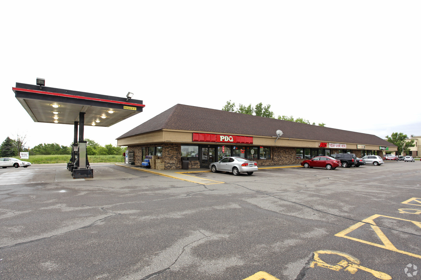
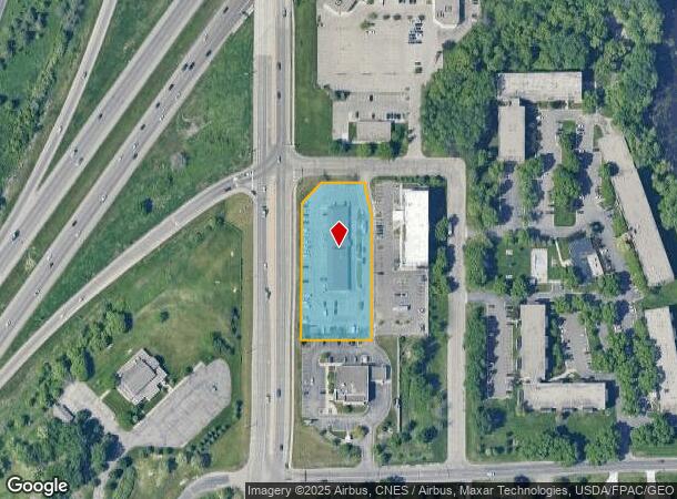
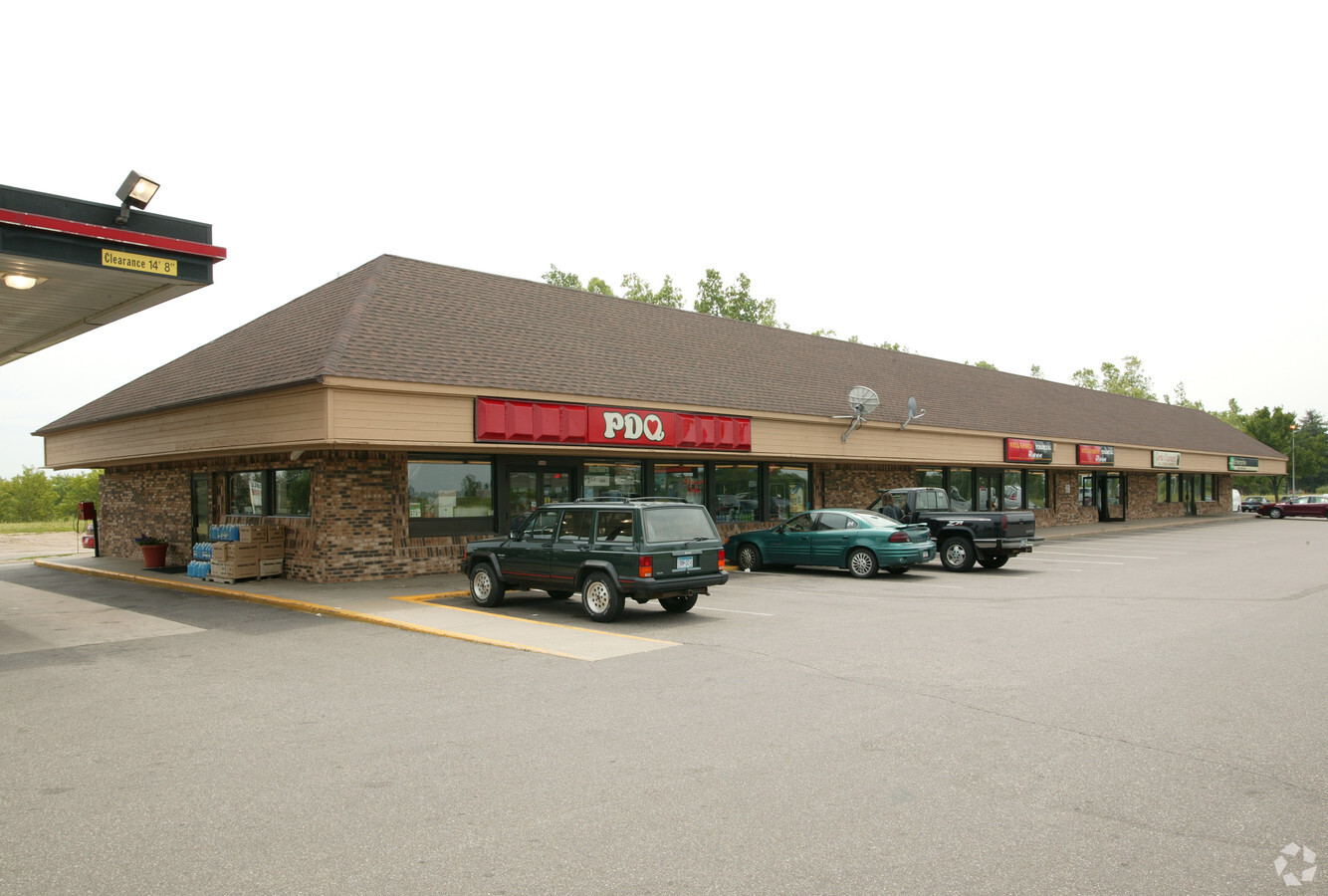
Property Record
5440 S Robert Trl, Inver Grove Heights, MN 55077


NEARBY LISTINGS FOR SALE OR LEASE
Property Detail
5440 S Robert Trl
Minneapolis-St. Paul-Bloomington, MN-WI
Salem Heights Plaza
20-65900-01-060
SALEM HEIGHTS PLAZA 6 1
Commercialnec
Dakota
X
Minnesota
27037C0105E
60
2024
1.53 AC
2023
West St Paul
060505
Minneapolis/St Paul
8,465 SF
DEMOGRAPHICS near 5440 S Robert Trl
1 Mile
3 Mile
5 Mile
2024 Total Population
4,801
63,124
151,159
2029 Population
4,911
64,646
153,410
Pop Growth 2024-2029
+ 2.29%
+ 2.41%
+ 1.49%
Average Age
36
41
40
2024 Total Households
2,096
26,423
62,501
HH Growth 2024-2029
+ 2.19%
+ 2.45%
+ 1.44%
Median Household Inc
$69,007
$76,331
$78,040
Avg Household Size
2.20
2.30
2.30
2024 Avg HH Vehicles
2.00
2.00
2.00
Median Home Value
$635,135
$289,143
$298,849
Median Year Built
1984
1975
1978
Nearby Places
- Restaurants
- Banks
- Shops
- Fitness
- Groceries
PUBLIC TRANSPORTATION
COMMUTER RAIL
St. Paul-Minneapolis (Empire Builder - Amtrak)
DRIVE
WALK
Distance
St. Paul-Minneapolis (Empire Builder - Amtrak)
13 min
5.9 mi
AIRPORT
Minneapolis-St Paul International/Wold-Chamberlain
DRIVE
WALK
Distance
Minneapolis-St Paul International/Wold-Chamberlain
15 min
9.2 mi
Freight Ports
Port Milwaukee
DRIVE
WALK
Distance
Port Milwaukee
366 min
331.9 mi
SALE & LEASE HISTORY
LISTING DATE
SALE/LEASE

Sep 25, 2016
For Lease
Mar 19, 2018
For Sale
Jun 09, 2020
For Lease
Jul 14, 2022
For Lease
Nearby Properties
Address
Land Use
TOTAL SIZE
Lot Size
Zoning
Address
Land Use
TOTAL SIZE
Lot Size
Zoning
Address
Land Use
TOTAL SIZE
Lot Size
Zoning
329,070 SF
5.75 AC
Address
Land Use
TOTAL SIZE
Lot Size
Zoning
247,470 SF
2.20 AC
Address
Land Use
TOTAL SIZE
Lot Size
Zoning
217,703 SF
3.51 AC
Address
Land Use
TOTAL SIZE
Lot Size
Zoning
228,050 SF
0.32 AC
Address
Land Use
TOTAL SIZE
Lot Size
Zoning
243,847 SF
5.24 AC
Address
Land Use
TOTAL SIZE
Lot Size
Zoning
541,075 SF
88.93 AC
Address
Land Use
TOTAL SIZE
Lot Size
Zoning
Address
Land Use
TOTAL SIZE
Lot Size
Zoning
227,200 SF
14.78 AC
Address
Land Use
TOTAL SIZE
Lot Size
Zoning
173,044 SF
18.49 AC
Address
Land Use
TOTAL SIZE
Lot Size
Zoning
191,349 SF
5.10 AC
Address
Land Use
TOTAL SIZE
Lot Size
Zoning
227,382 SF
13.14 AC
Address
Land Use
TOTAL SIZE
Lot Size
Zoning
174,820 SF
7.79 AC
Address
Land Use
TOTAL SIZE
Lot Size
Zoning
111,595 SF
2.24 AC
Address
Land Use
TOTAL SIZE
Lot Size
Zoning
128,798 SF
4.22 AC
Address
Land Use
TOTAL SIZE
Lot Size
Zoning
215,580 SF
27.86 AC
Address
Land Use
TOTAL SIZE
Lot Size
Zoning
147,944 SF
5.17 AC
Address
Land Use
TOTAL SIZE
Lot Size
Zoning
238,639 SF
10.01 AC
Address
Land Use
TOTAL SIZE
Lot Size
Zoning
174,678 SF
24.36 AC
Address
Land Use
TOTAL SIZE
Lot Size
Zoning
175,656 SF
15.53 AC
Address
Land Use
TOTAL SIZE
Lot Size
Zoning
98,138 SF
2.12 AC
Address
Land Use
TOTAL SIZE
Lot Size
Zoning
219,438 SF
90.20 AC
Address
Land Use
TOTAL SIZE
Lot Size
Zoning
135,959 SF
16.72 AC
Address
Land Use
TOTAL SIZE
Lot Size
Zoning
122,400 SF
8.79 AC
Address
Land Use
TOTAL SIZE
Lot Size
Zoning
127,980 SF
8.60 AC
Address
Land Use
TOTAL SIZE
Lot Size
Zoning
105,022 SF
8.89 AC
Address
Land Use
TOTAL SIZE
Lot Size
Zoning
117,784 SF
1.86 AC
Address
Land Use
TOTAL SIZE
Lot Size
Zoning
67,370 SF
1.18 AC
Address
Land Use
TOTAL SIZE
Lot Size
Zoning
128,188 SF
8.50 AC
Address
Land Use
TOTAL SIZE
Lot Size
Zoning
87,080 SF
2.16 AC
The World's #1 Commercial Real Estate Marketplace
Connect with us
© 2025 CoStar Group
The information above has been obtained from sources believed reliable. While we do not doubt its accuracy we have not verified it and make no guarantee, warranty or representation about it. It is your responsibility to independently confirm its accuracy and completeness. Any projections, opinions, assumptions, or estimates used are for example only and do not represent the current or future performance of the property. The value of this transaction to you depends on tax and other factors which should be evaluated by your tax, financial, and legal advisors. You and your advisors should conduct a careful, independent investigation of the property to determine to your satisfaction the suitability of the property for your needs.