Property Record
5443 W Us Highway 34, Loveland, CO 80537
NEARBY LISTINGS FOR SALE OR LEASE
-
-
View all Loveland listings for lease on LoopNet.com
Property Detail
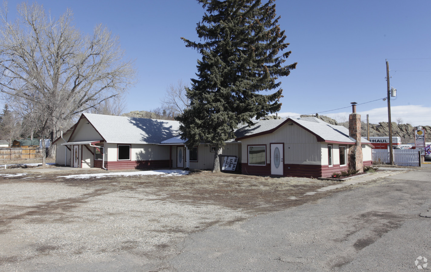
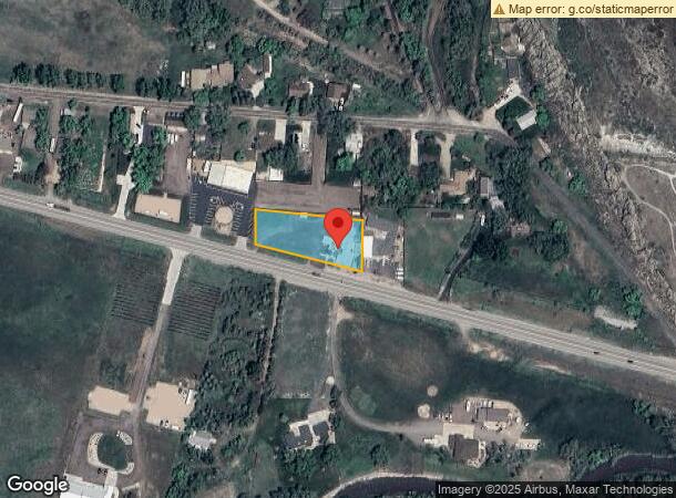
5443 W Us Highway 34
95074-00-015
BEG AT PT WH BEARS N 44 53 46 W 736.94 FT FROM SE COR 7-5-69; TH N 01 12 57 E 138.69 FT, TH N 84 39 W 292.82 FT, S 91.41 FT TO NRLY R/W LN STATE HWY, TH S 75 30 59 E 298.07 FT TPOB (C14N003637E)
Officebuilding
Larimer
AE
Colorado
08069C1167F
0.77 AC
2023
Outer Larimer County
2025
Denver
001808
Fort Collins, CO
3,276 SF
DEMOGRAPHICS near 5443 W Us Highway 34
1 Mile
3 Mile
5 Mile
2024 Total Population
1,326
22,368
63,438
2029 Population
1,363
23,295
66,490
Pop Growth 2024-2029
+ 2.79%
+ 4.14%
+ 4.81%
Average Age
50
46
44
2024 Total Households
563
9,172
26,673
HH Growth 2024-2029
+ 3.02%
+ 4.38%
+ 5.07%
Median Household Inc
$93,749
$81,373
$74,434
Avg Household Size
2.30
2.40
2.30
2024 Avg HH Vehicles
3.00
2.00
2.00
Median Home Value
$698,353
$494,327
$428,885
Median Year Built
1985
1989
1984
Nearby Places
- Restaurants
- Banks
- Shops
- Fitness
- Groceries
SALE & LEASE HISTORY
LISTING DATE
SALE/LEASE

Sep 25, 2016
For Lease
Nearby Properties
Address
Land Use
TOTAL SIZE
Lot Size
Zoning
Address
Land Use
TOTAL SIZE
Lot Size
Zoning
93,908 SF
28.86 AC
R1
Address
Land Use
TOTAL SIZE
Lot Size
Zoning
48,000 SF
10 AC
P58
Address
Land Use
TOTAL SIZE
Lot Size
Zoning
59.21 AC
FA
Address
Land Use
TOTAL SIZE
Lot Size
Zoning
50,715 SF
10.23 AC
R1
Address
Land Use
TOTAL SIZE
Lot Size
Zoning
50,098 SF
4.49 AC
B
Address
Land Use
TOTAL SIZE
Lot Size
Zoning
60,896 SF
8.72 AC
I
Address
Land Use
TOTAL SIZE
Lot Size
Zoning
31,800 SF
2.99 AC
B
Address
Land Use
TOTAL SIZE
Lot Size
Zoning
89,748 SF
8.02 AC
B
Address
Land Use
TOTAL SIZE
Lot Size
Zoning
107,050 SF
6.70 AC
B
Address
Land Use
TOTAL SIZE
Lot Size
Zoning
43,964 SF
9.40 AC
Address
Land Use
TOTAL SIZE
Lot Size
Zoning
37,500 SF
4.56 AC
R1
Address
Land Use
TOTAL SIZE
Lot Size
Zoning
147,858 SF
37.02 AC
I
Address
Land Use
TOTAL SIZE
Lot Size
Zoning
31,884 SF
2.22 AC
B
Address
Land Use
TOTAL SIZE
Lot Size
Zoning
41,963 SF
1.39 AC
B
Address
Land Use
TOTAL SIZE
Lot Size
Zoning
76,161 SF
5.76 AC
B
Address
Land Use
TOTAL SIZE
Lot Size
Zoning
33,330 SF
7.58 AC
R1E
Address
Land Use
TOTAL SIZE
Lot Size
Zoning
40,936 SF
3.06 AC
I
Address
Land Use
TOTAL SIZE
Lot Size
Zoning
28,634 SF
3.11 AC
FA1
Address
Land Use
TOTAL SIZE
Lot Size
Zoning
33,156 SF
5.95 AC
B
Address
Land Use
TOTAL SIZE
Lot Size
Zoning
6,589 SF
25 AC
Address
Land Use
TOTAL SIZE
Lot Size
Zoning
17,108 SF
1.53 AC
B
Address
Land Use
TOTAL SIZE
Lot Size
Zoning
14.45 AC
I
Address
Land Use
TOTAL SIZE
Lot Size
Zoning
14,634 SF
1.54 AC
B
Address
Land Use
TOTAL SIZE
Lot Size
Zoning
36.98 AC
FA
Address
Land Use
TOTAL SIZE
Lot Size
Zoning
13,530 SF
5.21 AC
R1
Address
Land Use
TOTAL SIZE
Lot Size
Zoning
25,558 SF
2.56 AC
B
Address
Land Use
TOTAL SIZE
Lot Size
Zoning
9,471 SF
1.38 AC
FA1
Address
Land Use
TOTAL SIZE
Lot Size
Zoning
10,985 SF
3 AC
Address
Land Use
TOTAL SIZE
Lot Size
Zoning
10,792 SF
1.75 AC
FA
The World's #1 Commercial Real Estate Marketplace
Connect with us
© 2025 CoStar Group
The information above has been obtained from sources believed reliable. While we do not doubt its accuracy we have not verified it and make no guarantee, warranty or representation about it. It is your responsibility to independently confirm its accuracy and completeness. Any projections, opinions, assumptions, or estimates used are for example only and do not represent the current or future performance of the property. The value of this transaction to you depends on tax and other factors which should be evaluated by your tax, financial, and legal advisors. You and your advisors should conduct a careful, independent investigation of the property to determine to your satisfaction the suitability of the property for your needs.