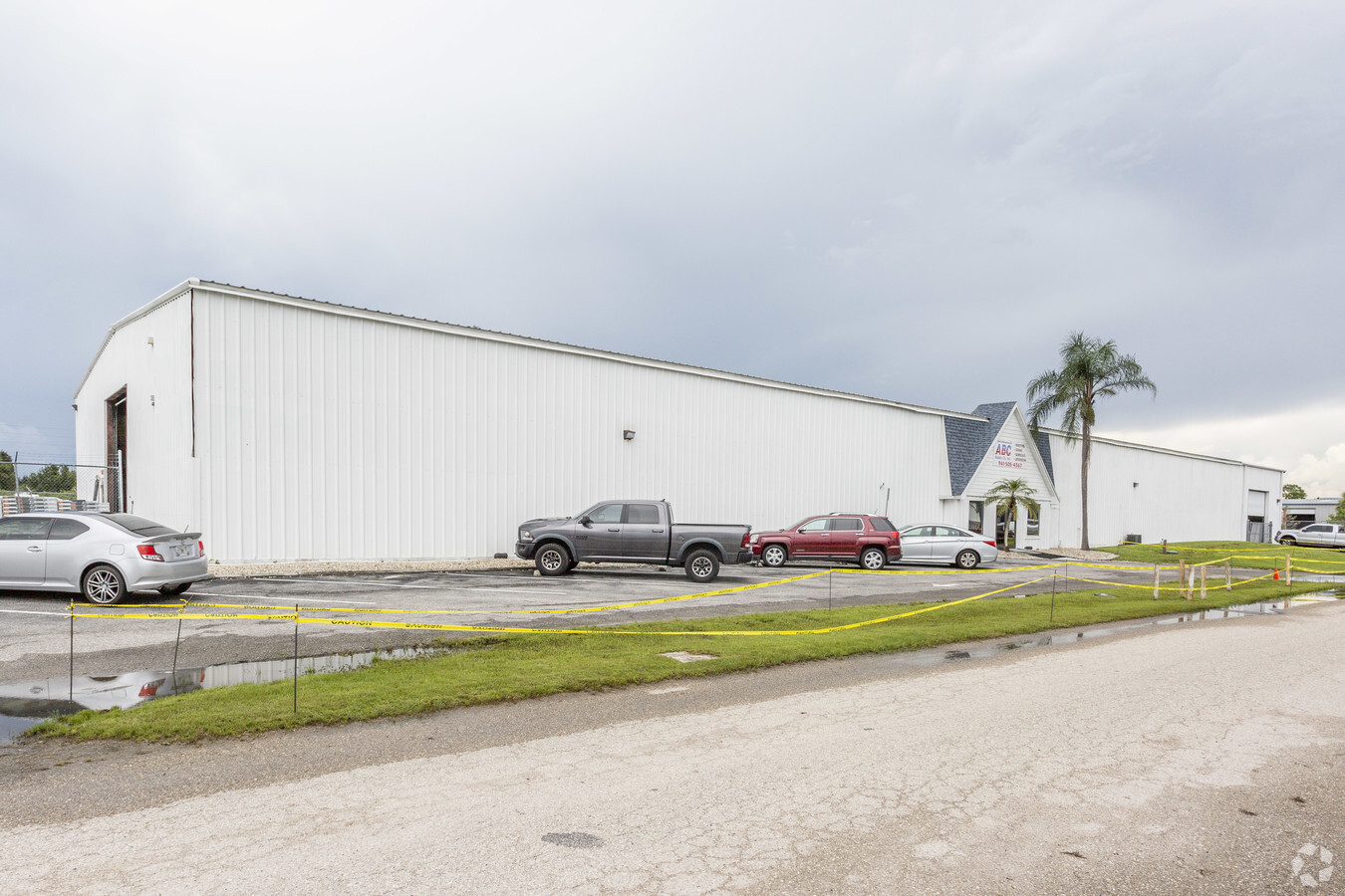
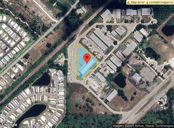
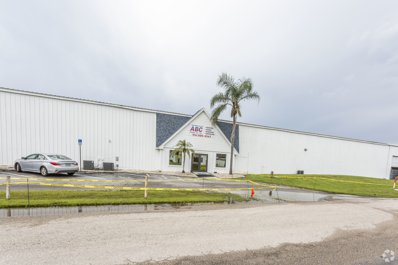
Property Record
5445 Williamsburg Dr, Punta Gorda, FL 33982
Current Lease Availabilities
NEARBY LISTINGS FOR SALE OR LEASE
Property Detail
5445 Williamsburg Dr
Punta Gorda, FL
1775 Industrial Pk
402334403008
1775 INDUSTRIAL PK LTS 28 29 30 & 39 713/882 762/402 984/387 984/388 984/389 984/390-95MERGER 1838/314 4131/1764
Warehouse
Charlotte
AE
Florida
12015C0253G
28
2023
1.65 AC
2023
Charlotte County
010200
Southwest Florida
30,684 SF
DEMOGRAPHICS near 5445 Williamsburg Dr
1 Mile
3 Mile
5 Mile
2024 Total Population
2,672
12,470
51,515
2029 Population
3,219
15,075
62,128
Pop Growth 2024-2029
+ 20.47%
+ 20.89%
+ 20.60%
Average Age
52
49
54
2024 Total Households
1,247
5,783
24,321
HH Growth 2024-2029
+ 20.69%
+ 21.13%
+ 20.92%
Median Household Inc
$40,490
$40,390
$52,900
Avg Household Size
2.10
2.10
2.00
2024 Avg HH Vehicles
2.00
2.00
2.00
Median Home Value
$154,634
$209,161
$248,239
Median Year Built
1990
1991
1992
Nearby Places
- Restaurants
- Banks
- Shops
- Fitness
- Groceries
PUBLIC TRANSPORTATION
AIRPORT
Punta Gorda
DRIVE
WALK
Distance
Punta Gorda
8 min
3.8 mi
Freight Ports
Port Manatee
DRIVE
WALK
Distance
Port Manatee
84 min
72.0 mi
Nearby Properties
Address
Land Use
TOTAL SIZE
Lot Size
Zoning
Address
Land Use
TOTAL SIZE
Lot Size
Zoning
349,844 SF
78.47 AC
P
Address
Land Use
TOTAL SIZE
Lot Size
Zoning
163,527 SF
44.20 AC
ECAP
Address
Land Use
TOTAL SIZE
Lot Size
Zoning
161,439 SF
171 AC
RE1
Address
Land Use
TOTAL SIZE
Lot Size
Zoning
345,043 SF
33.12 AC
ECAP
Address
Land Use
TOTAL SIZE
Lot Size
Zoning
121,585 SF
696.03 AC
RE1
Address
Land Use
TOTAL SIZE
Lot Size
Zoning
62,415 SF
281.65 AC
ECAP
Address
Land Use
TOTAL SIZE
Lot Size
Zoning
134,308 SF
16 AC
RSF3.5
Address
Land Use
TOTAL SIZE
Lot Size
Zoning
279,650 SF
374.81 AC
ECAP
Address
Land Use
TOTAL SIZE
Lot Size
Zoning
249,777 SF
47.99 AC
RMF10
Address
Land Use
TOTAL SIZE
Lot Size
Zoning
31,608 SF
8.02 AC
NC
Address
Land Use
TOTAL SIZE
Lot Size
Zoning
24,580 SF
84.50 AC
PKR
Address
Land Use
TOTAL SIZE
Lot Size
Zoning
116,186 SF
20.02 AC
RMF10
Address
Land Use
TOTAL SIZE
Lot Size
Zoning
49,958 SF
6.81 AC
CC
Address
Land Use
TOTAL SIZE
Lot Size
Zoning
30,940 SF
0.41 AC
NC
Address
Land Use
TOTAL SIZE
Lot Size
Zoning
181,137 SF
12.34 AC
NR-15
Address
Land Use
TOTAL SIZE
Lot Size
Zoning
17.06 AC
CG
Address
Land Use
TOTAL SIZE
Lot Size
Zoning
60,000 SF
1.44 AC
ECAP
Address
Land Use
TOTAL SIZE
Lot Size
Zoning
31,194 SF
7.93 AC
CG
Address
Land Use
TOTAL SIZE
Lot Size
Zoning
54.25 AC
RMF10
Address
Land Use
TOTAL SIZE
Lot Size
Zoning
66,461 SF
10.86 AC
CG
Address
Land Use
TOTAL SIZE
Lot Size
Zoning
14,980 SF
2.57 AC
OMI
Address
Land Use
TOTAL SIZE
Lot Size
Zoning
30,719 SF
107.17 AC
RE1
Address
Land Use
TOTAL SIZE
Lot Size
Zoning
52,934 SF
9.30 AC
P
Address
Land Use
TOTAL SIZE
Lot Size
Zoning
7,128 SF
0.76 AC
ECAP
Address
Land Use
TOTAL SIZE
Lot Size
Zoning
22,058 SF
19.13 AC
RMF5
Address
Land Use
TOTAL SIZE
Lot Size
Zoning
46,912 SF
3.41 AC
CG
Address
Land Use
TOTAL SIZE
Lot Size
Zoning
31,044 SF
10 AC
PD
Address
Land Use
TOTAL SIZE
Lot Size
Zoning
37,150 SF
3.66 AC
ECAP
Address
Land Use
TOTAL SIZE
Lot Size
Zoning
28,738 SF
20.26 AC
OMI
Address
Land Use
TOTAL SIZE
Lot Size
Zoning
2,160 SF
55.85 AC
RMF10
The World's #1 Commercial Real Estate Marketplace
Connect with us
© 2025 CoStar Group
The information above has been obtained from sources believed reliable. While we do not doubt its accuracy we have not verified it and make no guarantee, warranty or representation about it. It is your responsibility to independently confirm its accuracy and completeness. Any projections, opinions, assumptions, or estimates used are for example only and do not represent the current or future performance of the property. The value of this transaction to you depends on tax and other factors which should be evaluated by your tax, financial, and legal advisors. You and your advisors should conduct a careful, independent investigation of the property to determine to your satisfaction the suitability of the property for your needs.