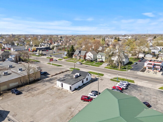
Property Record
546 N Main St, Marion, OH 43302


NEARBY LISTINGS FOR SALE OR LEASE
Property Detail
546 N Main St
12-1040000.400
OL 158 PG 4 210 4.00 4.00
Restaurantdrivein
Marion
X
Ohio
39101C0210E
0.38 AC
2024
Ohio North Area
2024
Other Market Areas
000900
Marion, OH
2,026 SF
DEMOGRAPHICS near 546 N Main St
1 Mile
3 Mile
5 Mile
2024 Total Population
11,446
39,894
47,663
2029 Population
11,657
40,069
47,748
Pop Growth 2024-2029
+ 1.84%
+ 0.44%
+ 0.18%
Average Age
37
40
40
2024 Total Households
4,631
15,709
18,934
HH Growth 2024-2029
+ 1.86%
+ 0.43%
+ 0.16%
Median Household Inc
$37,645
$43,879
$46,209
Avg Household Size
2.30
2.30
2.30
2024 Avg HH Vehicles
2.00
2.00
2.00
Median Home Value
$65,061
$97,302
$119,560
Median Year Built
1948
1956
1960
Nearby Places
Map Layers
Map Styles
 Street
 Aerial
- Restaurants
- Banks
- Shops
- Fitness
- Groceries
SALE & LEASE HISTORY
LISTING DATE
SALE/LEASE

Sep 25, 2025
For Sale
Oct 19, 2023
For Sale
Mar 10, 2020
For Sale
Apr 29, 2025
For Lease
Nearby Properties
Address
Land Use
TOTAL SIZE
Lot Size
Zoning
Address
Land Use
TOTAL SIZE
Lot Size
Zoning
882,546 SF
225.79 AC
Address
Land Use
TOTAL SIZE
Lot Size
Zoning
304,391 SF
19.05 AC
Address
Land Use
TOTAL SIZE
Lot Size
Zoning
357,564 SF
143.16 AC
Address
Land Use
TOTAL SIZE
Lot Size
Zoning
304,149 SF
107.63 AC
Address
Land Use
TOTAL SIZE
Lot Size
Zoning
135,911 SF
19.60 AC
Address
Land Use
TOTAL SIZE
Lot Size
Zoning
240,444 SF
38.03 AC
Address
Land Use
TOTAL SIZE
Lot Size
Zoning
262,750 SF
40.74 AC
Address
Land Use
TOTAL SIZE
Lot Size
Zoning
340,442 SF
47.81 AC
Address
Land Use
TOTAL SIZE
Lot Size
Zoning
67,783 SF
21.85 AC
Address
Land Use
TOTAL SIZE
Lot Size
Zoning
24,627 SF
281.31 AC
Address
Land Use
TOTAL SIZE
Lot Size
Zoning
61,664 SF
10.86 AC
Address
Land Use
TOTAL SIZE
Lot Size
Zoning
63,161 SF
10.02 AC
Address
Land Use
TOTAL SIZE
Lot Size
Zoning
5,002 SF
27.92 AC
Address
Land Use
TOTAL SIZE
Lot Size
Zoning
645,332 SF
45.90 AC
Address
Land Use
TOTAL SIZE
Lot Size
Zoning
190,637 SF
15.66 AC
Address
Land Use
TOTAL SIZE
Lot Size
Zoning
24,570 SF
78.15 AC
Address
Land Use
TOTAL SIZE
Lot Size
Zoning
53,588 SF
10.57 AC
Address
Land Use
TOTAL SIZE
Lot Size
Zoning
51,892 SF
4.19 AC
Address
Land Use
TOTAL SIZE
Lot Size
Zoning
74,872 SF
11.33 AC
Address
Land Use
TOTAL SIZE
Lot Size
Zoning
140,834 SF
16.63 AC
Address
Land Use
TOTAL SIZE
Lot Size
Zoning
240,692 SF
40.86 AC
Address
Land Use
TOTAL SIZE
Lot Size
Zoning
32,260 SF
7.73 AC
Address
Land Use
TOTAL SIZE
Lot Size
Zoning
147,097 SF
12.07 AC
Address
Land Use
TOTAL SIZE
Lot Size
Zoning
58,756 SF
0.15 AC
Address
Land Use
TOTAL SIZE
Lot Size
Zoning
265,232 SF
17.45 AC
Address
Land Use
TOTAL SIZE
Lot Size
Zoning
45,588 SF
5.23 AC
Address
Land Use
TOTAL SIZE
Lot Size
Zoning
57,802 SF
5.66 AC
Address
Land Use
TOTAL SIZE
Lot Size
Zoning
32,124 SF
2.05 AC
Address
Land Use
TOTAL SIZE
Lot Size
Zoning
47,220 SF
3.50 AC
Address
Land Use
TOTAL SIZE
Lot Size
Zoning
433,652 SF
8.10 AC
The World's #1 Commercial Real Estate Marketplace
Connect with us
© 2025 CoStar Group
The information above has been obtained from sources believed reliable. While we do not doubt its accuracy we have not verified it and make no guarantee, warranty or representation about it. It is your responsibility to independently confirm its accuracy and completeness. Any projections, opinions, assumptions, or estimates used are for example only and do not represent the current or future performance of the property. The value of this transaction to you depends on tax and other factors which should be evaluated by your tax, financial, and legal advisors. You and your advisors should conduct a careful, independent investigation of the property to determine to your satisfaction the suitability of the property for your needs.