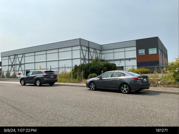
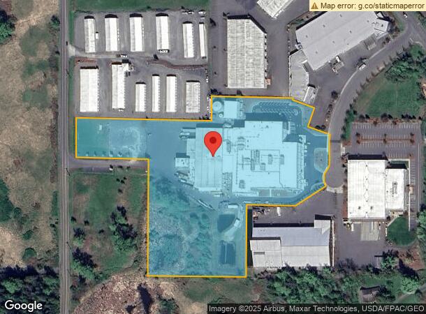
Property Record
5470 Nielsen Ave, Ferndale, WA 98248
NEARBY LISTINGS FOR SALE OR LEASE
Property Detail
5470 Nielsen Ave
Bellingham, WA
Conac/Hempler Lla
390229-320177-0000
LOT A CONAC/HEMPLER LLA AS REC AF 2016-0701662
Foodprocessing
Whatcom
AE
Washington
53073C1180E
a
2024
8.43 AC
2024
Bellingham/Northwest
010503
Other Market Areas
37,698 SF
DEMOGRAPHICS near 5470 Nielsen Ave
1 Mile
3 Mile
5 Mile
2024 Total Population
1,528
19,939
37,471
2029 Population
1,569
20,747
39,139
Pop Growth 2024-2029
+ 2.68%
+ 4.05%
+ 4.45%
Average Age
40
39
40
2024 Total Households
598
7,093
14,288
HH Growth 2024-2029
+ 2.34%
+ 3.89%
+ 4.50%
Median Household Inc
$84,375
$90,621
$72,933
Avg Household Size
2.50
2.80
2.60
2024 Avg HH Vehicles
2.00
2.00
2.00
Median Home Value
$550,387
$520,038
$498,663
Median Year Built
1979
1990
1993
Nearby Places
- Restaurants
- Banks
- Shops
- Fitness
- Groceries
PUBLIC TRANSPORTATION
AIRPORT
Bellingham International
DRIVE
WALK
Distance
Bellingham International
12 min
7.0 mi
Abbotsford International
DRIVE
WALK
Distance
Abbotsford International
47 min
25.6 mi
Freight Ports
Port of Bellingham, WA
DRIVE
WALK
Distance
Port of Bellingham, WA
16 min
9.9 mi
Nearby Properties
Address
Land Use
TOTAL SIZE
Lot Size
Zoning
Address
Land Use
TOTAL SIZE
Lot Size
Zoning
260,143 SF
36.13 AC
NC
Address
Land Use
TOTAL SIZE
Lot Size
Zoning
2,059 SF
8.02 AC
RM
Address
Land Use
TOTAL SIZE
Lot Size
Zoning
116,159 SF
24.54 AC
P
Address
Land Use
TOTAL SIZE
Lot Size
Zoning
74,027 SF
3.54 AC
RO
Address
Land Use
TOTAL SIZE
Lot Size
Zoning
63,802 SF
8.93 AC
MCD
Address
Land Use
TOTAL SIZE
Lot Size
Zoning
235,594 SF
56.20 AC
PBI
Address
Land Use
TOTAL SIZE
Lot Size
Zoning
66,344 SF
4.30 AC
RO
Address
Land Use
TOTAL SIZE
Lot Size
Zoning
64,509 SF
4.40 AC
GB
Address
Land Use
TOTAL SIZE
Lot Size
Zoning
153,557 SF
39.70 AC
PBI
Address
Land Use
TOTAL SIZE
Lot Size
Zoning
156,099 SF
11.44 AC
GB
Address
Land Use
TOTAL SIZE
Lot Size
Zoning
60,446 SF
4.03 AC
PBI
Address
Land Use
TOTAL SIZE
Lot Size
Zoning
77,782 SF
5.90 AC
GB
Address
Land Use
TOTAL SIZE
Lot Size
Zoning
49,744 SF
5.92 AC
GB
Address
Land Use
TOTAL SIZE
Lot Size
Zoning
140,381 SF
9.76 AC
M
Address
Land Use
TOTAL SIZE
Lot Size
Zoning
1,536 SF
5 AC
RM1.5
Address
Land Use
TOTAL SIZE
Lot Size
Zoning
23,499 SF
4.46 AC
MCD
Address
Land Use
TOTAL SIZE
Lot Size
Zoning
48,409 SF
2.24 AC
GB
Address
Land Use
TOTAL SIZE
Lot Size
Zoning
48,728 SF
2.30 AC
RM1.5
Address
Land Use
TOTAL SIZE
Lot Size
Zoning
46,333 SF
2.03 AC
RM1.5
Address
Land Use
TOTAL SIZE
Lot Size
Zoning
52,100 SF
4.07 AC
GB
Address
Land Use
TOTAL SIZE
Lot Size
Zoning
59,899 SF
2.94 AC
GB
Address
Land Use
TOTAL SIZE
Lot Size
Zoning
17,415 SF
332.54 AC
ROS
Address
Land Use
TOTAL SIZE
Lot Size
Zoning
122,762 SF
146.88 AC
R5A
Address
Land Use
TOTAL SIZE
Lot Size
Zoning
505.89 AC
HII
Address
Land Use
TOTAL SIZE
Lot Size
Zoning
61,534 SF
6 AC
M
Address
Land Use
TOTAL SIZE
Lot Size
Zoning
48,622 SF
4.34 AC
GB
Address
Land Use
TOTAL SIZE
Lot Size
Zoning
73,190 SF
3.19 AC
MCD
Address
Land Use
TOTAL SIZE
Lot Size
Zoning
60,880 SF
6.13 AC
LI
Address
Land Use
TOTAL SIZE
Lot Size
Zoning
34,952 SF
2.63 AC
MCD
The World's #1 Commercial Real Estate Marketplace
Connect with us
© 2025 CoStar Group
The information above has been obtained from sources believed reliable. While we do not doubt its accuracy we have not verified it and make no guarantee, warranty or representation about it. It is your responsibility to independently confirm its accuracy and completeness. Any projections, opinions, assumptions, or estimates used are for example only and do not represent the current or future performance of the property. The value of this transaction to you depends on tax and other factors which should be evaluated by your tax, financial, and legal advisors. You and your advisors should conduct a careful, independent investigation of the property to determine to your satisfaction the suitability of the property for your needs.