Property Record
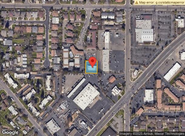
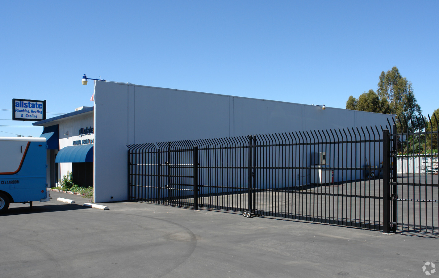
5485 Hemlock St, Sacramento, CA 95841

This Property Is For Sale
NEARBY LISTINGS FOR SALE OR LEASE
Property Detail
5485 Hemlock St
Sacramento--Roseville--Arden-Arcade, CA
Haggin Park
230-0480-056
THE S. 120FT OF THE W 141.5FT OF THE E 434FT OF LOT 28 HAGGIN PARK.
Lightindustrial
Sacramento
X
California
06067C0087J
28
2023
0.39 AC
2024
McClellan
007501
Sacramento
3,200 SF
DEMOGRAPHICS near 5485 Hemlock St
1 Mile
3 Mile
5 Mile
2024 Total Population
23,286
168,921
376,167
2029 Population
23,305
169,447
377,914
Pop Growth 2024-2029
+ 0.08%
+ 0.31%
+ 0.46%
Average Age
38
39
39
2024 Total Households
9,149
62,109
139,300
HH Growth 2024-2029
+ 0.02%
+ 0.27%
+ 0.43%
Median Household Inc
$57,212
$68,624
$72,992
Avg Household Size
2.50
2.60
2.60
2024 Avg HH Vehicles
2.00
2.00
2.00
Median Home Value
$355,226
$395,053
$429,936
Median Year Built
1973
1973
1974
Nearby Places
- Restaurants
- Banks
- Shops
- Fitness
- Groceries
PUBLIC TRANSPORTATION
COMMUTER RAIL
Roseville (California Zephyr - Amtrak, Capitol Corridor - Amtrak)
DRIVE
WALK
Distance
Roseville (California Zephyr - Amtrak, Capitol Corridor - Amtrak)
15 min
8.9 mi
AIRPORT
Sacramento International
DRIVE
WALK
Distance
Sacramento International
26 min
18.4 mi
Freight Ports
Port of Stockton
DRIVE
WALK
Distance
Port of Stockton
69 min
58.6 mi
Nearby Properties
Address
Land Use
TOTAL SIZE
Lot Size
Zoning
Address
Land Use
TOTAL SIZE
Lot Size
Zoning
512,630 SF
37.68 AC
SPA (NPA)
Address
Land Use
TOTAL SIZE
Lot Size
Zoning
430,406 SF
24.45 AC
RD-20
Address
Land Use
TOTAL SIZE
Lot Size
Zoning
187,369 SF
15.24 AC
RD20
Address
Land Use
TOTAL SIZE
Lot Size
Zoning
180,595 SF
10.74 AC
RD-30
Address
Land Use
TOTAL SIZE
Lot Size
Zoning
212,037 SF
17.20 AC
BP
Address
Land Use
TOTAL SIZE
Lot Size
Zoning
183,000 SF
12.49 AC
RD-20
Address
Land Use
TOTAL SIZE
Lot Size
Zoning
145,334 SF
8.84 AC
RD-20
Address
Land Use
TOTAL SIZE
Lot Size
Zoning
14.88 AC
RD-20
Address
Land Use
TOTAL SIZE
Lot Size
Zoning
136,483 SF
3.77 AC
BP
Address
Land Use
TOTAL SIZE
Lot Size
Zoning
75,700 SF
4.02 AC
RD-40
Address
Land Use
TOTAL SIZE
Lot Size
Zoning
217,550 SF
21.31 AC
SPA
Address
Land Use
TOTAL SIZE
Lot Size
Zoning
4.40 AC
RD20
Address
Land Use
TOTAL SIZE
Lot Size
Zoning
58.14 AC
RD-2
Address
Land Use
TOTAL SIZE
Lot Size
Zoning
21,890 SF
0.50 AC
SC
Address
Land Use
TOTAL SIZE
Lot Size
Zoning
4.90 AC
RD30
Address
Land Use
TOTAL SIZE
Lot Size
Zoning
170,556 SF
8.41 AC
SPA
Address
Land Use
TOTAL SIZE
Lot Size
Zoning
1,221,441 SF
36.86 AC
SPA
Address
Land Use
TOTAL SIZE
Lot Size
Zoning
217,380 SF
10 AC
SPA
Address
Land Use
TOTAL SIZE
Lot Size
Zoning
263,792 SF
7.27 AC
SPA
Address
Land Use
TOTAL SIZE
Lot Size
Zoning
200,104 SF
13.85 AC
RD-20
Address
Land Use
TOTAL SIZE
Lot Size
Zoning
4.02 AC
RD20
Address
Land Use
TOTAL SIZE
Lot Size
Zoning
99,408 SF
3.53 AC
BP
Address
Land Use
TOTAL SIZE
Lot Size
Zoning
148,663 SF
13.19 AC
SPA
Address
Land Use
TOTAL SIZE
Lot Size
Zoning
146,283 SF
8.73 AC
RD-20
Address
Land Use
TOTAL SIZE
Lot Size
Zoning
0.16 AC
RD-5
Address
Land Use
TOTAL SIZE
Lot Size
Zoning
123,622 SF
5.93 AC
RD-20
Address
Land Use
TOTAL SIZE
Lot Size
Zoning
148,576 SF
4.84 AC
RD-30
Address
Land Use
TOTAL SIZE
Lot Size
Zoning
280,864 SF
14.94 AC
RD-20
Address
Land Use
TOTAL SIZE
Lot Size
Zoning
72,119 SF
2.38 AC
BP (NPA)
Address
Land Use
TOTAL SIZE
Lot Size
Zoning
43,183 SF
12.35 AC
H F
The World's #1 Commercial Real Estate Marketplace
Connect with us
© 2025 CoStar Group
The information above has been obtained from sources believed reliable. While we do not doubt its accuracy we have not verified it and make no guarantee, warranty or representation about it. It is your responsibility to independently confirm its accuracy and completeness. Any projections, opinions, assumptions, or estimates used are for example only and do not represent the current or future performance of the property. The value of this transaction to you depends on tax and other factors which should be evaluated by your tax, financial, and legal advisors. You and your advisors should conduct a careful, independent investigation of the property to determine to your satisfaction the suitability of the property for your needs.