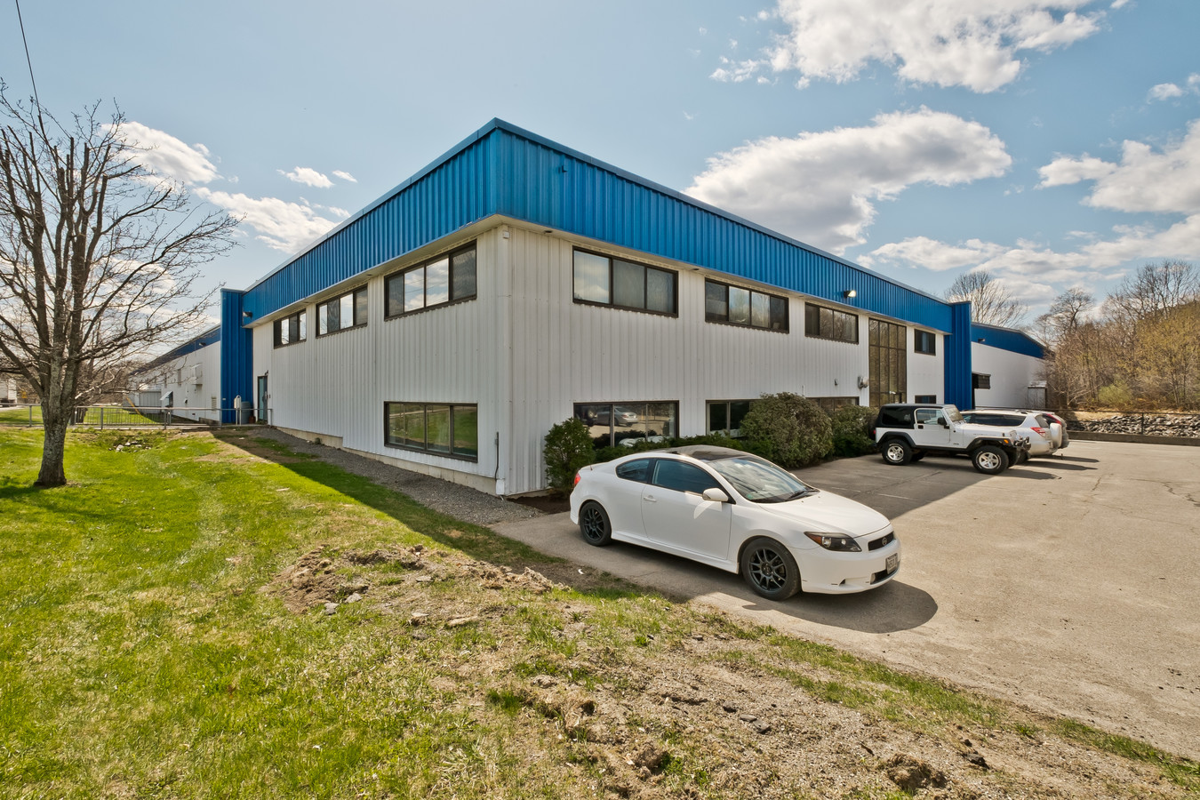
Property Record
55 Baker Blvd, Brewer, ME 04412

NEARBY LISTINGS FOR SALE OR LEASE
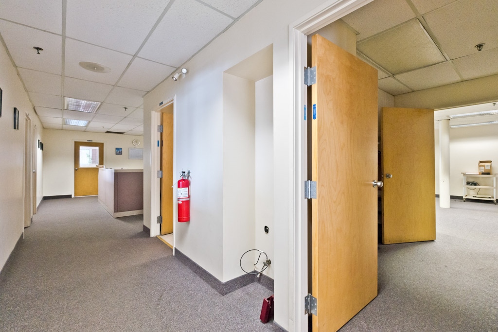
Property Detail
55 Baker Blvd
Bangor, ME
Penobscot
BRER M:20 L:13
Maine
Commercialbuilding
13
2023
5.50 AC
2023
Maine North & Bangor
004200
Other Market Areas
124,400 SF
DEMOGRAPHICS near 55 Baker Blvd
1 Mile
3 Mile
5 Mile
2024 Total Population
6,523
33,640
51,433
2029 Population
6,656
34,441
52,745
Pop Growth 2024-2029
+ 2.04%
+ 2.38%
+ 2.55%
Average Age
42
43
43
2024 Total Households
3,175
15,783
23,224
HH Growth 2024-2029
+ 2.24%
+ 2.55%
+ 2.69%
Median Household Inc
$37,913
$48,625
$55,295
Avg Household Size
2.00
2.00
2.10
2024 Avg HH Vehicles
1.00
1.00
2.00
Median Home Value
$177,259
$193,144
$209,979
Median Year Built
1952
1955
1967
Nearby Places
- Restaurants
- Banks
- Shops
- Fitness
- Groceries
PUBLIC TRANSPORTATION
AIRPORT
Bangor International
Drive
Walk
Distance
Bangor International
11 min
5.1 mi
Freight Ports
Searsport, ME
Drive
Walk
Distance
Searsport, ME
47 min
29.7 mi
SALE & LEASE HISTORY
LISTING DATE
SALE/LEASE

Sep 25, 2016
For Lease
Nearby Properties
Address
Land Use
TOTAL SIZE
Lot Size
Zoning
Address
Land Use
TOTAL SIZE
Lot Size
Zoning
466.65 AC
ADD
Address
Land Use
TOTAL SIZE
Lot Size
Zoning
186220
93.91 AC
G&SD
Address
Land Use
TOTAL SIZE
Lot Size
Zoning
609180
6.68 AC
USD
Address
Land Use
TOTAL SIZE
Lot Size
Zoning
307200
99.21 AC
G&ISD
Address
Land Use
TOTAL SIZE
Lot Size
Zoning
Address
Land Use
TOTAL SIZE
Lot Size
Zoning
Address
Land Use
TOTAL SIZE
Lot Size
Zoning
6.37 AC
UID
Address
Land Use
TOTAL SIZE
Lot Size
Zoning
243694
2.95 AC
G&ISD
Address
Land Use
TOTAL SIZE
Lot Size
Zoning
11000
188.98 AC
LDR
Address
Land Use
TOTAL SIZE
Lot Size
Zoning
87750
ADD
Address
Land Use
TOTAL SIZE
Lot Size
Zoning
124368
11.75 AC
G&ISD
Address
Land Use
TOTAL SIZE
Lot Size
Zoning
146924
2.62 AC
G&ISD
Address
Land Use
TOTAL SIZE
Lot Size
Zoning
400
3.44 AC
WDD
Address
Land Use
TOTAL SIZE
Lot Size
Zoning
100800
1.34 AC
DDD
Address
Land Use
TOTAL SIZE
Lot Size
Zoning
168615
19.44 AC
MDR-1
Address
Land Use
TOTAL SIZE
Lot Size
Zoning
12950
23.39 AC
31 - I
Address
Land Use
TOTAL SIZE
Lot Size
Zoning
38 AC
G&ISD
Address
Land Use
TOTAL SIZE
Lot Size
Zoning
Address
Land Use
TOTAL SIZE
Lot Size
Zoning
Address
Land Use
TOTAL SIZE
Lot Size
Zoning
115044
13.30 AC
G&ISD
Address
Land Use
TOTAL SIZE
Lot Size
Zoning
94081
17.56 AC
G&ISD
Address
Land Use
TOTAL SIZE
Lot Size
Zoning
94081
17.56 AC
G&ISD
Address
Land Use
TOTAL SIZE
Lot Size
Zoning
91844
7.85 AC
PB
Address
Land Use
TOTAL SIZE
Lot Size
Zoning
110031
3.81 AC
GC&S
Address
Land Use
TOTAL SIZE
Lot Size
Zoning
186197
21.70 AC
S&PS
Address
Land Use
TOTAL SIZE
Lot Size
Zoning
186197
21.70 AC
S&PS
Address
Land Use
TOTAL SIZE
Lot Size
Zoning
119930
9.50 AC
S&PS
Address
Land Use
TOTAL SIZE
Lot Size
Zoning
119930
9.50 AC
S&PS
Address
Land Use
TOTAL SIZE
Lot Size
Zoning
184000
16.43 AC
31 - I
Address
Land Use
TOTAL SIZE
Lot Size
Zoning
109507
1.96 AC
G&ISD
Start a new search to find other properties for sale or lease
Connect with us
© 2024 CoStar Group
The information above has been obtained from sources believed reliable. While we do not doubt its accuracy we have not verified it and make no guarantee, warranty or representation about it. It is your responsibility to independently confirm its accuracy and completeness. Any projections, opinions, assumptions, or estimates used are for example only and do not represent the current or future performance of the property. The value of this transaction to you depends on tax and other factors which should be evaluated by your tax, financial, and legal advisors. You and your advisors should conduct a careful, independent investigation of the property to determine to your satisfaction the suitability of the property for your needs.