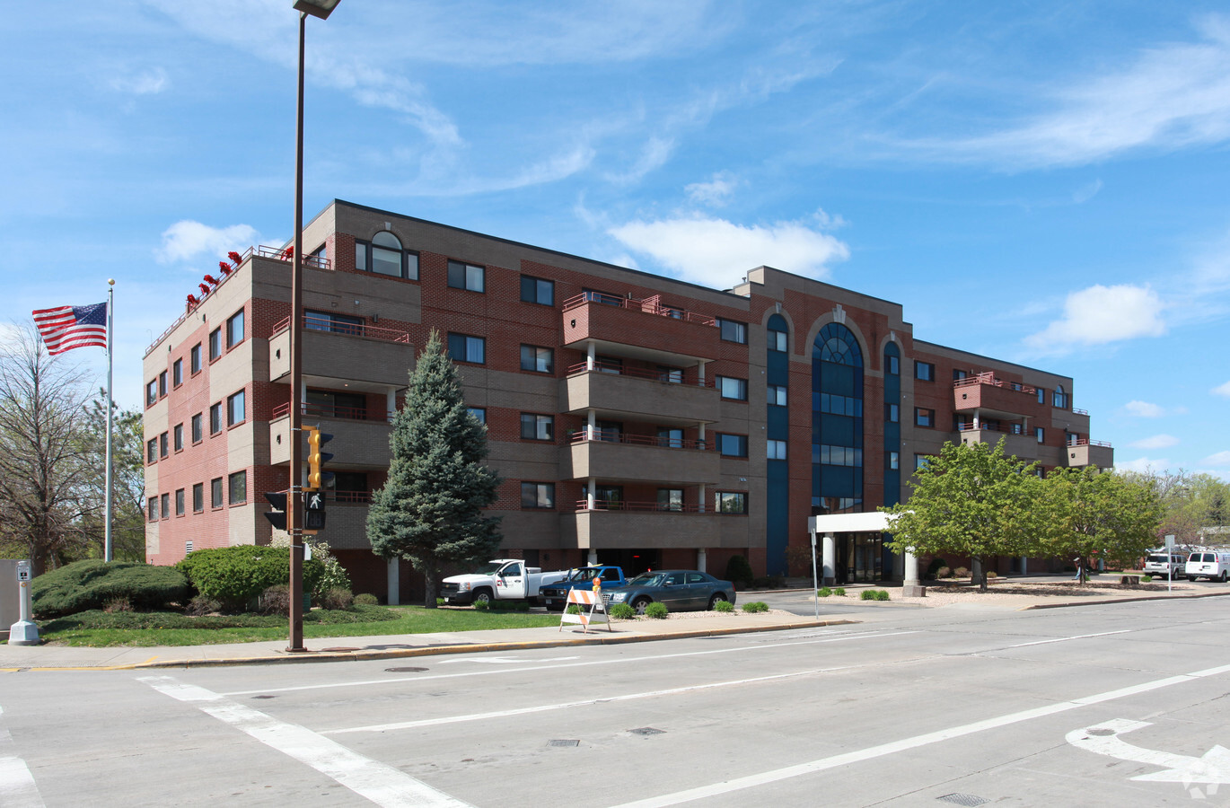
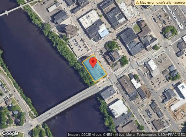
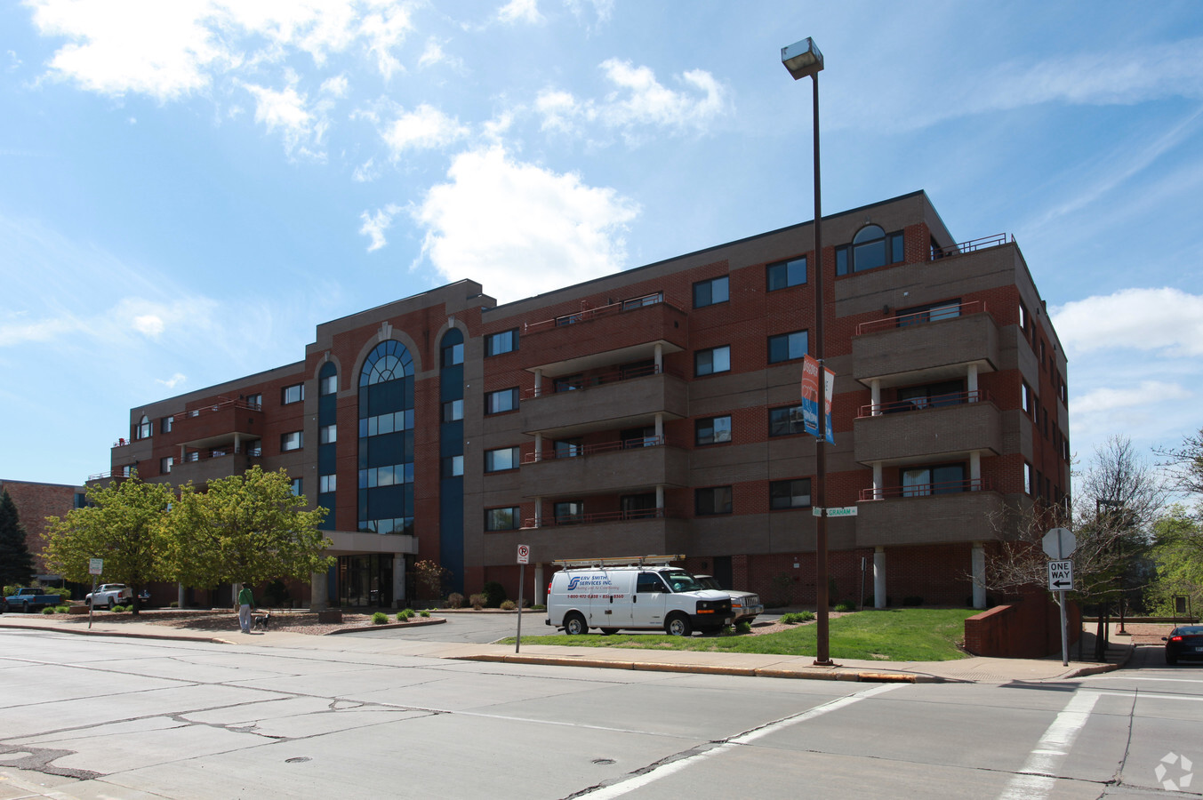
Property Record
550 Graham Ave, Eau Claire, WI 54701
NEARBY LISTINGS FOR SALE OR LEASE
Property Detail
550 Graham Ave
02-0391
LOT 1 CSM NO 590846 V 3 P 322 LOCATED IN BLK 66 VILL OF EC TID NO. 2
Apartment
Eau Claire
AE
Wisconsin
55017C0750E
1
2023
0.63 AC
2023
Downtown Eau Claire
001101
Other Market Areas
54,860 SF
Eau Claire, WI
DEMOGRAPHICS near 550 Graham Ave
1 Mile
3 Mile
5 Mile
2024 Total Population
16,483
64,305
92,923
2029 Population
17,087
66,771
96,713
Pop Growth 2024-2029
+ 3.66%
+ 3.83%
+ 4.08%
Average Age
31
37
39
2024 Total Households
6,499
26,580
38,398
HH Growth 2024-2029
+ 3.97%
+ 3.93%
+ 4.17%
Median Household Inc
$45,431
$58,251
$62,952
Avg Household Size
2.00
2.20
2.30
2024 Avg HH Vehicles
2.00
2.00
2.00
Median Home Value
$159,236
$218,131
$230,236
Median Year Built
1948
1972
1977
Nearby Places
- Restaurants
- Banks
- Shops
- Fitness
- Groceries
Nearby Properties
Address
Land Use
TOTAL SIZE
Lot Size
Zoning
Address
Land Use
TOTAL SIZE
Lot Size
Zoning
203,723 SF
20.28 AC
CBDP
Address
Land Use
TOTAL SIZE
Lot Size
Zoning
10.07 AC
FAIRFAX CO
Address
Land Use
TOTAL SIZE
Lot Size
Zoning
361,759 SF
8.46 AC
C3P
Address
Land Use
TOTAL SIZE
Lot Size
Zoning
206,042 SF
5.59 AC
Address
Land Use
TOTAL SIZE
Lot Size
Zoning
4.28 AC
Address
Land Use
TOTAL SIZE
Lot Size
Zoning
199,534 SF
7.23 AC
C3H
Address
Land Use
TOTAL SIZE
Lot Size
Zoning
21.83 AC
I1
Address
Land Use
TOTAL SIZE
Lot Size
Zoning
114,683 SF
5.47 AC
C3H
Address
Land Use
TOTAL SIZE
Lot Size
Zoning
21.41 AC
Address
Land Use
TOTAL SIZE
Lot Size
Zoning
4.94 AC
Address
Land Use
TOTAL SIZE
Lot Size
Zoning
94,173 SF
9.36 AC
C3
Address
Land Use
TOTAL SIZE
Lot Size
Zoning
81,260 SF
2.32 AC
R4
Address
Land Use
TOTAL SIZE
Lot Size
Zoning
2.70 AC
Address
Land Use
TOTAL SIZE
Lot Size
Zoning
1.04 AC
P
Address
Land Use
TOTAL SIZE
Lot Size
Zoning
105,434 SF
1.55 AC
CBD
Address
Land Use
TOTAL SIZE
Lot Size
Zoning
66,393 SF
12.95 AC
Address
Land Use
TOTAL SIZE
Lot Size
Zoning
65,378 SF
1.83 AC
CBDP
Address
Land Use
TOTAL SIZE
Lot Size
Zoning
114,100 SF
2.64 AC
Address
Land Use
TOTAL SIZE
Lot Size
Zoning
68,024 SF
0.80 AC
CBD
Address
Land Use
TOTAL SIZE
Lot Size
Zoning
169,740 SF
19.59 AC
C3P
Address
Land Use
TOTAL SIZE
Lot Size
Zoning
88,350 SF
0.40 AC
CBD
Address
Land Use
TOTAL SIZE
Lot Size
Zoning
4.89 AC
FAIRFAX CO
Address
Land Use
TOTAL SIZE
Lot Size
Zoning
36.58 AC
I1
Address
Land Use
TOTAL SIZE
Lot Size
Zoning
85,790 SF
5.68 AC
C3
Address
Land Use
TOTAL SIZE
Lot Size
Zoning
1.36 AC
CBD
Address
Land Use
TOTAL SIZE
Lot Size
Zoning
66,497 SF
0.81 AC
CBDP
Address
Land Use
TOTAL SIZE
Lot Size
Zoning
0.71 AC
Address
Land Use
TOTAL SIZE
Lot Size
Zoning
7,084 SF
26.73 AC
I2P
Address
Land Use
TOTAL SIZE
Lot Size
Zoning
10.68 AC
I1P
Address
Land Use
TOTAL SIZE
Lot Size
Zoning
92,339 SF
9.93 AC
C3
The World's #1 Commercial Real Estate Marketplace
Connect with us
© 2025 CoStar Group
The information above has been obtained from sources believed reliable. While we do not doubt its accuracy we have not verified it and make no guarantee, warranty or representation about it. It is your responsibility to independently confirm its accuracy and completeness. Any projections, opinions, assumptions, or estimates used are for example only and do not represent the current or future performance of the property. The value of this transaction to you depends on tax and other factors which should be evaluated by your tax, financial, and legal advisors. You and your advisors should conduct a careful, independent investigation of the property to determine to your satisfaction the suitability of the property for your needs.