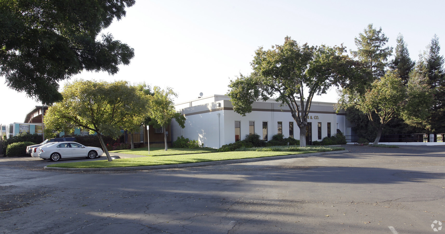
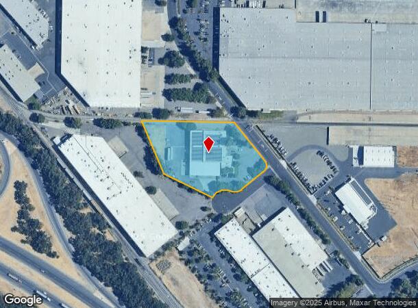
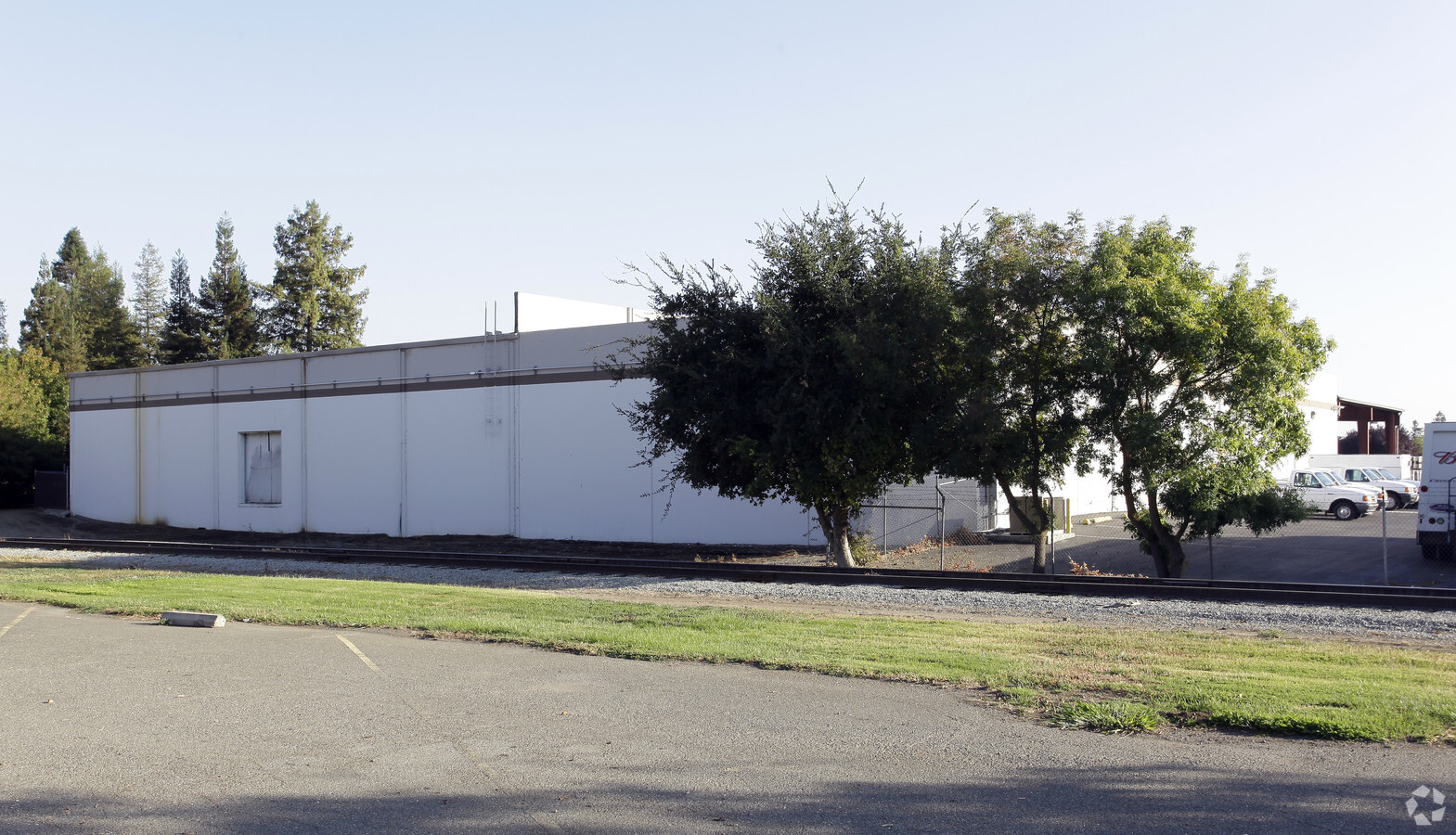
Property Record
550 Santa Anita Dr, Woodland, CA 95776
NEARBY LISTINGS FOR SALE OR LEASE
Property Detail
550 Santa Anita Dr
027-450-054-000
Ventura Indust Park Map 5
Warehouse
PM 3002 VENTURA IND PARK MAP #5 PCL 2
AE
Yolo
06113C0435H
California
2024
2.96 AC
2023
Davis/Woodland
011208
Sacramento
25,204 SF
Sacramento--Roseville--Arden-Arcade, CA
DEMOGRAPHICS near 550 Santa Anita Dr
1 Mile
3 Mile
5 Mile
2024 Total Population
1,450
52,476
65,126
2029 Population
1,448
53,149
66,122
Pop Growth 2024-2029
(0.14%)
+ 1.28%
+ 1.53%
Average Age
40
38
38
2024 Total Households
529
17,898
22,174
HH Growth 2024-2029
(0.19%)
+ 1.28%
+ 1.51%
Median Household Inc
$77,692
$72,261
$78,808
Avg Household Size
2.70
2.80
2.80
2024 Avg HH Vehicles
2.00
2.00
2.00
Median Home Value
$462,698
$443,802
$469,989
Median Year Built
1971
1978
1980
Nearby Places
- Restaurants
- Banks
- Shops
- Fitness
- Groceries
PUBLIC TRANSPORTATION
AIRPORT
Sacramento International
DRIVE
WALK
Distance
Sacramento International
19 min
12.8 mi
Freight Ports
Port of Stockton
DRIVE
WALK
Distance
Port of Stockton
77 min
66.3 mi
SALE & LEASE HISTORY
LISTING DATE
SALE/LEASE

Aug 31, 2017
For Sale
Nearby Properties
Address
Land Use
TOTAL SIZE
Lot Size
Zoning
Address
Land Use
TOTAL SIZE
Lot Size
Zoning
1,835,779 SF
98.96 AC
I
Address
Land Use
TOTAL SIZE
Lot Size
Zoning
524,112 SF
35.85 AC
I
Address
Land Use
TOTAL SIZE
Lot Size
Zoning
23.92 AC
M2
Address
Land Use
TOTAL SIZE
Lot Size
Zoning
180,816 SF
0.17 AC
R-M
Address
Land Use
TOTAL SIZE
Lot Size
Zoning
154,682 SF
15.17 AC
CH
Address
Land Use
TOTAL SIZE
Lot Size
Zoning
515,886 SF
71.53 AC
I
Address
Land Use
TOTAL SIZE
Lot Size
Zoning
125,330 SF
10.06 AC
CH
Address
Land Use
TOTAL SIZE
Lot Size
Zoning
348,386 SF
17.67 AC
RM
Address
Land Use
TOTAL SIZE
Lot Size
Zoning
150,269 SF
6.95 AC
R-M
Address
Land Use
TOTAL SIZE
Lot Size
Zoning
87.49 AC
A1
Address
Land Use
TOTAL SIZE
Lot Size
Zoning
400,450 SF
23.16 AC
I
Address
Land Use
TOTAL SIZE
Lot Size
Zoning
38.27 AC
I
Address
Land Use
TOTAL SIZE
Lot Size
Zoning
151,244 SF
8.17 AC
R3
Address
Land Use
TOTAL SIZE
Lot Size
Zoning
9.89 AC
M1
Address
Land Use
TOTAL SIZE
Lot Size
Zoning
260,400 SF
12.30 AC
I
Address
Land Use
TOTAL SIZE
Lot Size
Zoning
83,280 SF
4.49 AC
R-M
Address
Land Use
TOTAL SIZE
Lot Size
Zoning
260,400 SF
12.79 AC
I
Address
Land Use
TOTAL SIZE
Lot Size
Zoning
356,360 SF
26.50 AC
M2
Address
Land Use
TOTAL SIZE
Lot Size
Zoning
324,475 SF
22.49 AC
I
Address
Land Use
TOTAL SIZE
Lot Size
Zoning
427,073 SF
24.51 AC
I
Address
Land Use
TOTAL SIZE
Lot Size
Zoning
145,694 SF
9.26 AC
MDR20
Address
Land Use
TOTAL SIZE
Lot Size
Zoning
401,500 SF
22.08 AC
I
Address
Land Use
TOTAL SIZE
Lot Size
Zoning
19.12 AC
I
Address
Land Use
TOTAL SIZE
Lot Size
Zoning
140,000 SF
13.63 AC
I
Address
Land Use
TOTAL SIZE
Lot Size
Zoning
24,500 SF
7.42 AC
EOZ
Address
Land Use
TOTAL SIZE
Lot Size
Zoning
26.48 AC
A1
Address
Land Use
TOTAL SIZE
Lot Size
Zoning
94,860 SF
11.70 AC
EOZ-I/PD
Address
Land Use
TOTAL SIZE
Lot Size
Zoning
128,755 SF
13.61 AC
C2
Address
Land Use
TOTAL SIZE
Lot Size
Zoning
101,334 SF
8.52 AC
C2
Address
Land Use
TOTAL SIZE
Lot Size
Zoning
4.72 AC
R1
The World's #1 Commercial Real Estate Marketplace
Connect with us
© 2025 CoStar Group
The information above has been obtained from sources believed reliable. While we do not doubt its accuracy we have not verified it and make no guarantee, warranty or representation about it. It is your responsibility to independently confirm its accuracy and completeness. Any projections, opinions, assumptions, or estimates used are for example only and do not represent the current or future performance of the property. The value of this transaction to you depends on tax and other factors which should be evaluated by your tax, financial, and legal advisors. You and your advisors should conduct a careful, independent investigation of the property to determine to your satisfaction the suitability of the property for your needs.