Property Record
551 Concord St, Holliston, MA 01746


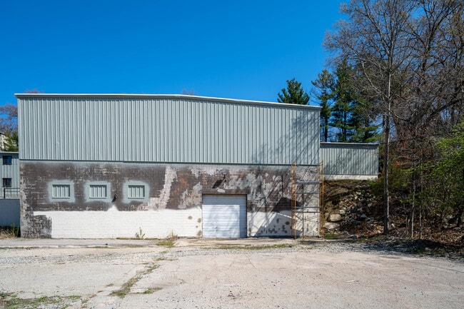

Property Detail
551 Concord St
HOLL-000014-000004-000100
Middlesex
Industrialgeneral
Massachusetts
I
100
B and X Area of moderate flood hazard, usually the area between the limits of the 100-year and 500-year floods.
4.31 AC
2025
Hopkinton/Holliston
2025
Boston
387201
Boston-Cambridge-Newton, MA-NH
47,722 SF
NEARBY LISTINGS FOR SALE OR LEASE
DEMOGRAPHICS near 551 Concord St
1 mile
3 mile
5 mile
2025 Total Population
6,457
35,325
116,030
2030 Population
6,763
36,674
121,440
Pop Growth 2025-2030
+ 4.74%
+ 3.82%
+ 4.66%
Average Age
42
41
40
2025 Total Households
2,450
12,734
43,273
HH Growth 2025-2030
+ 4.78%
+ 3.93%
+ 4.77%
Median Household Inc
$137,500
$133,863
$119,912
Avg Household Size
2.60
2.70
2.60
2025 Avg HH Vehicles
2.00
2.00
2.00
Median Home Value
$646,332
$685,242
$714,157
Median Year Built
1977
1971
1973
Nearby Places
Map Layers
Map Styles
 Street
 Aerial
Layers
 Traffic
 Biking
Places
Listings with unknown addresses are not visible on the map
- Restaurants
- Banks
- Shops
- Fitness
- Groceries
PUBLIC TRANSPORTATION
COMMUTER RAIL
Framingham Amtrak (Lake Shore Limited - Amtrak)
Drive
Walk
Distance
Framingham Amtrak (Lake Shore Limited - Amtrak)
6 min
3.5 mi
Framingham (Framingham/Worcester Line - Massachusetts Bay Transportation Authority Commuter Rail (Purple Line))
Drive
Walk
Distance
Framingham (Framingham/Worcester Line - Massachusetts Bay Transportation Authority Commuter Rail (Purple Line))
6 min
3.5 mi
AIRPORT
Worcester Regional
Drive
Walk
Distance
Worcester Regional
48 min
27.6 mi
General Edward Lawrence Logan International
Drive
Walk
Distance
General Edward Lawrence Logan International
44 min
28.3 mi
Freight Ports
Port of Boston
Drive
Walk
Distance
Port of Boston
42 min
26.7 mi
SALE & LEASE HISTORY
LISTING DATE
SALE/LEASE

Sep 26, 2023
For Sale
Jun 22, 2018
For Sale
Jun 19, 2020
For Sale
Jun 19, 2020
For Lease
Jan 08, 2018
For Sale
Jan 08, 2018
For Sale
Jan 05, 2024
For Lease
Dec 04, 2024
For Lease
Apr 23, 2018
For Sale
Apr 19, 2018
For Sale
Nearby Properties
Address
Land Use
TOTAL SIZE
Lot Size
Zoning
Address
Land Use
TOTAL SIZE
Lot Size
Zoning
315,055 SF
40.38 AC
G
Address
Land Use
TOTAL SIZE
Lot Size
Zoning
108.84 AC
M
Address
Land Use
TOTAL SIZE
Lot Size
Zoning
139,356 SF
52 AC
30
Address
Land Use
TOTAL SIZE
Lot Size
Zoning
154,724 SF
39.70 AC
R3
Address
Land Use
TOTAL SIZE
Lot Size
Zoning
42,000 SF
3.82 AC
30
Address
Land Use
TOTAL SIZE
Lot Size
Zoning
75,224 SF
4.05 AC
I
Address
Land Use
TOTAL SIZE
Lot Size
Zoning
90,256 SF
14.48 AC
R4
Address
Land Use
TOTAL SIZE
Lot Size
Zoning
226,884 SF
6.16 AC
WMUSD
Address
Land Use
TOTAL SIZE
Lot Size
Zoning
169,461 SF
32.30 AC
40
Address
Land Use
TOTAL SIZE
Lot Size
Zoning
71,070 SF
1.66 AC
R4
Address
Land Use
TOTAL SIZE
Lot Size
Zoning
85,380 SF
15.02 AC
R4
Address
Land Use
TOTAL SIZE
Lot Size
Zoning
237,660 SF
20.98 AC
I
Address
Land Use
TOTAL SIZE
Lot Size
Zoning
71,500 SF
3.40 AC
30
Address
Land Use
TOTAL SIZE
Lot Size
Zoning
134.63 AC
A
Address
Land Use
TOTAL SIZE
Lot Size
Zoning
40,000 SF
26.63 AC
30
Address
Land Use
TOTAL SIZE
Lot Size
Zoning
58,053 SF
22.07 AC
R4
Address
Land Use
TOTAL SIZE
Lot Size
Zoning
99,368 SF
10.07 AC
30
Address
Land Use
TOTAL SIZE
Lot Size
Zoning
114,492 SF
21.70 AC
30
Address
Land Use
TOTAL SIZE
Lot Size
Zoning
44,235 SF
69.50 AC
40
Address
Land Use
TOTAL SIZE
Lot Size
Zoning
53,945 SF
11.47 AC
C
Address
Land Use
TOTAL SIZE
Lot Size
Zoning
291,513 SF
4.79 AC
30
Address
Land Use
TOTAL SIZE
Lot Size
Zoning
40,000 SF
28 AC
30
Address
Land Use
TOTAL SIZE
Lot Size
Zoning
43,950 SF
4.02 AC
R4
Address
Land Use
TOTAL SIZE
Lot Size
Zoning
46,904 SF
1.42 AC
R4
Address
Land Use
TOTAL SIZE
Lot Size
Zoning
29,484 SF
0.73 AC
R4
Address
Land Use
TOTAL SIZE
Lot Size
Zoning
84,000 SF
15.46 AC
I
Address
Land Use
TOTAL SIZE
Lot Size
Zoning
26,485 SF
65.37 AC
R4
Address
Land Use
TOTAL SIZE
Lot Size
Zoning
32,274 SF
0.70 AC
R4
Address
Land Use
TOTAL SIZE
Lot Size
Zoning
113,516 SF
7.94 AC
I
Address
Land Use
TOTAL SIZE
Lot Size
Zoning
2,304 SF
12.31 AC
C
The World's #1 Commercial Real Estate Marketplace
Connect with us
© 2026 CoStar Group
The information above has been obtained from sources believed reliable. While we do not doubt its accuracy we have not verified it and make no guarantee, warranty or representation about it. It is your responsibility to independently confirm its accuracy and completeness. Any projections, opinions, assumptions, or estimates used are for example only and do not represent the current or future performance of the property. The value of this transaction to you depends on tax and other factors which should be evaluated by your tax, financial, and legal advisors. You and your advisors should conduct a careful, independent investigation of the property to determine to your satisfaction the suitability of the property for your needs.