Property Record
555 Donelson Pike, Nashville, TN 37214


NEARBY LISTINGS FOR SALE OR LEASE
-
-
View all Nashville listings for sale on LoopNet.com
Property Detail
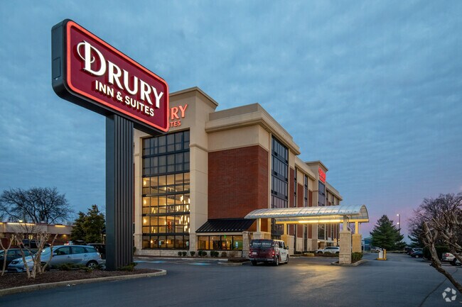
555 Donelson Pike
Nashville-Davidson--Murfreesboro--Franklin, TN
Donelson Village Resubdivision Of Revise
108-01-0-059
LOT 1 DONELSON VILLAGE SEC 5
Hotelormotel
Davidson
X
Tennessee
47037C0268H
1
2025
2.64 AC
2025
Nashville Airport
015502
Nashville
84,205 SF
DEMOGRAPHICS near 555 Donelson Pike
1 Mile
3 Mile
5 Mile
2024 Total Population
2,321
36,160
125,375
2029 Population
2,246
35,266
122,782
Pop Growth 2024-2029
(3.23%)
(2.47%)
(2.07%)
Average Age
41
39
38
2024 Total Households
1,032
16,039
52,410
HH Growth 2024-2029
(3.78%)
(2.81%)
(2.42%)
Median Household Inc
$60,728
$60,040
$61,600
Avg Household Size
2.20
2.20
2.30
2024 Avg HH Vehicles
2.00
2.00
2.00
Median Home Value
$285,599
$290,063
$308,330
Median Year Built
1959
1978
1979
Nearby Places
Map Layers
Map Styles
 Street
 Aerial
- Restaurants
- Banks
- Shops
- Fitness
- Groceries
PUBLIC TRANSPORTATION
COMMUTER RAIL
Donelson (East Corridor Line - Tennessee Regional Transportation Authority Music City Star (Music City Star))
DRIVE
WALK
Distance
Donelson (East Corridor Line - Tennessee Regional Transportation Authority Music City Star (Music City Star))
4 min
2.0 mi
Hermitage (East Corridor Line - Tennessee Regional Transportation Authority Music City Star (Music City Star))
DRIVE
WALK
Distance
Hermitage (East Corridor Line - Tennessee Regional Transportation Authority Music City Star (Music City Star))
10 min
6.4 mi
AIRPORT
Nashville International
DRIVE
WALK
Distance
Nashville International
4 min
2.5 mi
Freight Ports
Port of Mobile
DRIVE
WALK
Distance
Port of Mobile
489 min
449.3 mi
Nearby Properties
Address
Land Use
TOTAL SIZE
Lot Size
Zoning
Address
Land Use
TOTAL SIZE
Lot Size
Zoning
155,763 SF
2,110.61 AC
MULTI-ZONE
Address
Land Use
TOTAL SIZE
Lot Size
Zoning
24,800 SF
1,167.94 AC
MULTI-ZONE
Address
Land Use
TOTAL SIZE
Lot Size
Zoning
297,033 SF
40.41 AC
MULTI-ZONE
Address
Land Use
TOTAL SIZE
Lot Size
Zoning
291,852 SF
14.94 AC
ORI
Address
Land Use
TOTAL SIZE
Lot Size
Zoning
98,914 SF
51.60 AC
MULTI-ZONE
Address
Land Use
TOTAL SIZE
Lot Size
Zoning
313,498 SF
23.59 AC
ORI
Address
Land Use
TOTAL SIZE
Lot Size
Zoning
186,477 SF
3.31 AC
Address
Land Use
TOTAL SIZE
Lot Size
Zoning
9,956 SF
81.09 AC
RM9
Address
Land Use
TOTAL SIZE
Lot Size
Zoning
304,930 SF
31.88 AC
MULTI-ZONE
Address
Land Use
TOTAL SIZE
Lot Size
Zoning
571,677 SF
28.37 AC
MULTI-ZONE
Address
Land Use
TOTAL SIZE
Lot Size
Zoning
28,152 SF
24.89 AC
MULTI-ZONE
Address
Land Use
TOTAL SIZE
Lot Size
Zoning
237,496 SF
5.41 AC
ORI
Address
Land Use
TOTAL SIZE
Lot Size
Zoning
261,082 SF
4.78 AC
CS
Address
Land Use
TOTAL SIZE
Lot Size
Zoning
17,008 SF
19.25 AC
RM9
Address
Land Use
TOTAL SIZE
Lot Size
Zoning
14,352 SF
24.19 AC
RM15
Address
Land Use
TOTAL SIZE
Lot Size
Zoning
49,660 SF
16.96 AC
MULTIZONE
Address
Land Use
TOTAL SIZE
Lot Size
Zoning
56,500 SF
36.67 AC
MULTI-ZONE
Address
Land Use
TOTAL SIZE
Lot Size
Zoning
144,730 SF
13.13 AC
Address
Land Use
TOTAL SIZE
Lot Size
Zoning
292,815 SF
10.04 AC
ORI
Address
Land Use
TOTAL SIZE
Lot Size
Zoning
40,236 SF
34.21 AC
IR
Address
Land Use
TOTAL SIZE
Lot Size
Zoning
18,522 SF
22.42 AC
MULTI-ZONE
Address
Land Use
TOTAL SIZE
Lot Size
Zoning
14,170 SF
23.31 AC
8
Address
Land Use
TOTAL SIZE
Lot Size
Zoning
317,520 SF
44.91 AC
MULTI-ZONE
Address
Land Use
TOTAL SIZE
Lot Size
Zoning
52,305 SF
25.71 AC
MULTI-ZONE
Address
Land Use
TOTAL SIZE
Lot Size
Zoning
248,573 SF
25.36 AC
OL
Address
Land Use
TOTAL SIZE
Lot Size
Zoning
325.40 AC
MULTI-ZONE
Address
Land Use
TOTAL SIZE
Lot Size
Zoning
21,104 SF
21.07 AC
RM15
Address
Land Use
TOTAL SIZE
Lot Size
Zoning
51,846 SF
6.37 AC
MULTIZONE
Address
Land Use
TOTAL SIZE
Lot Size
Zoning
72,752 SF
4.56 AC
ORI
Address
Land Use
TOTAL SIZE
Lot Size
Zoning
15,044 SF
20.63 AC
RM20
The World's #1 Commercial Real Estate Marketplace
Connect with us
© 2025 CoStar Group
The information above has been obtained from sources believed reliable. While we do not doubt its accuracy we have not verified it and make no guarantee, warranty or representation about it. It is your responsibility to independently confirm its accuracy and completeness. Any projections, opinions, assumptions, or estimates used are for example only and do not represent the current or future performance of the property. The value of this transaction to you depends on tax and other factors which should be evaluated by your tax, financial, and legal advisors. You and your advisors should conduct a careful, independent investigation of the property to determine to your satisfaction the suitability of the property for your needs.