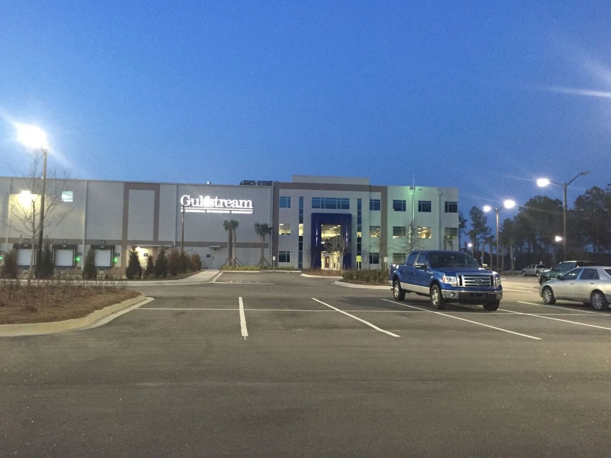
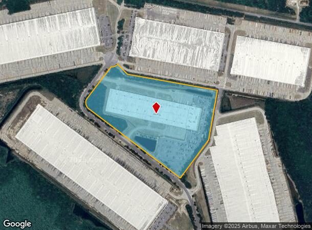
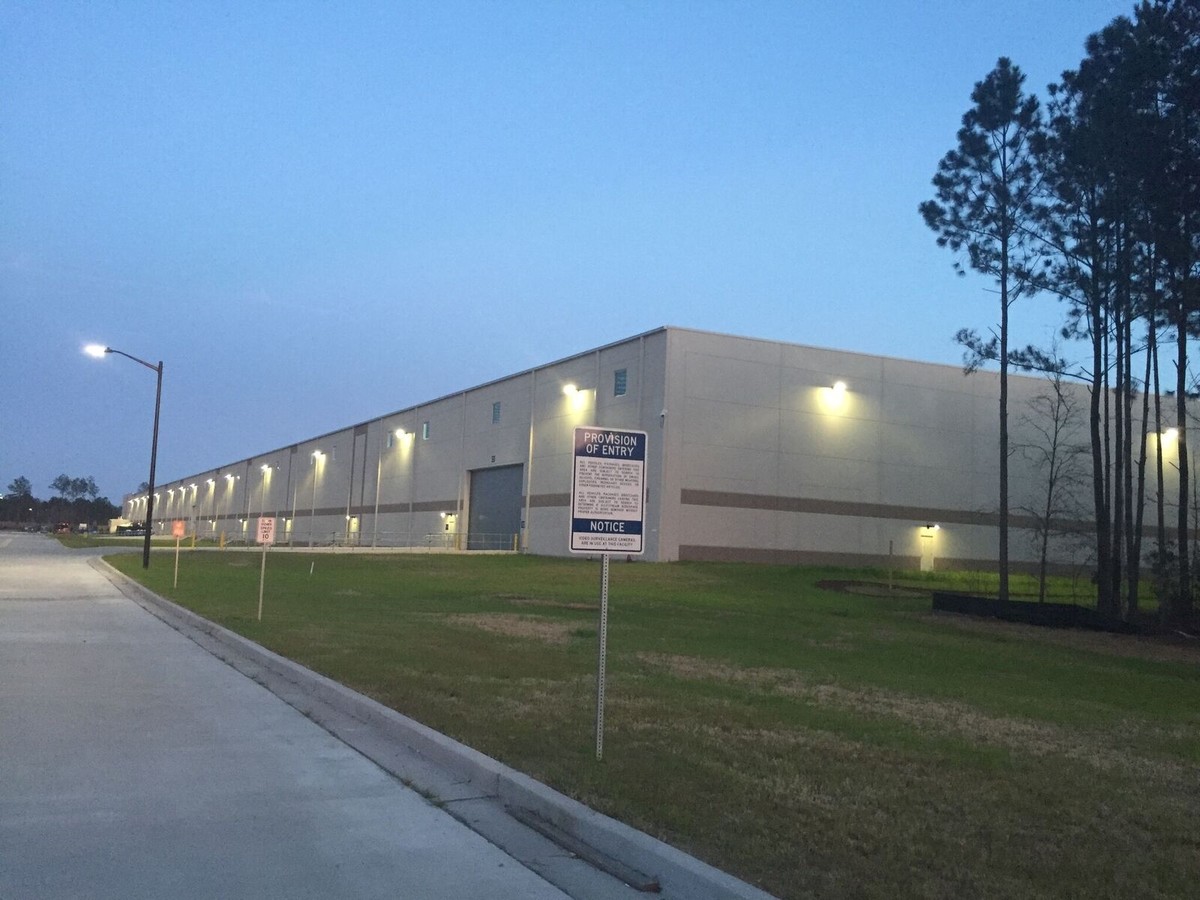
Property Record
555 Northport Pky, Port Wentworth, GA 31407
NEARBY LISTINGS FOR SALE OR LEASE
Property Detail
555 Northport Pky
1090302014
PARCEL A-1-D PT OF PARCEL A-1 OF OAK GROVE PLANTATION PRB 48P 65
Heavymanufacturing
Chatham
X
Georgia
45053C0475D
32.09 AC
0
Port Wentworth
2024
Savannah
010701
Savannah, GA
360,000 SF
DEMOGRAPHICS near 555 Northport Pky
1 Mile
3 Mile
5 Mile
2024 Total Population
679
10,819
28,141
2029 Population
749
11,541
30,196
Pop Growth 2024-2029
+ 10.31%
+ 6.67%
+ 7.30%
Average Age
35
35
35
2024 Total Households
303
3,611
10,052
HH Growth 2024-2029
+ 10.23%
+ 7.73%
+ 7.75%
Median Household Inc
$58,191
$79,916
$81,973
Avg Household Size
2.20
2.50
2.60
2024 Avg HH Vehicles
2.00
2.00
2.00
Median Home Value
$166,233
$168,665
$204,711
Median Year Built
2010
2009
2009
Nearby Places
- Restaurants
- Banks
- Shops
- Fitness
- Groceries
PUBLIC TRANSPORTATION
AIRPORT
Savannah/Hilton Head International
DRIVE
WALK
Distance
Savannah/Hilton Head International
22 min
8.9 mi
Hilton Head
DRIVE
WALK
Distance
Hilton Head
56 min
39.6 mi
Freight Ports
Georgia Ports - Savannah
DRIVE
WALK
Distance
Georgia Ports - Savannah
17 min
7.3 mi
Nearby Properties
Address
Land Use
TOTAL SIZE
Lot Size
Zoning
Address
Land Use
TOTAL SIZE
Lot Size
Zoning
1,008 SF
150 AC
I-H
Address
Land Use
TOTAL SIZE
Lot Size
Zoning
207.84 AC
PD
Address
Land Use
TOTAL SIZE
Lot Size
Zoning
981,943 SF
69.54 AC
I-H
Address
Land Use
TOTAL SIZE
Lot Size
Zoning
93.21 AC
PD
Address
Land Use
TOTAL SIZE
Lot Size
Zoning
73.57 AC
PD
Address
Land Use
TOTAL SIZE
Lot Size
Zoning
800,100 SF
44.51 AC
I-H
Address
Land Use
TOTAL SIZE
Lot Size
Zoning
750,480 SF
52.93 AC
IH
Address
Land Use
TOTAL SIZE
Lot Size
Zoning
70,000 SF
71.90 AC
IH
Address
Land Use
TOTAL SIZE
Lot Size
Zoning
Address
Land Use
TOTAL SIZE
Lot Size
Zoning
579,000 SF
33.93 AC
I-H
Address
Land Use
TOTAL SIZE
Lot Size
Zoning
2,156 SF
36.64 AC
PIL
Address
Land Use
TOTAL SIZE
Lot Size
Zoning
475,000 SF
35.73 AC
I-H
Address
Land Use
TOTAL SIZE
Lot Size
Zoning
600,000 SF
62.25 AC
I-H
Address
Land Use
TOTAL SIZE
Lot Size
Zoning
252,000 SF
31.18 AC
I-H
Address
Land Use
TOTAL SIZE
Lot Size
Zoning
416,000 SF
56.60 AC
PD
Address
Land Use
TOTAL SIZE
Lot Size
Zoning
21,120 SF
14 AC
PC3
Address
Land Use
TOTAL SIZE
Lot Size
Zoning
7,744 SF
13.03 AC
RA
Address
Land Use
TOTAL SIZE
Lot Size
Zoning
451,500 SF
14.79 AC
I-1
Address
Land Use
TOTAL SIZE
Lot Size
Zoning
225,000 SF
23.39 AC
I-1
Address
Land Use
TOTAL SIZE
Lot Size
Zoning
398,000 SF
22.58 AC
I-1
Address
Land Use
TOTAL SIZE
Lot Size
Zoning
893,000 SF
33.41 AC
RA
Address
Land Use
TOTAL SIZE
Lot Size
Zoning
331,800 SF
18.08 AC
I-1
Address
Land Use
TOTAL SIZE
Lot Size
Zoning
247,800 SF
14 AC
I-H
Address
Land Use
TOTAL SIZE
Lot Size
Zoning
203,200 SF
47.85 AC
PD
Address
Land Use
TOTAL SIZE
Lot Size
Zoning
27,072 SF
16.55 AC
PRM
Address
Land Use
TOTAL SIZE
Lot Size
Zoning
285,000 SF
12.73 AC
I-1
Address
Land Use
TOTAL SIZE
Lot Size
Zoning
178,924 SF
4.31 AC
I-H
Address
Land Use
TOTAL SIZE
Lot Size
Zoning
756.27 AC
Address
Land Use
TOTAL SIZE
Lot Size
Zoning
30,639 SF
12.06 AC
PUD
The World's #1 Commercial Real Estate Marketplace
Connect with us
© 2025 CoStar Group
The information above has been obtained from sources believed reliable. While we do not doubt its accuracy we have not verified it and make no guarantee, warranty or representation about it. It is your responsibility to independently confirm its accuracy and completeness. Any projections, opinions, assumptions, or estimates used are for example only and do not represent the current or future performance of the property. The value of this transaction to you depends on tax and other factors which should be evaluated by your tax, financial, and legal advisors. You and your advisors should conduct a careful, independent investigation of the property to determine to your satisfaction the suitability of the property for your needs.