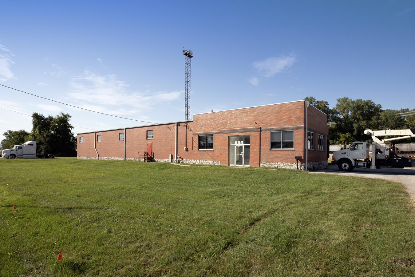
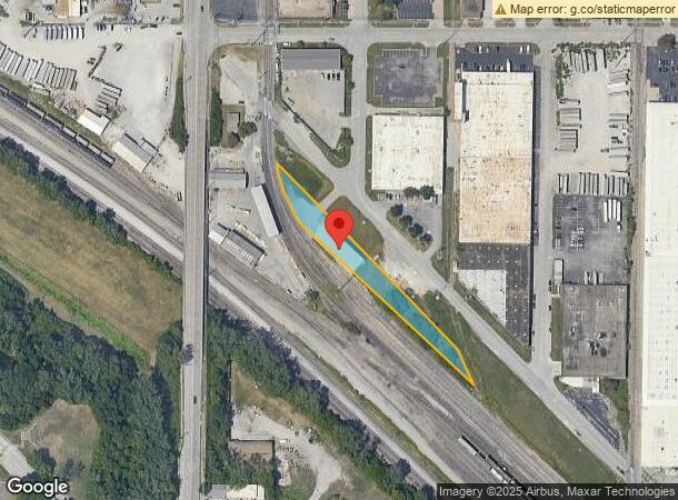
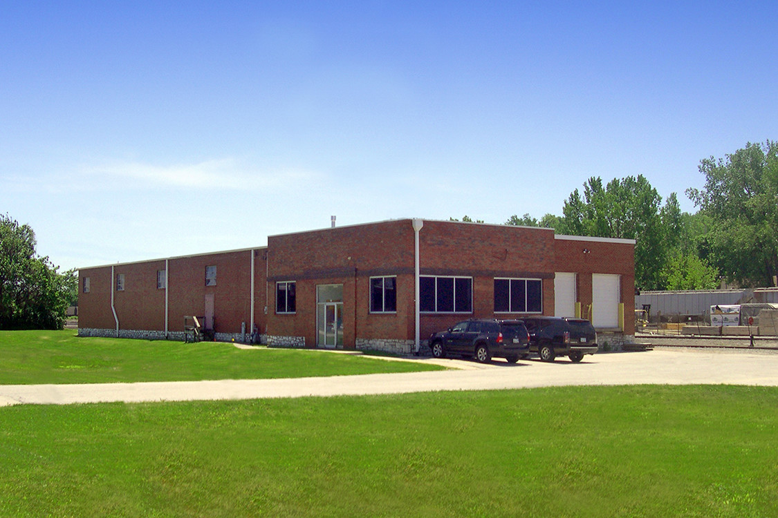
Property Record
555 Stanley Rd, Kansas City, KS 66115
NEARBY LISTINGS FOR SALE OR LEASE
Property Detail
555 Stanley Rd
903413
SEC-34 TWP-10 RNG-25, S34, T10, R25, ACRES 0.880000, 10J BEG 568.1FT SELY OF NW COR, SWLY-161.6FT TO TPOB; NLY CUR RT-168.46FT, SELY-712.65FT, SELY CUR LT- 104.29FT, NWLY-654.94FT TO POB CONTG 0.82AC M/L
Shipyard
Wyandotte
X
Kansas
29095C0138G
104
2024
0.88 AC
2024
Central KC KS/Fairfax
980000
Kansas City
7,800 SF
Kansas City, MO-KS
DEMOGRAPHICS near 555 Stanley Rd
1 Mile
3 Mile
5 Mile
2024 Total Population
3,246
54,837
164,557
2029 Population
3,268
55,221
168,130
Pop Growth 2024-2029
+ 0.68%
+ 0.70%
+ 2.17%
Average Age
37
36
36
2024 Total Households
1,305
20,993
67,944
HH Growth 2024-2029
+ 0.46%
+ 1.34%
+ 2.58%
Median Household Inc
$49,853
$48,984
$53,649
Avg Household Size
2.40
2.40
2.30
2024 Avg HH Vehicles
1.00
2.00
2.00
Median Home Value
$99,581
$122,082
$164,885
Median Year Built
1950
1955
1963
Nearby Places
- Restaurants
- Banks
- Shops
- Fitness
- Groceries
PUBLIC TRANSPORTATION
COMMUTER RAIL
Kansas City (Lincoln Service Missouri River Runner - Amtrak, Missouri River Runner - Amtrak, Southwest Chief - Amtrak)
DRIVE
WALK
Distance
Kansas City (Lincoln Service Missouri River Runner - Amtrak, Missouri River Runner - Amtrak, Southwest Chief - Amtrak)
13 min
5.9 mi
AIRPORT
Kansas City International
DRIVE
WALK
Distance
Kansas City International
21 min
15.4 mi
Freight Ports
Tulsa Port Of Catoosa
DRIVE
WALK
Distance
Tulsa Port Of Catoosa
271 min
240.4 mi
SALE & LEASE HISTORY
LISTING DATE
SALE/LEASE

May 05, 2020
For Lease
Mar 28, 2017
For Lease
Aug 08, 2023
For Lease
Apr 04, 2018
For Lease
Nearby Properties
Address
Land Use
TOTAL SIZE
Lot Size
Zoning
Address
Land Use
TOTAL SIZE
Lot Size
Zoning
126,962 SF
4.50 AC
KC0
Address
Land Use
TOTAL SIZE
Lot Size
Zoning
132,304 SF
3.72 AC
KCD
Address
Land Use
TOTAL SIZE
Lot Size
Zoning
8.29 AC
Address
Land Use
TOTAL SIZE
Lot Size
Zoning
846,143 SF
51.25 AC
Address
Land Use
TOTAL SIZE
Lot Size
Zoning
260,200 SF
71.68 AC
Address
Land Use
TOTAL SIZE
Lot Size
Zoning
215,920 SF
38.28 AC
Address
Land Use
TOTAL SIZE
Lot Size
Zoning
277,267 SF
4.18 AC
KCD
Address
Land Use
TOTAL SIZE
Lot Size
Zoning
162,989 SF
3.92 AC
KC0
Address
Land Use
TOTAL SIZE
Lot Size
Zoning
93,870 SF
3.31 AC
KC0
Address
Land Use
TOTAL SIZE
Lot Size
Zoning
139,499 SF
20.51 AC
KR1B
Address
Land Use
TOTAL SIZE
Lot Size
Zoning
4,012,734 SF
574.30 AC
KM3
Address
Land Use
TOTAL SIZE
Lot Size
Zoning
159,824 SF
1.59 AC
Address
Land Use
TOTAL SIZE
Lot Size
Zoning
122,247 SF
11.21 AC
KRP5
Address
Land Use
TOTAL SIZE
Lot Size
Zoning
10.97 AC
Address
Land Use
TOTAL SIZE
Lot Size
Zoning
52,374 SF
2.88 AC
KRP5
Address
Land Use
TOTAL SIZE
Lot Size
Zoning
260,644 SF
5.09 AC
Address
Land Use
TOTAL SIZE
Lot Size
Zoning
122,217 SF
23.87 AC
KR2
Address
Land Use
TOTAL SIZE
Lot Size
Zoning
239,083 SF
85.48 AC
KM3
Address
Land Use
TOTAL SIZE
Lot Size
Zoning
Address
Land Use
TOTAL SIZE
Lot Size
Zoning
37,944 SF
0.68 AC
Address
Land Use
TOTAL SIZE
Lot Size
Zoning
47,044 SF
2.01 AC
KCD
Address
Land Use
TOTAL SIZE
Lot Size
Zoning
491,448 SF
22.53 AC
Address
Land Use
TOTAL SIZE
Lot Size
Zoning
36,841 SF
7.72 AC
KRP5
Address
Land Use
TOTAL SIZE
Lot Size
Zoning
45,968 SF
2.58 AC
KR2
Address
Land Use
TOTAL SIZE
Lot Size
Zoning
48,244 SF
2.12 AC
1KCO
Address
Land Use
TOTAL SIZE
Lot Size
Zoning
Address
Land Use
TOTAL SIZE
Lot Size
Zoning
824,130 SF
20.12 AC
Address
Land Use
TOTAL SIZE
Lot Size
Zoning
44,698 SF
32.68 AC
KM3
Address
Land Use
TOTAL SIZE
Lot Size
Zoning
552,085 SF
21.81 AC
Address
Land Use
TOTAL SIZE
Lot Size
Zoning
36,576 SF
4.46 AC
The World's #1 Commercial Real Estate Marketplace
Connect with us
© 2025 CoStar Group
The information above has been obtained from sources believed reliable. While we do not doubt its accuracy we have not verified it and make no guarantee, warranty or representation about it. It is your responsibility to independently confirm its accuracy and completeness. Any projections, opinions, assumptions, or estimates used are for example only and do not represent the current or future performance of the property. The value of this transaction to you depends on tax and other factors which should be evaluated by your tax, financial, and legal advisors. You and your advisors should conduct a careful, independent investigation of the property to determine to your satisfaction the suitability of the property for your needs.