Property Record
5575 E State Highway Oo, Strafford, MO 65757
NEARBY LISTINGS FOR SALE OR LEASE
Property Detail
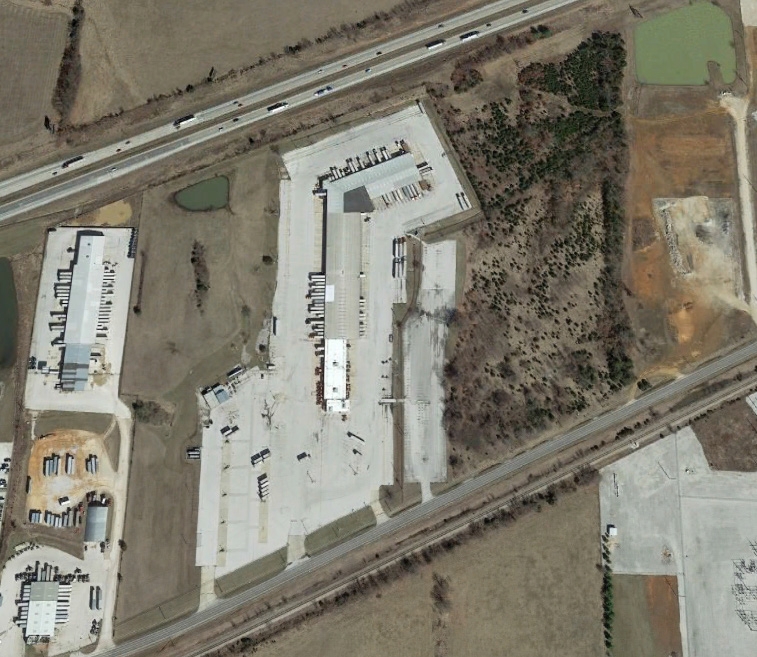
5575 E State Highway Oo
Springfield, MO
Mckinney Subdivision
12-01-100-054
Greene
Truckterminal
Missouri
X
33.70 AC
29077C0243E
Outlying Greene County
92,899 SF
Springfield
DEMOGRAPHICS near 5575 E State Highway Oo
1 Mile
3 Mile
5 Mile
2024 Total Population
129
4,081
24,927
2029 Population
135
4,254
25,858
Pop Growth 2024-2029
+ 4.65%
+ 4.24%
+ 3.73%
Average Age
40
43
41
2024 Total Households
54
1,640
10,607
HH Growth 2024-2029
+ 3.70%
+ 4.39%
+ 3.90%
Median Household Inc
$55,999
$89,019
$58,453
Avg Household Size
2.30
2.40
2.30
2024 Avg HH Vehicles
2.00
2.00
2.00
Median Home Value
$241,666
$324,844
$242,974
Median Year Built
1993
1997
1985
Nearby Places
- Restaurants
- Banks
- Shops
- Fitness
- Groceries
PUBLIC TRANSPORTATION
AIRPORT
Springfield-Branson Ntl
DRIVE
WALK
Distance
Springfield-Branson Ntl
25 min
16.1 mi
Freight Ports
Tulsa Port of Inola
DRIVE
WALK
Distance
Tulsa Port of Inola
198 min
178.5 mi
SALE & LEASE HISTORY
LISTING DATE
SALE/LEASE

Sep 25, 2016
For Lease
Nearby Properties
Address
Land Use
TOTAL SIZE
Lot Size
Zoning
Address
Land Use
TOTAL SIZE
Lot Size
Zoning
68.92 AC
INC
Address
Land Use
TOTAL SIZE
Lot Size
Zoning
20.01 AC
Address
Land Use
TOTAL SIZE
Lot Size
Zoning
617,990 SF
49.88 AC
INC
Address
Land Use
TOTAL SIZE
Lot Size
Zoning
39.60 AC
INC
Address
Land Use
TOTAL SIZE
Lot Size
Zoning
24.54 AC
INC.
Address
Land Use
TOTAL SIZE
Lot Size
Zoning
37.01 AC
INC
Address
Land Use
TOTAL SIZE
Lot Size
Zoning
9.17 AC
INC.
Address
Land Use
TOTAL SIZE
Lot Size
Zoning
127,740 SF
27.70 AC
INC
Address
Land Use
TOTAL SIZE
Lot Size
Zoning
31.56 AC
INC
Address
Land Use
TOTAL SIZE
Lot Size
Zoning
328,252 SF
18.67 AC
INC
Address
Land Use
TOTAL SIZE
Lot Size
Zoning
491,910 SF
49.03 AC
INC
Address
Land Use
TOTAL SIZE
Lot Size
Zoning
256,172 SF
19.03 AC
INC
Address
Land Use
TOTAL SIZE
Lot Size
Zoning
92,702 SF
42.54 AC
INC
Address
Land Use
TOTAL SIZE
Lot Size
Zoning
70,284 SF
22.88 AC
INC
Address
Land Use
TOTAL SIZE
Lot Size
Zoning
11.68 AC
INC
Address
Land Use
TOTAL SIZE
Lot Size
Zoning
16.03 AC
INC
Address
Land Use
TOTAL SIZE
Lot Size
Zoning
10.11 AC
INC
Address
Land Use
TOTAL SIZE
Lot Size
Zoning
110,347 SF
14.58 AC
INC
Address
Land Use
TOTAL SIZE
Lot Size
Zoning
54,952 SF
9.29 AC
INC
Address
Land Use
TOTAL SIZE
Lot Size
Zoning
129,666 SF
13.73 AC
INC
Address
Land Use
TOTAL SIZE
Lot Size
Zoning
8.82 AC
INC
Address
Land Use
TOTAL SIZE
Lot Size
Zoning
4.75 AC
INC
Address
Land Use
TOTAL SIZE
Lot Size
Zoning
67,502 SF
7.70 AC
INC
Address
Land Use
TOTAL SIZE
Lot Size
Zoning
84,784 SF
9.02 AC
INC
Address
Land Use
TOTAL SIZE
Lot Size
Zoning
102,824 SF
7.46 AC
M-1
Address
Land Use
TOTAL SIZE
Lot Size
Zoning
156,656 SF
39.23 AC
M-1
Address
Land Use
TOTAL SIZE
Lot Size
Zoning
75,471 SF
22.31 AC
INC
Address
Land Use
TOTAL SIZE
Lot Size
Zoning
48,528 SF
11.50 AC
INC
Address
Land Use
TOTAL SIZE
Lot Size
Zoning
99,186 SF
14.30 AC
INC
Address
Land Use
TOTAL SIZE
Lot Size
Zoning
5.22 AC
INC
The World's #1 Commercial Real Estate Marketplace
Connect with us
© 2025 CoStar Group
The information above has been obtained from sources believed reliable. While we do not doubt its accuracy we have not verified it and make no guarantee, warranty or representation about it. It is your responsibility to independently confirm its accuracy and completeness. Any projections, opinions, assumptions, or estimates used are for example only and do not represent the current or future performance of the property. The value of this transaction to you depends on tax and other factors which should be evaluated by your tax, financial, and legal advisors. You and your advisors should conduct a careful, independent investigation of the property to determine to your satisfaction the suitability of the property for your needs.