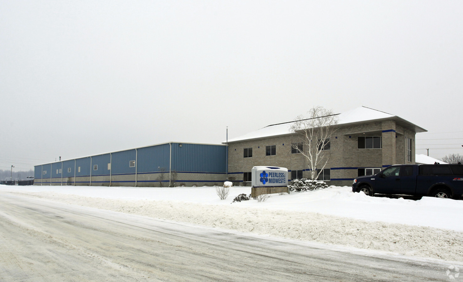
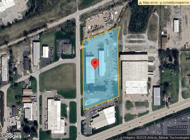
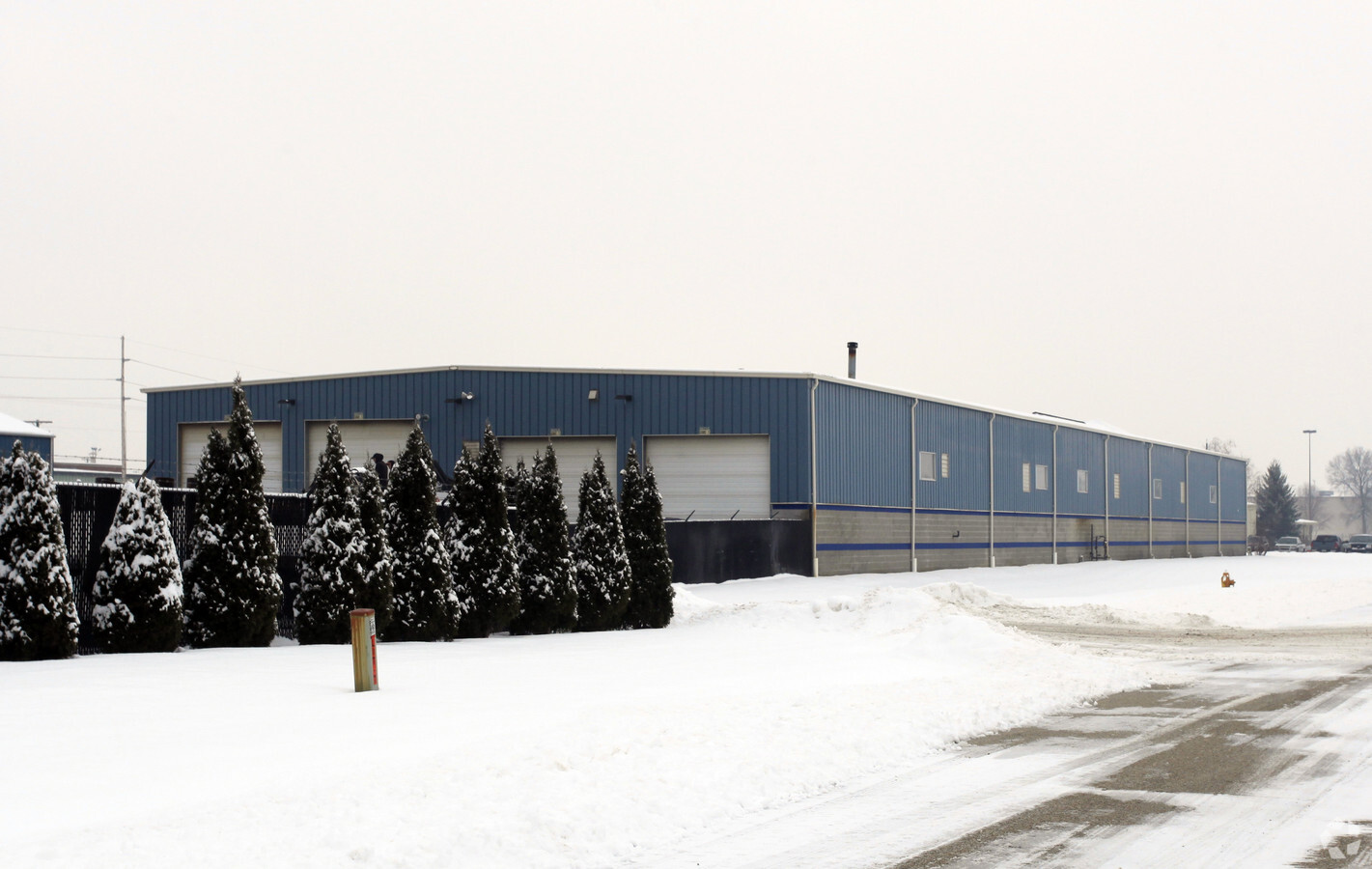
Property Record
55860 Russell Industrial Pky, Mishawaka, IN 46545
NEARBY LISTINGS FOR SALE OR LEASE
Property Detail
55860 Russell Industrial Pky
South Bend-Mishawaka, IN-MI
Bender Industrial Park
71-09-01-478-002.000-031
LOT 5,6,7 BENDER INDUSTRIAL PARK SEC 1 37 3E REPLATTED PER NP4050 7/6/95
Lightindustrial
St Joseph
X
Indiana
18141C0236E
5,6
2022
4.93 AC
2023
Outlying St Joseph County
011504
South Bend/Mishawaka
32,756 SF
DEMOGRAPHICS near 55860 Russell Industrial Pky
1 Mile
3 Mile
5 Mile
2024 Total Population
1,506
32,729
108,249
2029 Population
1,489
32,291
107,396
Pop Growth 2024-2029
(1.13%)
(1.34%)
(0.79%)
Average Age
43
40
39
2024 Total Households
586
13,035
44,795
HH Growth 2024-2029
(1.19%)
(1.38%)
(0.75%)
Median Household Inc
$91,532
$69,762
$61,345
Avg Household Size
2.50
2.50
2.30
2024 Avg HH Vehicles
2.00
2.00
2.00
Median Home Value
$246,648
$171,529
$167,202
Median Year Built
1981
1972
1973
Nearby Places
- Restaurants
- Banks
- Shops
- Fitness
- Groceries
PUBLIC TRANSPORTATION
COMMUTER RAIL
Elkhart Amtrak Station (Capitol Limited - Amtrak, Lake Shore Limited - Amtrak)
DRIVE
WALK
Distance
Elkhart Amtrak Station (Capitol Limited - Amtrak, Lake Shore Limited - Amtrak)
14 min
8.4 mi
South Bend Amtrak Station (Capitol Limited - Amtrak, Lake Shore Limited - Amtrak)
DRIVE
WALK
Distance
South Bend Amtrak Station (Capitol Limited - Amtrak, Lake Shore Limited - Amtrak)
18 min
8.9 mi
AIRPORT
South Bend International
DRIVE
WALK
Distance
South Bend International
29 min
12.9 mi
Freight Ports
Port Milwaukee
DRIVE
WALK
Distance
Port Milwaukee
225 min
188.4 mi
Nearby Properties
Address
Land Use
TOTAL SIZE
Lot Size
Zoning
Address
Land Use
TOTAL SIZE
Lot Size
Zoning
653,141 SF
32.18 AC
Address
Land Use
TOTAL SIZE
Lot Size
Zoning
124,260 SF
5.68 AC
Address
Land Use
TOTAL SIZE
Lot Size
Zoning
87,409 SF
15.88 AC
Address
Land Use
TOTAL SIZE
Lot Size
Zoning
88,854 SF
10.32 AC
Address
Land Use
TOTAL SIZE
Lot Size
Zoning
623,232 SF
74.18 AC
Address
Land Use
TOTAL SIZE
Lot Size
Zoning
85,524 SF
3.24 AC
Address
Land Use
TOTAL SIZE
Lot Size
Zoning
389,851 SF
23.89 AC
Address
Land Use
TOTAL SIZE
Lot Size
Zoning
270,962 SF
27.20 AC
Address
Land Use
TOTAL SIZE
Lot Size
Zoning
67,537 SF
7.74 AC
Address
Land Use
TOTAL SIZE
Lot Size
Zoning
120,513 SF
7.92 AC
Address
Land Use
TOTAL SIZE
Lot Size
Zoning
105,917 SF
5.90 AC
Address
Land Use
TOTAL SIZE
Lot Size
Zoning
108,400 SF
9.38 AC
Address
Land Use
TOTAL SIZE
Lot Size
Zoning
261,621 SF
23.42 AC
Address
Land Use
TOTAL SIZE
Lot Size
Zoning
35,066 SF
3.16 AC
Address
Land Use
TOTAL SIZE
Lot Size
Zoning
198,582 SF
10.37 AC
Address
Land Use
TOTAL SIZE
Lot Size
Zoning
295,683 SF
21.32 AC
Address
Land Use
TOTAL SIZE
Lot Size
Zoning
26,105 SF
5 AC
Address
Land Use
TOTAL SIZE
Lot Size
Zoning
43,745 SF
3.24 AC
Address
Land Use
TOTAL SIZE
Lot Size
Zoning
204,322 SF
14.99 AC
Address
Land Use
TOTAL SIZE
Lot Size
Zoning
226,496 SF
25.73 AC
Address
Land Use
TOTAL SIZE
Lot Size
Zoning
32,548 SF
3.70 AC
Address
Land Use
TOTAL SIZE
Lot Size
Zoning
147,528 SF
14.41 AC
Address
Land Use
TOTAL SIZE
Lot Size
Zoning
57,293 SF
15 AC
Address
Land Use
TOTAL SIZE
Lot Size
Zoning
34,304 SF
4.50 AC
Address
Land Use
TOTAL SIZE
Lot Size
Zoning
149,944 SF
16.81 AC
Address
Land Use
TOTAL SIZE
Lot Size
Zoning
47,240 SF
6.66 AC
Address
Land Use
TOTAL SIZE
Lot Size
Zoning
42,500 SF
1.93 AC
Address
Land Use
TOTAL SIZE
Lot Size
Zoning
26,630 SF
2.76 AC
Address
Land Use
TOTAL SIZE
Lot Size
Zoning
58,136 SF
9.49 AC
Address
Land Use
TOTAL SIZE
Lot Size
Zoning
29,712 SF
7.78 AC
The World's #1 Commercial Real Estate Marketplace
Connect with us
© 2025 CoStar Group
The information above has been obtained from sources believed reliable. While we do not doubt its accuracy we have not verified it and make no guarantee, warranty or representation about it. It is your responsibility to independently confirm its accuracy and completeness. Any projections, opinions, assumptions, or estimates used are for example only and do not represent the current or future performance of the property. The value of this transaction to you depends on tax and other factors which should be evaluated by your tax, financial, and legal advisors. You and your advisors should conduct a careful, independent investigation of the property to determine to your satisfaction the suitability of the property for your needs.