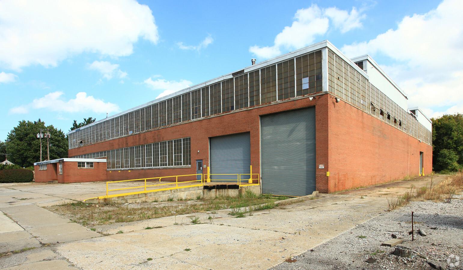
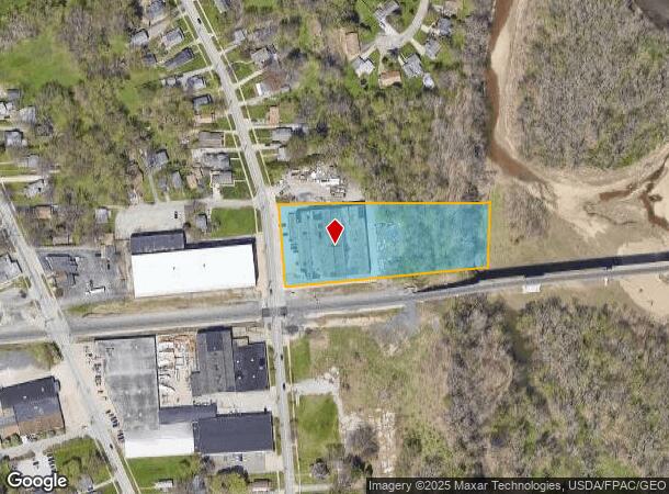
Property Record
559 Bank St, Painesville, OH 44077

NEARBY LISTINGS FOR SALE OR LEASE
Property Detail
559 Bank St
15-B-016-0-00-020
LOT 14 TRACT 2
Industrialgeneral
Lake
AE
Ohio
39085C0128F
14
2024
2.52 AC
2023
East Lake County
204400
Cleveland
35,485 SF
Cleveland-Elyria, OH
DEMOGRAPHICS near 559 Bank St
1 Mile
3 Mile
5 Mile
2024 Total Population
7,158
37,514
73,341
2029 Population
7,142
37,521
73,134
Pop Growth 2024-2029
(0.22%)
+ 0.02%
(0.28%)
Average Age
39
40
42
2024 Total Households
2,899
14,858
29,517
HH Growth 2024-2029
(0.28%)
(0.02%)
(0.34%)
Median Household Inc
$53,706
$69,763
$79,999
Avg Household Size
2.30
2.40
2.40
2024 Avg HH Vehicles
2.00
2.00
2.00
Median Home Value
$144,773
$170,449
$197,768
Median Year Built
1960
1973
1976
Nearby Places
- Restaurants
- Banks
- Shops
- Fitness
- Groceries
Nearby Properties
Address
Land Use
TOTAL SIZE
Lot Size
Zoning
Address
Land Use
TOTAL SIZE
Lot Size
Zoning
78,850 SF
12.95 AC
Address
Land Use
TOTAL SIZE
Lot Size
Zoning
82,044 SF
8.79 AC
Address
Land Use
TOTAL SIZE
Lot Size
Zoning
59,448 SF
8 AC
Address
Land Use
TOTAL SIZE
Lot Size
Zoning
160,976 SF
3.31 AC
B-4
Address
Land Use
TOTAL SIZE
Lot Size
Zoning
165,749 SF
8 AC
R-1
Address
Land Use
TOTAL SIZE
Lot Size
Zoning
78,850 SF
Address
Land Use
TOTAL SIZE
Lot Size
Zoning
197,433 SF
26.82 AC
R-1
Address
Land Use
TOTAL SIZE
Lot Size
Zoning
243,207 SF
43.47 AC
R-3
Address
Land Use
TOTAL SIZE
Lot Size
Zoning
113,375 SF
2.73 AC
B-3
Address
Land Use
TOTAL SIZE
Lot Size
Zoning
137,183 SF
12.35 AC
Address
Land Use
TOTAL SIZE
Lot Size
Zoning
82,044 SF
8.79 AC
Address
Land Use
TOTAL SIZE
Lot Size
Zoning
59,448 SF
Address
Land Use
TOTAL SIZE
Lot Size
Zoning
163,586 SF
24.91 AC
Address
Land Use
TOTAL SIZE
Lot Size
Zoning
400,874 SF
26.37 AC
I-2
Address
Land Use
TOTAL SIZE
Lot Size
Zoning
83,837 SF
9.43 AC
B-3
Address
Land Use
TOTAL SIZE
Lot Size
Zoning
111,506 SF
9.84 AC
Address
Land Use
TOTAL SIZE
Lot Size
Zoning
153,534 SF
36.47 AC
I2
Address
Land Use
TOTAL SIZE
Lot Size
Zoning
42,089 SF
7.32 AC
Address
Land Use
TOTAL SIZE
Lot Size
Zoning
47,436 SF
16.83 AC
R1
Address
Land Use
TOTAL SIZE
Lot Size
Zoning
78,810 SF
8.15 AC
R-1
Address
Land Use
TOTAL SIZE
Lot Size
Zoning
47,934 SF
0.73 AC
B-4
Address
Land Use
TOTAL SIZE
Lot Size
Zoning
Address
Land Use
TOTAL SIZE
Lot Size
Zoning
74,502 SF
11.47 AC
R-1
Address
Land Use
TOTAL SIZE
Lot Size
Zoning
74,502 SF
6.35 AC
R-1
Address
Land Use
TOTAL SIZE
Lot Size
Zoning
142,393 SF
11.81 AC
Address
Land Use
TOTAL SIZE
Lot Size
Zoning
16,955 SF
69.10 AC
B3
Address
Land Use
TOTAL SIZE
Lot Size
Zoning
68,656 SF
6.74 AC
Address
Land Use
TOTAL SIZE
Lot Size
Zoning
75,593 SF
2.49 AC
B-3
Address
Land Use
TOTAL SIZE
Lot Size
Zoning
116,755 SF
11.12 AC
Address
Land Use
TOTAL SIZE
Lot Size
Zoning
35,049 SF
3.67 AC
I-N
The World's #1 Commercial Real Estate Marketplace
Connect with us
© 2025 CoStar Group
The information above has been obtained from sources believed reliable. While we do not doubt its accuracy we have not verified it and make no guarantee, warranty or representation about it. It is your responsibility to independently confirm its accuracy and completeness. Any projections, opinions, assumptions, or estimates used are for example only and do not represent the current or future performance of the property. The value of this transaction to you depends on tax and other factors which should be evaluated by your tax, financial, and legal advisors. You and your advisors should conduct a careful, independent investigation of the property to determine to your satisfaction the suitability of the property for your needs.