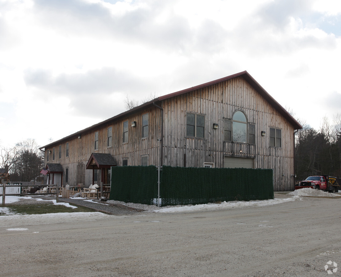
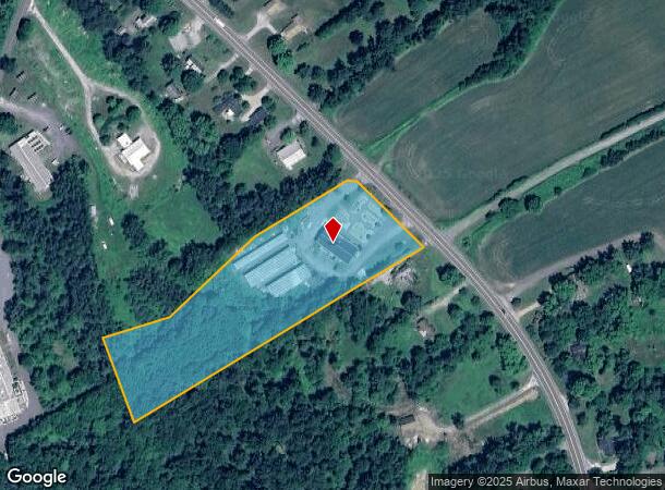
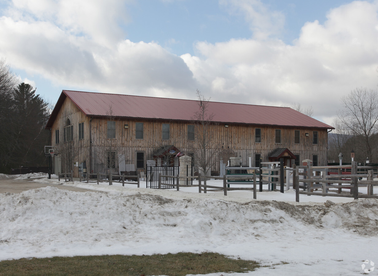
Property Record
560 S Main St, Sheffield, MA 01257
NEARBY LISTINGS FOR SALE OR LEASE
-
-
View all Sheffield listings for sale on LoopNet.com
Property Detail
560 S Main St
Pittsfield, MA
Berkshire
SHEF-000200-000002-000231
Massachusetts
Commercialofficeresidentialmixeduse
23.1
2025
4.58 AC
2025
Massachusetts North/West Area
926100
Other Market Areas
10,000 SF
DEMOGRAPHICS near 560 S Main St
1 Mile
3 Mile
5 Mile
2024 Total Population
213
1,955
4,971
2029 Population
199
1,853
4,773
Pop Growth 2024-2029
(6.57%)
(5.22%)
(3.98%)
Average Age
50
48
47
2024 Total Households
105
879
2,221
HH Growth 2024-2029
(7.62%)
(5.46%)
(4.05%)
Median Household Inc
$69,999
$72,387
$68,308
Avg Household Size
2.00
2.20
2.20
2024 Avg HH Vehicles
2.00
2.00
2.00
Median Home Value
$427,272
$347,252
$334,237
Median Year Built
1951
1959
1957
Nearby Places
- Restaurants
- Banks
- Shops
- Fitness
- Groceries
Nearby Properties
Address
Land Use
TOTAL SIZE
Lot Size
Zoning
Address
Land Use
TOTAL SIZE
Lot Size
Zoning
190,834 SF
85 AC
R1
Address
Land Use
TOTAL SIZE
Lot Size
Zoning
14,853 SF
4.57 AC
VC
Address
Land Use
TOTAL SIZE
Lot Size
Zoning
5,939 SF
5.13 AC
VC
Address
Land Use
TOTAL SIZE
Lot Size
Zoning
11,262 SF
0.23 AC
VC
Address
Land Use
TOTAL SIZE
Lot Size
Zoning
84,380 SF
7.50 AC
VC
Address
Land Use
TOTAL SIZE
Lot Size
Zoning
3,973 SF
0.75 AC
VC
Address
Land Use
TOTAL SIZE
Lot Size
Zoning
2,812 SF
2.50 AC
R1
Address
Land Use
TOTAL SIZE
Lot Size
Zoning
2,152 SF
14.52 AC
R1
Address
Land Use
TOTAL SIZE
Lot Size
Zoning
6,918 SF
0.88 AC
VC
Address
Land Use
TOTAL SIZE
Lot Size
Zoning
5,440 SF
0.51 AC
VC
Address
Land Use
TOTAL SIZE
Lot Size
Zoning
3,966 SF
3 AC
VC
Address
Land Use
TOTAL SIZE
Lot Size
Zoning
49,005 SF
2.64 AC
C
Address
Land Use
TOTAL SIZE
Lot Size
Zoning
41,155 SF
4 AC
R1
Address
Land Use
TOTAL SIZE
Lot Size
Zoning
4,902 SF
0.61 AC
VC
Address
Land Use
TOTAL SIZE
Lot Size
Zoning
2,459 SF
22.40 AC
R1
Address
Land Use
TOTAL SIZE
Lot Size
Zoning
9,100 SF
1.70 AC
C
Address
Land Use
TOTAL SIZE
Lot Size
Zoning
16,971 SF
3.18 AC
R1
Address
Land Use
TOTAL SIZE
Lot Size
Zoning
8,100 SF
4.21 AC
GB
Address
Land Use
TOTAL SIZE
Lot Size
Zoning
2,256 SF
0.50 AC
VC
Address
Land Use
TOTAL SIZE
Lot Size
Zoning
4,138 SF
1.46 AC
VC
Address
Land Use
TOTAL SIZE
Lot Size
Zoning
9,780 SF
0.41 AC
VC
Address
Land Use
TOTAL SIZE
Lot Size
Zoning
1,590 SF
11.94 AC
R1
Address
Land Use
TOTAL SIZE
Lot Size
Zoning
73.42 AC
R1
Address
Land Use
TOTAL SIZE
Lot Size
Zoning
4,806 SF
3.86 AC
R1
Address
Land Use
TOTAL SIZE
Lot Size
Zoning
11,217 SF
2.44 AC
R1
Address
Land Use
TOTAL SIZE
Lot Size
Zoning
10,447 SF
0.63 AC
VC
Address
Land Use
TOTAL SIZE
Lot Size
Zoning
2,383 SF
0.50 AC
VC
Address
Land Use
TOTAL SIZE
Lot Size
Zoning
214.51 AC
R1
Address
Land Use
TOTAL SIZE
Lot Size
Zoning
3,234 SF
41.10 AC
GB
The World's #1 Commercial Real Estate Marketplace
Connect with us
© 2025 CoStar Group
The information above has been obtained from sources believed reliable. While we do not doubt its accuracy we have not verified it and make no guarantee, warranty or representation about it. It is your responsibility to independently confirm its accuracy and completeness. Any projections, opinions, assumptions, or estimates used are for example only and do not represent the current or future performance of the property. The value of this transaction to you depends on tax and other factors which should be evaluated by your tax, financial, and legal advisors. You and your advisors should conduct a careful, independent investigation of the property to determine to your satisfaction the suitability of the property for your needs.