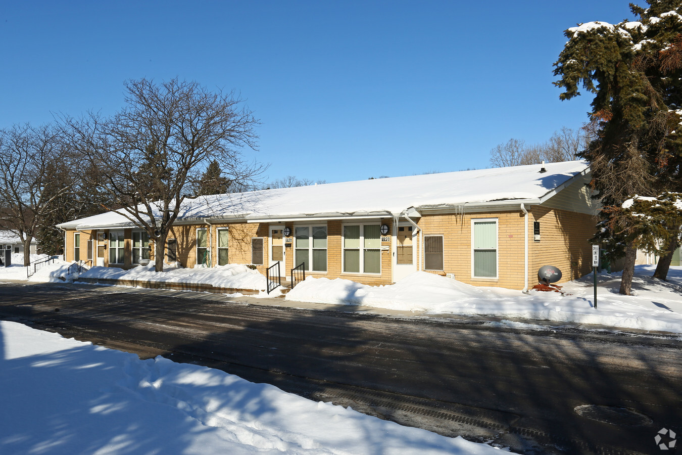
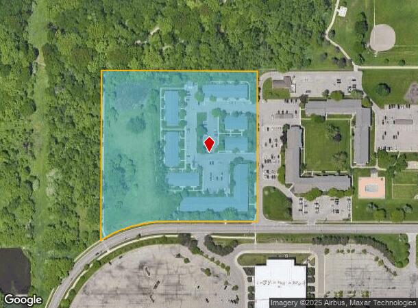
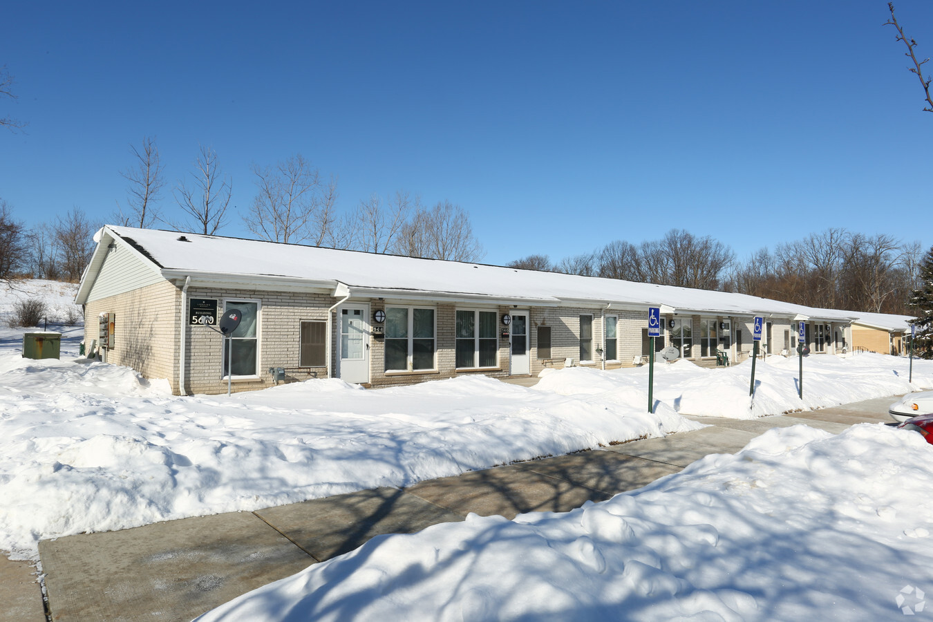
Property Record
5600 Mall Dr W, Lansing, MI 48917
NEARBY LISTINGS FOR SALE OR LEASE
-
-
View all Lansing listings for sale on LoopNet.com
Property Detail
5600 Mall Dr W
040-011-400-012-00
COM 1,625.83 FT N `& 1,738.68 FT W OF SE CORNER SEC 11; W 371.76 FT; SWLY ON CURVE TO LEFT 302.43 FT, SAID CURVE HAVING A CENTRAL ANGLE OF 31 DEG 32' 02", A RADIUS OF 549.5 FT, & A CHORD BEARING S 74 DEG 22'13" W 298.63 FT; N 711.12 FT; E 656.92 FT;
Retirementnursinghomecombined
Eaton
X
Michigan
26065C0110D
9.69 AC
2023
Delta Township
2024
West Michigan
020103
Lansing-East Lansing, MI
65,633 SF
DEMOGRAPHICS near 5600 Mall Dr W
1 Mile
3 Mile
5 Mile
2024 Total Population
9,180
41,195
108,466
2029 Population
9,139
40,949
108,512
Pop Growth 2024-2029
(0.45%)
(0.60%)
+ 0.04%
Average Age
42
42
39
2024 Total Households
4,304
18,626
47,453
HH Growth 2024-2029
(0.35%)
(0.61%)
(0.01%)
Median Household Inc
$55,144
$64,961
$55,473
Avg Household Size
2.10
2.10
2.20
2024 Avg HH Vehicles
2.00
2.00
2.00
Median Home Value
$207,160
$168,655
$147,933
Median Year Built
1974
1972
1964
Nearby Places
- Restaurants
- Banks
- Shops
- Fitness
- Groceries
PUBLIC TRANSPORTATION
COMMUTER RAIL
East Lansing Amtrak Station (Blue Water - Amtrak)
DRIVE
WALK
Distance
East Lansing Amtrak Station (Blue Water - Amtrak)
15 min
9.4 mi
AIRPORT
Capital Region International
DRIVE
WALK
Distance
Capital Region International
10 min
5.0 mi
Freight Ports
Port of Toledo
DRIVE
WALK
Distance
Port of Toledo
154 min
120.6 mi
Nearby Properties
Address
Land Use
TOTAL SIZE
Lot Size
Zoning
Address
Land Use
TOTAL SIZE
Lot Size
Zoning
Address
Land Use
TOTAL SIZE
Lot Size
Zoning
115.14 AC
NONE
Address
Land Use
TOTAL SIZE
Lot Size
Zoning
541,656 SF
38.20 AC
NONE
Address
Land Use
TOTAL SIZE
Lot Size
Zoning
166,083 SF
39.98 AC
NONE
Address
Land Use
TOTAL SIZE
Lot Size
Zoning
3,478 SF
61.37 AC
NONE
Address
Land Use
TOTAL SIZE
Lot Size
Zoning
170,856 SF
16.35 AC
NONE
Address
Land Use
TOTAL SIZE
Lot Size
Zoning
913 SF
80 AC
NONE
Address
Land Use
TOTAL SIZE
Lot Size
Zoning
389,485 SF
30.04 AC
NONE
Address
Land Use
TOTAL SIZE
Lot Size
Zoning
356,516 SF
37.81 AC
NONE
Address
Land Use
TOTAL SIZE
Lot Size
Zoning
287,309 SF
30.86 AC
NONE
Address
Land Use
TOTAL SIZE
Lot Size
Zoning
48.16 AC
NONE
Address
Land Use
TOTAL SIZE
Lot Size
Zoning
48.16 AC
NONE
Address
Land Use
TOTAL SIZE
Lot Size
Zoning
2,276,796 SF
96.93 AC
NONE
Address
Land Use
TOTAL SIZE
Lot Size
Zoning
292,918 SF
I-FAC
Address
Land Use
TOTAL SIZE
Lot Size
Zoning
113.83 AC
NONE
Address
Land Use
TOTAL SIZE
Lot Size
Zoning
280,098 SF
46.96 AC
RM
Address
Land Use
TOTAL SIZE
Lot Size
Zoning
231,000 SF
26 AC
Address
Land Use
TOTAL SIZE
Lot Size
Zoning
10,440 SF
18.30 AC
LI
Address
Land Use
TOTAL SIZE
Lot Size
Zoning
115.92 AC
C
Address
Land Use
TOTAL SIZE
Lot Size
Zoning
115.92 AC
C
Address
Land Use
TOTAL SIZE
Lot Size
Zoning
235,893 SF
18.69 AC
NONE
Address
Land Use
TOTAL SIZE
Lot Size
Zoning
73,485 SF
7.86 AC
LI
Address
Land Use
TOTAL SIZE
Lot Size
Zoning
105,217 SF
10.69 AC
NONE
Address
Land Use
TOTAL SIZE
Lot Size
Zoning
178,142 SF
19.17 AC
NONE
Address
Land Use
TOTAL SIZE
Lot Size
Zoning
189,157 SF
15.55 AC
NONE
Address
Land Use
TOTAL SIZE
Lot Size
Zoning
187,716 SF
27.62 AC
NONE
Address
Land Use
TOTAL SIZE
Lot Size
Zoning
95,747 SF
7.16 AC
NONE
Address
Land Use
TOTAL SIZE
Lot Size
Zoning
250,100 SF
25.45 AC
NONE
Address
Land Use
TOTAL SIZE
Lot Size
Zoning
404,215 SF
40 AC
NONE
Address
Land Use
TOTAL SIZE
Lot Size
Zoning
180,156 SF
16.68 AC
NONE
The World's #1 Commercial Real Estate Marketplace
Connect with us
© 2025 CoStar Group
The information above has been obtained from sources believed reliable. While we do not doubt its accuracy we have not verified it and make no guarantee, warranty or representation about it. It is your responsibility to independently confirm its accuracy and completeness. Any projections, opinions, assumptions, or estimates used are for example only and do not represent the current or future performance of the property. The value of this transaction to you depends on tax and other factors which should be evaluated by your tax, financial, and legal advisors. You and your advisors should conduct a careful, independent investigation of the property to determine to your satisfaction the suitability of the property for your needs.