Property Record
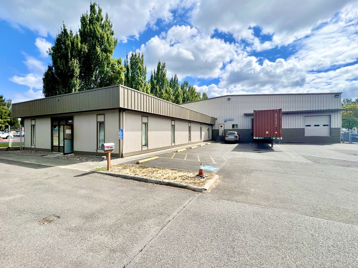
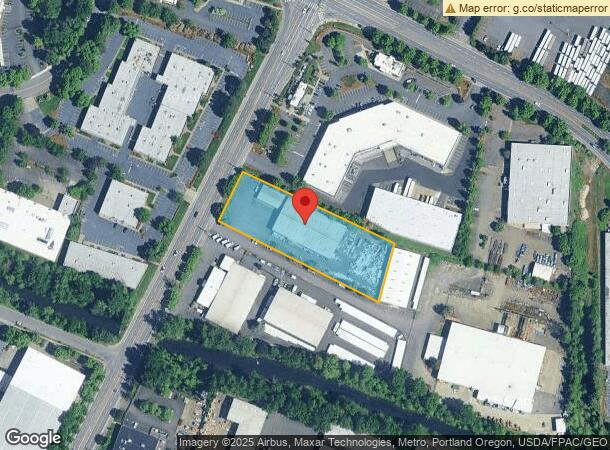
5600 Ne 122Nd Ave, Portland, OR 97230

NEARBY LISTINGS FOR SALE OR LEASE
Property Detail
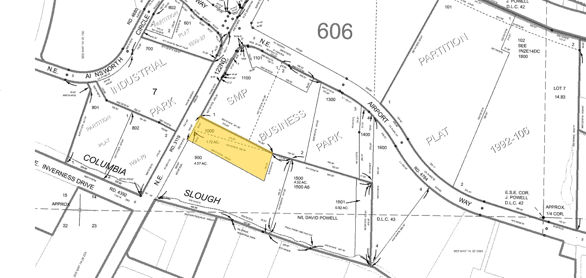
5600 Ne 122Nd Ave
R317133
SECTION 14 1N 2E, TL 1000 1.72 ACRES
Industrialgeneral
Multnomah
X
Oregon
53011C0508D
1.72 AC
2023
East Columbia Corridor
2023
Portland
007300
Portland-Vancouver-Hillsboro, OR-WA
21,075 SF
DEMOGRAPHICS near 5600 Ne 122Nd Ave
1 Mile
3 Mile
5 Mile
2024 Total Population
4,005
71,324
311,451
2029 Population
3,891
70,697
312,396
Pop Growth 2024-2029
(2.85%)
(0.88%)
+ 0.30%
Average Age
39
43
41
2024 Total Households
1,472
28,003
119,459
HH Growth 2024-2029
(3.33%)
(0.99%)
+ 0.22%
Median Household Inc
$51,428
$70,853
$72,908
Avg Household Size
2.40
2.40
2.50
2024 Avg HH Vehicles
1.00
2.00
2.00
Median Home Value
$406,667
$431,314
$441,037
Median Year Built
1974
1973
1974
Nearby Places
- Restaurants
- Banks
- Shops
- Fitness
- Groceries
PUBLIC TRANSPORTATION
AIRPORT
Portland International
DRIVE
WALK
Distance
Portland International
8 min
3.6 mi
Freight Ports
Port of Portland
DRIVE
WALK
Distance
Port of Portland
21 min
13.6 mi
SALE & LEASE HISTORY
LISTING DATE
SALE/LEASE

Sep 25, 2016
For Lease
Sep 16, 2024
For Sale
Jan 11, 2018
For Lease
Feb 07, 2023
For Sale
Nearby Properties
Address
Land Use
TOTAL SIZE
Lot Size
Zoning
Address
Land Use
TOTAL SIZE
Lot Size
Zoning
273,811 SF
6.39 AC
NULL
Address
Land Use
TOTAL SIZE
Lot Size
Zoning
236,035 SF
13.01 AC
R7
Address
Land Use
TOTAL SIZE
Lot Size
Zoning
197,027 SF
28.54 AC
R7H
Address
Land Use
TOTAL SIZE
Lot Size
Zoning
339,894 SF
27.82 AC
R-22
Address
Land Use
TOTAL SIZE
Lot Size
Zoning
23.94 AC
IG2
Address
Land Use
TOTAL SIZE
Lot Size
Zoning
817,845 SF
22.54 AC
IG2
Address
Land Use
TOTAL SIZE
Lot Size
Zoning
356,805 SF
27.10 AC
EG2
Address
Land Use
TOTAL SIZE
Lot Size
Zoning
126.40 AC
IG2
Address
Land Use
TOTAL SIZE
Lot Size
Zoning
140,000 SF
14.53 AC
R7
Address
Land Use
TOTAL SIZE
Lot Size
Zoning
233,829 SF
11.70 AC
R5
Address
Land Use
TOTAL SIZE
Lot Size
Zoning
273,844 SF
13.09 AC
R-22
Address
Land Use
TOTAL SIZE
Lot Size
Zoning
365,000 SF
38.87 AC
GI
Address
Land Use
TOTAL SIZE
Lot Size
Zoning
698,484 SF
34.21 AC
GI
Address
Land Use
TOTAL SIZE
Lot Size
Zoning
118,040 SF
10.28 AC
EG2
Address
Land Use
TOTAL SIZE
Lot Size
Zoning
152,575 SF
5.32 AC
EG1
Address
Land Use
TOTAL SIZE
Lot Size
Zoning
47.70 AC
IG2
Address
Land Use
TOTAL SIZE
Lot Size
Zoning
257,560 SF
NULL
Address
Land Use
TOTAL SIZE
Lot Size
Zoning
86,586 SF
5.51 AC
IG2
Address
Land Use
TOTAL SIZE
Lot Size
Zoning
172,814 SF
10 AC
R-30
Address
Land Use
TOTAL SIZE
Lot Size
Zoning
60,788 SF
10.21 AC
GI
Address
Land Use
TOTAL SIZE
Lot Size
Zoning
53.15 AC
IG2
Address
Land Use
TOTAL SIZE
Lot Size
Zoning
175,276 SF
13.05 AC
IG2
Address
Land Use
TOTAL SIZE
Lot Size
Zoning
Address
Land Use
TOTAL SIZE
Lot Size
Zoning
184,000 SF
18.88 AC
EG2
Address
Land Use
TOTAL SIZE
Lot Size
Zoning
316,197 SF
11.49 AC
R-30
Address
Land Use
TOTAL SIZE
Lot Size
Zoning
58,843 SF
4.53 AC
EG2
Address
Land Use
TOTAL SIZE
Lot Size
Zoning
1,566 SF
51.74 AC
IG2
Address
Land Use
TOTAL SIZE
Lot Size
Zoning
357,603 SF
22.69 AC
GI
Address
Land Use
TOTAL SIZE
Lot Size
Zoning
99,100 SF
1.31 AC
CS
Address
Land Use
TOTAL SIZE
Lot Size
Zoning
174,624 SF
1.68 AC
CM2
The World's #1 Commercial Real Estate Marketplace
Connect with us
© 2025 CoStar Group
The information above has been obtained from sources believed reliable. While we do not doubt its accuracy we have not verified it and make no guarantee, warranty or representation about it. It is your responsibility to independently confirm its accuracy and completeness. Any projections, opinions, assumptions, or estimates used are for example only and do not represent the current or future performance of the property. The value of this transaction to you depends on tax and other factors which should be evaluated by your tax, financial, and legal advisors. You and your advisors should conduct a careful, independent investigation of the property to determine to your satisfaction the suitability of the property for your needs.